Alta Vista | |
|---|---|
Neighbourhood | |
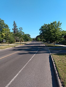 Alta Vista Drive | |
 Alta Vista Location within Ottawa | |
| Coordinates: 45°23′20″N75°39′00″W / 45.38889°N 75.65000°W | |
| Country | Canada |
| Province | Ontario |
| City | Ottawa |
| Government | |
| • MPs | David McGuinty |
| • MPPs | John Fraser |
| • Councillors | Marty Carr |
| • Governing body | Alta Vista Community Association |
| • Chair | Stephanie Glover [1] |
| Area | |
• Total | 7.231 km2 (2.792 sq mi) |
| Elevation | 90 m (300 ft) |
| Population (2021) | |
• Total | 24,726 |
| • Density | 3,400/km2 (8,900/sq mi) |
| Canada 2021 Census | |
| Time zone | UTC-5 (Eastern (EST)) |
| Forward sortation areas | K1H, K1V |
Alta Vista is a neighbourhood in Alta Vista Ward in Ottawa, Ontario, Canada. Its boundaries according to the Alta Vista Community Association are that part of Alta Vista Ward south of Smyth Road in the north, north of Walkley Road and east of the Rideau River (and Bank Street), and west of the "greenspace underneath Haig Drive". [2] However, the name is ambiguous, as there are several sub-neighbourhoods in this area, (see list below), as the neighbourhood could refer to the ward as a whole, down to the core Alta Vista area, (which could be defined as south of Pleasant Park Road, north of Heron Road, and west of the eastern greenspace corridor), centred on Alta Vista Drive.
Contents
Alta Vista Drive is a major street running through the neighbourhood, and shares its name. Both are named for their relative height, as the neighbourhood is generally higher than most of the city. Alta Vista is a highly residential neighbourhood with a strong community, several schools, religious buildings of many faiths, and community centres. It also has a vast amount of greenspace and parks, much of which is part of the Alta Vista Transportation Corridor Environmental Assessment Ottawa East Community Association.
The OC Transpo Transitway also runs through Alta Vista, with two stations in the neighbourhood itself (Pleasant Park and Riverside) as well as two just outside (Billings Bridge and Smyth), serving as a vital transit link to the rest of the city.
The General Campus of the Ottawa Hospital, and The Children's Hospital of Eastern Ontario are located just on the north side of Smyth Road, in Riverview, while the Riverside Campus of the Ottawa Hospital is located at Smyth and Riverside Drive. There are two shopping malls in and around Alta Vista: the Billings Bridge Plaza Shopping Centre at Bank Street and Riverside and the Elmvale Shopping Centre at St. Laurent and Smyth.
Alta Vista had a population of about 24,726 as of the Canada 2021 Census (Community Association borders).
