
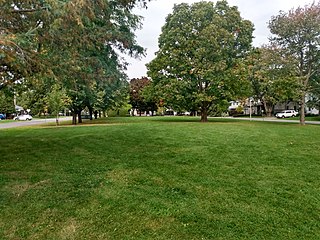
Heron Gate or Herongate is a neighbourhood in Alta Vista Ward and Gloucester-Southgate Ward in the south end of Ottawa, Ontario, Canada. It is defined by the Herongate Tenant Coalition as being bounded on the north by Heron Road, on the west by Heron-Walkley Park and Albion Road, and by the Walkley rail corridor on the south. The total population for this area according to the Canada 2021 Census was 9,974.

Carling Avenue is a major east–west arterial road in the west end of Ottawa, Ontario, Canada. It runs from March Road in Kanata to Bronson Avenue in the Glebe. The road is named for John Carling, founder of Carling Brewery and Conservative MP and Senator, Postmaster General and Minister of Agriculture.

Britannia is a group of neighbourhoods in Bay Ward in the west end of Ottawa, Ontario, Canada. It is located on the Ottawa River across from Aylmer, Quebec, adjacent to its namesake, Britannia Bay, north of Richmond Road, west of the Kichi Zibi Mikan and east of Boyce Avenue. The total population of this area was 6,692 as of the 2016 census. The area constituted a municipal ward from 1973 to 1994.
Glabar Park is a neighbourhood in Bay Ward, in the west end of Ottawa, Ontario, Canada. It is bounded on the west by Woodroffe Avenue north by Carling Avenue, south by The Queensway and on the east by Maitland Avenue. The population at the 2011 census was about 2,806.

Lincoln Heights is a neighbourhood in the Britannia area of Bay Ward in the west end of Ottawa, Ontario, Canada. It is defined by its community association as being bounded to the south by the north side of Regina Lane, to the north by the Ottawa River, to the west by the east side of Croydon Avenue, and to the east by the Kichi Zibi Mikan. According to the Canada 2016 Census, the population of the neighbourhood is 1,630. The greater Lincoln Heights area can be defined as extending as far west as Greenview Avenue and as far south as Carling Avenue, which overlaps with neighbouring Britannia Village.

Carlington is a neighbourhood located in River Ward in the west-end of Ottawa, Ontario, Canada.
Qualicum-Graham Park or Qualicum is a suburban neighbourhood in College Ward in the City of Ottawa, Ontario, Canada. It is located in the former City of Nepean in the west end of the city. Many of the residences in the area are executive homes situated on large lots (100x100) being built in the 1960s. Qualicum Street boasts large custom houses built by Bill Teron. The neighbourhood is bounded to the north by the Queensway, to the west by Richmond Road, to the south by Baseline Road, and to the east by Morrison Drive at the former Ottawa-Nepean border towards Redwood. Named after Qualicum Beach in British Columbia.

Fisher Heights is a neighbourhood located in the far northeast corner of the former City of Nepean in Ottawa, Ontario, Canada. It is located in Knoxdale-Merivale Ward. The area is located south of the Experimental Farm and approximately 8 km away from downtown Ottawa.

Carleton Heights is a neighbourhood in River Ward in Ottawa, Ontario, Canada. According to the Carleton Heights and Area Community Association, the neighbourhood is bounded on the north by the Central Experimental Farm, on the east by the Rideau River, on the south by the junction of Prince of Wales Drive and Fisher Avenue and on the west by Fisher Avenue. The neighbourhood is sometimes referred to as Hog's Back after the nearby falls. The total population of the neighbourhood is 7,586 according to the Canada 2016 Census.
Braemar Park is a neighbourhood in College Ward in the west end of Ottawa, Ontario, Canada. It is bounded on the north by the Queensway, east on Maitland Drive, south by the Central Experimental Pathway and west by J. H. Putman Public School.
Copeland Park is a neighbourhood located in College Ward in the west end of Ottawa, Canada. It is bounded to the west by Agincourt Road, to the south by Baseline Road, to the east by Clyde Avenue and to the north by the Central Experimental Farm Pathway.
Britannia Heights is a neighbourhood in Bay Ward in west end of Ottawa, Ontario, Canada. The neighbourhood is a sub-neighbourhood of Britannia area of the city, but is within the Queensway Terrace North Community Association boundaries. The neighbourhood is away from the Ottawa River on a steep hill. It is bounded to the North by Carling Avenue, east by OC Transpo Transitway, south by Henley Street, and west by Bayshore Drive. The population of the neighbourhood is approximately 1750.
McKellar Heights is a small neighbourhood located in Kitchissippi Ward, in the west end of Ottawa, Ontario, Canada. The neighbourhood is generally triangular in shape, and is generally bounded on the north by Westboro, on the west by Glabar Park, and on the south by Carlington. The population as of the Canada 2016 Census was 575.

Queensway Terrace North (QTN) is a neighbourhood in Bay Ward in the west end of Ottawa, Ontario, Canada. Its neighbourhood association is bounded to the north by Carling Avenue, to the west by Pinecrest Road, to the south by the Queensway, and to the east by the Transitway. These boundaries include the adjacent neighbourhood of Britannia Heights.

Queensway Terrace South is a neighbourhood in College Ward in the west end of Ottawa, Ontario, Canada. It used to be part of Queensway Terrace but in 1967, Highway 417 was built and split apart into Queensway Terrace North and South. The borders are to the east Southwood Drive, to the south Baseline Road, Queensway to the north and Greenbank Road to the west. Along with next-door Ridgeview, the neighbourhood is part of the Queensway Terrace South Ridgeview Community Association.

Cyrville is a neighbourhood in Beacon Hill-Cyrville Ward in the east-end of Ottawa, Ontario, Canada. The area is located within the former City of Gloucester, and is roughly bounded on the north, west and south by the former Gloucester City limit, and on the east by the Aviation Parkway and Highway 417. Once a francophone farming village, the area now a mix of residential and industrial land, being home to the Cyrville Industrial Area. It has been described as a "tangle of freeways and utility corridors". It has a population of 4513, 280 of which live south of the Queensway.

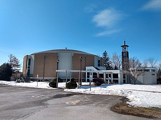
Britannia United Church is a United Church of Canada congregation in Ottawa, Ontario, Canada. One of Ottawa's oldest congregations, members had been meeting in homes since 1869. The Britannia Heights Methodist Church formed in 1873. It joined the United Church when it was formed in 1925. In 1925, Britannia became officially Britannia United Church. The Britannia United Church has operated out of Pinecrest Road location since 1961.

Belltown is a neighbourhood in the Britannia area of Bay Ward, in the west end of Ottawa. It is bounded on the east by Britannia Park, on the north by the Ottawa River, on the west by Andrew Haydon Park and the south by Carling Avenue. Prior to Ottawa's amalgamation in 2001, the neighbourhood spanned the Ottawa-Nepean municipal boundary. The neighbourhood's population is 2089, with 294 people living in the Nepean portion.

