Glabar Park

Last updated
Glabar Park
Neighbourhood
Glabar Park, Ottawa.jpg
Glabar Park
Newottawamap.png
Red pog.svg
Glabar Park
Location within Ottawa
Coordinates: 45°22′02″N75°45′51″W / 45.36726°N 75.76422°W / 45.36726; -75.76422 Coordinates: 45°22′02″N75°45′51″W / 45.36726°N 75.76422°W / 45.36726; -75.76422
CountryCanada
Province Ontario
City Ottawa
Government
   MPs Anita Vandenbeld
   MPPs Jeremy Roberts
   Councillors Theresa Kavanagh
  Governing bodyGlabar Park Community Alliance
  PresidentVacant [1]
Area
  Total1.177 km2 (0.454 sq mi)
Elevation
80 m (260 ft)
Population
 (2016)
  Total2,806
  Density2,400/km2 (6,200/sq mi)
  Canada 2016 Census
Time zone UTC-5 (Eastern (EST))
Forward sortation area
K2A
Website Glabar Park Community Alliance

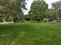
Glabar Park is a neighbourhood in Bay Ward, in the west end of Ottawa, Ontario, Canada. It is bounded on the west by Woodroffe Avenue north by Carling Avenue, south by The Queensway and on the east by Maitland Avenue. [2] The population at the 2011 census was about 2,806. [3]

Most of the neighbourhood was built in the 1950s. [4] [5] The first part of the neighbourhood was built in 1950 in the area around Hare Avenue (surrounding the eponymous Glabar Park) by the F. J. Shouldice Construction Company and sold by the Brownlee & McKeown Realtors. [6] Further development in the neighbourhood was done by Teron Construction and subdivided by J. P. Chenier Ltd. [7] In 1985 townhouses on Esterlawn Private were built which is off Fairlawn Avenue just behind Fairlawn Centre. Today a few houses on Carling Avenue have demolished and turned into low-rise apartments.

The neighbourhood is home to D. Roy Kennedy Public School, St Paul's Presbyterian Church, and the Seventh-day Adventist Church of Ottawa. It is home to two parks, Kingsmere Park and Lorry Greenberg Park. Kingsmere Park is the park with more of a social setting, it features a large wading pool in the summer, and a double-sized hockey and skating rink in the winter. These amenities are provided by the City of Ottawa. Fairlawn Mall is on Carling Avenue across from Carlingwood.

Related Research Articles

The Glebe Neighbourhood in Ottawa, Ontario, Canada

The Glebe is a neighbourhood in Ottawa, Ontario, Canada. It is located just south of Ottawa's downtown area in the Capital Ward. According to the Glebe Community Association, the neighbourhood is bounded on the north by the Queensway, on the east and south by the Rideau Canal and on the west by LeBreton Street South, Carling Avenue and Dow's Lake. As of 2016, this area had a population of 13,055. This area includes the Glebe Annex, an area west of Bronson Avenue that maintains its own neighbourhood association.

Lindenlea Neighbourhood in Ottawa, Ontario, Canada

Lindenlea is a neighbourhood in Rideau-Rockcliffe Ward in Ottawa, Ontario, Canada, northeast of Downtown. It is bordered by Maple Lane to the north, Acacia Avenue to the east, Beechwood Avenue to the south and Springfield Road to the west.

Alta Vista, Ottawa Neighbourhood in Ottawa, Ontario, Canada

Alta Vista is a neighbourhood in Alta Vista Ward in Ottawa, Ontario, Canada. Its boundaries according to the Alta Vista Community Association are that part of Alta Vista Ward south of Smyth Road in the north, north of Walkley Road and east of the Rideau River, and west of the "greenspace underneath Haig Drive". However, the name is ambiguous, as there are several sub-neighbourhoods in this area,, as the neighbourhood could refer to the ward as a whole, down to thecore Alta Vista area,, centred on Alta Vista Drive.

Manor Park, Ottawa Neighbourhood in Ottawa, Ontario, Canada

Manor Park is a neighbourhood in Rideau-Rockcliffe Ward in the east end of Ottawa, Ontario, Canada on the east side of Rockcliffe Park.

Lincoln Heights, Ottawa Neighbourhood in Ottawa, Ontario, Canada

Lincoln Heights is a neighbourhood in the Britannia area of Bay Ward in the west end of Ottawa, Ontario, Canada. It is defined by its community association as being bounded to the south by the north side of Regina Lane, to the north by the Ottawa River, to the west by the east side of Croydon Avenue, and to the east by the Ottawa River Parkway. According to the Canada 2016 Census, the population of the neighbourhood is 1,630. The greater Lincoln Heights area can be defined as extending as far west as Greenview Avenue and as far south as Carling Avenue, which overlaps with neighbouring Britannia Village.

Carlingwood Neighbourhood in Ottawa, Ontario, Canada

Carlingwood is a neighbourhood in Bay Ward in the west end of Ottawa, Ontario, Canada. The neighbourhood is roughly bounded on the north by Richmond Road, on the east by Sherbourne Road, on the south by Carling Avenue and on the west by Woodroffe Avenue. This area corresponds to census tract 5050032.01, which had a population of 3,558 according to the Canada 2016 Census.

Carlington Neighbourhood in Ottawa, Ontario, Canada

Carlington is a neighbourhood located in River Ward in the west-end of Ottawa, Ontario, Canada.

Civic Hospital Neighbourhood in Ottawa, Ontario, Canada

Civic Hospital is a neighbourhood in Kitchissippi Ward in central Ottawa, Canada. It is named after the Ottawa Civic Hospital, which is located in the neighbourhood.

Carleton Heights Neighbourhood in Ottawa, Ontario, Canada

Carleton Heights is a neighbourhood in River Ward in Ottawa, Ontario, Canada. According to the Carleton Heights and Area Community Association, the neighbourhood is bounded on the north by the Central Experimental Farm, on the east by the Rideau River, on the south by the junction of Prince of Wales Drive and Fisher Avenue and on the west by Fisher Avenue. The neighbourhood is sometimes referred to as Hog's Back after the nearby falls. The total population of the neighbourhood is 7,586 according to the Canada 2016 Census.

Forbes, Ottawa Neighbourhood in Ottawa, Ontario, Canada

Forbes is a neighbourhood in Rideau-Rockcliffe Ward in the east end of Ottawa, Ontario, Canada.

Ellwood, Ottawa Neighbourhood in Ottawa, Ontario, Canada

Ellwood is a neighbourhood and former railway point in River Ward, in the south end of Ottawa, Ontario, Canada. It is bounded by Walkley Road on the north, the Transitway on the west, Albion Road on the east, and Ledbury Park on the south. The population of this area is approximately 2908.

Eastway Gardens Neighbourhood in Ottawa, Ontario, Canada

Eastway Gardens is a small neighbourhood in Alta Vista Ward in the east end of Ottawa, Ontario, Canada. It consists of a series of dead end streets coming off of Tremblay Road between Riverside Drive and St. Laurent Boulevard. Most of these streets are named for letters of the alphabet, beginning with Avenue K and ending with Avenue U. According to the Canada 2016 Census, the neighbourhood had a population of 602. The residents association boundaries for the neighbourhood are the Rideau River to the west, St. Laurent Boulevard to the east, Coventry Road to the north, and Belfast Road to the south.

Bel-Air Park Neighbourhood in Ottawa, Ontario, Canada

Bel-Air Park is a neighbourhood in College Ward in the west end of Ottawa, Ontario, Canada. It is bounded on the east by the Experimental Farm Pathway, on the south by Baseline Road, on the west by Woodroffe Avenue and on the north by the Queensway.

Braemar Park Neighbourhood in Ottawa, Ontario, Canada

Braemar Park is a neighbourhood in College Ward in the west end of Ottawa, Ontario, Canada. It is bounded on the north by the Queensway, east on Maitland Drive, south by the Central Experimental Pathway and west by J. H. Putman Public School.

Kenson Park Neighbourhood in Ottawa, Ontario, Canada

Kenson Park is a neighbourhood located in College Ward in the west end of Ottawa, Ontario, Canada. It's bounded to the east by Woodroffe Avenue, to the north highway 417, to the south Baseline Road, and to the west "past Adirondack Drive". The population for this area, according to the Canada 2016 Census was 429.

McKellar Heights Neighbourhood in Ottawa, Ontario, Canada

McKellar Heights is a small neighbourhood located in Kitchissippi Ward, in the west end of Ottawa, Ontario, Canada. The neighbourhood is generally triangular in shape, and is generally bounded on the north by Westboro, on the west by Glabar Park, and on the south by Carlington. The population as of the Canada 2016 Census was 575.

Foster Farm Neighbourhood in Ottawa, Ontario, Canada

Foster Farm, nicknamed "the Farm", is a neighbourhood in the Britannia area of Bay Ward in the west end of Ottawa, Ontario, Canada. It is roughly bounded to the north by Richmond Road, to the east by Pinecrest Road, to the west by the former Ottawa/Nepean city limits and the south by the Highway 417, the Queensway. It is bordered by Fairfield Heights, Queensway Terrace North, Redwood, Michele Heights. The total population of this area according to the 2016 Canada Census was 3,636.

Cyrville Neighbourhood in Ottawa, Ontario, Canada

Cyrville is a neighbourhood in Beacon Hill-Cyrville Ward in the east-end of Ottawa, Ontario, Canada. The area is located within the former City of Gloucester, and is roughly bounded on the north, west and south by the former Gloucester City limit, and on the east by the Aviation Parkway and Highway 417. Once a francophone farming village, the area now a mix of residential and industrial land, being home to the Cyrville Industrial Area. It has been described as a "tangle of freeways and utility corridors". It has a population of 4513, 280 of which live south of the Queensway.

Belltown, Ottawa Neighbourhood in Ottawa, Ontario, Canada

Belltown is a neighbourhood in the Britannia area of Bay Ward, in the west end of Ottawa. It is bounded on the east by Britannia Park, on the north by the Ottawa River, on the west by Andrew Haydon Park and the south by Carling Avenue. Prior to Ottawa's amalgamation in 2001, the neighbourhood spanned the Ottawa-Nepean municipal boundary. The neighbourhood's population is 2089, with 294 people living in the Nepean portion.

Urbandale, Ottawa Neighbourhood in Ottawa, Ontario, Canada

Urbandale is a neighbourhood in Alta Vista Ward in Ottawa, Ontario, Canada. The neighbourhood is roughly located south of Pleasant Park Road, west of St. Laurent Boulevard, north of Walkley Road and east of the Kilborn Allotment Garden. The total population for this area was 4,622 according to the Canada 2016 Census.

References

  1. https://glabarpark.ca/contact-and-links/
  2. https://glabarpark.ca/welcome-to-the-glabar-park-front-page/
  3. Population calculated by combining Dissemination areas 35060444, 35061091, 35060443, 35061092, 35060445 and 35060446
  4. GeoOttawa aerial maps - 1958
  5. Ottawa- Gatineau District, Ontario. 1:63,360. Map Sheet 031G05-G12, [ed. 3], 1953; Open Data Producer: Geographical Section, General Staff, Department of National Defence; Date published: 1953-01-01 (publication), 2016-01-01 (publication)
  6. "Medium Priced Homes Designed for 'Luxury Living'". Ottawa Citizen. August 26, 1950. Retrieved October 3, 2020.
  7. "Developer Must Clear All Ditches". Ottawa Citizen. September 24, 1958. Retrieved October 3, 2020.