Whitehaven, Ottawa

Last updated

Whitehaven
Neighbourhood
Whitehaven mosbo6.jpg
Rosewood Avenue
Whitehaven, Ottawa
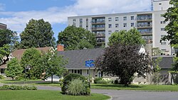
Location of Whitehaven
CountryCanada
Province Ontario
City Ottawa
Government
   MPs Anita Vandenbeld
   MPPs Chandra Pasma
   Councillors Theresa Kavanagh
Population
 (2021)
  Total2,323
Time zone UTC−5 (EST)
  Summer (DST) UTC−4 (EDT)

Whitehaven (also spelled White Haven) is a neighbourhood located in Bay Ward in the west end of Ottawa, Ontario, Canada, about 10 kilometres west of downtown. It is bounded by Carling Avenue to the north, Woodroffe Avenue to the east, the OC Transpo Transitway to the west and Highway 417 to the south. [1] As of 2021, the population of the neighbourhood is 2323. [2] [3]

Whitehaven was developed on the lands of Fox farm starting in the 1950s. The Fox farm homestead can still be found on Fox Crescent in the north part of the neighbourhood with its windmill tower now shaded by a large tree. Originally the east side of the neighbourhood was subdivided into large lots, typically 50 by 50 metres. In the 1960s, the west side was developed with smaller lots but mostly large custom homes. At the same time, many lots in the east side of the neighbourhood were subdivided and infill housing was built. Subdivisions have continued through to today, giving Whitehaven a very eclectic housing character. Whitehaven Crescent was built up throughout the mid 1960s as the area's namesake.

The south west side of the neighbourhood contains a large park with a playground, with schools including D. Roy Kennedy Public School and Woodroffe High School. In the 1960s there was also a public primary school which operated until 1999 called Whitehaven Public School. It was closed for a few years after much dispute and then was reopened and expanded as a French primary school, called Terre des Jeunes.

Whitehaven has plenty of transportation links, green space and shopping centres. The Carlingwood and Lincoln Fields shopping malls are within walking distance of the neighbourhood. Both shopping centres are serviced extensively by OC Transpo with Lincoln Fields being serviced by the Lincoln Fields Transit Station on the Transitway

Whitehaven is also connected locally to a network of bike paths with direct access to downtown Ottawa.

Related Research Articles

<span class="mw-page-title-main">Westboro, Ottawa</span> Neighbourhood in Ontario, Canada

Westboro is an area in the west end of Ottawa, Ontario, Canada. Located along the Ottawa River, Island Park Drive defines Westboro's eastern border, while the Ottawa River defines its northern border. Under this definition, the population of the area is 22,725.

<span class="mw-page-title-main">OC Transpo</span> Public transit service in Ottawa, Ontario, Canada

OC Transpo is the organisation that operates and plans public transport in the city of Ottawa. OC Transpo's system includes bus rapid transit, light rail, conventional bus routes, and door-to-door paratransit.

<span class="mw-page-title-main">Transitway (Ottawa)</span> Bus rapid transit system in Ottawa, Canada

The Transitway is a bus rapid transit (BRT) network operated by OC Transpo in Ottawa, Ontario, Canada. It comprises a series of bus-only roadways and reserved lanes on city streets and highways. The dedicated busways ensure that buses and emergency vehicles on the Transitway rarely intersect directly with the regular traffic, and make it possible for them to continue at full speed even during rush hour. OC Transpo operates a network of rapid routes which use the Transitway to connect communities with the O-Train light rail system. Additional bus routes also use segments of the Transitway.

<span class="mw-page-title-main">Barrhaven</span> Community in Ontario, Canada

Barrhaven is a suburb of Ottawa, Ontario, Canada. It is located about 17 km (11 mi) southwest of the city's downtown core. Prior to amalgamation with Ottawa in 2001, Barrhaven was part of the City of Nepean. Its population as of the Canada 2021 Census was 103,234.

uOttawa station Transit station in Ottawa, Canada

uOttawa is a light rail transit (LRT) station on the O-Train Confederation Line, located on the University of Ottawa campus.

<span class="mw-page-title-main">Hurdman station</span> Mass transit station in Ottawa, Canada

Hurdman is a major station on Ottawa's O-Train Confederation Line, and bus rapid transit (BRT) system, transitway.

<span class="mw-page-title-main">Kichi Zibi Mikan</span> Parkway in Ottawa, Ontario, Canada

The Kichi Zībī Mīkan, formerly the Sir John A. Macdonald Parkway, and previously the Ottawa River Parkway, is a four-lane scenic parkway along the Ottawa River in Ottawa, Ontario, Canada. It runs from Carling Avenue near Connaught Avenue, to Booth Street at the Canadian War Museum and National Holocaust Monument. It is maintained by the National Capital Commission. The speed limit is 60 km/h (37 mph). Bicycles are allowed on the road and on a parallel recreational path along the parkway.

<span class="mw-page-title-main">Dominion station</span> Dominion Station on the Transitway in Ottawa ,Ontario

Dominion is a station on the transitway in Ottawa, Ontario. It is located north of the western edge of Westboro village, where the below-grade transitway segment joins the Kichi Zībī Mīkan. The station is named after nearby Dominion Avenue.

<span class="mw-page-title-main">Lincoln Fields station</span>

Lincoln Fields is a station on Ottawa's transitway located at Carling Avenue and the Kichi Zibi Mikan. It is adjacent to the now-shuttered Lincoln Fields Shopping Centre. It is the main western hub of the transitway system and has a ticket sales and information office as well as a small convenience store. The transitway routes branch off in two directions: westward to Kanata and Stittsville, and southward to Barrhaven. The western branch of the transitway from this point is currently incomplete, forcing westbound routes to use existing streets such as Carling Avenue and the Queensway.

<span class="mw-page-title-main">Bayshore station (Ottawa)</span>

Bayshore is a station on the transitway in Ottawa, Ontario, served by OC Transpo buses. It is located in the western transitway section at the Bayshore Shopping Centre in the neighbourhood of Bayshore.

<span class="mw-page-title-main">Place d'Orléans station</span>

Place d'Orléans is a transitway station in the suburb of Orléans in the former city of Gloucester in Ottawa, Ontario, Canada. The station opened in 1994, just off Regional Road 174 and Champlain Street right next to Place d'Orléans Shopping Centre. It is the main transit hub between local routes in Orléans and route 39.

<span class="mw-page-title-main">Carlingwood</span> Neighbourhood in Ottawa, Ontario, Canada

Carlingwood is a neighbourhood in Bay Ward in the west end of Ottawa, Ontario, Canada. The neighbourhood is roughly bounded on the north by Richmond Road, on the east by Sherbourne Road, on the south by Carling Avenue and on the west by Woodroffe Avenue. This area corresponds to census tract 5050032.01, which had a population of 3,558 according to the Canada 2016 Census.

<span class="mw-page-title-main">Teron station</span> Transitway station in Ottawa

Teron is an OC Transpo Transitway Station in Ottawa, Ontario. The station is located in the suburb of Kanata on Campeau Drive just east of the intersection with Teron Road from which it takes its name, which in turn was named after William Teron, who was responsible for developing Kanata. It is near the western off-ramp of Highway 417 at March Road and an overpass north of Eagleson Station and Park and Ride. Teron was officially included in the Transitway system in the 2007 fall schedules.

<span class="mw-page-title-main">Marketplace station</span>

Marketplace is a Southwest Transitway station in the Barrhaven neighbourhood of Ottawa, Ontario, Canada. The station is located at the Chapman Mills Marketplace shopping centre, an extensive commercial zone which contains big-box stores and department stores.

<span class="mw-page-title-main">Fallowfield station (Ontario)</span> Bus and train station in Ottawa, Ontario, Canada

Fallowfield station or Fallowfield Train Station is an inter-city passenger railway station and bus rapid transit station located at 3347 Fallowfield Road in the suburban neighbourhood of Barrhaven in Ottawa, Ontario, Canada.

Katimavik-Hazeldean is a neighbourhood in Kanata South Ward in the west end of Ottawa, Ontario, Canada. It is located in the former City of Kanata which amalgamated into Ottawa in 2001. It is located in south-central Kanata, bounded by Eagleson Road to the east, Hazeldean Road to the south, the Carp River to the west, and Highway 417 to the north.

Britannia Heights is a neighbourhood in Bay Ward in west end of Ottawa, Ontario, Canada. The neighbourhood is a sub-neighbourhood of Britannia area of the city, but is within the Queensway Terrace North Community Association boundaries. The neighbourhood is away from the Ottawa River on a steep hill. It is bounded to the North by Carling Avenue, east by OC Transpo Transitway, south by Henley Street, and west by Bayshore Drive. The population of the neighbourhood is approximately 1750.

<span class="mw-page-title-main">Queensway Terrace North</span> Neighbourhood in Ottawa, Canada

Queensway Terrace North (QTN) is a neighbourhood in Bay Ward in the west end of Ottawa, Ontario, Canada. Its neighbourhood association is bounded to the north by Carling Avenue, to the west by Pinecrest Road, to the south by the Queensway, and to the east by the Transitway. These boundaries include the adjacent neighbourhood of Britannia Heights.

<span class="mw-page-title-main">Parkway Park</span> Neighbourhood in Ottawa, Ontario, Canada

Parkway Park is a neighbourhood in College Ward in Ottawa, Ontario, Canada. It is bounded to the north by the Queensway, to the west by Cobden Road, to the south by Baseline Road and to the east by Pinecrest Creek and the OC Transpo Transitway.

Country Place is a residential neighbourhood near the geographical centre of Ottawa, Canada, in Knoxdale-Merivale Ward. Prior to 2001, it was part of the former city of Nepean. It is a mature residential subdivision with about 400 houses located just inside the Ottawa greenbelt near the Rideau River, and about 11 km from downtown Ottawa. It is bordered by the Black Rapids Creek and the greenbelt to the south, Prince of Wales Drive to the east, Merivale Road to the west, and the Pineglen community to the north. Amberwood Crescent meanders through the community, exiting onto Prince of Wales and Merivale. Tennyson Drive links Country Place to Pineglen.

References

  1. "Baywardlive.ca".
  2. "Census of Population". Statistics Canada . Retrieved July 1, 2024.
  3. Population calculated by combining Dissemination Areas 35061178, 35061192, and 35061285

45°21′50″N75°46′30″W / 45.36389°N 75.77500°W / 45.36389; -75.77500