Orleans is a suburb of Ottawa, Ontario, Canada. It is located in the east end of the city along the Ottawa River, about 16 km (10 mi) from Downtown Ottawa. The Canada 2021 Census determined that Orléans' population was 125,937. Prior to being amalgamated into Ottawa in 2001, the community of Orléans was spread over two municipal jurisdictions, the eastern portion being in the pre-amalgamation City of Cumberland, the western portion in the City of Gloucester. According to the 2021 census, 75,453 people lived in the Cumberland portion of Orleans, while 50,484 people lived in the Gloucester portion. Today, Orléans spans the municipal wards of Orléans East-Cumberland, Orléans West-Innes, and Orléans South-Navan. Orléans contains a significant francophone population.

The Kichi Zībī Mīkan, formerly the Sir John A. Macdonald Parkway, and previously the Ottawa River Parkway, is a four-lane scenic parkway along the Ottawa River in Ottawa, Ontario, Canada. It runs from Carling Avenue near Connaught Avenue, to Booth Street at the Canadian War Museum and National Holocaust Monument. It is maintained by the National Capital Commission. The speed limit is 60 km/h (37 mph). Bicycles are allowed on the road and on a parallel recreational path along the parkway.

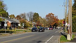
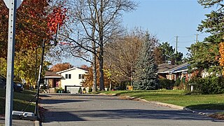
Pineview is a neighbourhood in Beacon Hill-Cyrville Ward in the east end of Ottawa, Ontario, Canada. Prior to amalgamation in 2001, the neighbourhood was part of the City of Gloucester. As of the Canada 2021 Census, the neighbourhood had a population of 6,179.

Crystal Beach is a neighbourhood in Ottawa, Ontario, Canada. It is located in the west end of Ottawa, in Bay Ward. The neighbourhood is triangular in shape, and its boundaries can broadly be described as Carling Avenue to the northeast, Moodie Drive to the west, and Corkstown Road to the south. It is. According to the Canada 2011 Census, the total population of the neighbourhood was 2,416.

Carlington is a neighbourhood located in River Ward in the west-end of Ottawa, Ontario, Canada.
Qualicum-Graham Park or Qualicum is a suburban neighbourhood in College Ward in the City of Ottawa, Ontario, Canada. It is located in the former City of Nepean in the west end of the city. Many of the residences in the area are executive homes situated on large lots (100x100) being built in the 1960s. Qualicum Street boasts large custom houses built by Bill Teron. The neighbourhood is bounded to the north by the Queensway, to the west by Richmond Road, to the south by Baseline Road, and to the east by Morrison Drive at the former Ottawa-Nepean border towards Redwood. Named after Qualicum Beach in British Columbia.
Katimavik-Hazeldean is a neighbourhood in Kanata South Ward in the west end of Ottawa, Ontario, Canada. It is located in the former City of Kanata which amalgamated into Ottawa in 2001. It is located in south-central Kanata, bounded by Eagleson Road to the east, Hazeldean Road to the south, the Carp River to the west, and Highway 417 to the north.
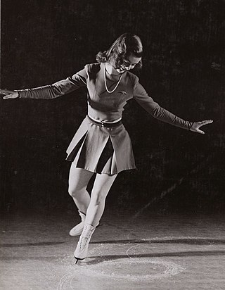
Barbara Ann Scott was a Canadian figure skater. She was the 1948 Olympic champion, a two-time World champion (1947–1948), and a four-time Canadian national champion in ladies' singles. Known as "Canada's Sweetheart,” she is the only Canadian to have won the Olympic ladies' singles gold medal, the first North American to have won three major titles in one year and the only Canadian to have won the European Championship (1947–48). During her forties she was rated among the top equestrians in North America. She received many honours and accolades, including being made an Officer of the Order of Canada in 1991 and a member of the Order of Ontario in 2008.

Riverside Park is a neighbourhood in the south end of Ottawa, Canada.
City View is a neighbourhood in College Ward in the west end of the city of Ottawa, Ontario, Canada. It is located within the former city of Nepean.
Britannia Heights is a neighbourhood in Bay Ward in west end of Ottawa, Ontario, Canada. The neighbourhood is a sub-neighbourhood of Britannia area of the city, but is within the Queensway Terrace North Community Association boundaries. The neighbourhood is away from the Ottawa River on a steep hill. It is bounded to the North by Carling Avenue, east by OC Transpo Transitway, south by Henley Street, and west by Bayshore Drive. The population of the neighbourhood is approximately 1750.
Queensway Terrace North (QTN) is a neighbourhood in Bay Ward in the west end of Ottawa, Ontario, Canada. Its neighbourhood association is bounded to the north by Carling Avenue, to the west by Pinecrest Road, to the south by the Queensway, and to the east by the Transitway. These boundaries include the adjacent neighbourhood of Britannia Heights.

Foster Farm, nicknamed "the Farm", is a neighbourhood in the Britannia area of Bay Ward in the west end of Ottawa, Ontario, Canada. It is roughly bounded to the north by Richmond Road, to the east by Pinecrest Road, to the west by the former Ottawa/Nepean city limits and the south by the Highway 417, the Queensway. It is bordered by Fairfield Heights, Queensway Terrace North, Redwood, Michele Heights. The total population of this area according to the 2016 Canada Census was 3,636.

Queensway Terrace South is a neighbourhood in College Ward in the west end of Ottawa, Ontario, Canada. It used to be part of Queensway Terrace but in 1967, Highway 417 was built and split apart into Queensway Terrace North and South. The borders are to the east Southwood Drive, to the south Baseline Road, Queensway to the north and Greenbank Road to the west. Along with next-door Ridgeview, the neighbourhood is part of the Queensway Terrace South Ridgeview Community Association.
Ridgeview is a neighbourhood in College Ward in the west end of Ottawa, Ontario, Canada. It is bordered to the south by Baseline Road, to the east by Cobden Road, to the North by the Queensway, and to the west by Southwood Drive. It was developed in the 1960s along with Parkway Park.

Briargreen is a suburban neighbourhood located in College Ward in the west end of Ottawa, Ontario, Canada. Prior to amalgamation in 2001 it was located in the City of Nepean. The borders of the neighbourhood are Pinecrest Cemetery to the north, Centrepointe to the east, Craig Henry to the south, and Greenbank Road to the west. The community was built in the late 1960s to early 1970s same time as the nearby neighbourhoods of Leslie Park and Arlington Woods. The main roads in the community are Ashgrove Crescent and Meadowbank Drive.

Belltown is a neighbourhood in the Britannia area of Bay Ward, in the west end of Ottawa. It is bounded on the east by Britannia Park, on the north by the Ottawa River, on the west by Andrew Haydon Park and the south by Carling Avenue. Prior to Ottawa's amalgamation in 2001, the neighbourhood spanned the Ottawa-Nepean municipal boundary. The neighbourhood's population is 2089, with 294 people living in the Nepean portion.