Rosedale is a neighbourhood in central Toronto, Ontario, Canada. It was formerly the estate of William Botsford Jarvis, and so named by his wife, granddaughter of William Dummer Powell, for the wild roses that grew there in abundance. It is located north of Downtown Toronto and is one of its oldest suburbs. In 2013, Rosedale was ranked the best neighbourhood in Toronto to live in by Toronto Life. According to Today’s Senior Magazine, it is known as the area where the city's 'old money' lives, and is home to some of Canada's richest and most famous citizens including Gerry Schwartz, founder of Onex Corporation, Adrienne Clarkson, the 26th Governor General of Canada, and her husband, the author John Ralston Saul, as well as David Thomson, 3rd Baron Thomson of Fleet of the Thomson Corporation, the latter of whom is the richest man in Canada.
Riverview is a neighbourhood in Ottawa, Ontario, Canada. It is southeast of the downtown adjacent to the Rideau River, its location on which is its namesake. The 2021 Census population of Riverview is 13,113.
Westboro is an area in the west end of Ottawa, Ontario, Canada. Located along the Ottawa River, Island Park Drive defines Westboro's eastern border, while the Ottawa River defines its northern border. Under this definition, the population of the area is 22,725.

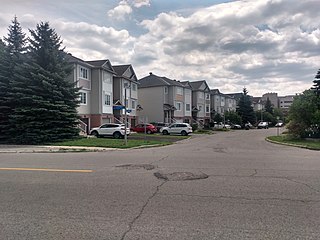
Kanata is a suburb and former city within Ottawa, Ontario, Canada. It is located about 22 km (14 mi) west of the city's downtown core. As of 2021, the former City of Kanata had a population of 98,938, with the population centre having a population of 137,118. Before it was amalgamated into Ottawa in 2001, it was one of the fastest-growing cities in Canada and the fastest-growing community in Eastern Ontario. Located just to the west of the National Capital Commission Greenbelt, it is one of the largest of several communities that surround central Ottawa.

Heron Gate or Herongate is a neighbourhood in Alta Vista Ward and Gloucester-Southgate Ward in the south end of Ottawa, Ontario, Canada. It is defined by the Herongate Tenant Coalition as being bounded on the north by Heron Road, on the west by Heron-Walkley Park and Albion Road, and by the Walkley rail corridor on the south. The total population for this area according to the Canada 2016 Census was 9,714.

Barrhaven is a suburb of Ottawa, Ontario, Canada. It is located about 17 km (11 mi) southwest of the city's downtown core. Prior to amalgamation with Ottawa in 2001, Barrhaven was part of the City of Nepean. Its population as of the Canada 2021 Census was 103,234.
Alta Vista is a neighbourhood in Alta Vista Ward in Ottawa, Ontario, Canada. Its boundaries according to the Alta Vista Community Association are that part of Alta Vista Ward south of Smyth Road in the north, north of Walkley Road and east of the Rideau River, and west of the "greenspace underneath Haig Drive". However, the name is ambiguous, as there are several sub-neighbourhoods in this area,, as the neighbourhood could refer to the ward as a whole, down to the core Alta Vista area,, centred on Alta Vista Drive.

Lincoln Heights is a neighbourhood in the Britannia area of Bay Ward in the west end of Ottawa, Ontario, Canada. It is defined by its community association as being bounded to the south by the north side of Regina Lane, to the north by the Ottawa River, to the west by the east side of Croydon Avenue, and to the east by the Kichi Zibi Mikan. According to the Canada 2016 Census, the population of the neighbourhood is 1,630. The greater Lincoln Heights area can be defined as extending as far west as Greenview Avenue and as far south as Carling Avenue, which overlaps with neighbouring Britannia Village.

Carlington is a neighbourhood located in River Ward in the west-end of Ottawa, Ontario, Canada.
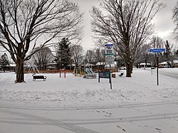
Hampton Park is a park and neighbourhood in Kitchissippi Ward, in the west end of Ottawa, Ontario, Canada. It is directly north of the Queensway at Island Park Drive. The park is maintained by the National Capital Commission.
Qualicum-Graham Park or Qualicum is a suburban neighbourhood in College Ward in the City of Ottawa, Ontario, Canada. It is located in the former City of Nepean in the west end of the city. Many of the residences in the area are executive homes situated on large lots (100x100) being built in the 1960s. Qualicum Street boasts large custom houses built by Bill Teron. The neighbourhood is bounded to the north by the Queensway, to the west by Richmond Road, to the south by Baseline Road, and to the east by Morrison Drive at the former Ottawa-Nepean border towards Redwood. Named after Qualicum Beach in British Columbia.
Central Park is a neighbourhood in River Ward in the west end of Ottawa, Ontario, Canada. It is bounded on the east by Merivale Road, on the south by Baseline Road, on the west by Clyde Avenue and on the north by the Carlington neighbourhood. The population of the neighbourhood in 2016 was 3,888 in an area of 0.91 km2. It more than doubled its population between 2001 and 2006 as the neighbourhood expanded. Excluding the residences south of Baseline which are included in the Census Tract, the population of the neighbourhood is 3,760.

Carleton Heights is a neighbourhood in River Ward in Ottawa, Ontario, Canada. According to the Carleton Heights and Area Community Association, the neighbourhood is bounded on the north by the Central Experimental Farm, on the east by the Rideau River, on the south by the junction of Prince of Wales Drive and Fisher Avenue and on the west by Fisher Avenue. The neighbourhood is sometimes referred to as Hog's Back after the nearby falls. The total population of the neighbourhood is 7,586 according to the Canada 2016 Census.

Eastway Gardens is a small neighbourhood in Alta Vista Ward in the east end of Ottawa, Ontario, Canada. It consists of a series of dead end streets coming off of Tremblay Road between Riverside Drive and St. Laurent Boulevard. Most of these streets are named for letters of the alphabet, beginning with Avenue K and ending with Avenue U. According to the Canada 2016 Census, the neighbourhood had a population of 602. The residents association boundaries for the neighbourhood are the Rideau River to the west, St. Laurent Boulevard to the east, Coventry Road to the north, and Belfast Road to the south.

Bel-Air Park is a neighbourhood in College Ward in the west end of Ottawa, Ontario, Canada. It is bounded on the east by the Experimental Farm Pathway, on the south by Baseline Road, on the west by Woodroffe Avenue and on the north by the Queensway.
McKellar Heights is a small neighbourhood located in Kitchissippi Ward, in the west end of Ottawa, Ontario, Canada. The neighbourhood is generally triangular in shape, and is generally bounded on the north by Westboro, on the west by Glabar Park, and on the south by Carlington. The population as of the Canada 2016 Census was 575.

Champlain Park is an older urban neighbourhood in Kitchissippi Ward in Ottawa, Ontario, Canada. It was considered in the 1930s as the west end of town. The boundaries of the neighbourhood are the Ottawa River and Scott Street. To the east is Tunney's Pasture and to the west is Island Park Drive. Westboro Beach is also to the west. The population as of the 2016 Census was 1090.
Urbandale is a neighbourhood in Alta Vista Ward in Ottawa, Ontario, Canada. The neighbourhood is roughly located south of Pleasant Park Road, west of St. Laurent Boulevard, north of Walkley Road and east of the Kilborn Allotment Garden. The total population for this area was 4,622 according to the Canada 2016 Census.

Hunt Club Park is a residential neighbourhood in Gloucester-Southgate Ward in the south end of Ottawa, Ontario, Canada. The Ottawa Neighbourhood Study defines the boundaries of the neighbourhood as being Johnston Road-Blohm Drive and Hunterswood Crescent on the north, Hunt Club Road on the south, Hawthorne Road on the east and Conroy Road on the west. The neighbourhood generally corresponds to Census Tracts 5050001.08 and 5050001.07 which had a combined population of 8,825 as of the Canada 2016 Census. The Census also showed 5 people living east of Hawthorne Road, an area generally not considered part of the neighbourhood, but part of the former census tract.