Centepointe | |
---|---|
Neighbourhood | |
Coordinates: 45°20′33″N75°46′05″W / 45.34261°N 75.76810°W | |
Country | Canada |
Province | Ontario |
City | Ottawa |
Government | |
• MPs | Anita Vandenbeld |
• MPPs | Chandra Pasma |
• Councillors | Laine Johnson |
• Governing body | Centrepointe Community Association |
• President | Ron Benn [1] |
Area | |
• Total | 2.07 km2 (0.80 sq mi) |
Elevation | 85 m (279 ft) |
Population | |
• Total | 7,245 |
• Density | 3,500/km2 (9,100/sq mi) |
Time zone | Eastern (EST) |
Forward sortation area | K2G |
Website | Community Association |
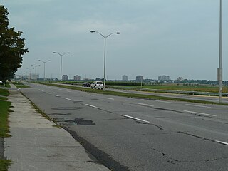
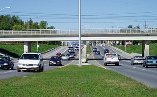
Centrepointe is a neighbourhood in College Ward in the west end of the city of Ottawa, Ontario, Canada. It was formerly part of the city of Nepean. It is a newer residential subdivision in the west/central part of Ottawa, developed from 1984 onwards, and is informally bounded by Baseline Road to the north, Woodroffe Avenue to the east, the CN railroad to the south, and the Briargreen subdivision and Forest Ridge Apartments to the west. The housing stock includes approximately 1,000 detached homes, with the remainder mostly townhomes (row houses) and terrace homes.
According to the Canada 2016 Census, the neighbourhood had a total population of 7,245. [2]
Year | Pop. | ±% |
---|---|---|
1996 | 6,163 | — |
2001 | 7,144 | +15.9% |
2006 | 7,275 | +1.8% |
2011 | 7,523 | +3.4% |
2016 | 7,245 | −3.7% |
Sources: [3] |
Previously farmland, it was purchased by the Canada Mortgage and Housing Corporation, which let the land lay fallow for many years. It had been intended to be developed as a demonstration model of an "ideal community". After facing budget cuts, CMHC sold the land, [4] with most being sold off to Ottawa's largest housing developer Minto Group, which built and sold off a wide range of homes from townhouses to large upscale houses. The neighbourhood was built to be Nepean's "downtown", with plans to build shops and offices and a civic square, to house Nepean's city hall. [5] The neighbourhood was built as a "self-contained community" and was projected to cost $700 million. [4]
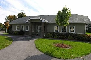
Its major attraction is Ben Franklin Place, named for the former mayor of Nepean, which houses the Centrepointe Branch of the Ottawa Public Library, the locally renowned Centrepointe Theatre, and the former Nepean City Hall (now housing satellite offices for the City of Ottawa).
The neighbourhood has a significant Jewish population. The 2011 National Household Survey indicated that 13% of the neighbourhood's population was Jewish. [6]
The Centrepointe Community Association was formed on February 4, 2006 to represent and advance the interests of neighbourhood residents. A major issue confronting the association is the City of Ottawa's proposed development of the Centrepointe Town Centre concept, which could add up to two million square feet of high density residential and commercial space to the area. Residential construction in Centrepointe continues. In 2007, a former snow dump next to Centrepointe Park was converted into approximately 260 townhouses, terrace homes and low-rise apartments, which was completed in early 2011. The Centrepointe Community Association has not been very active as of late; however, it does advertise a community garage sale each spring.
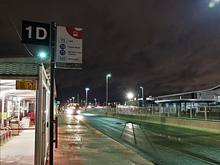
The easternmost portion of Centrepointe underwent major development. As of January 2012, construction had finished on three major projects: the City of Ottawa Archives at the corner of Tallwood Drive and Woodroffe Avenue, a new trades building for nearby Algonquin College, and expansion of Centrepointe Theatre at Ben Franklin Place. Baseline Station Portions of Constellation Drive were rerouted to accommodate the new buildings and as part of the City's long-term public transportation plan.
As of 2022, two major apartment building projects are underway in the north section of Centrepointe: a 2-tower (22 and 24 storeys) Richcraft condominium complex on the southwest corner at 19 Centrepointe Drive, and a 15-storey rental apartment building near the northeast corner of Constellation Drive (2140 Baseline Road).
Baseline station is expected to be the terminus of Stage 2 of the LRT's Confederation Line, to be completed in 2023. [7]
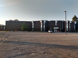
Many school-aged children attend Briargreen, Manordale, Knoxdale (French Immersion), Greenbank Middle School (closed in 2017), and then Sir Robert Borden High School.
Centrepointe has 2805, ethnic minorities per stats can 2016 census. [8]
Riverview is a neighbourhood in Ottawa, Ontario, Canada. It is southeast of the downtown adjacent to the Rideau River, its location on which is its namesake. The 2021 Census population of Riverview is 13,113.
Ottawa West—Nepean is a federal electoral district in Ontario, Canada, that has been represented in the House of Commons of Canada since 1997.
Nepean is a former municipality and now geographic area of Ottawa, Ontario, Canada. Located west of Ottawa's inner core, it was an independent city until amalgamated with the Regional Municipality of Ottawa–Carleton in 2001 to become the new city of Ottawa. However, the name Nepean continues in common usage in reference to the area. The population of Nepean is about 186,593 people.
Baseline Road is a road in Ottawa, Ontario, Canada.
Barrhaven is a suburb of Ottawa, Ontario, Canada. It is located about 17 km (11 mi) southwest of the city's downtown core. Prior to amalgamation with Ottawa in 2001, Barrhaven was part of the City of Nepean. Its population as of the Canada 2021 Census was 103,234.
Parkway Forest is a neighbourhood in Toronto, Ontario, Canada. It is located in the north of the city, in the former suburb of North York. Parkway Forest is bounded on the west by Don Mills Road, on the north by Sheppard Avenue, on the east by the Don Valley Parkway, and on the south by Highway 401. It is contained within the city's officially designated neighbourhood of Henry Farm, although it is distinct in character from the residential community of that same name west of Don Mills Road. Parkway Forest is part of Ward 17 in the Toronto City Council, part of the new Don Valley North federal electoral district, and part of the Don Valley East provincial electoral district.
Baseline (Algonquin) is a public transit station directly across from the main campus of Algonquin College in Ottawa's west end, near the intersection of Woodroffe Avenue and Baseline Road. Many Algonquin College students and Centrepointe residents use this station to get to various points in the city, and to and from the college. Several residential and business areas such as Centrepointe and College Square are also served by this station.
Woodroffe Avenue is a major north-south arterial road in Ottawa, Ontario, Canada's west end. It runs south from the Kichi Zibi Mikan through Baseline Road and Barrhaven to just short of Prince of Wales Drive near Manotick. The road runs through the heart of Nepean in Ottawa's west end. A satellite Via Rail station is also located at the intersection of Fallowfield Road.
Bells Corners is a suburban neighbourhood in Ottawa, Ontario, Canada. It is located along Robertson Road west of downtown, within Ottawa's western Greenbelt, in College Ward. As of the Canada 2016 Census, the community had a population of 9,272.
Meadowlands Drive is a suburban road in Ottawa, Ontario, Canada. It begins at Prince of Wales Drive as a continuation of Hog's Back Road in the neighborhood of Rideauview. There are two small shopping plazas and a Shell station at its corner with Prince of Wales. It then continues westward towards Fisher Avenue and consists of low-income housing projects, low-rise apartment buildings, townhouses and semi-detached homes. The speed limit here is 50 km/h (31 mph). most of Meadowlands is one lane, other than between Prince of Wales to Fisher, and from Chesterton to Merivale.
Centrepointe Theatre stylized as Meridian Theatres @ Centrepointe, are publicly owned performance halls located in the former city of Nepean in Ottawa, Ontario, Canada. The building originally opened in 1988 with a 954-seat mainstage theatre and added a smaller studio theatre in February 2011. In 2018, Meridian Credit Union entered into a fifteen-year naming rights agreement with the City of Ottawa. The studio theatre was renamed the Les Lye Studio Theatre in 2019.
Craig Henry is a residential neighbourhood in Knoxdale-Merivale Ward in the west end of Ottawa, Canada. It is located in the former city of Nepean. It is a residential subdivision that was developed from 1971 onwards. The neighbourhood is bordered by Woodroffe Avenue to the east, Greenbank Road to the west, Knoxdale Road to the south and the CN railroad separating it from Centrepointe and Briargreen to the north. The land previously belonged to the Craig Henry farm, and was developed by Jack Aaron.
Borden Farm is a neighbourhood in Knoxdale-Merivale Ward in Ottawa, Ontario, Canada. It is located in the former city of Nepean, which was amalgamated into Ottawa in 2001. It was built on the site of the former Borden Dairy Farm. The land was bought by the Canada Mortgage and Housing Corporation (CMHC) in 1959. The Borden farm community was built in 1967–1976 as a joint development of the CMHC and the Ontario Housing Corporation and features single-family homes with parks and bikeways placed behind the houses, instead of on the streets. There was more development in the 1980s and early 1990s.
Woodpark is a small neighbourhood in Bay Ward, in the west end of Ottawa, Ontario, Canada. It is bounded in the north by Richmond Road, to the East by Woodroffe Avenue north, in the South by Carling Avenue and in the west by the Kichi Zibi Mikan. The total population of the neighbourhood according to the Canada 2016 Census was 2,191.
Westcliffe Estates, is a neighbourhood of Bells Corners in College Ward, in the west end of Ottawa, Ontario, Canada. Founded in 1969, most of the older homes in this area were built by Assaly Construction and later the Thomas C. Assaly Corporation. The Westcliffe community is characterized by significantly higher residential densities than other parts of Bells Corners. There is a multi-storey housing complex operated by Nepean Housing as well as a multi-storey seniors residence and co-operative housing project. Today there are a total of 1760 homes in the neighbourhood.
Redwood is a neighbourhood located in Ottawa's west end. The boundaries of the neighbourhood is Greenbank Road to the east, Baseline Road to the south, Morrison Drive to the west and Highway 417 to the north.
Tanglewood, also known as Tanglewood-Hillsdale, is a suburban neighbourhood in Knoxdale-Merivale Ward in the city of Ottawa, Ontario, Canada. It is located within the former City of Nepean in the west end of the city. It is located in the federal and provincial ridings of Nepean-Carleton. It is informally bounded by CN Railway to the north, Merivale Road to the east, Hunt Club Road to the south, and Woodroffe Avenue to the west.
Briargreen is a suburban neighbourhood located in College Ward in the west end of Ottawa, Ontario, Canada. Prior to amalgamation in 2001 it was located in the City of Nepean. The borders of the neighbourhood are Pinecrest Cemetery to the north, Centrepointe to the east, Craig Henry to the south, and Greenbank Road to the west. The community was built in the late 1960s to early 1970s same time as the nearby neighbourhoods of Leslie Park and Arlington Woods. The main roads in the community are Ashgrove Crescent and Meadowbank Drive.
The Minto Group is a Canadian real estate company based in Ottawa, Ontario. It builds homes in Ottawa, Toronto, Calgary, and Florida, and manages multi-residential and commercial properties in Ontario and Alberta. As of 2018, Minto has built 85,000 new homes, and manages $2.9 billion in assets, including 13,000 multi-residential units and 2.7 million square feet of commercial space. The firm is one of Ottawa's largest residential landlords. Minto also has a publicly traded subsidiary, holding some of its multi-residential units, called Minto Apartment Real Estate Investment Trust. Some of Minto's joint-venture partners have been with Lasalle Investment Management, Greystar, and CPPIB.
{{cite web}}
: CS1 maint: multiple names: authors list (link)