Related Research Articles
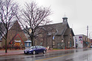
Westboro is an area in the west end of Ottawa, Ontario, Canada. Located along the Ottawa River, Island Park Drive defines Westboro's eastern border, while the Ottawa River defines its northern border. Under this definition, the population of the area is 22,725.

Kanata is a suburb and former city within Ottawa, Ontario, Canada. It is located about 22 km (14 mi) west of the city's downtown core. As of 2021, the former City of Kanata had a population of 98,938, with the population centre having a population of 137,118. Before it was amalgamated into Ottawa in 2001, it was one of the fastest-growing cities in Canada and the fastest-growing community in Eastern Ontario. Located just to the west of the National Capital Commission Greenbelt, it is one of the largest of several communities that surround central Ottawa.

Ottawa West—Nepean is a federal electoral district in Ontario, Canada, that has been represented in the House of Commons of Canada since 1997.

Ottawa Centre is an urban federal electoral district in Ontario, Canada, that has been represented in the House of Commons of Canada since 1968. While the riding's boundaries have changed over the years to account for population changes, the riding has always comprised the central areas of Ottawa, the nation's capital.

Carleton is a federal electoral district in Ontario, Canada, represented in the House of Commons of Canada from 1867 to 1968 and since 2015. It was represented in the Legislative Assembly of Upper Canada from 1821 to 1840 and in the Legislative Assembly of the Province of Canada from 1841 until 1866. It has been represented by Pierre Poilievre, the current Leader of the Opposition, since its creation in 2015.

The Kichi Zībī Mīkan, formerly the Sir John A. Macdonald Parkway, and previously the Ottawa River Parkway, is a four-lane scenic parkway along the Ottawa River in Ottawa, Ontario, Canada. It runs from Carling Avenue near Connaught Avenue, to Booth Street at the Canadian War Museum and National Holocaust Monument. It is maintained by the National Capital Commission. The speed limit is 60 km/h (37 mph). Bicycles are allowed on the road and on a parallel recreational path along the parkway.
Ottawa Centre is an urban provincial electoral district in Ontario, Canada that has been represented in the Legislative Assembly of Ontario since 1968. While the riding's boundaries have changed over the years to account for population changes, the riding has always comprised the central areas of Ottawa, the nation's capital.

Ottawa—Vanier is a provincial electoral district in Ottawa, Ontario, Canada, that has been represented in the Legislative Assembly of Ontario since 1908. It is located in the east end of Ottawa.

Crystal Beach is a neighbourhood in Ottawa, Ontario, Canada. It is located in the west end of Ottawa, in Bay Ward. The neighbourhood is triangular in shape, and its boundaries can broadly be described as Carling Avenue to the northeast, Moodie Drive to the west, and Corkstown Road to the south. It is. According to the Canada 2011 Census, the total population of the neighbourhood was 2,416.

Woodroffe North is a neighbourhood in Bay Ward in the west end of Ottawa, Ontario, Canada. It is bounded on the south by Richmond Road on the west by Pooler Avenue, on the north by the Ottawa River and on the east by the northern prolongation of Sherbourne Avenue. Woodroffe North has also been referred to as a community within the neighbourhood of Westboro which claims its western border to be Woodroffe Avenue. The Woodroffe North Community includes residents that live on streets West of Woodroffe Avenue. Originally the homes used to be cottages similar to those in Britannia. Most of the cottages were demolished and changed into houses. Lockhart Avenue is split up at Richmond Road and continues at Byron and ends at Saville Row in front of Carlingwood.
Dovercourt is a residential neighbourhood in north west Edmonton, Alberta, Canada. While the area was originally annexed by the City of Edmonton in 1913, residential development did not occur until after the end of World War II.

McKellar Park is a neighbourhood located in Bay Ward in the west end of Ottawa, Ontario, Canada. It is sometimes considered to be part of the greater Westboro area. It is bounded on the east by Denbury Avenue, on the south and west by Sherbourne Avenue and on the north by the Ottawa River. The neighborhood of Highland Park is directly to its east. It is considered a trendy and expensive area, being close to the Westboro Village.
Katimavik-Hazeldean is a neighbourhood in Kanata South Ward in the west end of Ottawa, Ontario, Canada. It is located in the former City of Kanata which amalgamated into Ottawa in 2001. It is located in south-central Kanata, bounded by Eagleson Road to the east, Hazeldean Road to the south, the Carp River to the west, and Highway 417 to the north.
Newswest is a community publication serving a number of communities within Canada's National Capital Region. Newswest is a wholly Canadian publication and not related to the 1980s U.S. newspaper NewsWest, previously owned by Tab Communications.

Woodpark is a small neighbourhood in Bay Ward, in the west end of Ottawa, Ontario, Canada. It is bounded in the north by Richmond Road, to the East by Woodroffe Avenue north, in the South by Carling Avenue and in the west by the Kichi Zibi Mikan. The total population of the neighbourhood according to the Canada 2021 Census was 2,306.
McKellar Heights is a small neighbourhood located in Kitchissippi Ward, in the west end of Ottawa, Ontario, Canada. The neighbourhood is generally triangular in shape, and is generally bounded on the north by Westboro, on the west by Glabar Park, and on the south by Carlington. The population as of the Canada 2016 Census was 575.

Queensway Terrace North (QTN) is a neighbourhood in Bay Ward in the west end of Ottawa, Ontario, Canada. Its neighbourhood association is bounded to the north by Carling Avenue, to the west by Pinecrest Road, to the south by the Queensway, and to the east by the Transitway. These boundaries include the adjacent neighbourhood of Britannia Heights.
Laurentian View is a sub-neighbourhood of Westboro, Ottawa, Ontario, Canada. It is bounded west by Tweedsmuir, north to Richmond Road, east to Hilson and south by Carling Avenue. While the name still appears on maps, it fell out of use to describe the area in the 1970s, as the area is now found completely with in the boundaries of the Hampton-Iona neighbourhood.

Byron Linear Tramway Park is a municipal park in Kitchissippi Ward and Bay Ward in Ottawa, Ontario, Canada. The park forms a narrow strip of park land that runs westward from Holland Avenue to Richardson Avenue in Woodpark, with the exception of Westboro Village. Running through the entirety of the park is a path through grass and trees. The park forms a narrow 2.5 km strip, but has a width varies between 5 and 15 metres.
References
- ↑ "Place names - Highland Park".
- ↑ "Map of Highland Park". 10 October 2011.
- ↑ "A History of Westboro". aix1.uottawa.ca. Retrieved 2022-10-07.
- ↑ Population calculated by combining Dissemination Areas 35061749, 35061751, 35061753, 35061754, 35060437, 35060434, 35060436, 35060438 and subtracting Dissemination Blocks 3506043408, 3506043603, 3506043606, 3506043607, 3506043608, 3506043806, 3506043807
- ↑ "Home". ndh.ocsb.ca. Retrieved 2023-02-02.