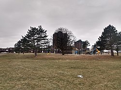
Heron Gate | |
---|---|
Neighbourhood | |
Coordinates: 45°22′40″N75°39′00″W / 45.37778°N 75.65000°W | |
Country | Canada |
Province | Ontario |
City | Ottawa |
Government | |
• MPs | David McGuinty |
• MPPs | John Fraser |
• Councillors | Marty Carr, Jessica Bradley |
• Community association | Herongate Tenant Coalition |
Area | |
• Total | 1.538 km2 (0.594 sq mi) |
Elevation | 90 m (300 ft) |
Population (2021) | |
• Total | 9,974 |
• Density | 6,458/km2 (16,730/sq mi) |
Canada 2021 Census | |
Time zone | UTC-5 (Eastern (EST)) |
Heron Gate [1] or Herongate is a neighbourhood in Alta Vista Ward and Gloucester-Southgate Ward in the south end of Ottawa, Ontario, Canada. It is defined by the Herongate Tenant Coalition as being bounded on the north by Heron Road, on the west by Heron-Walkley Park and Albion Road, and by the Walkley rail corridor on the south. [2] The total population for this area (excluding the Oak apartments on Albion which are in a different Census block) according to the Canada 2021 Census was 9,974. [3]
There are several parks in the neighbourhood, and is served by Ridgemont High School), St. Patrick's High School, St. Patrick Intermediate and Charles Hulse Elementary School for education. The area has train tracks to the south. It is one of the most densely populated neighbourhoods in the city. A number of new developments were completed on the west of the neighbourhood between 2006 and 2008.
The neighbourhood north of Walkely was first built by Minto in 1966, [4] [5] while the neighbourhood south of Walkely was first built prior to 1976. [6] Ottawa City Council approved the construction of 576 units on Heatherington in 1970, [7] and 150 units at the corner of Heatherington and Albion in 1972. [8]
The neighbourhood is extremely linguistically and racially diverse. According to the 2016 Census, a plurality of the neighbourhood (42%) is Anglophone and 13% is Francophone. Other major languages include Arabic (12%), Somali (11%), Nepali (4%), Spanish (2%), Creoles (2%) and Persian (2%). It is a plurality Black Canadian (32%), and is nearly equally White (31%). Arab Canadians also make up a significant proportion (15%). Other races include South Asian (7%), Filipino (3%), Latin American (2%), Indigenous (2%), Chinese (2%), West Asian (1%) and Southeast Asian (1%). [9] [10] [11] [12] [13] [14]
The main shopping area in the Herongate area is the Herongate Square (formerly Herongate Mall). There are also stores nearby which are separate from the mall.
Most properties south of Heron and north of Walkley, within Baycrest Drive, Sandalwood Drive and Cedarwood Drive are managed by Timbercreek Asset Management [15] who took possession in 2012. In 2016, Timbercreek evicted residents from 80 townhomes in Heron Gate, to make room for new developments in the area. [15] In May 2018, it announced that it would evict residents of a further 150 townhomes, due to structural problems with the buildings. [16] The decision to redevelop the area received criticism from residents and interested parties such as the UN special rapporteur on Adequate Housing, [17] and was described as the "'largest forced displacement in Canada' in recent history." [18]
These evictions were criticized as being part of a broader pattern of racist “reno-victions” or “demo-victions”, [19] as “90% of more than 500 tenants evicted in 2018 after rental properties were allowed to deteriorate were racial minorities”. [20] Nonetheless, Heron Gate has been noted by scholars such as Emily Power, Bjarke Skærlund Risager, [21] and Marina Gomá as an important site of working class, anti-racist activism by its residents. As Gomá notes, “The Herongate Tenant Coalition articulates a different reality to the narrative of Canadian benevolence, embodying class solidarity, denouncing structural racism, and recruiting allies to donate to their legal case against Timbercreek Management.” [22]
Following an extended grassroots activist campaign and a human rights challenge, [23] Timbercreek agreed to provide CAD$2,000 in moving compensation, relocation assistance and negotiated discounts with Ottawa moving companies. [24]
Regent Park is a neighbourhood located in downtown Toronto, Ontario built in the late 1940s as a public housing project managed by Toronto Community Housing. It sits on what used to be a significant part of the Cabbagetown neighbourhood and is bounded by Gerrard Street East to the north, River Street to the east, Shuter Street to the south and Parliament Street to the west. Regent Park's residential dwellings, prior to the ongoing redevelopment, were entirely social housing and covered all of the 69 acres (280,000 m2) which comprise the community. The original neighbourhood was razed in the process of creating Regent Park. The nickname Cabbagetown is now applied to the remaining historical, area north and west of the housing project, which has experienced considerable gentrification since the 1960s and 1970s.
Sandy Hill is a neighbourhood in Ottawa, Ontario, located just east of downtown. The neighbourhood is bordered on the west by the Rideau Canal, and on the east by the Rideau River. To the north it stretches to Rideau Street and the Byward Market area while to the south it is bordered by the Queensway highway and Nicholas Street. The area is named for its hilliness, caused by the river, and its sandy soil, which makes it difficult to erect large buildings. It is home to a number of embassies, residences and parks. Le Cordon Bleu operates its Canadian school there, at the opposite end of Sandy Hill from the University of Ottawa.
Riverview is a neighbourhood in Ottawa, Ontario, Canada. It is southeast of the downtown adjacent to the Rideau River, its location on which is its namesake. The 2021 Census population of Riverview is 13,113.
Heron Road is a major road in Ottawa, Ontario, Canada. It runs from Walkley Road at an angle to the Rideau River, where it turns into Baseline Road. Heron is home to the Sir Leonard Tilley Building, the Canada Post headquarters, and the Edward Drake Building. It is also home to St. Patrick's Intermediate High School and Herongate Mall.
Russell Road is an arterial road in Eastern Ontario, Canada. It begins in Ottawa in the Riverview neighbourhood and runs eastward through the rural communities of Ramsayville, Carlsbad Springs and Bearbrook in Ottawa and through the Municipality of Clarence-Rockland, connecting the communities of Cheney and Bourget, ending at Boundary Road on the eastern border of Clarence Rockland. In Ottawa it is officially Ottawa Road #26, and in Clarence-Rockland as United Counties of Prescott and Russell County Road #2.
Ottawa South is a federal electoral district in Ottawa, Ontario, Canada. It is represented in the House of Commons of Canada by David McGuinty, brother of former Premier of Ontario and Ottawa South MPP Dalton McGuinty. It has been held continuously by Liberal candidates since it was first contested in 1988, and is regarded as one of the strongest Liberal ridings in Canada. Ottawa South is a suburban, generally middle class riding, notable for having the highest Arab population in Ontario.
LeBreton Flats, known colloquially as The Flats, is a neighbourhood in Somerset Ward in central Ottawa, Ontario, Canada. It lies to the west of Centretown neighbourhood, and to the north of Centretown West. The Ottawa River forms the western and northern limit, with the western side being a wider area of the river known as Nepean Bay.
Alta Vista is a neighbourhood in Alta Vista Ward in Ottawa, Ontario, Canada. Its boundaries according to the Alta Vista Community Association are that part of Alta Vista Ward south of Smyth Road in the north, north of Walkley Road and east of the Rideau River, and west of the "greenspace underneath Haig Drive". However, the name is ambiguous, as there are several sub-neighbourhoods in this area,, as the neighbourhood could refer to the ward as a whole, down to the core Alta Vista area,, centred on Alta Vista Drive.
Westmount is a neighbourhood in the southwest part of London, Ontario, Canada. As of the 2016 Canadian census, the population of Westmount is 18,985 (2016). The top five ethnic origins are English, Scottish, Canadian, Irish, and German. The average household income for the neighbourhood is $98,850, one of the highest in the city, however employment levels are down in comparison with the city. The top three occupations of Westmount residents are: Sales and Service occupations, Business & Finance, and Administration.
Carlington is a neighbourhood located in River Ward in the west-end of Ottawa, Ontario, Canada.
Sheffield Glen is a neighbourhood in Alta Vista Ward in southeast Ottawa, Ontario, Canada. It is bounded on the west by Russell Road, on the south by Walkley Road and on the north and east by Lancaster Road. The neighbourhood is more commonly referred to as Southvale by Ottawans, but appears as Sheffield Glen on maps. Southvale Crescent is the name of the main street which runs through the neighbourhood and is home to a majority of residents. The neighbourhood is home to many apartment buildings and townhouses. Its population according to the Canada 2011 Census was 2877. This decreased to 2,744 according to the Canada 2016 Census.
Heron Park is a neighbourhood in Capital Ward in Ottawa, Ontario, Canada. Its boundaries are the Rideau River to the north, the Sawmill Creek to the west, Bank Street to the east and Walkley Road to the south.
Guildwood Estates is a sub neighbourhood within the Alta Vista area of Ottawa, Ontario, Canada. It can be broadly described as south of Kilborn Ave., west of the Walkley-Kilborn greenspace, east of Parkland and north of Heron Road. The population of this area according to the Canada 2011 Census was 3,179. However, maps usually show Guildwood Estates as the western section of this area, while the eastern half is the neighbourhood of Urbandale Acres. Guildwood Estates is newer, having mostly been built in the early 1970s, while Urbandale Acres was built in the 1960s.
The Herongate Square is an unenclosed shopping centre in the Heron Gate neighbourhood of Ottawa, Ontario, Canada, at the intersection of Walkley Road and Heron Road. Prior to redevelopment in the mid-2010s, it was the site of the Herongate Mall, a medium-sized mall launched in 1981. It is currently owned by Trinity Financial.
Eastway Gardens is a small neighbourhood in Alta Vista Ward in the east end of Ottawa, Ontario, Canada. It consists of a series of dead end streets coming off of Tremblay Road between Riverside Drive and St. Laurent Boulevard. Most of these streets are named for letters of the alphabet, beginning with Avenue K and ending with Avenue U. According to the Canada 2016 Census, the neighbourhood had a population of 602. The residents association boundaries for the neighbourhood are the Rideau River to the west, St. Laurent Boulevard to the east, Coventry Road to the north, and Belfast Road to the south.
Bayshore is a neighbourhood in Bay Ward in the west end of Ottawa, Ontario, Canada. Prior to amalgamation in 2001, the neighbourhood was in the City of Nepean. It is bounded east by row houses off Bayshore Drive, to the north Carling Avenue, to the west Holly Acres Drive and the Lakeview neighbourhood, and to the south Ontario Highway 417. The main street in Bayshore is Woodridge Crescent, while the Bayshore Station is the major bus transit station.
Hawthorne Meadows is a neighbourhood in Alta Vista Ward in southeast Ottawa, Ontario, Canada. It is triangular in shape; it is bounded on the west by St. Laurent Boulevard, on the northeast by Russell Road and on the south by Walkley Road. According to the Canada 2016 Census, the population of this area was 3,577.
Timbercreek Asset Management is a Canadian real estate company based in Toronto, Ontario. It has $7.5 billion in assets under management, through a number of affiliates, including one listed on the Toronto Stock Exchange. As of August 2016, it owned 200 multi-residential properties worth $3.5 billion, making it the fifth-largest landlord in Canada.