Related Research Articles

Heron Gate or Herongate is a neighbourhood in Alta Vista Ward and Gloucester-Southgate Ward in the south end of Ottawa, Ontario, Canada. It is defined by the Herongate Tenant Coalition as being bounded on the north by Heron Road, on the west by Heron-Walkley Park and Albion Road, and by the Walkley rail corridor on the south. The total population for this area according to the Canada 2016 Census was 9,714.

Lindenlea is a neighbourhood in Rideau-Rockcliffe Ward in Ottawa, Ontario, Canada, northeast of Downtown. It is bordered by Maple Lane to the north, Acacia Avenue to the east, Beechwood Avenue to the south and Springfield Road to the west.

Alta Vista is a neighbourhood in Alta Vista Ward in Ottawa, Ontario, Canada. Its boundaries according to the Alta Vista Community Association are that part of Alta Vista Ward south of Smyth Road in the north, north of Walkley Road and east of the Rideau River, and west of the "greenspace underneath Haig Drive". However, the name is ambiguous, as there are several sub-neighbourhoods in this area,, as the neighbourhood could refer to the ward as a whole, down to thecore Alta Vista area,, centred on Alta Vista Drive.

Manor Park is a neighbourhood in Rideau-Rockcliffe Ward in the east end of Ottawa, Ontario, Canada on the east side of Rockcliffe Park.
Glabar Park is a neighbourhood in Bay Ward, in the west end of Ottawa, Ontario, Canada. It is bounded on the west by Woodroffe Avenue north by Carling Avenue, south by The Queensway and on the east by Maitland Avenue. The population at the 2011 census was about 2,806.

Lincoln Heights is a neighbourhood in the Britannia area of Bay Ward in the west end of Ottawa, Ontario, Canada. It is defined by its community association as being bounded to the south by the north side of Regina Lane, to the north by the Ottawa River, to the west by the east side of Croydon Avenue, and to the east by the Ottawa River Parkway. According to the Canada 2016 Census, the population of the neighbourhood is 1,630. The greater Lincoln Heights area can be defined as extending as far west as Greenview Avenue and as far south as Carling Avenue, which overlaps with neighbouring Britannia Village.

Hunt Club is a community in River Ward, in the south end of Ottawa, Ontario, Canada. The area is named after the Ottawa Hunt and Golf Club, which has been part of the area since 1876. Hunt Club Road and many local businesses were also named after the golf course.

Civic Hospital is a neighbourhood in Kitchissippi Ward in central Ottawa, Canada. It is named after the Ottawa Civic Hospital, which is located in the neighbourhood.

Heron Park is a neighbourhood in Capital Ward in Ottawa, Ontario, Canada. Its boundaries are the Rideau River to the north, the Sawmill Creek to the west, Bank Street to the east and Walkley Road to the south.

Fisher Heights is a neighbourhood located in the far northeast corner of the former City of Nepean in Ottawa, Ontario, Canada. It is located in Knoxdale-Merivale Ward. The area is located south of the Experimental Farm and approximately 8 km away from downtown Ottawa.

Carleton Heights is a neighbourhood in River Ward in Ottawa, Ontario, Canada. According to the Carleton Heights and Area Community Association, the neighbourhood is bounded on the north by the Central Experimental Farm, on the east by the Rideau River, on the south by the junction of Prince of Wales Drive and Fisher Avenue and on the west by Fisher Avenue. The neighbourhood is sometimes referred to as Hog's Back after the nearby falls. The total population of the neighbourhood is 7,586 according to the Canada 2016 Census.

Forbes is a neighbourhood in Rideau-Rockcliffe Ward in the east end of Ottawa, Ontario, Canada.
City View is a neighbourhood in College Ward in the west end of the city of Ottawa, Ontario, Canada. It is located within the former city of Nepean.
Ellwood is a neighbourhood and former railway point in River Ward, in the south end of Ottawa, Ontario, Canada. It is bounded by Walkley Road on the north, the Transitway on the west, Albion Road on the east, and Ledbury Park on the south. The population of this area is approximately 2908.
Braemar Park is a neighbourhood in College Ward in the west end of Ottawa, Ontario, Canada. It is bounded on the north by the Queensway, east on Maitland Drive, south by the Central Experimental Pathway and west by J. H. Putman Public School.
McKellar Heights is a small neighbourhood located in Kitchissippi Ward, in the west end of Ottawa, Ontario, Canada. The neighbourhood is generally triangular in shape, and is generally bounded on the north by Westboro, on the west by Glabar Park, and on the south by Carlington. The population as of the Canada 2016 Census was 575.

Foster Farm, nicknamed "the Farm", is a neighbourhood in the Britannia area of Bay Ward in the west end of Ottawa, Ontario, Canada. It is roughly bounded to the north by Richmond Road, to the east by Pinecrest Road, to the west by the former Ottawa/Nepean city limits and the south by the Highway 417, the Queensway. It is bordered by Fairfield Heights, Queensway Terrace North, Redwood, Michele Heights. The total population of this area according to the 2016 Canada Census was 3,636.

Cyrville is a neighbourhood in Beacon Hill-Cyrville Ward in the east-end of Ottawa, Ontario, Canada. The area is located within the former City of Gloucester, and is roughly bounded on the north, west and south by the former Gloucester City limit, and on the east by the Aviation Parkway and Highway 417. Once a francophone farming village, the area now a mix of residential and industrial land, being home to the Cyrville Industrial Area. It has been described as a "tangle of freeways and utility corridors". It has a population of 4513, 280 of which live south of the Queensway.

Hawthorne Meadows is a neighbourhood in Alta Vista Ward in southeast Ottawa, Ontario, Canada. It is triangular in shape; it is bounded on the west by St. Laurent Boulevard, on the northeast by Russell Road and on the south by Walkley Road. According to the Canada 2016 Census, the population of this area was 3,577.

Belltown is a neighbourhood in the Britannia area of Bay Ward, in the west end of Ottawa. It is bounded on the east by Britannia Park, on the north by the Ottawa River, on the west by Andrew Haydon Park and the south by Carling Avenue. Prior to Ottawa's amalgamation in 2001, the neighbourhood spanned the Ottawa-Nepean municipal boundary. The neighbourhood's population is 2089, with 294 people living in the Nepean portion.
References
- ↑ "Place names - Elizabeth Park".
- ↑ Geographical Section, General Staff, Department of National Defence, Ottawa, Ontario. 1:63,360. Map Sheet 031G05, [ed. 16], gridded, 1941; Compare with the map from 1940 (Reference: Ottawa, Ontario. 1:63,360. Map Sheet 031G05, [ed. 15], 1940) which does not show the community
- ↑ GeoOttawa satellite map from 1965 shows the neighbourhood expanded, compared to Surveys and Mapping Branch, Department of Energy, Mines and Resources, Uplands, Ontario. 1:25,000. Map Sheet 031G05B, ed. 2, 1962
- ↑ GeoOttawa satellite maps, comparing 2005 and 2007
- ↑ "Home". wisteriaparkcommunityassociation.weebly.com.
- ↑ Population calculated by combining dissemination areas 35060565, 35060564, 35060563, 35060562 and dissemination block 35060823021.
| Infrastructure | |
|---|---|
| Sport in Ottawa | |
| Entertainment and festivals | |
| Museums |
|
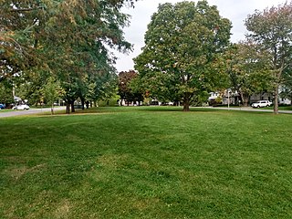
| Parks, squares and natural landmarks | |
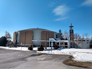
| Historical | |
| Demolished structures | |
| Shopping | |
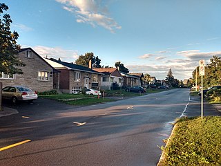
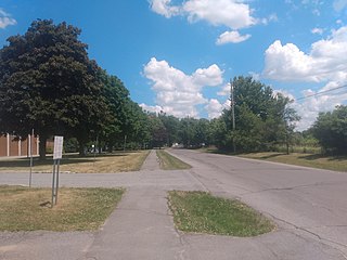
| Neighbourhoods | |