Little Italy, Ottawa

Last updated

Little Italy
Neighbourhood
LitlleItalyOttawa.jpg
The skyline of Little Italy
Coordinates: 45°24′15″N75°42′42″W / 45.4042°N 75.7117°W / 45.4042; -75.7117
Country Canada
Province Ontario
City Ottawa

Little Italy is a neighbourhood of Ottawa, Ontario, Canada, and the cultural centre of Ottawa's Italian community. Situated in Centretown West, it is bounded by Albert Street to the north, Carling Avenue to the south, the O-Train Trillium Line to the west, and approximately Bronson Avenue to the east, while the neighbourhood's main commercial area is along Preston Street.

Contents

Little Italy is adjacent to Chinatown, whose business district centres on Somerset Street.

History

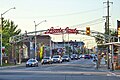
Little Italy was initially settled around 1900 by Italian immigrants. Following a fire at a small Murray Street chapel, the 1913 founding of St. Anthony of Padua Church at the corner of Booth Street and Gladstone Avenue cemented the immigrants' connections with the neighbourhood. Roughly between World War I and World War II, a second wave of Italian immigrants was joined by communities of Ukrainian and Polish immigrants in the area. In recent years with the integration of European immigrants, the neighbourhood has found itself home to Asian immigrants, primarily from China and Vietnam. [1]

In the 1960s a large section of the poorer neighbourhood was demolished, and replaced with the High School of Commerce, today the Adult High School in 1967. Since 1975, each June the neighbourhood hosts the Italian Week festival, Ottawa's celebration of Italian culture.

In 2018, Ottawa's tallest tower, the Claridge Icon, was built to the south end of the neighborhood at the intersection of Preston and Carling. Nearly a dozen projects are either proposed, approved or under construction, including three buildings that will claim the top three spots on the city's list of tallest buildings. These projects are fueled by a recent service improvement announcement for the O-Train Trillium Line which will result in an eight-minute headway between trains at Carling Station as well as a new community design plan calling for high density near the transit station.

Culture

Two area streets have been given commemorative Italian street names. Gladstone Avenue is also called Via Marconi , and Preston Street is called Corso Italia.

Related Research Articles

<span class="mw-page-title-main">The Glebe</span> Neighbourhood in Ottawa, Ontario, Canada

The Glebe is a neighbourhood in Ottawa, Ontario, Canada. It is located just south of Downtown Ottawa in the Capital Ward. As of 2016, the neighbourhood had a population of 13,055.

<span class="mw-page-title-main">Little Italy, Toronto</span> Neighbourhood in Toronto, Ontario, Canada

Little Italy, sometimes referred to as College Street West, is a district in Toronto, Ontario, Canada. It is known for its Italian Canadian restaurants and businesses. There is also a significant Latin-Canadian and Portuguese-Canadian community in the area. The district is centred on a restaurant/bar/shopping strip along College Street, centred on College Street, imprecisely between Harbord Street and Dundas Street, and spreading out east and west between Bathurst Street and Ossington Avenue. It is contained within the larger city-recognized neighbourhood of Palmerston-Little Italy.

<span class="mw-page-title-main">Carling Avenue</span> Major arterial road in Ottawa, Ontario, Canada

Carling Avenue is a major east–west arterial road in the west end of Ottawa, Ontario, Canada. It runs from March Road in Kanata to Bronson Avenue in the Glebe. The road is named for John Carling, founder of Carling Brewery and Conservative MP and Senator, Postmaster General and Minister of Agriculture.

<span class="mw-page-title-main">Dufferin Street</span> Roadway in Ontario, Canada

Dufferin Street is a major north–south street in Toronto, Vaughan and King, Ontario, Canada. It is a concession road, two concessions (4 km) west of Yonge Street. The street starts at Exhibition Place, continues north to Toronto's northern boundary at Steeles Avenue with some discontinuities and continues into Vaughan, where it is designated York Regional Road 53. The street is named for Frederick Hamilton-Temple-Blackwood, 1st Marquess of Dufferin and Ava, who served as Governor General of Canada from 1872 to 1878. Prior to 1878 the street was labelled as Western City Limits or Sideline Road south off Bloor. In 2003 and 2007, it was voted as one of "Ontario's Worst 20 Roads" in the Ontario's Worst Roads poll organized by the Canadian Automobile Association.

<span class="mw-page-title-main">St. Anthony of Padua (Ottawa)</span> Church in Ottawa, Ontario

St. Anthony of Padua is a Roman Catholic church at 427 Booth Street in Ottawa, Ontario, Canada, in the heart of Little Italy.

<span class="mw-page-title-main">Italian Canadians</span> Canadian citizens of Italian descent

Italian Canadians are Canadian-born citizens who are fully or partially of Italian descent, whose ancestors were Italians who migrated to Canada as part of Italian diaspora, or Italian-born people in Canada. According to the 2021 Census of Canada, 1,546,390 Canadians claimed full or partial Italian ancestry. They comprise a subgroup of Southern European Canadians which is a further subgroup of European Canadians. The census enumerates the entire Canadian population, which consists of Canadian citizens, landed immigrants and non-permanent residents and their families living with them in Canada. Residing mainly in central urban industrial metropolitan areas, Italian Canadians are the seventh largest self-identified ethnic group in Canada behind French, English, Irish, Scottish, German and Chinese Canadians.

<span class="mw-page-title-main">Dow's Lake station</span> Railway station in Ottawa, Ontario, Canada

Dow's Lake is an O-Train station on the Trillium Line, one block west of the intersection of Carling Avenue and Preston Street in Ottawa, Ontario. It is near Dow's Lake the western terminal of the Rideau Canal skating rink and a key site during the Canadian Tulip Festival in May. The station is also near government offices at the area of Carling Avenue and Booth Street. South of Carling, the train enters a tunnel to pass under the Rideau Canal. The station was originally named for nearby Carling Avenue and Sir John Carling.

<span class="mw-page-title-main">Hintonburg</span> Neighbourhood in Ottawa, Ontario, Canada

Hintonburg is a neighbourhood in Kitchissippi Ward in Ottawa, Ontario, Canada, located west of the Downtown core. It is a historically working-class, predominantly residential neighbourhood, with a commercial strip located along Wellington Street West. It is home to the Parkdale Farmer's Market, located along Parkdale Avenue, just north of Wellington. It is considered to be one of Ottawa's most "hipster" neighbourhoods.

<span class="mw-page-title-main">Little Italy, Montreal</span> Neighbourhood in Montreal, Quebec, Canada

Little Italy is a neighbourhood in Montreal, Quebec, Canada. It is centered on Saint Laurent Boulevard between Jean Talon Street and St. Zotique Street in the borough of Rosemont–La Petite-Patrie, south of Villeray and Jarry Park.

<span class="mw-page-title-main">Centretown West</span> Neighbourhood in Ottawa, Ontario, Canada

Centretown West is a neighbourhood in Ottawa, Ontario, Canada. It lies to the west of Bronson Avenue, east of the O-Train Trillium Line, north of Carling Avenue, and south of Nanny Goat Hill, which is an escarpment to the north of Somerset Street West. To the east lies Centretown, to the north lies Lebreton Flats, to the west lies Hintonburg, and to the south lies Dow's Lake. Much of the neighbourhood makes up what is also called Dalhousie.

<span class="mw-page-title-main">Preston Street (Ottawa)</span> Street in Ottawa, Ontario, Canada

Preston Street is a street in Ottawa, Ontario, Canada, running between Scott Street in the north and Prince of Wales Drive and Queen Elizabeth Driveway in the south. It is the main commercial artery in Ottawa's Little Italy, home to numerous small business and Italian restaurants, and is synonymous with "Little Italy" to many Ottawa residents when referring to area businesses.

<span class="mw-page-title-main">Earlscourt</span> Neighbourhood in Toronto, Ontario, Canada

Earlscourt is a neighbourhood in Toronto, Ontario, Canada. It is centred on St. Clair Avenue West, with Dufferin Street, Davenport Road, and Old Weston Road forming its boundaries. It is contained within the larger city-recognized neighbourhood of Corso Italia-Davenport.

<span class="mw-page-title-main">Corso Italia (Toronto)</span> Neighbourhood in Toronto, Ontario, Canada

Corso Italia is a neighbourhood in Toronto, Ontario, Canada, situated on St. Clair Avenue West, between Westmount Avenue and Lansdowne Avenue. It is contained within the larger city-recognized neighbourhood of Corso Italia-Davenport.

<span class="mw-page-title-main">Fairbank, Toronto</span> Neighbourhood in Toronto, Ontario, Canada

Fairbank is a neighbourhood in Toronto, Ontario, Canada. The area is centred on the intersection of Dufferin Street and Eglinton Avenue West. Fairbank includes the neighbourhoods of Briar Hill–Belgravia and Caledonia–Fairbank. The western border is the CNR lines. The northern and southern borders are the former borders of the City of York and the eastern border is Dufferin Street.

<span class="mw-page-title-main">Carlington</span> Neighbourhood in Ottawa, Ontario, Canada

Carlington is a neighbourhood located in River Ward in the west-end of Ottawa, Ontario, Canada.

<span class="mw-page-title-main">Civic Hospital</span> Neighbourhood in Ottawa, Ontario, Canada

Civic Hospital is a neighbourhood in Kitchissippi Ward in central Ottawa, Canada. It is named after the Ottawa Civic Hospital, which is located in the neighbourhood.

<span class="mw-page-title-main">Oakwood Village</span> Neighbourhood in Toronto, Ontario, Canada

Oakwood Village, formerly known as Oakwood–Vaughan, is a neighbourhood in Toronto, Ontario, Canada. Located in the former suburb of York, the neighbourhood is a Business Improvement Area (BIA); it has an annual arts festival and a public library built in 1997.

<span class="mw-page-title-main">Italian Canadians in the Greater Toronto Area</span>

Toronto has a large Italian Canadian community, with 30.3 per cent of the ethnic Italians in Canada living in the Greater Toronto Area (GTA) as of 2021. Toronto is home to the fourth largest population of people of Italian descent after Buenos Aires, São Paulo and New York City, respectively. As of the Canada 2021 Census, there were 468,970 Italian Canadians located in the Greater Toronto Area, with 444,755 located within the Toronto CMA.

Corso Italia is an infill station currently under construction on the Trillium Line in Ottawa, Ontario. It will service Ottawa's Little Italy neighbourhood. It is being constructed as part of the Stage 2 O-Train expansion and is scheduled for completion in 2024. The station will consist of two side platforms and is located north of Gladstone Avenue, near Preston Street. The station was known as Gladstone during development.

References

  1. "Neighbours". Our Little Italy. Retrieved 27 June 2018.