Armour Square, Chicago

Last updated

Armour Square
Community Area 34 - Armour Square
Chinatown, Wentworth Ave.jpg
Chinatown neighborhood within Armour Square.
Armour square map.png
Map of Armour Square
US-IL-Chicago-CA34.svg
Location within the city of Chicago
Coordinates: 41°50′24″N87°37′59″W / 41.8400333°N 87.6331070°W / 41.8400333; -87.6331070 [1]
CountryUnited States
StateIllinois
County Cook
CityChicago
Neighborhoods
Area
  Total0.99 sq mi (2.56 km2)
Elevation
[1]
587 ft (179 m)
Population
 (2020)
  Total13,890
  Density14,000/sq mi (5,400/km2)
Demographics 2020 [2]
   White 14.0%
  Black8.9%
  Hispanic5.6%
  Asian70.7%
  Other0.9%
Time zone UTC-6 (CST)
  Summer (DST) UTC-5 (CDT)
ZIP codes
parts of 60609 and 60616
Median household income 2020 [2] $37,123
Source: U.S. Census, Record Information Services

Armour Square is a Chicago neighborhood on the city's South Side, as well as a larger, officially defined community area, which also includes Chinatown and the CHA Wentworth Gardens housing project. Armour Square is bordered by Bridgeport to the west, Pilsen to the northwest, Douglas and Grand Boulevard to the east and southeast, and with the Near South Side bordering the area to the north, and Fuller Park bordering its southernmost boundary, along Pershing Road.

Contents

Geography

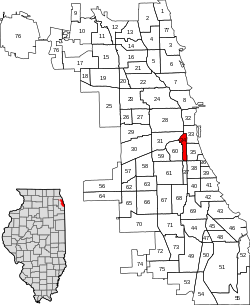
Armour Square is bounded by 18th Street to the north, Pershing Road to the south, the Union Pacific railroad tracks on the west and the Dan Ryan Expressway to the east.


Neighborhood demographics

Historical population
CensusPop.Note
1930 21,450
1940 18,472−13.9%
1950 23,29426.1%
1960 15,783−32.2%
1970 13,063−17.2%
1980 12,475−4.5%
1990 10,801−13.4%
2000 12,03211.4%
2010 13,39111.3%
2020 13,8903.7%
[2]

Armour Square has historically been a predominantly white, working-class neighborhood with a particularly significant population of both Italian-Americans and Croatian-Americans. [3] With its location being immediately south of Chinatown, today the neighborhood also has a large Asian population as well. [4] A 2014 survey found that 46.6% of the neighborhood speaks Chinese at home. [5] The 3406 census tract in the south of Armour Square is 99% black or African American. [6]

Buildings and structures

Armour Square's most recognizable landmarks are the historic Armour Square Park and nearby Guaranteed Rate Field, which sits at the southeast corner of W.35th and Shields Avenue, on the neighborhood's southernmost end. Guaranteed Rate is home to the Major League Baseball franchise, the Chicago White Sox. There are three Catholic parishes in Armour Square: Santa Lucia, St. Therese Catholic Community at 218 W. Alexander St., and St. Jerome Croatian Catholic Church.

Historical images of Armour Square can be found in Explore Chicago Collections, [7] a digital repository made available by Chicago Collections archives, libraries and other cultural institutions in the city. [8]

In September 2022, the Chicago Plan Commission approved a plan to renovate a vacant Armour Square warehouse building into 47 solar-powered apartments. [9]

The Chicago Housing Authority operates a 392-unit residential building for seniors age 62 and up in Armour Square on Wentworth Avenue. [10]

Chicago White Sox

In 1900, Charles Comiskey moved his St. Paul Saints to Chicago, where they became the team now known as the Chicago White Sox. They began play at the South Side Park on 39th Street in Armour Square, and have remained in the neighborhood ever since. No other major professional sports franchise has played in the same neighborhood longer than the White Sox. [11] In 1910, Comiskey Park opened just 4 blocks north of South Side Park on a site that was formerly a junkyard. [12] The Park remained the home of the Sox until 1990, when it was the oldest park in Major League Baseball. [13] The new Comiskey Park, currently known as Guaranteed Rate Field, opened in 1991 across 35th Street from the old ballpark. [14] Comiskey Park was then demolished in 1991 and converted into a parking lot. A plaque embedded in the asphalt marks the spot where home plate was on the original field. [15]

Chinatown

Chicago's Chinatown is located in the Armour Square community area centered on and around Cermak and Wentworth Avenues, and is an example of an American Chinatown, or ethnic-Chinese neighborhood.

The Chinatown in the Armour Square community area is not to be confused with the West Argyle Street Historic District, sometimes called "New Chinatown", which is on the North Side of Chicago in and around Argyle Street and hosts Chinese, Vietnamese, Filipino, Thai and other Southeast Asian homes and businesses.

Politics

The Armour Square community area has supported the Democratic Party in the past two presidential elections. In the 2016 presidential election, Armour Square cast 2,892 votes for Hillary Clinton and cast 761 votes for Donald Trump (76.67% to 20.17%). [16] In the 2012 presidential election, Armour Square cast 2,581 votes for Barack Obama and cast 575 votes for Mitt Romney (81.01% to 18.05%). [17]

Mass transit stations

Armour Square is served by the Dan Ryan branch of the Chicago Transit Authority's Red Line, with stops at Cermak-Chinatown and Sox-35th. It is also served by Metra on the Rock Island Line via the 35th Street station.

Education

Chicago Public Schools serves residents of the community area; [18] K-8 schools serving Armour Square include Haines and James Ward. [19] Ward Elementary opened as Garibaldi Street Primary School in 1874, and became the Ward School in 1875, before receiving its current name in 1908. [20] Residents are zoned to Phillips Academy High School. [21]

Related Research Articles

<span class="mw-page-title-main">Bridgeport, Chicago</span> Community area in Chicago, Illinois

Bridgeport is one of the 77 community areas in Chicago, on the city's South Side, bounded on the north by the South Branch of the Chicago River, on the west by Bubbly Creek, on the south by Pershing Road, and on the east by the Union Pacific railroad tracks. Neighboring communities are Pilsen across the river to the north, McKinley Park to the west, Canaryville to the south, and Armour Square to the east. Bridgeport has been the home of five Chicago mayors. Once known for its racial intolerance, Bridgeport today ranks as one of the city's most diverse neighborhoods.

<span class="mw-page-title-main">Gage Park, Chicago</span> Community area in Chicago

Gage Park is one of Chicago's 77 well-defined community areas, located on the city's southwest side; it is also the name of a park within the neighborhood. Gage Park's population is largely working-class, and its housing stock is mostly bungalows. For generations, the neighborhood was Eastern European and Irish Catholic. The neighborhood remains overwhelmingly Catholic with the addition of many Hispanic residents. Gage Park is bounded by 49th Street to the north, 59th Street to the south, Central Park Ave to the west, and Leavitt Street to the east.

<span class="mw-page-title-main">South Side Park</span> Former baseball stadium in Chicago, Illinois (USA)

South Side Park was the name used for three different baseball parks that formerly stood in Chicago, Illinois, at different times, and whose sites were all just a few blocks away from each other.

<span class="mw-page-title-main">West Lawn, Chicago</span> Community area in Chicago

West Lawn, one of Chicago's 77 official community areas, is located on the southwest side of the city. It is considered to be a "melting pot" of sorts, due to its constant change of races moving in and out of the area, as well as the diversity that exists there. It has a small town atmosphere in the big city. West Lawn is home to many Polish-Americans, Irish-Americans, Mexican-Americans, and other people of Latin American and Eastern European origin.

<span class="mw-page-title-main">Ashburn, Chicago</span> Community area in Chicago

Ashburn, one of Chicago's 77 community areas, is located on the south side of the city. Greater Ashburn covers nearly five square miles. The approximate boundaries of Ashburn are 72nd Street (north), Western Avenue (east), 87th Street (south) and Cicero Avenue (west).

<span class="mw-page-title-main">Near South Side, Chicago</span> Community area in Chicago

The Near South Side is a community area of Chicago, Illinois, United States, just south of the downtown central business district, the Loop. The Near South Side's boundaries are as follows: North—Roosevelt Road ; South—26th Street; West—Chicago River between Roosevelt and 18th Street, Clark Street between 18th Street and Cermak Road, Federal between Cermak Road and the Stevenson Expressway just south of 25th Street, and Clark Street again between the Stevenson and 26th Street; and East—Lake Michigan.

<span class="mw-page-title-main">West Pullman, Chicago</span> Community area in Chicago

West Pullman is a neighborhood located on the far south side of the city of Chicago, Illinois. It is one of the 77 official community areas of Chicago. The Neighborhood of West Pullman was largely inhabited by workers of the Pullman Train Company who were looking to escape the grip of the company town Pullman. The commercial corridor of Kensington/115th Street was one of many Italian communities within Chicago.

<span class="mw-page-title-main">West Ridge, Chicago</span> Community area in Chicago

West Ridge is one of 77 Chicago community areas. It is a middle-class neighborhood located on the far North Side of the City of Chicago. It is located in the 50th ward and the 40th ward. Also historically called North Town, and frequently referred to as West Rogers Park, it is bordered on the north by Howard Street, on the east by Ridge Boulevard, Western Avenue, and Ravenswood Avenue, the south by Bryn Mawr Avenue and Peterson Avenue, and on the west by Kedzie Avenue and the North Shore channel of the Chicago River. At one time joined with neighboring Rogers Park, it seceded to become its own village in 1890 over a conflict concerning park districts. West Ridge was annexed to Chicago on April 4, 1893, along with Rogers Park.

<span class="mw-page-title-main">Brighton Park, Chicago</span> Community area in Chicago

Brighton Park is a community area located on the southwest side of Chicago, Illinois. It is number 58 of the 77 community areas of Chicago.

<span class="mw-page-title-main">South Lawndale, Chicago</span> Community area in Chicago

South Lawndale is a community area on the West Side of Chicago, Illinois. Over 80% of the residents are of Mexican descent and the community is home to the largest foreign-born Mexican population in Chicago.

<span class="mw-page-title-main">Lower West Side, Chicago</span> Community area in Chicago, Illinois, United States

Lower West Side is a community area on the West Side of Chicago, Illinois, United States. It is three miles southwest of the Chicago Loop and its main neighborhood is Pilsen. The Heart of Chicago is a neighborhood in the southwest corner of the Lower West Side.

<span class="mw-page-title-main">Oakland, Chicago</span> Community area in Chicago

Oakland, located on the South Side of Chicago, Illinois, USA, is one of 77 officially designated Chicago community areas. Bordered by 35th and 43rd Streets, Cottage Grove Avenue and Lake Shore Drive, The Oakland area was constructed between 1872 and 1905. Some of Chicago's great old homes may be seen on Drexel Boulevard. The late 19th-century Monument Baptist Church on Oakwood Blvd. is modeled after Boston's Trinity Church. Oakwood /41st Street Beach in Burnham Park is at 4100 S. Lake Shore Drive. With an area of only 0.6 sq mi Oakland is the smallest community area by area in Chicago.

<span class="mw-page-title-main">Kenwood, Chicago</span> Community area in Chicago

Kenwood, one of Chicago's 77 community areas, is on the shore of Lake Michigan on the South Side of the city. Its boundaries are 43rd Street, 51st Street, Cottage Grove Avenue, and the lake. Kenwood was originally part of Hyde Park Township, which was annexed to the city of Chicago in 1889. Kenwood was once one of Chicago's most affluent neighborhoods, and it still has some of the largest single-family homes in the city. It contains two Chicago Landmark districts, Kenwood and North Kenwood. A large part of the southern half of the community area is in the Hyde Park-Kenwood Historic District. In recent years, Kenwood has received national attention as the home of former U.S. President Barack Obama.

<span class="mw-page-title-main">Avalon Park, Chicago</span> Community area in Chicago

Avalon Park, located on the south side of the U.S. city of Chicago, Illinois, is one of the city's 77 semi-official community areas and is named after its main park. Its boundaries are 76th St. to the north, South Chicago Ave. to the east and 87th St. to the south. The community area includes the neighborhoods of Avalon Park, Marynook and Stony Island Park.

<span class="mw-page-title-main">Burnside, Chicago</span> Community area in Chicago

Burnside is one of the 77 community areas in Chicago. The 47th numbered area, it is located on the city's far south side. This area is also called "The Triangle" by locals, as it is bordered by railroad tracks on every side; the Canadian National Railway on the west, the Union Pacific Railroad on the south and the Norfolk Southern Railway on the east. With a population of 2,254 in 2016, it is the least populous of the community areas, as well as the second smallest by area after Oakland.

<span class="mw-page-title-main">McKinley Park, Chicago</span> Community area in Chicago

McKinley Park, one of the 77 official community areas of Chicago, Illinois, is located on the city's southwest side.

<span class="mw-page-title-main">Chicago Lawn, Chicago</span> Community area in Chicago

Chicago Lawn is one of the 77 community areas of Chicago, Illinois. It is located on the southwest side of the city. Its community neighbors include Gage Park, West Englewood, Ashburn, and West Lawn. It is bounded by Bell Avenue on the east, Central Park Avenue on the west, 59th Street on the north, and 75th Street on the south, and is 13 km (8.1 mi) southwest of the Loop. Local citizens refer to the area as "Marquette Park," after the park in its center.

<span class="mw-page-title-main">Auburn Gresham, Chicago</span> Community area in Chicago

Auburn Gresham, most commonly referred to simply as Gresham, is one of the 77 official community areas of the city of Chicago, Illinois. It is located on the far south side of the city and was the original location of the South Side Irish Parade before it was relocated to the adjoining Beverly neighborhood immediately southwest.

<span class="mw-page-title-main">Cermak Road</span>

Cermak Road, also known as 22nd Street, is a 19-mile, major east–west street on Chicago's near south and west sides and the city's western suburbs. In Chicago's street numbering system, Cermak is 2200 south, or twenty-two blocks south of the baseline of Madison Street. Normally, one mile comprises eight Chicago blocks, but the arterial streets Roosevelt Road, formerly named Twelfth Street and at 1200 South, and Cermak Road were platted before the eight-blocks-per-mile plan was implemented. Roosevelt Road is one mile south of Madison Avenue and there are twelve blocks within that mile. Cermak Road is two miles south of Madison Avenue and there are ten blocks within the mile between Roosevelt and Cermak Roads.

References

  1. 1 2 "Armour Square". Geographic Names Information System . United States Geological Survey, United States Department of the Interior. May 15, 1997.
  2. 1 2 3 "Community Data Snapshot - Armour Square" (PDF). MetroPulse. Retrieved July 11, 2020.
  3. "Armour Square".
  4. "Armour Square neighborhood in Chicago, Illinois (IL), 60609, 60616 subdivision profile - real estate, apartments, condos, homes, community, population, jobs, income, streets".
  5. Common Neighborhoods For A Foreign Language CBS CHICAGO, John Dodge, FEBRUARY 14, 2014
  6. "U.S. Census website". United States Census Bureau . Retrieved November 25, 2012.
  7. Explore Chicago Collections
  8. Long, Elizabeth. "A Single Portal to Chicago's History". The University of Chicago News. Retrieved September 17, 2016.
  9. Chicago Plan Commission approves renovation of old warehouse into solar-powered apartments Brian J. Rogal, Chicago Tribune, September 15, 2022
  10. ARMOUR SQUARE AND ARMOUR SQUARE ANNEX Chicago Housing Authority
  11. Bova, George. "Sox Fan's Guide to Sox Uniforms". White Sox Interactive. Archived from the original on October 11, 2014. Retrieved April 14, 2013.
  12. "Beginnings". White Sox Interactive. Retrieved April 14, 2013.
  13. "Reinsdorf: Rebirth And Death". White Sox Interactive. Retrieved April 14, 2013.
  14. "Progress? New Comiskey Park". White Sox Interactive. Retrieved April 14, 2013.
  15. "The Parking Lot". White Sox Interactive. Retrieved April 14, 2013.
  16. Ali, Tanveer (November 9, 2016). "How Every Chicago Neighborhood Voted In The 2016 Presidential Election". DNAInfo . Archived from the original on September 24, 2019. Retrieved October 4, 2019.
  17. Ali, Tanveer (November 9, 2012). "How Every Chicago Neighborhood Voted In The 2012 Presidential Election". DNAInfo . Archived from the original on February 3, 2019. Retrieved October 4, 2019.
  18. Armour Square (Map). City of Chicago. Retrieved on December 24, 2016.
  19. Near North West Central Elementary Schools Archived June 12, 2009, at the Wayback Machine ." Chicago Public Schools . Retrieved on April 7, 2009.
  20. "School History". James Ward Elementary School. Retrieved January 13, 2024.
  21. "West/Central/South High Schools Archived 2010-03-31 at the Wayback Machine . Chicago Public Schools . Retrieved on April 7, 2009.