Portage Park, Chicago

Last updated
Portage Park
Community Area 15 - Portage Park
Portage Park Chicago Gate.JPG
The southwestern entrance into Portage Park at the intersection of Irving Park Road and Central Avenue
US-IL-Chicago-CA15.svg
Location within the city of Chicago
Coordinates: 41°57′N87°45.6′W / 41.950°N 87.7600°W / 41.950; -87.7600
CountryUnited States
StateIllinois
County Cook
CityChicago
Neighborhoods
Area
  Total3.98 sq mi (10.31 km2)
Population
 (2020) [1]
  Total63,020
  Density16,000/sq mi (6,100/km2)
Demographics 2018 [1]
   White 49%
  Black1.41%
  Hispanic41.57%
  Asian5.42%
  Other2.61%
Time zone UTC-6 (CST)
  Summer (DST) UTC-5 (CDT)
ZIP Codes
parts of 60630, 60634, 60641
Median household income 2018 [1] $66,309
Source: U.S. Census, Record Information Services

Portage Park is located on the northwest side of the City of Chicago, Illinois and is one of 77 officially designated Chicago community areas. Portage Park is bordered by the community areas of Jefferson Park and Forest Glen to the north, Dunning and the suburb of Harwood Heights to the west, Irving Park to the east and Belmont-Cragin to the south.

Contents

The area is notable for its Six Corners outdoor shopping district, centered at the intersection of Irving Park Road, Cicero Avenue and the diagonal Milwaukee Avenue, the Portage Theater and for its namesake - Portage Park. The name of the park was taken from the major portage linking the Des Plaines and Chicago rivers along what is today Irving Park Road. The area was so swampy that in wet weather, Native Americans and trappers were easily able to paddle through the area in either direction without leaving their canoes. [2] In those days, the Des Plaines was perhaps the most significant way to the Illinois, and then on to the Mississippi (and to return).

Portage Park has the largest Polish community in the Chicago Metropolitan Area according to the 2000 census. Portage Park is home to the Polish American Association, the Polish Jesuit Millennium Center, the Polish Army Veterans Association in the beautiful building of the former Irving State bank, in addition to the multitude of Polish shops and businesses throughout the district. One of the area's parks is named Chopin Park after Frédéric Chopin, Poland's most famous pianist and composer.

History

In 1850, along with construction of the Northwest Plank Road (present Milwaukee Avenue), Jefferson Township was incorporated at the legendary Dickinson Tavern. Jefferson Township was part of a large swath of land annexed to the city in 1889 [3] in advance of the World's Columbian Exposition. Much of the area was still largely rural in the early 20th century until the extension of streetcar lines into the area along Milwaukee, Irving, and Cicero lured in immigrants from the overcrowded tenements of the city's ethnic enclaves. Soon Scandinavian, German, Italian, Polish and Irish families from the industrial areas by the Chicago River such as Polish Downtown and Goose Island were buying lots in the vicinity to build their homes. Area developers such as Szajkowski, Schorsch as well as Koester and Zander subdivided what had been farmland into subdivisions of what became part of Chicago's famous "bungalow belt".

Demographics

Historical population
CensusPop.Note
1930 64,203
1940 66,3573.4%
1950 64,736−2.4%
1960 65,9251.8%
1970 63,626−3.5%
1980 57,349−9.9%
1990 56,513−1.5%
2000 65,33515.6%
2010 64,124−1.9%
2020 63,020−1.7%
U.S. Decennial Census [4] 2018 US Census American Community Survey [1]

Transportation

A Portage Park two-flat Portage Park Two Flat.jpg
A Portage Park two-flat

The Portage Park neighborhood is accessible via mass transit through the Blue Line. The Montrose station is located on Portage Park's northeastern edge in the Kennedy Expressway median and the Irving Park station is located on Portage Park's southeaster edge in the Kennedy Expressway median as well. The Milwaukee District / North Line has a station stop at Mayfair, just west of the Kennedy Expressway.

Neighborhood

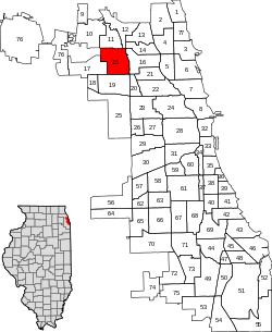
The neighborhood of Portage Park is a primarily residential area. The area's building stock is composed primarily of bungalows and two-flats. There are two large business districts in Portage Park; one, Six Corners, at the intersection of Irving, Cicero, and Milwaukee, and another at Belmont and Central extending south into Belmont-Cragin.

Portage Theater marquee in 2007 Portagetheater.jpg
Portage Theater marquee in 2007

The area was home to a number of movie palaces, among which were the Portage, Patio, and Belpark theaters. While the Belpark is now closed, the Portage Theater has been renovated with public TIF funds and is now home to a performing arts center showing arthouse and silent films. The Patio was privately restored and now hosts musical and theater acts.

Portage Park is also home to a cluster of architecturally significant churches, and is one of the few neighborhoods on the city's North Side highlighted in Marilyn Chiat's The Spiritual Traveler: Chicago and Illinois. The spires and steeples of these monumental edifices such as St. Ladislaus, St. John of Rila the Wonderworker, St. Bartholomew, St. Ferdinand, and Our Lady of Victory tower over the neighborhood, giving the area much of its charm.

Portage Park (Chicago Park District)

A footpath in the Chicago Park District's Portage Park Portage Park Chicago Trail.JPG
A footpath in the Chicago Park District's Portage Park

Portage Park served as the focus that brought together the different communities in the area and created the neighborhood.

The field house at Portage Park was designed by Clarence Hatzfeld, whose firm Hatzfeld and Knox would later design many of the Prairie and Craftsman-style bungalows just east in the Villa District in Irving Park [5] near historic St. Wenceslaus.

The park originally had a dirt bottom pond that blended into a concrete bottom pool. The hill to the east of the pool that exists now, was the dirt that was removed when the pool was first created when the park was first established. The pond portion of the pool extended to the western edge of this 'hill'. The earliest building in the park is the gymnasium, followed by the field house. The staircase to the field house was a circular affair, supported by several cement posts under the platform that was created by a large landing at the second floor.

The WPA was very involved in the creation of the long gone Rock House at the south end of the Park. This Rock House had a small pond area that had goldfish and flower basins. Until the polio epidemic, the water was kept at a substantial depth to support the fish over winter. The flower planters to the north and east of the main entrance off Central at Irving Park Road will give an idea of just what the Rock House looked like. There were seats throughout the half circle structure of flagstone. Except for the overhead wooden canopy, every where you looked there was white flagstone - walls, seats, floor, support pillars. The Chicago Park District has WPA photos of the structure. The park predates all of the buildings that surround it.

The swimming events of the Pan-American Games were held here in 1959 in the second pool constructed in the park, as were the US swimming trials for the 1972 Summer Olympics.

Other parks

The neighborhood of Portage Park has a number of other greenspaces aside from the neighborhood's namesake park:

Education

Portage Park residents are served by Chicago Public Schools, which includes neighborhood and citywide options for students. There are also a number of private parochial schools run by Roman Catholic and Lutheran congregations in the area.

Public Elementary Schools

Public High Schools

Private Elementary Schools

Private High Schools

Politics

Portage Park has supported the Democratic Party in the past two presidential elections by large margins. In the 2016 presidential election, Portage Park cast 15,884 votes for Hillary Clinton and cast 5,344 votes for Donald Trump (71.11% to 23.93%). [7] In the 2012 presidential election, Portage Park cast 14,028 votes for Barack Obama and cast 4,989 votes for Mitt Romney (72.34% to 25.73%). [8]

Public libraries

Chicago Public Library operates three branches located in the Portage Park community area: Portage-Cragin, Austin-Irving and Jefferson Park.

Culture

Related Research Articles

<span class="mw-page-title-main">Berwyn, Illinois</span> City in Illinois, United States

Berwyn is a suburban city in Cook County, Illinois, United States, coterminous with Berwyn Township, which was formed in 1908 after breaking off from Cicero Township. As of the 2020 census, the city had a total population of 57,250. It is part of the Chicago metropolitan area.

<span class="mw-page-title-main">Jefferson Park, Chicago</span> Community area in Chicago

Jefferson Park is one of the 77 community areas of Chicago, located on the northwest side of the city. The neighborhood of Jefferson Park occupies a larger swath of territory.

<span class="mw-page-title-main">Lincoln Square, Chicago</span> Community area in Chicago

Lincoln Square on the North Side of Chicago, Illinois, is one of the city's 77 community areas. It encompasses the smaller neighborhoods of Ravenswood, Ravenswood Gardens, Bowmanville, Budlong Woods, as well as Lincoln Square itself.

<span class="mw-page-title-main">Albany Park, Chicago</span> Community area in Chicago

Albany Park is one of 77 well-defined community areas of Chicago. Located on the Northwest Side of the City of Chicago with the North Branch of the Chicago River forming its east and north boundaries, it includes the ethnically diverse Albany Park neighborhood, with one of the highest percentages of foreign-born residents of any Chicago neighborhood.

<span class="mw-page-title-main">North Park, Chicago</span> Community area in Chicago

North Park is one of 77 well-defined community areas of the City of Chicago. It is bordered by the North Shore Channel on the east, the Chicago River's North Branch and Foster Avenue on the south, Cicero Avenue on the west and Devon Avenue on the north.

<span class="mw-page-title-main">Logan Square, Chicago</span> Community area in Chicago

Logan Square is an official community area, historical neighborhood, and public square on the northwest side of the City of Chicago. The Logan Square community area is one of the 77 city-designated community areas established for planning purposes. The Logan Square neighborhood, located within the Logan Square community area, is centered on the public square that serves as its namesake, located at the three-way intersection of Milwaukee Avenue, Logan Boulevard and Kedzie Boulevard.

<span class="mw-page-title-main">Avondale, Chicago</span> Community area in Chicago

Avondale is one of Chicago's 77 officially designated community areas. It is on the Northwest Side of the city. The northern border is Addison Street from the north branch of the Chicago River in the east to Pulaski Road in the west. The neighborhood extends further west along Belmont Avenue to the Union Pacific/Northwest Line. Its southern border is Diversey Avenue from the Union Pacific/Northwest Line to the Chicago River.

<span class="mw-page-title-main">Belmont Cragin, Chicago</span> Community area in Chicago

Belmont Cragin is one of 77 officially designated Chicago community areas located on the Northwest Side of the City of Chicago, Illinois. It is designated Community Area 19, and is located 8 miles (13 km) NW of the Loop.

<span class="mw-page-title-main">Dunning, Chicago</span> Community area in Chicago

Dunning is one of 77 officially designated community areas of the city of Chicago, Illinois. Dunning also is a neighborhood located on the Northwest Side of the city.

<span class="mw-page-title-main">Forest Glen, Chicago</span> Community area in Chicago

Forest Glen is one of the 77 official city community areas of Chicago, Illinois, located on the city's Northwest Side. It comprises the neighborhoods of Forest Glen, Edgebrook and Sauganash, with sub-neighborhoods of Sauganash Park, Wildwood, North Edgebrook and Old Edgebrook.

<span class="mw-page-title-main">Hermosa, Chicago</span> Community area in Chicago

Hermosa is one of 77 designated Chicago community areas and is located on the northwest side of Chicago, Illinois. The Hermosa community area contains the Kelvyn Park and Hermosa neighborhoods. The area includes the birthplace of Walt Disney and is the former headquarters of the Schwinn Bicycle Company. While being one of the smaller community areas, Hermosa is one of the city's most densely populated neighborhoods.

<span class="mw-page-title-main">Irving Park, Chicago</span> Community area in Chicago

Irving Park is one of 77 officially designated Chicago community areas, and is located on the Northwest Side. It is bounded by the Chicago River on the east, the Milwaukee Road railroad tracks on the west, Addison Street on the south and Montrose Avenue on the north, west of Pulaski Road stretching to encompass the region between Belmont Avenue on the south and, roughly, Leland Avenue on the north. It is named after the American author Washington Irving.

<span class="mw-page-title-main">Montclare, Chicago</span> Community area in Chicago

Montclare is one of 77 officially designated Chicago community areas located on the Northwest Side of the City of Chicago, Illinois.

<span class="mw-page-title-main">Clearing, Chicago</span> Community area in Chicago

Clearing, one of the 77 semi-official community areas, is located on the southwest side of the city of Chicago, Illinois. The southern portion of Chicago Midway International Airport is located within this community area.

<span class="mw-page-title-main">Six Corners</span>

Six Corners is a shopping district in the Portage Park neighborhood of Chicago's Northwest Side.

<span class="mw-page-title-main">Milwaukee Avenue (Chicago)</span> Street in Illinois, United States

North Milwaukee Avenue is a street in the city of Chicago and the northern suburbs.

<span class="mw-page-title-main">Villa District</span> Historic district in Illinois, United States

The Villa District, also known as Villa Historic District, is a historic district in Chicago, Illinois, United States. It is located on Chicago's Northwest Side within the community area of Irving Park. Its borders are along Pulaski Road to the west, the Union Pacific/Northwest rail line to the north, Hamlin Avenue to the east, and Addison Street to the south. Located directly north of the Wacławowo area of Avondale, the Villa District is serviced by the Blue Line's Addison street station.

<span class="mw-page-title-main">Poles in Chicago</span>

Both immigrant Poles and Americans of Polish heritage live in Chicago, Illinois. They are a part of worldwide Polonia, the Polish term for the Polish Diaspora outside of Poland. Poles in Chicago have contributed to the economic, social and cultural well-being of Chicago from its very beginning. Poles have been a part of the history of Chicago since 1837, when Captain Joseph Napieralski, along with other veterans of the November Uprising first set foot there. As of the 2000 U.S. census, Poles in Chicago were the largest European American ethnic group in the city, making up 7.3% of the total population. However, according to the 2006–2008 American Community Survey, German Americans and Irish Americans each had slightly surpassed Polish Americans as the largest European American ethnic groups in Chicago. German Americans made up 7.3% of the population, and numbered at 199,789; Irish Americans also made up 7.3% of the population, and numbered at 199,294. Polish Americans now made up 6.7% of Chicago's population, and numbered at 182,064. Polish is the fourth most widely spoken language in Chicago behind English, Spanish, and Mandarin.

<span class="mw-page-title-main">Portage Park (Chicago park)</span> United States historic place

Portage Park is a 36-acre (15 ha) park in the Portage Park community area of Chicago, Illinois on the National Register of Historic Places. The park stretches from Irving Park Road on the south to Berteau Avenue between Central and Long Avenues. The largest public park on Chicago's Northwest Side, it has many recreational facilities including six tennis courts, two playgrounds, a slab for in-line skating, a bike path, a nature walk, five baseball fields, two combination football/soccer fields and two fieldhouses— one housing a gymnasium and the other a cultural arts building. The park also has an Olympic-size pool featuring a large deck for sunning, misting sprays, as well as an interactive water play area with slide and diving boards in addition to a smaller heated pool. Plans are currently underway for the development of a new, 6,500-square-foot (600 m2) senior center at Portage Park.

Clarence Hatzfeld (1873–1943) was a prolific Chicago architect who designed residences, park field houses, Masonic temples, banks and other commercial buildings in the Craftsman, Prairie, and Revival styles.

References

  1. 1 2 3 4 "Community Data Snapshot - Portage Park" (PDF). cmap.illinois.gov. MetroPulse. Retrieved July 26, 2020.
  2. Keating, Ann Durkin (Ed.) (2004). Chicago Neighborhoods and Suburbs: A Historical Guide, p. 254. University of Chicago Press.
  3. Pogorzelski, Daniel, & Maloof, John (2008). Portage Park, p.7. Arcadia Publishing.
  4. Paral, Rob. "Chicago Community Areas Historical Data". Archived from the original on 18 March 2013. Retrieved 30 August 2012.
  5. Skerrett, Ellen (2003). "It's More Than a Bungalow: Portage Park and the Making of the Bungalow Belt". In The Chicago Architecture Foundation, The Chicago Bungalow, p. 104. Arcadia Publishing.
  6. "Luther North College Prep | Our Number One Priority is Your Child's Success". luthernorthcollegeprep.org. Retrieved 2020-06-17.
  7. Ali, Tanveer (November 9, 2016). "How Every Chicago Neighborhood Voted In The 2016 Presidential Election". DNAInfo . Archived from the original on September 24, 2019. Retrieved October 4, 2019.
  8. Ali, Tanveer (November 9, 2012). "How Every Chicago Neighborhood Voted In The 2012 Presidential Election". DNAInfo . Archived from the original on February 3, 2019. Retrieved October 4, 2019.
  9. Pashman, Manya Brachear. "Cardinal Francis George dies after long struggle with cancer". Chicago Tribune .