List of Chicago Landmarks

Last updated

Glessner House, designated on October 14, 1970 as one of the first official Chicago Landmarks Glessnerhousenew.JPG
Glessner House, designated on October 14, 1970 as one of the first official Chicago Landmarks

Night view of the top of The Chicago Board of Trade Building at 141 West Jackson, an address that has twice housed Chicago's tallest building Cbot-close-night.jpg
Night view of the top of The Chicago Board of Trade Building at 141 West Jackson, an address that has twice housed Chicago's tallest building

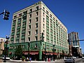
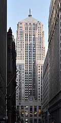
Chicago Landmark is a designation by the Mayor and the City Council of Chicago for historic sites in Chicago, Illinois. Listed sites are selected after meeting a combination of criteria, including historical, economic, architectural, artistic, cultural, and social values. Once a site is designated as a landmark, it is subject to the Chicago Landmarks Ordinance, which requires that any alterations beyond routine maintenance, up to and including demolition, must have their permit reviewed by the Landmarks Commission. [1] Many Chicago Landmarks are also listed on the National Register of Historic Places, providing federal tax support for preservation, and some are further designated National Historic Landmarks, providing additional federal oversight.

Contents

Criteria

The Mayor and the City Council appoint a nine-member Commission on Chicago Landmarks to develop landmark recommendations in accordance with a 1968 Chicago city ordinance. [2] The commission considers areas, districts, places, buildings, structures, works of art, and other objects within the City of Chicago for nomination based solely on whether each meets two or more of the following criteria: [3]

  1. Its value as an example of the architectural, cultural, economical, historical, social, or other aspect of the heritage of the City of Chicago, State of Illinois, or the United States;
  2. Its location as a site of a significant historic event which may or may not have taken place within or involved the use of any existing improvements;
  3. Its identification with a person or persons who significantly contributed to architectural, cultural, economic, historic, social, or other aspect of the development of the City of Chicago, State of Illinois, or the United States;
  4. Its exemplification of an architectural type or style distinguished by innovation, rarity, uniqueness, or overall quality of design, detail, materials or craftsmanship;
  5. Its identification as the work of an architect, designer, engineer, or builder whose individual work is significant in the history or development of the City of Chicago, the State of Illinois, or the United States;
  6. Its representation of an architectural, cultural, economic, historic, social, or other theme expressed through distinctive areas, districts, places, buildings, structures, works of art, or other objects that may or may not be contiguous;
  7. Its unique location or distinctive physical appearance or presence representing an established and familiar visual feature of a neighborhood, community, or the City of Chicago.

Once the commission has determined that a candidate meets at least two of the above criteria, the group may provide a preliminary landmark designation if the candidate "has a significant historic, community, architectural or aesthetic interest or value, the integrity of which is preserved in light of its location, design, setting, materials, workmanship, and ability to express such historic, community, architectural or aesthetic interest or value." [4]

History

In Chicago, the historic preservation movement initially sought to ensure the survival of individual buildings of special significance. [5] However, the movement has evolved to include districts and neighborhoods and even encompasses distinctive areas of the natural environment. [5] Preservation is now an integral element of urban planning and design. [5] Three trends led to popular support of the formalization of the movement in response to extensive and far reaching destruction of Chicago's environment:

  1. government-sponsored "urban renewal", which had resulted in destruction of some residential areas;
  2. construction of high-speed, limited-access expressways financed largely by federal highway funds, which divided neighborhoods; and
  3. the real estate boom in response to the demand for increased office space in the Loop. [5]

In 1957, Chicago City Council 5th ward alderman Leon Despres began the landmark preservation movement in Chicago, by adopting the Frank Lloyd Wright Robie House. [6] [7] This led to the formation of the City Landmarks Commission, who chose 39 buildings as "honorary" landmarks. [6] That body evolved into the present Commission on Chicago Landmarks which was empowered by Despres's 1968 city ordinance to select and protect 12 important buildings as the inaugural official Chicago Landmarks. [6] Although the movement was unable to save either Louis Sullivan's Garrick Theater in 1960 or Sullivan's Chicago Stock Exchange Building in 1972, the efforts spawned the Landmarks Preservation Council of Illinois in addition to the municipal Commission. [6]

National recognition

Many landmarks have been designated with National Historic Landmark status by the United States Secretary of the Interior for historical significance. All of those and a number of other districts, sites, buildings, structures, and objects worthy of preservation have been listed on the National Register of Historic Places. Not all Chicago Landmarks have been listed on the National Register, and not all Registered Historic Places (not even all of those that are further designated National Historic Landmarks) have been designated Chicago Landmarks. No Chicago Landmarks are classified as any other type of National Park System protected area including National Parks, National Monuments, or National Preserves. The charts below detail these designations for the city of Chicago-designated sites and the National Historic Landmarks.
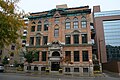
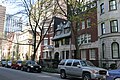
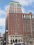
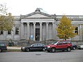
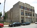
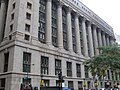
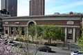
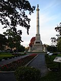
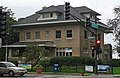
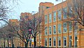
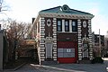
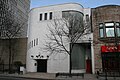
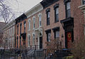
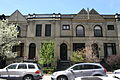
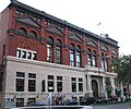
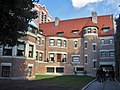
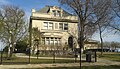
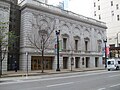
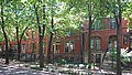
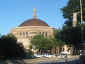
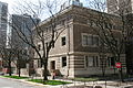
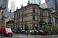
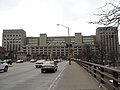
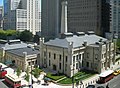
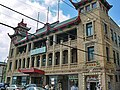
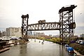
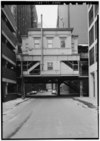
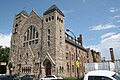
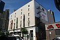
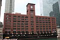
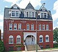
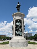
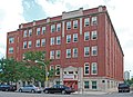
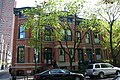
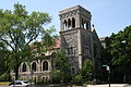
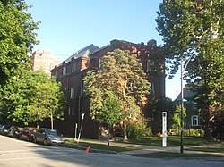
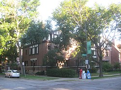
List of landmarks

For consistency, the list below uses the name from the Chicago Landmark website. Neighborhood names and boundaries are consistent with the Community areas in Chicago.

Chicago Landmark [8] ImageDesignation date [8] Construction date or period [8] Location [8] Community AreaNRHP date [9] [10] NHL date [11] [12]
227 East Walton Place Apartment Building [13] Upload image June 6, 20121956227 E. Walton Place
41°54′0.2″N87°37′14.7″W / 41.900056°N 87.620750°W / 41.900056; -87.620750 (227 East Walton Place Apartment Building)
Near North Side
300 West Adams Building
300 West Adams Building 4.JPG
May 13, 20091927300 W. Adams Street
41°52′47″N87°38′09″W / 41.87972°N 87.63583°W / 41.87972; -87.63583 (300 West Adams Building)
Loop
333 North Michigan Building
20070516 333 North Michigan.JPG
February 7, 19971928333 N. Michigan Avenue
41°53′16″N87°37′27″W / 41.88778°N 87.62417°W / 41.88778; -87.62417 (333 North Michigan Building)
Loop
35 East Wacker Building
20070513 35 East Wacker.JPG
February 9, 19941925–192735 E. Wacker Drive
41°53′11″N87°37′36″W / 41.88639°N 87.62667°W / 41.88639; -87.62667 (35 East Wacker Building)
Loop
42nd Precinct / Town Hall Police Station [14]
42nd Precinct Police Station 8.JPG
June 6, 201319073600 N. Halsted Street
41°56′51″N87°39′00″W / 41.94750°N 87.65000°W / 41.94750; -87.65000 (42nd Precinct / Town Hall Police Stationg)
Lake View
63rd Street Bathing Pavilion [15]
20070602 Jackson Park Beach (6).JPG
December 8, 20041919Intersection of S. Lake Shore Drive and E. 63rd Street
41°46′53″N87°34′26″W / 41.78139°N 87.57389°W / 41.78139; -87.57389 (63rd Street Bathing Pavilion)
Woodlawn
6901 Oglesby Cooperative Apartment Building [16] Upload image September 10, 20081928–19296901 S. Oglesby Avenue
41°46′11″N87°34′04″W / 41.76972°N 87.56778°W / 41.76972; -87.56778 (6901 Oglesby Cooperative Apartment Building)
South Shore
860-880 Lake Shore Drive
860-880 Lake Shore Drive.jpg
June 10, 19961949–1951860-880 N. Lake Shore Drive
41°53′56″N87°37′08″W / 41.89889°N 87.61889°W / 41.89889; -87.61889 (860-880 Lake Shore Drive)
Near North Side August 28, 1980
Dr. Wallace C. Abbott House
Abbott, Dr Wallace C House 2.JPG
March 1, 200618914605 N. Hermitage Avenue
41°57′55″N87°40′20″W / 41.96528°N 87.67222°W / 41.96528; -87.67222 (Dr. Wallace C. Abbott House)
Uptown
Adams House
William M Adams House Front.jpg
June 16, 19941900–19019326 S. Pleasant Avenue
41°43′27″N87°40′12″W / 41.72417°N 87.67000°W / 41.72417; -87.67000 (Adams House)
Beverly
All Saints Church and Rectory (Ravenswood, Illinois)
All Saints Episcopal Church Chicago Illinois 2020-3608.jpg
December 27, 19821883, 19054550 N. Hermitage Avenue
41°57′54″N87°40′22″W / 41.96500°N 87.67278°W / 41.96500; -87.67278 (All Saints Church and Rectory (Ravenswood, Illinois))
Uptown
Allerton Hotel
20120929 Allerton Hotel.JPG
May 29, 19981922–1924701 N. Michigan Avenue
41°53′43″N87°37′25″W / 41.89528°N 87.62361°W / 41.89528; -87.62361 (Allerton Hotel)
Near North Side
Alta Vista Terrace District
Alta Vista 1.JPG
September 15, 19711900–19043800 block of N. Alta Vista Terrace (1050 W) Lake View March 16, 1972
American Book Company Building
American Book Company Building Chicago 2021-3246.jpg
July 29, 20091912320 E. Cermak Road/2132 S. Calumet Avenue
41°51′13″N87°37′10″W / 41.85361°N 87.61944°W / 41.85361; -87.61944 (American Book Company Building)
Near South Side
American School of Correspondence
American school of correspondence.JPG
April 15, 19951906–1907850 E. 58th Street
41°47′23″N87°36′14″W / 41.78972°N 87.60389°W / 41.78972; -87.60389 (American School of Correspondence)
Hyde Park
American System-Built Houses
H Howard Hyde House Front.jpg
July 13, 1994191710410 and 10541 S. Hoyne Avenue
41°42′16″N87°40′28″W / 41.70444°N 87.67444°W / 41.70444; -87.67444 (American System-Built House)
41°42′06″N87°40′26″W / 41.70167°N 87.67389°W / 41.70167; -87.67389 (American System-Built House)
Beverly
(Former) Anshe Sholom Synagogue Building [17] Upload image June 25, 20141926754 S. Independence Boulevard
41°52′16.2″N87°43′14.7″W / 41.871167°N 87.720750°W / 41.871167; -87.720750 (Anshe Sholom Synagogue Building)
West Garfield Park
Arlington and Roslyn Place District
Arlington and Roslyn Place District 7.JPG
November 15, 19891894–1910400-blocks of W. Arlington Place and W. Roslyn Place, between N. Clark Street and N. Lakeview Avenue Lincoln Park
Arlington-Deming District Upload image September 27, 20071870–1930Predominantly 500- and 600-Blocks of W. Arlington Place, 500- and 600-Blocks of W. Deming Place, 2400-Block of N. Geneva Terrace; and 2400-Block of N. Orchard Street Lincoln Park
Armitage-Halsted District
Armitage-Halsted District 5.JPG
February 5, 20031870–1930Predominately W. Armitage Avenue between N. Halsted Street and N. Racine Avenue, and N. Halsted Street between W. Armitage Avenue and W. Webster Street Lincoln Park
Assumption School Building
Assumption School Building 3.JPG
July 10, 20031899319 W. Erie Street
41°53′37″N87°38′12″W / 41.89361°N 87.63667°W / 41.89361; -87.63667 (Assumption School Building)
Near North Side
Astor Street District
Astor Street District 5.JPG
December 19, 19751880–19401200–1600 blocks of N. Astor Street (and cross streets) Near North Side
Auditorium Building
Auditorium Building Chicago June 30, 2012-92.jpg
September 15, 19761886–1890430 S. Michigan Avenue
41°52′33″N87°37′31″W / 41.87583°N 87.62528°W / 41.87583; -87.62528 (Auditorium Building)
Loop April 17, 1970May 15, 1975 [18]
Emil Bach House
Bach House Chicago.jpg
September 28, 197719157415 N. Sheridan Road
42°0′58″N87°39′53″W / 42.01611°N 87.66472°W / 42.01611; -87.66472 (Bach House)
Rogers Park January 23, 1979
Bachman House
Myron Bachman House.JPG
December 9, 19921947–19481244 W. Carmen Avenue
41°58′29″N87°39′42″W / 41.97472°N 87.66167°W / 41.97472; -87.66167 (Bachman House)
Uptown
Beeson House and Coach House
Beeson House and Coach House.JPG
January 20, 199918925810 W. Midway Park
41°53′21″N87°46′14″W / 41.88917°N 87.77056°W / 41.88917; -87.77056 (Beeson House and Coach House)
Austin
Belmont-Sheffield Trust and Savings Bank Building
Belmont-Sheffield Trust and Savings Bank by Taric Alani.jpg
July 9, 200819291001 W. Belmont Avenue
41°56′23″N87°39′16″W / 41.93972°N 87.65444°W / 41.93972; -87.65444 (Belmont-Sheffield Trust and Savings Bank Building)
Lake View March 1, 1984 [9]
Beverly/Morgan Railroad District
99th StreetBeverly Hills Metra Station.jpg
April 15, 19951889–1945W. 91st, 95th, 99th, 107th, 111th, and 115th Streets, along the Metra railroad line Beverly and Morgan Park
Biograph Theater
Victory Gardens Theatre.JPG
March 28, 200119142433–43 N. Lincoln Avenue
41°55′35″N87°38′59″W / 41.92639°N 87.64972°W / 41.92639; -87.64972 (Biograph Theater)
Lincoln Park May 17, 1984
Bissell Street District
Bissell Street District 4.JPG
September 5, 200718832100-Block of N. Bissell Street between W. Webster and W. Dickens Avenues Lincoln Park
Black Metropolis-Bronzeville District Upload image September 9, 19981889–19363619-27 S. State Street
3647-55 S. State Street
3763 S. Wabash Avenue
3435 S. Indiana Avenue
3140 S. Indiana Avenue
3533 S. Giles Avenue
315 E. 35th Street
3501 S. King Drive
Douglas April 30, 1986
Blackstone Hotel
20080409 Blackstone Hotel Exterior.JPG
May 29, 19981908–1910636 S. Michigan Avenue
41°52′24″N87°37′29″W / 41.87333°N 87.62472°W / 41.87333; -87.62472 (Blackstone Hotel)
Loop May 8, 1986
Blackstone Library
20061028 Blackstone Library Front.JPG
December 8, 201019044904 S. Lake Park Avenue
41°48′21″N87°35′25″W / 41.80583°N 87.59028°W / 41.80583; -87.59028 (Blackstone Library)
Kenwood
Blackwell-Israel Samuel A.M.E. Zion Church Building [19] Upload image February 6, 202018863956 S. Langley Avenue
41°49′21.2″N87°36′36.2″W / 41.822556°N 87.610056°W / 41.822556; -87.610056 (Blackwell-Israel Samuel A.M.E. Zion Church Building)
Grand Boulevard
Brewster Apartments
Brewster Apartments 3.JPG
October 6, 198218932800 N. Pine Grove Avenue
41°55′59″N87°38′30″W / 41.93306°N 87.64167°W / 41.93306; -87.64167 (Brewster Apartments)
Lake View
Brooks Building
2010-07-12 1880x2820 chicago brooks building.jpg
January 14, 19971909–1910223 W. Jackson Boulevard
41°52′40″N87°38′05″W / 41.87778°N 87.63472°W / 41.87778; -87.63472 (Brooks Building)
Loop
Gwendolyn Brooks House Upload image February 10, 201018907428 S. Evans Avenue
41°45′34.3″N87°36′25″W / 41.759528°N 87.60694°W / 41.759528; -87.60694 (Gwendolyn Brooks House)
Greater Grand Crossing
Bryn Mawr Apartment Hotel
Belle Shore Apartment Hotel
2004-09-09 2660x2000 chicago belle shore.jpg
January 20, 19991928–19295550 N. Kenmore Avenue
41°59′00″N87°39′25″W / 41.98333°N 87.65694°W / 41.98333; -87.65694 (Bryn Mawr Apartment Hotel)
1062 W. Bryn Mawr Avenue
41°59′02″N87°39′27″W / 41.98389°N 87.65750°W / 41.98389; -87.65750 (Belle Shore Apartment Hotel)
Edgewater April 20, 1995 [9]
Clarence Buckingham Memorial Fountain and Garden
Buckingham Fountain in Chicago, USA.jpg
August 30, 20001927Bounded by S. Lake Shore Drive, E. Balbo Drive, S. Columbus Drive and E. Jackson Drive
41°52′33″N87°37′08″W / 41.87583°N 87.61889°W / 41.87583; -87.61889 (Clarence Buckingham Memorial Fountain and Garden)
Loop
Burling Row House District
Burling Row House District 1 crop.jpg
November 15, 200018752225–2245 N. Burling Street Lincoln Park
Bush Temple of Music
Bush Temple of Music 1.JPG
June 27, 20011901100 W. Chicago Avenue
41°53′49″N87°37′54″W / 41.89694°N 87.63167°W / 41.89694; -87.63167 (Bush Temple of Music)
Near North Side
Cable House
Cable House.JPG
October 2, 1991188625 E. Erie Street
41°53′38″N87°37′37″W / 41.89389°N 87.62694°W / 41.89389; -87.62694 (Cable House)
Near North Side
Cairo Supper House [20]
Cairo Supper Club Building 4015-4017 North Sheridan Road Chicago 2020-3404.jpg
August 7, 201419204015-4017 N. Sheridan Road
41°57′19″N87°39′15.8″W / 41.95528°N 87.654389°W / 41.95528; -87.654389 (Cairo Supper House)
Uptown
Alfred Caldwell Lily Pool
20070516 Alfred Caldwell Lily Pool.jpg
November 6, 20021936–1938North end of Lincoln Park Zoo at W. Fullerton Parkway
41°55′31″N87°38′02″W / 41.92528°N 87.63389°W / 41.92528; -87.63389 (Alfred Caldwell Lily Pool)
Lincoln Park February 17, 2006February 17, 2006 [21]
Calumet/Giles Prairie District Upload image July 13, 19881870–19103100-3500 blocks of S. Calumet, Giles and Prairie Avenues Douglas
Calumet National Bank Building Upload image July 9, 200819109117 S. Commercial Avenue
41°43′46.2″N87°33′03″W / 41.729500°N 87.55083°W / 41.729500; -87.55083 (Calumet National Bank Building)
South Chicago
Calumet Park Fieldhouse
Calumet Park Fieldhouse.jpg
October 4, 20061922–19249801 S. Avenue G
41°43′04″N87°31′50″W / 41.71778°N 87.53056°W / 41.71778; -87.53056 (Calumet Park Fieldhouse)
East Side August 21, 2003 [9]
Canaan Baptist Church of Christ Building Upload image July 26, 20061904–19056657-59 S. Harvard Avenue
41°46′22″N87°37′59″W / 41.77278°N 87.63306°W / 41.77278; -87.63306 (Canaan Baptist Church of Christ Building)
Englewood
Carbide and Carbon Building
Carbide & Carbon Building (7185086785).jpg
May 9, 19961929230 N. Michigan Avenue
41°53′12″N87°37′30″W / 41.88667°N 87.62500°W / 41.88667; -87.62500 (Carbide and Carbon Building)
Loop
Carson, Pirie, Scott and Company Building
Carson, Pirie, Scott and Company Building 1 South State Street from north.jpg
November 5, 19701898–1899; 1902–1904
Additions in 1905–1906 and 1960–1961
1 S. State Street
41°52′54″N87°37′38″W / 41.88167°N 87.62722°W / 41.88167; -87.62722 (Carson, Pirie, Scott and Company Building)
Loop April 17, 1970May 15, 1975 [22]
Cermak Road Bridge District
Cermak Road Bridge Historic District.JPG
April 26, 20061901–1924 Cermak Road, predominantly between Grove and Jefferson Streets Lower West Side and Armour Square May 1, 2012
Chapin and Gore Building
Chapin and Gore Building.jpg
January 21, 1982190463 E. Adams Street
41°52′45.5″N87°37′31.5″W / 41.879306°N 87.625417°W / 41.879306; -87.625417 (Chapin and Gore Building)
Loop June 27, 1979
Charnley House
James Charnley Residence HABS ILL,16-CHIG,12-1.jpg
August 20, 197218911365 N. Astor Street
41°54′27.5″N87°37′39″W / 41.907639°N 87.62750°W / 41.907639; -87.62750 (Charnley House)
Near North Side April 17, 1970August 5, 1998 [23]
Chatham-Greater Grand Crossing Commercial District Upload image October 8, 20081911–193019 buildings in the vicinity of Cottage Grove Avenue and 75th and 79th Streets–two contiguous "core" areas and six non-contiguous individual buildings. Chatham and Greater Grand Crossing
Chess Records Office and Studio
Chess Records Studio.jpg
May 16, 199019112120 S. Michigan Avenue
41°51′13″N87°37′27″W / 41.85361°N 87.62417°W / 41.85361; -87.62417 (Chess Records Office and Studio)
Near South Side
Chicago & Alton Railway Bridge
Ashland station and railroad bridge, December 2018.JPG
December 12, 20071906East of Ashland Avenue and North of Archer Avenue, Fork of the South Branch of the Chicago River
41°50′23″N87°39′53″W / 41.83972°N 87.66472°W / 41.83972; -87.66472 (Chicago & Alton Railway Bridge)
McKinley Park
Chicago & Illinois Western Railway Bridge Upload image December 12, 2007191433rd Street and East of Kedzie Avenue, Slip of the Chicago Sanitary and Ship Canal.
41°49′56″N87°42′10″W / 41.83222°N 87.70278°W / 41.83222; -87.70278 (Chicago & Illinois Western Railway Bridge)
Brighton Park
Chicago & North Western Railway Office Building [24] May 20, 20201905226 W. Jackson Boulevard
41°52′43″N87°38′5.8″W / 41.87861°N 87.634944°W / 41.87861; -87.634944 (Chicago & North Western Railway Office Building)
Loop
Chicago & North Western Railway Powerhouse
CNW Powerhouse.JPG
January 11, 20061909–1911211 N. Clinton Street
41°53′11″N87°38′25″W / 41.88639°N 87.64028°W / 41.88639; -87.64028 (Chicago & North Western Railway Powerhouse)
Near West Side October 12, 2004 [9]
Chicago & Northwestern Railway Bridge
KinzieStRRBrdg08.jpg
December 12, 20071907–1908South of Kinzie Street and East of Canal Street, North Branch of the Chicago River
41°53′18.5″N87°38′21″W / 41.888472°N 87.63917°W / 41.888472; -87.63917 (Chicago & Northwestern Railway Bridge)
Near North Side
Chicago & Western Indiana Railroad Bridge December 12, 20071967–1968North of 126th Street and East of Torrence Avenue, Calumet River
41°40′10″N87°33′32″W / 41.66944°N 87.55889°W / 41.66944; -87.55889 (Chicago & Western Indiana Railroad Bridge)
South Deering
Chicago Bee Building
20070601 Chicago Bee Building (3).JPG
September 9, 19981929–19313647-3655 S. State Street
41°49′41″N87°37′34.5″W / 41.82806°N 87.626250°W / 41.82806; -87.626250 (Chicago Bee Building)
Douglas April 30, 1986
Chicago Board of Trade Building
Chicago Board Of Trade Building.jpg
May 4, 19771930141 W. Jackson Boulevard
41°52′40″N87°37′56″W / 41.87778°N 87.63222°W / 41.87778; -87.63222 (Chicago Board of Trade Building)
Loop June 16, 1978June 2, 1978 [25]
Chicago Building
2010-03-03 1856x2784 chicago chicago building.jpg
March 26, 19961904–19057 W. Madison Street
41°52′54.5″N87°37′41″W / 41.881806°N 87.62806°W / 41.881806; -87.62806 (Chicago Building)
Loop September 5, 1975 [9]
Chicago City Bank and Trust Building October 8, 20081929–1930815 W. 63rd Street
41°46′46″N87°38′44″W / 41.77944°N 87.64556°W / 41.77944; -87.64556 (Chicago City Bank and Trust Building)
Englewood
Chicago Defender Building
20070601 Chicago Defender Building (3).JPG
September 9, 199818993435 S. Indiana Avenue
41°49′54.5″N87°37′17″W / 41.831806°N 87.62139°W / 41.831806; -87.62139 (Chicago Defender Building)
Douglas
Site of the Origin of the Chicago Fire of 1871
Site of the Origin of the Chicago Fire 4.JPG
September 15, 19711871
Sculpture erected 1961
W. DeKoven and S. Jefferson Streets
41°52′08.5″N87°38′32″W / 41.869028°N 87.64222°W / 41.869028; -87.64222 (Site of the Origin of the Chicago Fire of 1871)
Near West Side
Chicago Harbor Lighthouse
Chicago-lighthouse.jpg
April 9, 20031893; 1917–1918South End of the North Breakwater, North Side of the Chicago Harbor Entrance
41°53′21.5″N87°35′26″W / 41.889306°N 87.59056°W / 41.889306; -87.59056 (Chicago Harbor Lighthouse)
Near North Side July 19, 1984
Former Chicago Historical Society Building
Excalibur Nightclub.JPG
February 26, 19971892632 N. Dearborn Street
41°53′36″N87°37′48″W / 41.89333°N 87.63000°W / 41.89333; -87.63000 (Former Chicago Historical Society Building)
Near North Side November 28, 1978
Chicago, Milwaukee & St. Paul Railway Bridge No. Z-2
Cherry Ave bridge west panorama 20100725.jpg
December 12, 20071901–1902N. Cherry Avenue and W. North Avenue, North Branch of the Chicago River 41°54′37″N87°39′20″W / 41.91028°N 87.65556°W / 41.91028; -87.65556 (Chicago, Milwaukee & St. Paul Railway Bridge No. Z-2) Near North Side
Chicago Motor Club Building [26] March 1, 2012192868 E. Wacker Place
41°53′13.8″N87°37′31.5″W / 41.887167°N 87.625417°W / 41.887167; -87.625417 (Chicago Motor Club Building)
Loop
Chicago Orphan Asylum Building May 13, 20091898–19995120 S. Dr. Martin Luther King Jr. Drive
41°48′05″N87°36′59″W / 41.80139°N 87.61639°W / 41.80139; -87.61639 (Chicago Orphan Asylum Building)
Washington Park
Chicago Public Library/Cultural Center
Chicago Cultural Center.jpg
November 15, 1976189778 E. Washington Street
41°53′02″N87°37′30″W / 41.88389°N 87.62500°W / 41.88389; -87.62500 (Chicago Public Library/Cultural Center)
Loop July 31, 1972
Chicago Theatre
Chicago Theater - day.jpg
January 28, 19831921175 N. State Street
41°53′07″N87°37′39″W / 41.88528°N 87.62750°W / 41.88528; -87.62750 (Chicago Theatre)
Loop June 6, 1979
Chicago Varnish Company Building
Chicago Varnish Co. Building Harry Carays Chicago June 30, 2012-13.jpg
July 25, 2001189533 W. Kinzie Street
41°53′20.5″N87°37′45.5″W / 41.889028°N 87.629306°W / 41.889028; -87.629306 (Chicago Varnish Company Building)
Near North Side June 14, 2001
City Hall-County Building
City County.jpg
January 21, 19821905–1908; 1909–1911121 N. LaSalle Street/118 N. Clark Street
41°53′02″N87°37′54″W / 41.88389°N 87.63167°W / 41.88389; -87.63167 (City Hall-County Building)
Loop
Civic Opera Building
Civic Opera House 060528.jpg
February 5, 19981927–192920 N. Wacker Drive
41°52′57″N87°38′15″W / 41.88250°N 87.63750°W / 41.88250; -87.63750 (Civic Opera Building)
Loop
Clarke House
Henry B. Clarke House (10563977674).jpg
October 14, 197018361855 S. Indiana Avenue
41°51′25.5″N87°37′19″W / 41.857083°N 87.62194°W / 41.857083; -87.62194 (Clarke House)
Near South Side May 6, 1971
Colvin House
Colvin House.jpg
October 5, 199419095940 N. Sheridan Road
41°59′25″N87°39′20.5″W / 41.99028°N 87.655694°W / 41.99028; -87.655694 (Colvin House)
Edgewater
Commercial National Bank Building [27]
125 South Clark.JPG
June 22, 20161909125 S. Clark Street
41°52′48.2″N87°37′49.8″W / 41.880056°N 87.630500°W / 41.880056; -87.630500 (Commercial National Bank Building)
Loop June 1, 2013
Congress Theater
Congress Theater Chicago.jpg
July 10, 20021925–19262117–2139 N. Milwaukee Avenue / 2117–2139 N. Rockwell Street
41°55′12″N87°41′32″W / 41.92000°N 87.69222°W / 41.92000; -87.69222 (Congress Theater)
Logan Square
Continental and Commercial Bank Building
Continental and Commercial National Bank (6039061228).jpg
December 12, 20071914208 S. LaSalle Street
41°52′45″N87°37′58″W / 41.87917°N 87.63278°W / 41.87917; -87.63278 (Continental and Commercial Bank Building)
Loop February 14, 2007 [9]
Continental Center [28]
Continental Center.JPG
June 27, 20121961–196255 E. Jackson Boulevard
41°52′41″N87°37′32″W / 41.87806°N 87.62556°W / 41.87806; -87.62556 (Continental Center)
Loop
Cook County Hospital Administration Building [29]
Cook County Hospital.jpg
January 23, 20191912–19141835 West Harrison Street
41°52′26.2″N87°40′22.5″W / 41.873944°N 87.672917°W / 41.873944; -87.672917 (Cook County Hospital Administration Building)
Near West Side
Cortland Street Drawbridge
CortlandStDrawbridge.jpg
July 24, 199119021440 W. Cortland Street
41°55′01″N87°39′51″W / 41.91694°N 87.66417°W / 41.91694; -87.66417 (Cortland Street Drawbridg)
Lincoln Park
Cosmopolitan State Bank Building
Cosmopolitan State Bank Building 3.JPG
October 8, 20081920
1995 Addition
801 N. Clark Street
41°53′49″N87°37′51″W / 41.89694°N 87.63083°W / 41.89694; -87.63083 (Cosmopolitan State Bank Building)
Near North Side
Courthouse Place
Chicago Criminal Courts Building, 54 West Hubbard Street, Chicago (Cook County, Illinois).jpg
June 9, 1993189354 W. Hubbard Street
41°53′25″N87°37′48″W / 41.89028°N 87.63000°W / 41.89028; -87.63000 (Courthouse Place)
Near North Side November 13, 1984
Crown Hall
Crown Hall 060514.jpg
October 1, 19971950–19563360 S. State Street
41°49′59″N87°37′37″W / 41.83306°N 87.62694°W / 41.83306; -87.62694 (Crown Hall)
Douglas August 7, 2001August 7, 2001 [30]
Daley Center
Daley Center Chicago.jpg
November 6, 20021965
1967 Picasso Sculpture
50 W. Washington Street
41°53′02″N87°37′49″W / 41.88389°N 87.63028°W / 41.88389; -87.63028 (Daley Center)
Loop
Dearborn Street Station
Dearborn Station 060409.jpg
March 2, 1982188547 W. Polk Street
41°52′19″N87°37′45″W / 41.87194°N 87.62917°W / 41.87194; -87.62917 (Dearborn Street Station)
Loop March 26, 1976
Delaware Building
Delaware Building Chicago 2.JPG
November 23, 19831872–1874
1889 two-story addition.
36 W. Randolph Street
41°53′05″N87°37′45″W / 41.88472°N 87.62917°W / 41.88472; -87.62917 (Delaware Building)
Loop July 18, 1974
August Dewes House
Dewes, August House 2.JPG
March 9, 20051894–1896509 W. Wrightwood Avenue
41°55′49″N87°38′30.5″W / 41.93028°N 87.641806°W / 41.93028; -87.641806 (August Dewes House)
Lincoln Park
Francis J. Dewes House
Dewes House.JPG
June 12, 19741896503 W. Wrightwood Avenue
41°55′49″N87°38′29.5″W / 41.93028°N 87.641528°W / 41.93028; -87.641528 (Francis J. Dewes House)
Lincoln Park August 14, 1973
Dexter Building
Dexter Building 061028.jpg
July 31, 19961887630 S. Wabash Avenue
41°52′25″N87°37′35″W / 41.87361°N 87.62639°W / 41.87361; -87.62639 (Dexter Building)
Loop
R.R. Donnelley and Sons Co. Calumet Plant
Calumet Plant R R Donnelly and Sons Company E Chicago IL.jpg
March 31, 20041912, 1925, 1929350 E. Cermak Road
41°51′12″N87°37′06″W / 41.85333°N 87.61833°W / 41.85333; -87.61833 (R.R. Donnelley and Sons Co. Calumet Plant)
Near South Side February 17, 1983
Stephen A. Douglas Tomb
Stephen Arnold Douglas tomb.jpg
September 28, 19771881636 E. 35th Street
41°49′54″N87°36′30″W / 41.83167°N 87.60833°W / 41.83167; -87.60833 (Stephen A. Douglas Tomb)
Douglas May 28, 1976
Dover Street District
Dover Street District 1.JPG
December 12, 20071893–1927Predominantly 4500–, 4600- and 4700-Blocks of N. Dover Street; and four properties located at 4742-4754 N. Beacon Street Uptown
Joseph Downey House and Coach House [31]
Downey house - Berger Park.jpg
April 4, 201319066205 N. Sheridan Road
41°59′41.5″N87°39′19″W / 41.994861°N 87.65528°W / 41.994861; -87.65528 (Joseph Downey House and Coach House)
Edgewater
Drake Fountain
Drake Fountain, Chicago, October 13, 1912 (NBY 615).jpg
March 10, 20041892
Relocated 1909
92nd Street at South Chicago and Exchange Avenues
41°43′41″N87°33′10″W / 41.72806°N 87.55278°W / 41.72806; -87.55278 (Drake Fountain)
South Chicago
DuPont-Whitehouse House
DuPont - Whitehouse House.jpg
April 16, 19961875–18763558 S. Artesian Avenue
41°49′43″N87°41′11″W / 41.82861°N 87.68639°W / 41.82861; -87.68639 (DuPont-Whitehouse House)
McKinley Park
DuSable High School [32]
DuSable High School (Chicago).jpg
October 31, 20121931–19354934 S. Wabash Avenue
41°48′17″N87°37′30″W / 41.80472°N 87.62500°W / 41.80472; -87.62500 (DuSable High School)
Grand Boulevard
East Lake Shore Drive District
20070617 East Lake Shore Drive Historic District.JPG
April 18, 19851912–1929140 E. Walton Street, 179-229 E. Lake Shore Drive, and 999 N. Lake Shore Drive Near North Side
East Village District
East Village Historic District A Chicago IL.jpg
January 11, 2006Four sections primarily situated on N. Winchester Avenue, N. Wolcott Avenue, N. Honore Street, and N. Hermitage Avenue between W. Chicago Avenue and W. Division Street West Town December 8, 2009
Ebenezer Missionary Baptist Church (formerly Isaiah Temple)
The Ebenezer Missionary Baptist Church.jpg
July 28, 20111898–18994501 S. Vincennes Avenue
41°48′46.9″N87°36′48.9″W / 41.813028°N 87.613583°W / 41.813028; -87.613583 (Ebenezer Missionary Baptist Church)
Grand Boulevard
Eighth Church of Christ, Scientist June 9, 19931910–19114359 S. Michigan Avenue
41°48′54″N87°37′21″W / 41.81500°N 87.62250°W / 41.81500; -87.62250 (Eighth Church of Christ, Scientist)
Grand Boulevard
Eighth Regiment Armory
Bronzevillemilitary.jpg
September 9, 19981914–19153533 S. Giles Avenue
41°49′49″N87°37′08″W / 41.83028°N 87.61889°W / 41.83028; -87.61889 (Eighth Regiment Armory)
Douglas April 30, 1986
Elam House March 21, 197919034726 S. Dr. Martin Luther King Jr. Drive
41°48′30.5″N87°37′01.5″W / 41.808472°N 87.617083°W / 41.808472; -87.617083 (Elam House)
Grand Boulevard
Eliel House October 2, 199118864122 S. Ellis Avenue
41°49′09.4″N87°36′09.5″W / 41.819278°N 87.602639°W / 41.819278; -87.602639 (Eliel House)
Oakland
Elks National Memorial Headquarters Building
Elks Club.jpg
October 1, 20031924–19262750 N. Lakeview Avenue
41°55′56″N87°38′24″W / 41.93222°N 87.64000°W / 41.93222; -87.64000 (Elks National Memorial Headquarters Building)
Lincoln Park
Engine Company 5, Truck 2 October 1, 20031928324 S. Desplaines Street
41°52′38″N87°38′40″W / 41.87722°N 87.64444°W / 41.87722; -87.64444 (Engine Company 5, Truck 2)
Near West Side
Engine Company 27 (Former)
Former engine company 27.JPG
October 1, 20031874
1907 addition
1244 N. Wells Street
41°54′18.7″N87°38′05″W / 41.905194°N 87.63472°W / 41.905194; -87.63472 (Engine Company 27 (Former))
Near North Side
Engine Company 35, Truck 28 (Former)
1623 N. Damen Ave..jpg
October 1, 20031894
1904 addition
1625 N. Damen Avenue
41°54′40.5″N87°40′38″W / 41.911250°N 87.67722°W / 41.911250; -87.67722 (Engine Company 35, Truck 28 (Former))
West Town
Engine Company 42 (Former)
Firehouse 42.jpg
December 12, 20071887228 W. Illinois Street
41°53′27.5″N87°38′07″W / 41.890972°N 87.63528°W / 41.890972; -87.63528 (Engine Company 42 Firehouse (Former))
Near North Side
Engine Company 45, Truck 15 October 1, 200319284600 S. Cottage Grove Avenue
41°48′40.3″N87°36′25″W / 41.811194°N 87.60694°W / 41.811194; -87.60694 (Engine Company 45, Truck 15)
Grand Boulevard
Engine Company 59, Truck 47
Engine Co 59, Truck 47 2.JPG
October 1, 200319285714 N. Ridge Avenue
41°59′09″N87°39′50″W / 41.98583°N 87.66389°W / 41.98583; -87.66389 (Engine Company 59, Truck 47)
Edgewater
Engine Company 61 October 1, 20031927–19285349 S. Wabash Avenue
41°47′48″N87°37′26″W / 41.79667°N 87.62389°W / 41.79667; -87.62389 (Engine Company 61)
Washington Park
Engine Company 65, Truck 52 October 1, 200319293000 W. 42nd Street
41°49′03″N87°41′59″W / 41.81750°N 87.69972°W / 41.81750; -87.69972 (Engine Company 65, Truck 52)
Brighton Park
Engine Company 78
Engine78 outside Wrigley Field.JPG
October 1, 200319151052 W. Waveland Avenue
41°56′57″N87°39′23.5″W / 41.94917°N 87.656528°W / 41.94917; -87.656528 (Engine Company 78)
Lake View
Engine Company 84, Truck 51 October 1, 200319296204 S. Green Street
41°46′52.5″N87°38′47″W / 41.781250°N 87.64639°W / 41.781250; -87.64639 (Engine Company 84, Truck 51)
Englewood
Engine Company 86 (Former)
Former Engine Company 86 Chicago 2021-5111.jpg
October 1, 200318992414 W. Cuyler Avenue
41°57′19″N87°41′21″W / 41.95528°N 87.68917°W / 41.95528; -87.68917 (Engine Company 86 (Former))
North Center
Engine Company 104, Truck 31 (Former)
Engine Company 104 Truck 31 Firehouse 1401 South Michigan Avenue.jpg
October 1, 200319051401 S. Michigan Avenue
41°51′50″N87°37′26″W / 41.86389°N 87.62389°W / 41.86389; -87.62389 (Engine Company 104, Truck 31 (Former))
Near South Side
Engine Company 129, Truck 50 October 1, 20031928–19298120 S. Ashland Avenue
41°44′45.5″N87°39′49″W / 41.745972°N 87.66361°W / 41.745972; -87.66361 (Engine Company 129, Truck 50)
Auburn Gresham
Epworth United Methodist Church [33]
20080704 Epworth Methodist Episcopal Church.JPG
June 21, 202319305253 N. Kenmore Avenue
41°58′41.2″N87°39′22.4″W / 41.978111°N 87.656222°W / 41.978111; -87.656222 (Epworth United Methodist Church)
Edgewater June 10, 2008
Essanay Studios
Essanay.jpg
March 26, 19961908–19151333-45 W. Argyle Street
41°58′21″N87°39′49″W / 41.97250°N 87.66361°W / 41.97250; -87.66361 (Essanay Studios)
Uptown
Essex Inn [34]
Hilton Chicago (3025364).jpg
December 1, 20161961800 S. Michigan Avenue
41°52′18.9″N87°37′28.7″W / 41.871917°N 87.624639°W / 41.871917; -87.624639 (Essex Inn)
Loop
Farwell Building
Farwell.jpg
March 10, 20041927664 N. Michigan Avenue
41°53′39.4″N87°37′29″W / 41.894278°N 87.62472°W / 41.894278; -87.62472 (Farwell Building)
Near North Side
Field Building
Field Building 135 South Lasalle Street entrance.jpg
February 9, 19941928–1934135 S. LaSalle Street
41°52′47″N87°37′54″W / 41.87972°N 87.63167°W / 41.87972; -87.63167 (Field Building)
Loop
Fine Arts Building
Fine Arts Building 410 South Michigan Avenue.jpg
June 7, 19781885
Two story addition 1898
410 S. Michigan Avenue
41°52′35″N87°37′29″W / 41.87639°N 87.62472°W / 41.87639; -87.62472 (Fine Arts Building)
Loop August 11, 1975
First Baptist Congregational Church
Union Park Congregational Church and Carpenter Chapel 3.JPG
January 21, 1982187160 N. Ashland Avenue
41°52′59″N87°40′02″W / 41.88306°N 87.66722°W / 41.88306; -87.66722 (First Baptist Congregational Church)
Near West Side
First Church of Deliverance
First Church of Deliverance 2.jpg
October 5, 19941939
Towers added 1946
4315 S. Wabash Avenue
41°48′57″N87°37′27″W / 41.81583°N 87.62417°W / 41.81583; -87.62417 (First Church of Deliverance)
Grand Boulevard
Fisher Building
2010-03-03 1968x2952 chicago fisher building.jpg
June 7, 19781896
1907 addition
343 S. Dearborn Street
41°52′38″N87°37′44.5″W / 41.87722°N 87.629028°W / 41.87722; -87.629028 (Fisher Building)
Loop March 16, 1976
Fisher Studio Houses
Fisher Studio Houses 3.JPG
July 31, 199619361209 N. State Parkway
41°54′15.3″N87°37′42″W / 41.904250°N 87.62833°W / 41.904250; -87.62833 (Fisher Studio Houses)
Near North Side
Five Houses on Avers District March 2, 19941892–18941942, 1950, 1952, 1958 and 2102 S. Avers Avenue North Lawndale
Florsheim Shoe Company Building
Florsheim Shoe Company Building 2.JPG
March 29, 20061924–19263963 W. Belmont Avenue
41°56′20″N87°43′53″W / 41.93889°N 87.73139°W / 41.93889; -87.73139 (Florsheim Shoe Company Building)
Avondale
Site of Fort Dearborn
Fort Dearborn Site 1.JPG
September 15, 19711803–1837Intersection of N. Michigan Avenue and E. Wacker Drive
41°53′18″N87°37′28″W / 41.88833°N 87.62444°W / 41.88833; -87.62444 (Site of Fort Dearborn)
Loop
Foster House and Stable
Stephen A. Foster House and Stable.jpg
May 9, 1996190012147 S. Harvard Avenue
41°40′22″N87°37′50″W / 41.67278°N 87.63056°W / 41.67278; -87.63056 (Foster House and Stable)
West Pullman
Fremont Row House District
Fremont Rowhouses.jpg
March 10, 200418752100–2144 N. Fremont Street (even addresses) Lincoln Park
Fullerton State Bank (Former)
Fullerton State Bank Building 4.JPG
July 9, 200819231423-27 W. Fullerton Avenue
41°55′30″N87°39′51.5″W / 41.92500°N 87.664306°W / 41.92500; -87.664306 (Fullerton State Bank (Former))
Lincoln Park
Fulton-Randolph Market District [35]
20020420 11 Fulton St. @ Peoria St. (8107041701).jpg
July 29, 20151904–1916Primarily the 800- to 1100-blocks of W. Fulton Market Street, the 900-block of W. Lake Street, and the 700- to 1000-blocks of W. Randolph Street Near West Side
Gage Group Buildings
Gage Group Buildings.jpg
September 11, 19961899–190018, 24 and 30 S. Michigan Avenue Loop November 14, 1985
41°52′52.5″N87°37′29″W / 41.881250°N 87.62472°W / 41.881250; -87.62472 (Gage Group Buildings)
Garfield Boulevard "L" Station and Overpass
Garfield CTA Historic Entrance.jpg
December 12, 20011892319 E. Garfield Boulevard
41°47′39.5″N87°37′06″W / 41.794306°N 87.61833°W / 41.794306; -87.61833 (Garfield Boulevard "L" Station and Overpass)
Washington Park
Garfield Park Fieldhouse
Garfield Pk Fieldhouse, Chicago 1.JPG
November 18, 20091928100 N. Central Park Avenue
41°52′58″N87°42′57″W / 41.88278°N 87.71583°W / 41.88278; -87.71583 (Garfield Park Fieldhouse)
East Garfield Park August 31, 1993
Gauler Twin Houses
Chicago, Illinois Gauler Twin Houses 1.jpg
June 28, 200019085917 and 5921 N. Magnolia Avenue
41°59′22.7″N87°39′41″W / 41.989639°N 87.66139°W / 41.989639; -87.66139 (Gauler Twin Houses)
Edgewater June 17, 1977
Greater Union Baptist Church [36]
Greater Union Baptist Church.jpg
April 19, 20231956 W. Warren Boulevard
41°52′57.6″N87°40′35″W / 41.882667°N 87.67639°W / 41.882667; -87.67639 (Greater Union Baptist Church)
Near West Side
Henry Gerber House
Gerber, Henry House 2.JPG
June 6, 200118851710 N. Crilly Court
41°54′47.5″N87°38′09.5″W / 41.913194°N 87.635972°W / 41.913194; -87.635972 (Henry Gerber House)
Lincoln Park June 21, 2015June 21, 2015
Germania Club Building
Germania Club.JPG
January 13, 201118891538–1542 N. Clark Street
41°54′38″N87°37′55″W / 41.91056°N 87.63194°W / 41.91056; -87.63194 (Germania Club Buildinge)
Near North Side
Getty Tomb
Getty Tomb Graceland Sullivan front.jpg
March 10, 19711890 Graceland Cemetery, N. Clark Street and W. Irving Park Road
41°57′40.5″N87°39′40.3″W / 41.961250°N 87.661194°W / 41.961250; -87.661194 (Getty Tomb)
Uptown February 15, 1974
Giles-Calumet District July 29, 20091885–1923Consisting of the following addresses: 3737 through 3847

S. Giles Avenue (odds); 3800 through 3848 S. Calumet Avenue (evens); 3831 through 3847 S. Calumet Avenue (odds); 310 E. 38th Street

Douglas
Glessner House
John J. Glessner House (10563936875).jpg
October 14, 197018861800 S. Prairie Avenue
41°51′28″N87°37′16″W / 41.85778°N 87.62111°W / 41.85778; -87.62111 (Glessner Hous)
Near South Side April 17, 1970January 7, 1976 [37]
Goldblatt Bros. Department Store
Goldblatt Brothers Department Store 2.JPG
April 1, 19981921–1922; 1925–19281613-35 W. Chicago Avenue
41°53′45″N87°40′06″W / 41.89583°N 87.66833°W / 41.89583; -87.66833 (Goldblatt Bros. Department Store)
West Town
Greenwood Row House District December 8, 200419035200-44 S. Greenwood Avenue Hyde Park
Walter Burley Griffin Place District November 13, 19811909–19141600–1800 blocks of W. Griffin Place (formerly West 104th Place) Beverly
Griffiths-Burroughs House
John W Griffiths Mansion Chicago IL.jpg
February 10, 201018923806 S. Michigan Avenue
41°49′31″N87°37′25″W / 41.82528°N 87.62361°W / 41.82528; -87.62361 (Griffiths-Burroughs House)
Douglas March 5, 1982
Groesbeck House
Abraham Groesbeck House Chicago IL.jpg
January 12, 199318691304 W. Washington Boulevard
41°52′59.5″N87°39′36″W / 41.883194°N 87.66000°W / 41.883194; -87.66000 (Groesbeck House)
Near West Side February 4, 1993
Samuel H. Gunder House and Coach House [31]
Samuel H. Gunder house.jpg
April 4, 20131909–19106219 N. Sheridan Road
41°59′43″N87°39′18″W / 41.99528°N 87.65500°W / 41.99528; -87.65500 (Samuel H. Gunder House and Coach House)
Edgewater
George Cleveland Hall Branch, Chicago Public Library
Hall library.jpg
February 10, 201019314801 S. Michigan Avenue
41°48′26″N87°37′20″W / 41.80722°N 87.62222°W / 41.80722; -87.62222 (George Cleveland Hall Branch, Chicago Public Library)
Grand Boulevard
Lorraine Hansberry House
20070107 6120 South Rhodes at Night.JPG
February 10, 201019096140 S. Rhodes Avenue
41°46′58″N87°36′44″W / 41.78278°N 87.61222°W / 41.78278; -87.61222 (Lorraine Hansberry House)
Woodlawn
Harris and Selwyn Theaters
Harris and Selwyn.jpg
March 31, 19831922180-190 N. Dearborn Street
41°53′06″N87°37′47″W / 41.88500°N 87.62972°W / 41.88500; -87.62972 (Harris and Selwyn Theaters)
Loop
Haskell-Barker-Atwater Buildings
Haskell-Barker-Atwater Buildings 22 South Wabash Avenue.jpg
November 13, 19961875–1877
18 S. Wabash remodeled 1896
18, 22, 28 S. Wabash Avenue
41°52′23″N87°37′35″W / 41.87306°N 87.62639°W / 41.87306; -87.62639 (Haskell-Barker-Atwater Buildings)
Loop
Hawthorne Place District
Hawthorne Place District 4.JPG
March 26, 19961884–1937530-593 W. Hawthorne Place Lake View
Site of the Haymarket Tragedy March 25, 19921886151-199 N. Desplaines Street
41°53′05.6″N87°38′39″W / 41.884889°N 87.64417°W / 41.884889; -87.64417 (Site of the Haymarket Tragedy)
Near West Side
Hazelton-Mikota House July 27, 200518815453 N. Forest Glen Avenue
41°58′52″N87°45′14″W / 41.98111°N 87.75389°W / 41.98111; -87.75389 (Hazelton-Mikota House)
Forest Glen
Heald Square Monument
Heald Monument (2).JPG
September 15, 19711936–1941E. Wacker Drive at N. Wabash Avenue
41°53′14″N87°37′36.6″W / 41.88722°N 87.626833°W / 41.88722; -87.626833 (Heald Square Monument)
Loop
Heller House
Isadore H. Heller House (7187780071).jpg
September 15, 197118975132 S. Woodlawn Avenue
41°48′05″N87°35′49″W / 41.80139°N 87.59694°W / 41.80139; -87.59694 (Heller House)
Hyde Park March 16, 1972August 18, 2004 [38]
Heyworth Building
Heyworth Building.JPG
August 30, 2000190429 E. Madison Street
41°52′55″N87°37′36″W / 41.88194°N 87.62667°W / 41.88194; -87.62667 (Heyworth Building)
Loop
Hill House/ Serbian American Museum St. Sava [39] March 28, 20181902448 W. Barry Avenue
41°56′17.45″N87°38′29.1″W / 41.9381806°N 87.641417°W / 41.9381806; -87.641417 (Hill House/ Serbian American Museum St. Sava)
Lake View
Hitchcock House July 7, 199218715704 W. Ohio Street
41°53′28.5″N87°46′05″W / 41.891250°N 87.76806°W / 41.891250; -87.76806 (Hitchcock House)
Austin December 30, 1974
Holden Block
Holden Block.jpg
May 4, 201118721027 W. Madison Street
41°52′53.9″N87°39′11.5″W / 41.881639°N 87.653194°W / 41.881639; -87.653194 (Holden Block)
Near West Side
Holy Trinity Orthodox Cathedral and Rectory
Holy Trinity Cathedral Chicago.jpg
March 21, 197919031121 N. Leavitt Street
41°54′07.2″N87°40′54.2″W / 41.902000°N 87.681722°W / 41.902000; -87.681722 (Holy Trinity Orthodox Cathedral and Rectory)
West Town March 16, 1976
Home Bank and Trust Company Building
Home Bank and Trust Company Chicago IL.jpg
February 6, 20081925–19261200-08 N. Ashland Avenue/1600-12 W. Division Street
41°54′13″N87°40′04″W / 41.90361°N 87.66778°W / 41.90361; -87.66778 (Home Bank and Trust Building)
West Town February 21, 2007
Hotel St. Benedict Flats
Hotel St Benedict Flats.JPG
March 26, 19961882–188340-52 E. Chicago Avenue
41°53′49″N87°37′35″W / 41.89694°N 87.62639°W / 41.89694; -87.62639 (Hotel St. Benedict Flats)
Near North Side September 1, 1995 [9]
Jane Addams Hull House
Hull House 2.JPG
June 12, 19741856 house
1905 dining hall
800 S. Halsted Street
41°52′18″N87°38′51″W / 41.87167°N 87.64750°W / 41.87167; -87.64750 (Hull House)
Near West Side October 15, 1966June 23, 1965 [40]
Humboldt Park Boathouse Pavilion
Humboldt Park Lagoon.jpg
November 13, 19961906–19071301 N. Humboldt Drive
41°54′20″N87°42′03″W / 41.90556°N 87.70083°W / 41.90556; -87.70083 (Humboldt Park Boathouse Pavilion)
West Town February 20, 1992
Humboldt Park Receptory Building and Stable
Humboldt Park Stables and Receptory.jpg
February 6, 20081895–18963015 W. Division Street
41°54′08″N87°42′12″W / 41.90222°N 87.70333°W / 41.90222; -87.70333 (Humboldt Park Receptory Building and Stable)
West Town February 20, 1992
Hutchinson Street District
Hutchinson Street District 2.JPG
August 31, 19771894–1918600 through 900 blocks of W. Hutchinson Street Uptown
Hyde Park-Kenwood National Bank Building
HydParBank.JPG
October 8, 20081928–19291525 E. 53rd Street
41°47′58″N87°35′17″W / 41.79944°N 87.58806°W / 41.79944; -87.58806 (Hyde Park-Kenwood National Bank Building)
Hyde Park
Site of the Origins of the I&M Canal May 9, 19961836-38 south canal
145-48 north canal
2800 block of S. Ashland Avenue, along the south fork of the South Branch of the Chicago River
41°50′33″N87°39′55″W / 41.84250°N 87.66528°W / 41.84250; -87.66528 (Site of the Origins of the I&M Canal)
McKinley Park
IBM Building (330 North Wabash)
2004-09-02 1580x2800 chicago IBM building.jpg
February 6, 20081969–1972330 N. Wabash Street
41°53′19″N87°37′39″W / 41.88861°N 87.62750°W / 41.88861; -87.62750 (IBM Building (330 North Wabash))
Near North Side March 11, 2010
Iglehart House
Iglehart House.jpg
July 13, 1994185711118 S. Artesian Avenue
41°41′28.2″N87°40′57.5″W / 41.691167°N 87.682639°W / 41.691167; -87.682639 (Iglehart House)
Morgan Park
Illinois Bell Building [41] January 27, 20211966225 W. Randolph Street
41°53′3.5″N87°38′6.4″W / 41.884306°N 87.635111°W / 41.884306; -87.635111 (Illinois Bell Building)
Loop
Illinois Central Railroad Swing Bridge 1 December 12, 20071898–1900North of 35th Street between Pulaski Road and Lawndale Avenue, Chicago Sanitary and Ship Canal
41°49′43″N87°42′52″W / 41.82861°N 87.71444°W / 41.82861; -87.71444 (Illinois Central Railroad Swing Bridge)
South Lawndale
Illinois Central Railroad Swing Bridge 2 December 12, 20071899–1900North of Stevenson Expressway, East of Kedzie Avenue, Chicago Sanitary and Ship Canal
41°49′57″N87°42′09″W / 41.83250°N 87.70250°W / 41.83250; -87.70250 (Illinois Central Railroad Swing Bridge)
South Lawndale
Illinois–Indiana State Line Boundary Marker
IllinoisIndiana State Line Boundary Marker.jpg
September 4, 20021838
moved 1988
S. Avenue G, near E. 103rd Street (located on the Illinois-Indiana State Boundary Line)
41°42′28″N87°31′28″W / 41.70778°N 87.52444°W / 41.70778; -87.52444 (Illinois-Indiana State Line Boundary Marker)
East Side
Immaculata High School and Convent Buildings
Lyceechicago.jpg
July 27, 19831922 high school
1955–1956 addition
1954–1955 convent
640 W. Irving Park Road and 4030 N. Marine Drive
41°57′18″N87°38′45″W / 41.95500°N 87.64583°W / 41.95500; -87.64583 (Immaculata High School and Convent Buildings)
Uptown August 30, 1977
Indian Boundary Park Fieldhouse
Indian Boundary Park Fieldhouse.jpg
May 11, 200519222500 W. Lunt Avenue
42°00′32″N87°41′33″W / 42.00889°N 87.69250°W / 42.00889; -87.69250 (Indian Boundary Park Fieldhouse)
West Ridge April 20, 1995
Inland Steel Building
Inland Steel Building (7183857941).jpg
October 7, 19981956–195730 W. Monroe Street
41°52′52″N87°37′45″W / 41.88111°N 87.62917°W / 41.88111; -87.62917 (Inland Steel Building)
Loop February 18, 2009
Jackson Boulevard District and Extension
West Jackson Boulevard District A Chicago IL.jpg
November 15, 1976;
extended July 30, 1997
1879–18931500-blocks of W. Jackson and W. Adams Streets; 200-block of S. Ashland Avenue Near West Side May 19, 1978
Jackson Park Highlands District October 25, 198919056700-7100 blocks of S. Bennett, Constance, Cregier and Euclid Avenues; 1800–2000 blocks of W. 68th, 69th and 70th Streets South Shore
Jackson-Thomas House
Jackson-Thomas House 5.JPG
October 16, 198418747053 N. Ridge Boulevard
42°00′37.4″N87°40′55.4″W / 42.010389°N 87.682056°W / 42.010389; -87.682056 (Jackson-Thomas House)
Rogers Park
Jewelers' Building
Jewelers' Building 15-17 South Wabash Avenue.jpg
December 18, 19811881–188215-17 S. Wabash Avenue
41°52′54″N87°37′33″W / 41.88167°N 87.62583°W / 41.88167; -87.62583 (Jewelers' Building)
Loop August 7, 1974
Jewelers Row District
Haskell-Barker-Atwater Buildings 22 South Wabash Avenue.jpg
July 9, 20031872–1941N. and S. Wabash Avenue, predominantly between E. Washington and E. Monroe Streets Loop
Jewish People's Institute
Jewish Peoples Institute Chicago IL.jpg
June 28, 200019273500 W. Douglas Boulevard
41°51′48″N87°42′48″W / 41.86333°N 87.71333°W / 41.86333; -87.71333 (Jewish People's Institute)
North Lawndale November 15, 1978
Site of the John and Mary Jones House May 26, 20041850s–70sSouthwest corner of W. 9th Street and S. Plymouth Court
41°52′13.5″N87°37′43.5″W / 41.870417°N 87.628750°W / 41.870417; -87.628750 (Site of the John and Mary Jones House)
Loop
Johnson Publishing Company Building [42]
JOHNSON PUBLISHING COMPANY ON MICHIGAN AVENUE IN CHICAGO THE BLACK OWNED FIRM PUBLISHES EBONY, JET, BLACK WORLD... - NARA - 556249.jpg
December 13, 20171969–1971820 S. Michigan Avenue
41°52′16.5″N87°38′29.6″W / 41.871250°N 87.641556°W / 41.871250; -87.641556 (Johnson Publishing Company Building)
Loop
KAM Isaiah Israel Temple
20080909 K.A.M. Isaiah Israel Temple and Obama security detail.JPG
April 16, 19961924
1926 addition
1100 E. Hyde Park Boulevard
41°48′09.5″N87°35′55″W / 41.802639°N 87.59861°W / 41.802639; -87.59861 (K.A.M. Isaiah Israel Temple)
Kenwood
Kaufmann Store and Flats
Kaufmann Store and Flats 2.JPG
April 16, 19961883 south half
1887 north half
2312-14 N. Lincoln Avenue
41°55′26″N87°38′49.5″W / 41.92389°N 87.647083°W / 41.92389; -87.647083 (Kaufmann Store and Flats)
Lincoln Park
Keck-Gottschalk-Keck Apartments
Keck-Gottschalk-Keck Apartments.jpg
August 3, 199419375551 S. University Avenue
41°47′36.7″N87°35′52″W / 41.793528°N 87.59778°W / 41.793528; -87.59778 (Keck-Gottschalk-Keck Apartments)
Hyde Park
Kenna Apartments September 12, 199019162214 E. 69th Street
41°46′12″N87°34′15″W / 41.77000°N 87.57083°W / 41.77000; -87.57083 (Kenna Apartments)
South Shore
Kent House
Sydney Kent House.jpg
March 18, 198718832944 S. Michigan Avenue
41°50′26.3″N87°37′26″W / 41.840639°N 87.62389°W / 41.840639; -87.62389 (Sydney Kent House)
Douglas November 17, 1977
Kenwood District June 29, 19791880–1920Bounded by E. 47th and E. 51st Streets, S. Blackstone and S. Drexel Avenues Kenwood
Kenwood United Church of Christ
20080909 Kenwood Evangelical Church from west.JPG
October 5, 20111887–18884600-08 S. Greenwood Avenue
41°52′53.9″N87°39′11.5″W / 41.881639°N 87.653194°W / 41.881639; -87.653194 (Kenwood United Church of Christ)
Kenwood May 16, 1991
Kimbell Trust and Savings Bank Building
Kimbell Trust and Savings Bank Building 3.JPG
October 8, 20081924–19253600 W. Fullerton Avenue
41°55′30″N87°43′02″W / 41.92500°N 87.71722°W / 41.92500; -87.71722 (Kimbell Trust and Savings Bank Building)
Logan Square
King-Nash House
King-Nash (Patrick J. King) House.jpg
February 10, 198819013234 W. Washington Boulevard
41°52′59″N87°42′27″W / 41.88306°N 87.70750°W / 41.88306; -87.70750 (King-Nash House)
East Garfield Park February 10, 1983
Krause Music Store
2005-03-15 1860x2480 chicago krause.jpg
September 28, 197719224611 N. Lincoln Avenue
41°57′55″N87°41′10″W / 41.96528°N 87.68611°W / 41.96528; -87.68611 (Krause Music Store)
Lincoln Square May 31, 2006
Lake-Franklin Group
Lake Franklin Group 3.JPG
February 26, 19971872–1875
1896 addition.
227-235 W. Lake Street and 173-191 N. Franklin Street
41°53′07″N87°38′06″W / 41.88528°N 87.63500°W / 41.88528; -87.63500 (Lake-Franklin Group)
Loop
Lake Shore & Michigan Southern Railway Bridges
Lake Shore and Michigan Southern Railway Bridge No. 6.jpg
December 12, 20071912–1915East of the Chicago Skyway and North of 98th Street, Calumet River
41°43′11″N87°32′34″W / 41.71972°N 87.54278°W / 41.71972; -87.54278 (Lake Shore & Michigan Southern Railway Bridges)
East Side and South Deering
Lakeview Avenue Row House District [27] November 16, 20161915–19172700–2710 N. Lakeview Avenue Lincoln Park
Laramie State Bank Building
Laramie State Bank Building 2.JPG
June 14, 19951927–19295200 W. Chicago Avenue
41°53′43″N87°45′21″W / 41.89528°N 87.75583°W / 41.89528; -87.75583 (Laramie State Bank Building)
Austin
LaSalle Street Cable Car Powerhouse
LaSalle Street Cable Car Powerhouse 2.JPG
June 27, 20011886–1887500 N. LaSalle Street
41°53′28″N87°37′59″W / 41.89111°N 87.63306°W / 41.89111; -87.63306 (LaSalle Street Cable Car Powerhouse)
Near North Side
Lathrop House
Bryan Lathrop House (7372609858).jpg
May 9, 19731892120 E. Bellevue Place
41°54′06.5″N87°37′30″W / 41.901806°N 87.62500°W / 41.901806; -87.62500 (Lathrop House)
Near North Side February 15, 1974
Leiter II Building
Robert Morris Center Leiter II Building 403 South State Street.jpg
January 14, 19971891403 S. State Street
41°52′35″N87°37′38″W / 41.87639°N 87.62722°W / 41.87639; -87.62722 (Leiter II Buildinge)
Loop January 7, 1976January 7, 1976 [43]
Lincoln Avenue Row House District
Lincoln Avenue Rowhouse District 3.JPG
November 18, 200918751928–1936 N. Lincoln Avenue
41°52′02″N87°38′15.5″W / 41.86722°N 87.637639°W / 41.86722; -87.637639 (Lincoln Avenue Row House District)
Lincoln Park
Abraham Lincoln Monument
Lincoln Lincoln Park.jpg
December 12, 20011887In Lincoln Park at N. Dearborn Parkway
41°54′45.4″N87°37′48.9″W / 41.912611°N 87.630250°W / 41.912611; -87.630250 (Abraham Lincoln Monument)
Lincoln Park
Lindblom (Robert) Technical High School
LMSA Exterior.JPG
June 9, 20101917–19196130 S. Wolcott Avenue
41°46′55″N87°40′19″W / 41.78194°N 87.67194°W / 41.78194; -87.67194 (Robert Lindblom Technical High School)
West Englewood
Lindeman & Hoverson Co. Showroom & Warehouse
Lindeman and Haverson Showroom Chicago IL.jpg
January 13, 200919252620 W. Washington Boulevard
41°53′00″N87°41′31″W / 41.88333°N 87.69194°W / 41.88333; -87.69194 (Lindeman & Hoverson Co. Showroom & Warehouse)
East Garfield Park November 26, 2008
Lion House
Lion House (9416126514).jpg
November 30, 20051912 Lincoln Park Zoo
41°55′17″N87°38′00″W / 41.92139°N 87.63333°W / 41.92139; -87.63333 (Lion House)
Lincoln Park
Little Village Arch [44] January 26, 202219903100 West 26th Street
41°50′41.3″N87°42′9.8″W / 41.844806°N 87.702722°W / 41.844806; -87.702722 (Little Village Arch)
South Lawndale
Logan Square Boulevards District
Logan Square Boulevards Historic District 3.JPG
November 1, 20051880–1930Generally W. Logan, N. Kedzie, W. Palmer, and N. Humboldt Boulevards (north of W. Cortland St.) Logan Square November 20, 1985 [9]
London Guarantee Building
360 N. Michigan Avenue, 75 E. Wacker Drive e 35 E. Wacker Drive.jpg
April 16, 19961922–1923360 N. Michigan Avenue
41°53′16″N87°37′30″W / 41.88778°N 87.62500°W / 41.88778; -87.62500 (London Guarantee Building)
Loop
Longwood Drive District
Ridge Historic District.jpg
November 13, 19811873–19299800-11000 blocks of S. Longwood Drive; 10400-10700 blocks of S. Seeley Avenue Beverly and Morgan Park
Charles N. Loucks House
Loucks, Charles N House 2.JPG
October 8, 20081889–18913926 N. Keeler Avenue
41°57′09.5″N87°43′48″W / 41.952639°N 87.73000°W / 41.952639; -87.73000 (Charles N. Loucks House)
Irving Park February 9, 1984
Ludington Building
20070613 Ludington Building.JPG
June 10, 199618911104 S. Wabash Avenue
41°52′08″N87°37′05″W / 41.86889°N 87.61806°W / 41.86889; -87.61806 (Ludington Building)
Loop May 8, 1980
Ludlow Typograph Company Building [45] April 27, 20221913–19482028-2062 N. Clybourn Avenue
41°55′6.0″N87°39′37.1″W / 41.918333°N 87.660306°W / 41.918333; -87.660306 (Ludlow Typograph Company Building)
Lincoln Park
Madlener House
Madlener, Albert F House 4.JPG
March 22, 197319024 W. Burton Place
41°54′34.5″N87°37′45″W / 41.909583°N 87.62917°W / 41.909583; -87.62917 (Madlener House)
Near North Side October 15, 1970
Madonna Della Strada Chapel
Madonna Della Strada Chapel 6.JPG
November 3, 20041938–19396453 N. Sheridan Road
41°59′58″N87°39′23″W / 41.99944°N 87.65639°W / 41.99944; -87.65639 (Madonna Della Strada Chapel)
Rogers Park
Main Building and Machinery Hall, Illinois Institute of Technology
IIT Main Building.jpg
May 26, 20041891–18933300-20 S. Federal Street
41°50′03″N87°37′45″W / 41.83417°N 87.62917°W / 41.83417; -87.62917 (Main Building, Illinois Institute of Technology)
100 W. 33rd Street
41°50′05″N87°37′45″W / 41.83472°N 87.62917°W / 41.83472; -87.62917 (Machinery Hall, Illinois Institute of Technology)
Douglas August 12, 2005 [9]
Majestic Building and Theater
Majestic Building and Theater.JPG
May 11, 2005190622 W. Monroe Street
41°52′51″N87°37′43″W / 41.88083°N 87.62861°W / 41.88083; -87.62861 (Majestic Building and Theater)
Loop
Manhattan Building
South Dearborn Street 060409.jpg
July 7, 19781891431 S. Dearborn Street
41°52′34″N87°37′44″W / 41.87611°N 87.62889°W / 41.87611; -87.62889 (Manhattan Building)
Loop March 16, 1976
Marina City [27]
Marina City, Chicago, Illinois, Estados Unidos, 2012-10-20, DD 01.jpg
February 2, 20161964–1968300 N. State Street
41°53′18.7″N87°37′43.5″W / 41.888528°N 87.628750°W / 41.888528; -87.628750 (Marina City)
Near North Side
Marquette Building
Marquette Building exterior overview - Chicago Illinois.jpg
June 9, 19751895140 S. Dearborn Street
41°52′47″N87°37′47″W / 41.87972°N 87.62972°W / 41.87972; -87.62972 (Marquette Building)
Loop August 17, 1973January 7, 1976 [46]
Marquette Park State Bank (Former) October 8, 200819246314 S. Western Avenue
41°46′44.3″N87°41′1.5″W / 41.778972°N 87.683750°W / 41.778972; -87.683750 (Marquette Park State Bank)
Chicago Lawn
Marshall Field and Company Building
Marshall Field Building.jpg
November 1, 20051892, 1902, 1906, 1907, 1914111 N. State Street
41°53′02″N87°37′37″W / 41.88389°N 87.62694°W / 41.88389; -87.62694 (Marshall Field and Company Building)
Loop June 2, 1978June 2, 1978 [47]
Marshfield Trust and Savings Bank (Former) October 8, 200819243325 N. Lincoln Avenue
41°56′33.0″N87°40′13.0″W / 41.942500°N 87.670278°W / 41.942500; -87.670278 (Marshfield Trust and Savings Bank)
Lake View
Mather Tower
Mather Tower 3.JPG
March 7, 2001192875 E. Wacker Drive
41°53′15.5″N87°37′31.5″W / 41.887639°N 87.625417°W / 41.887639; -87.625417 (Mather Tower)
Loop
McCormick Double House
McCormick Double House 2.JPG
October 6, 20051875660 N. Rush Street
41°53′39.5″N87°37′33″W / 41.894306°N 87.62583°W / 41.894306; -87.62583 (McCormick Double House)
Near North Side
McCormick Row House District
McCormick Row House District 7.JPG
May 4, 19771882–1889800-block of W. Chalmers Place; 832-58 W. Belden Avenue; 833-927 W. Fullerton Avenue Lincoln Park
John A. McGill House
McGill 1.JPG
April 26, 200618914938 S. Drexel Boulevard
41°48′17.5″N87°36′17″W / 41.804861°N 87.60472°W / 41.804861; -87.60472 (McGill House)
Kenwood
McGraw-Hill Building
Mcgraw hill.jpg
February 7, 19971928–1929520 N. Michigan Avenue
41°53′29″N87°37′28″W / 41.89139°N 87.62444°W / 41.89139; -87.62444 (McGraw-Hill Building)
Near North Side
Medinah Temple
Medinah Temple 2.JPG
June 27, 20011912600 N. Wabash Avenue
41°53′34″N87°37′38″W / 41.89278°N 87.62722°W / 41.89278; -87.62722 (Medinah Temple)
Near North Side
John and Clara Merchant House
Merchant, John and Clara House 1.JPG
October 8, 200818723854 N. Kostner Avenue
41°57′6.0″N87°44′18.3″W / 41.951667°N 87.738417°W / 41.951667; -87.738417 (John and Clara Merchant House)
Irving Park
Metropolitan Apostolic Community Church Building July 19, 20071888–1890
1913 addition
4100 S. Dr. Martin Luther King, Jr. Drive
41°49′12.8″N87°37′3.2″W / 41.820222°N 87.617556°W / 41.820222; -87.617556 (Metropolitan Apostolic Community Church Building)
Grand Boulevard
Metropolitan Missionary Baptist Church
Metropolitan Missionary Baptist Church 3.JPG
February 16, 198919012151 W. Washington Boulevard
41°52′58.6″N87°40′52.3″W / 41.882944°N 87.681194°W / 41.882944; -87.681194 (Metropolitan Missionary Baptist Church)
Near West Side
Michigan Avenue Bridge and Esplanade
Michigan Ave Bridge 060415.jpg
October 2, 19911920 bridge and bridge house
esplanade
Chicago River, between N. Michigan and S. Wabash Avenues
41°53′21.6″N87°37′27.5″W / 41.889333°N 87.624306°W / 41.889333; -87.624306 (Michigan Avenue Bridge and Esplanade)
Loop and Near North Side
Historic Michigan Boulevard District
Michigan Boulevard District.jpg
February 27, 20021882–1930N-S Michigan Avenue, between E. 11th and E. Randolph Streets Loop
Mid-City Trust and Savings Bank [48] April 24, 20121911–19122 S. [Halsted Street]]/801 W. Madison Street
41°52′53.8″N87°38′51.7″W / 41.881611°N 87.647694°W / 41.881611; -87.647694 (Mid-city Trust and Savings Bank)
Near West Side
Mid-North District
Mid-North District 2.JPG
August 31, 1977Bounded by Fullerton Avenue, Armitage Avenue, Lincoln Avenue and Clark Street Lincoln Park
Mid-North District Extension September 29, 2004Cobden Apartments: 418-24 W. Belden Avenue/2300-24 N. Clark Street
Benson Apartments: 428-38 W. Belden Avenue
Lincoln Park
Miller House
Allan Miller House.jpg
December 1, 199319157121 S. Paxton Avenue
41°45′56.3″N87°34′15.9″W / 41.765639°N 87.571083°W / 41.765639; -87.571083 (Miller House)
South Shore August 23, 1991
Milwaukee Avenue District
Milwaukee Avenue District 5.JPG
April 9, 20081870–1929Predominantly the 1200–1600 blocks of N. Milwaukee Avenue, the 1500-block of N. Damen Avenue, and the 1900–2000- blocks of W. North Avenue West Town
Milwaukee-Diversey-Kimball District
Milwaukee-Diversey-Kimball District 4.JPG
February 9, 20051922–1930Generally at the intersection of Milwaukee, Diversey, and Kimball Avenues Logan Square and Avondale
The Miracle House [49] April 21, 202119542001 N. Nordica Avenue
41°54′59.9″N87°48′7.0″W / 41.916639°N 87.801944°W / 41.916639; -87.801944 (The Miracle House)
Austin
Monadnock Block
Monadnock.jpg
November 14, 19731889–1891 north half
1891–1893 south half
53 W. Jackson Boulevard
41°52′39.6″N87°37′46.4″W / 41.877667°N 87.629556°W / 41.877667; -87.629556 (Monadnock Block)
Loop November 20, 1970
Monastery of the Holy Cross [50] October 14, 202119013101-11 S. Aberdeen Street
41°51′43.6″N87°39′14.2″W / 41.862111°N 87.653944°W / 41.862111; -87.653944 (Monastery of the Holy Cross)
Bridgeport
Montgomery Ward & Co. Catalog House
Montgomery Ward Company Complex 4.JPG
May 17, 20001907–1908600-618 W. Chicago Avenue
41°53′59.8″N87°38′35.6″W / 41.899944°N 87.643222°W / 41.899944; -87.643222 (Montgomery Ward & Co. Catalog House)
Near North Side June 2, 1978June 2, 1978 [51]
Monumental Baptist Church of Chicago [52] September 21, 20221899–1901729 E. Oakwood Boulevard
41°49′21.2″N87°36′30.1″W / 41.822556°N 87.608361°W / 41.822556; -87.608361 (Monumental Baptist Church of Chicago)
Grand Boulevard
Morton Salt Company Warehouse Complex [53]
Morton Salt.jpg
June 25, 202119301357 North Elston Avenue
41°54′23.9″N87°39′33.8″W / 41.906639°N 87.659389°W / 41.906639; -87.659389 (Morton Salt Company Warehouse Complex)
West Town
John Lothrop Motley School [27]
Corner View John Lothrop Motley School.jpg
November 16, 20161884, 1898 addition739 N. Ada Street
41°53′44.0″N87°39′40.0″W / 41.895556°N 87.661111°W / 41.895556; -87.661111 (John Lothrop Motley School)
West Town
Motor Row District
Motor Row Historic District A Chicago IL.jpg
December 13, 20001444, 1454, 1737, 1925, 2000 S. Michigan Avenue, 2200–2500 blocks of S. Michigan Avenue, 2246-3453 S. Indiana Avenue, and 2211-47 S. Wabash Avenue Near South Side November 18, 2002
Mt. Pisgah Missionary Baptist Church Complex [54] April 24, 202019124600-28 S. Dr. Martin Luther King Jr., Drive
41°48′38.2″N87°37′1.6″W / 41.810611°N 87.617111°W / 41.810611; -87.617111 (Mt. Pisgah Missionary Baptist Church Complex)
Grand Boulevard
Muddy Waters House [55] October 14, 202118914339 S. Lake Park Avenue
41°48′57.9″N87°35′52.3″W / 41.816083°N 87.597861°W / 41.816083; -87.597861 (Muddy Waters House)
Kenwood
(Former) James Mulligan Public School Building [17] April 2, 201418901855-63 N. Sheffield Avenue
41°54′55.9″N87°39′10.5″W / 41.915528°N 87.652917°W / 41.915528; -87.652917 (James Mulligan Public School Building)
Lincoln Park
Mundelein College Skyscraper Building
Mundelein College Skyscraper 12.JPG
December 13, 20061930–19311020 W. Sheridan Road
42°0′5.2″N87°39′21.8″W / 42.001444°N 87.656056°W / 42.001444; -87.656056 (Mundelein College Skyscraper Building)
Rogers Park May 31, 1980
Municipal Tuberculosis Sanitarium Complex [56]
Peterson Park Fieldhouse Chicago 2018-0893.jpg
March 13, 20191911–19155801 N. Pulaski Road
41°59′1.8″N87°43′20.8″W / 41.983833°N 87.722444°W / 41.983833; -87.722444 (Municipal Tuberculosis Sanitarium Complex)
North Park
Museum of Science and Industry
Museum of Science and Industry 060409.jpg
November 1, 19951891–1893
1929–1930 reconstruction
1930–1941 interior renovation
57th Street at Lake Shore Drive
41°47′26.5″N87°34′59.2″W / 41.790694°N 87.583111°W / 41.790694; -87.583111 (Museum of Science and Industry)
Hyde Park
Mutual Insurance Building [57]
Mutual Insurance Building-Emerman Building Chicago 2020-0038 01.jpg
January 10, 20131921
1926–1927 top four floors added
4750 N. Sheridan Road
41°58′8.0″N87°39′18.9″W / 41.968889°N 87.655250°W / 41.968889; -87.655250 (Mutual Insurance Building)
Uptown
Navy Pier Headhouse and Auditorium
Navy Pier from the shoreline.jpg
November 14, 19771916 Grand Avenue and Streeter Drive at Lake Michigan
41°53′32.2″N87°36′36.2″W / 41.892278°N 87.610056°W / 41.892278; -87.610056 (Navy Pier Headhouse and Auditorium)
Near North Side September 13, 1979
Charles M. Netterstrom House [58] February 1, 20171872–1874833 W. Aldine Avenue
41°56′30.1″N87°39′2.4″W / 41.941694°N 87.650667°W / 41.941694; -87.650667 (Charles M. Netterstrom House)
Lake View
New Regal Theater
New Regal (Avalon) Theater.jpg
June 17, 19921926–19271641 E. 79th Street
41°45′5.58″N87°35′2.7″W / 41.7515500°N 87.584083°W / 41.7515500; -87.584083 (New Regal Theater)
South Chicago
New York Life Insurance Building
New York Life Insurance Building 2.JPG
July 26, 2006
May 13, 2009 Amendment [59]
1893–1894
1898 east addition
1903 top floor
37-43 S. LaSalle Street
41°52′24.0″N87°37′54.6″W / 41.873333°N 87.631833°W / 41.873333; -87.631833 (New York Life Insurance Building)
Loop
Newport Avenue District February 9, 20051891–1928Newport Avenue, between Halsted and Clark Streets Lake View
Richard Nickel Studio
Nickel, Richard Studio 2.JPG
June 9, 201018891810 W. Cortland Street
41°54′58.9″N87°40′23.7″W / 41.916361°N 87.673250°W / 41.916361; -87.673250 (Richard Nickel Studio)
Logan Square
Nickerson House
Nickerson, Samuel House 2.JPG
September 28, 1977188340 E. Erie Street
41°53′40.1″N87°37′35.8″W / 41.894472°N 87.626611°W / 41.894472; -87.626611 (Nickerson House)
Near North Side November 7, 1976
Noble-Seymour-Crippen House
Noble-Seymour-Crippen House 5.JPG
May 11, 19881833
1863 addition
5624 N. Newark Avenue
41°59′0.9″N87°47′45.1″W / 41.983583°N 87.795861°W / 41.983583; -87.795861 (Noble-Seymour-Crippen House)
Norwood Park August 10, 2000
North Chicago Hospital Building
North Chicago Hospital Building 1.JPG
May 13, 20091928–19292551 N. Clark Street
41°55′46.1″N87°38′32.6″W / 41.929472°N 87.642389°W / 41.929472; -87.642389 (North Chicago Hospital Building)
Lincoln Park
North Kenwood District June 9, 19931875–19204500-block of S. Berkeley Avenue, as well as surrounding historic structures in an area bounded by E. 43rd Street, E. 47th Street, S. Cottage Grove Avenue, and the Illinois Central Railroad tracks. Kenwood
Northwestern University Chicago Campus District [17] September 10, 20141926303-361 E. Chicago Avenue Near North Side
Northwestern University Settlement House
Northwestern University Settlement House 3.JPG
December 1, 199319211400 W. Augusta Boulevard
41°54′0.8″N87°39′46.0″W / 41.900222°N 87.662778°W / 41.900222; -87.662778 (Northwestern University Settlement House)
West Town
Site of First Self-Sustaining Nuclear Chain Reaction
Nuclear Energy Henry Moore.JPG
October 27, 19711942
1967 sculpture erected
5600 block of S. Ellis Avenue
41°47′36.1″N87°36′5.0″W / 41.793361°N 87.601389°W / 41.793361; -87.601389 (Site of First Self-Sustaining Nuclear Chain Reaction)
Hyde Park October 15, 1966February 18, 1965 [60]
John Nuveen House [61] January 15, 202018923916 N. Tripp Avenue
41°57′9.0″N87°44′3.8″W / 41.952500°N 87.734389°W / 41.952500; -87.734389 (John Nuveen House)
Irving Park
Oakdale Avenue District
Oakdale Avenue District 3.JPG
March 29, 20061890–1927800 Block of W. Oakdale Avenue between Halsted Street and Mildred Avenue Lake View
Oakland District March 25, 19921872–19054100 block of S. Berkeley Avenue, as well as surrounding historic structures in an area bounded by 35th Street, 43rd Streets, Cottage Grove Avenue, and the Illinois Central Railroad tracks Oakland
Old Chicago Coast Guard Station
Old Chicago Coast Guard Station 7.JPG
December 12, 20071936 Lake Michigan near the mouth of the Chicago River
41°53′15.4″N87°36′37.0″W / 41.887611°N 87.610278°W / 41.887611; -87.610278 (Old Chicago Coast Guard Station)
Near North Side
Old Chicago Main Post Office Building [62]
Old Post Office.JPG
March 28, 20181921, 1934433 West Van Buren Street
41°52′36.5″N87°38′18.0″W / 41.876806°N 87.638333°W / 41.876806; -87.638333 (Old Chicago Main Post Office Building)
Near West Side
Old Chicago Water Tower District
Chicago Pumping Station Rev.jpg
October 6, 19711869Both sides of N. Michigan Avenue, between E. Chicago Avenue and E. Pearson Street Near North Side April 23, 1975
Old Colony Building
20070513 Old Colony Building.JPG
July 7, 19781894407 S. Dearborn Street
41°52′36.3″N87°37′44.8″W / 41.876750°N 87.629111°W / 41.876750; -87.629111 (Old Colony Building)
Loop January 2, 1976
Old Dearborn Bank Building
20070530 203 North Wabash (2).JPG
June 4, 20031928203 N. Wabash Avenue
41°53′10.4″N87°37′33.7″W / 41.886222°N 87.626028°W / 41.886222; -87.626028 (Old Dearborn Bank Building)
Loop
Old Edgebrook District
Old Edgebrook District 4.JPG
December 14, 19881894Bounded by N. Central and N. Devon Avenues, the North Branch of the Chicago River, and the Edgebrook Golf Course Forest Glen
Old Republic Building
Old Republic Building.jpg
December 8, 20101924307 N. Michigan Avenue
41°53′13.9″N87°37′27.3″W / 41.887194°N 87.624250°W / 41.887194; -87.624250 (Old Republic Building)
Loop
Old Town Triangle District
Old Town banner.jpg
September 28, 19771871–1900Bounded by N. Lincoln Avenue, W. North Avenue, N. Wells Street, and the former Ogden right-of-way Lincoln Park November 8, 1984
Oliver Building
Oliver Building.jpg
May 9, 19841870
1920 top two floors
159 N. Dearborn Street
41°53′5.8″N87°37′45.5″W / 41.884944°N 87.629306°W / 41.884944; -87.629306 (Oliver Building)
Loop December 8, 1983
On Leong Merchants Association Building
Chicago-chinatown2 new.jpg
December 1, 19931926–19272216 S. Wentworth Avenue
41°51′9.2″N87°37′56.3″W / 41.852556°N 87.632306°W / 41.852556; -87.632306 (On Leong Merchants Association Building)
Armour Square
One North LaSalle Building
20120929 One North LaSalle.JPG
April 16, 19961929–19301 N. LaSalle Street
41°52′56.9″N87°37′55.4″W / 41.882472°N 87.632056°W / 41.882472; -87.632056 (One North LaSalle Building)
Loop November 22, 1999
Oppenheimer-Goldblatt Bros. Department Store Building [63]
Goldblatt's Department Store (NRHP).jpg
May 8, 201319154700 S. Ashland Avenue
41°48′30.6″N87°40′3.5″W / 41.808500°N 87.667639°W / 41.808500; -87.667639 (Oppenheimer-Goldblatt Bros. Department Store Building)
New City
Overton Hygienic Building
Overton Hygienic Building Chicago IL.jpg
September 9, 19981922–19233619-27 S. State Street
41°49′45.0″N87°37′34.3″W / 41.829167°N 87.626194°W / 41.829167; -87.626194 (Overton Hygienic Building)
Douglas April 30, 1986
Page Brothers Building [64]
Page Brothers.JPG
January 28, 19831872177-91 N. State Street
41°53′7.9″N87°37′37.9″W / 41.885528°N 87.627194°W / 41.885528; -87.627194 (Page Brothers Building)
Loop June 5, 1975
Palliser's Cottage Home No. 35 [65]
Morgan Park Palliser Design -35.jpg
February 16, 200018822314 W. 111th Place
41°41′28.4″N87°40′46.0″W / 41.691222°N 87.679444°W / 41.691222; -87.679444 (Palliser's Cottage Home No. 35)
Morgan Park
Palmer House Hotel [66]
Palmer House (7184381863).jpg
December 13, 20061925–192717 E. Monroe Street
41°52′49.3″N87°37′32.4″W / 41.880361°N 87.625667°W / 41.880361; -87.625667 (Palmer House Hotel)
Loop
Palmolive Building [67]
Palmolive Building 5.JPG
February 16, 20001927–1929919 N. Michigan Avenue
41°53′59.8″N87°37′24.8″W / 41.899944°N 87.623556°W / 41.899944; -87.623556 (Palmolive Building)
Near North Side August 21, 2003
Elizabeth Palmer Peabody School [27]
Elizabeth Peabody School.jpg
November 16, 201618941438–1454 W. Augusta Boulevard
41°54′0.6″N87°39′50.5″W / 41.900167°N 87.664028°W / 41.900167; -87.664028 (Elizabeth Palmer Peabody School)
West Town
Paseo Boricua Gateway Flags [68]
Division Street (Paseo Boricua).jpg
September 21, 20221995West Division Street at Artesian Avenue [2400-West] and Mozart Street [2800-West]
41°54′10.7″N87°41′18.6″W / 41.902972°N 87.688500°W / 41.902972; -87.688500 (Paseo Boricua Gateway Flags)
Humboldt Park
Pate-Comiskey House [69] October 1, 200319015131 S. Michigan Avenue
41°48′4.4″N87°37′20.1″W / 41.801222°N 87.622250°W / 41.801222; -87.622250 (Pate-Comiskey House)
Washington Park
Pennsylvania Railroad Bridge [70]
Canal Street railroad bridge.jpg
December 12, 20071914Near 19th Street, East of Lumber Street, South Branch of the Chicago River
41°51′22.3″N87°38′13.2″W / 41.856194°N 87.637000°W / 41.856194; -87.637000 (Pennsylvania Railroad Bridge)
Armour Square and Lower West Side
Pennsylvania Railroad "Eight Track" Bridge [70] December 12, 20071901–1910South of 31st Street, West of Western Avenue, Chicago Sanitary and Ship Canal
41°50′15.5″N87°41′14.8″W / 41.837639°N 87.687444°W / 41.837639; -87.687444 (Pennsylvania Railroad "Eight Track" Bridge)
Lower West Side and South Lawndale
Pentecostal Church of Holiness [71] May 26, 20211931–19324208 W. 15th Street
41°51′39.7″N87°43′49.0″W / 41.861028°N 87.730278°W / 41.861028; -87.730278 (Pentecostal Church of Holiness)
North Lawndale
Peoples Gas Irving Park Neighborhood Store [72]
Peoples Gas Irving Park Neighborhood Store 3.JPG
March 18, 198719264839 W. Irving Park Road
41°57′12.2″N87°44′56.0″W / 41.953389°N 87.748889°W / 41.953389; -87.748889 (Peoples Gas Irving Park Neighborhood Store)
Portage Park
Peoples Gas South Chicago Neighborhood Store [73] April 16, 199619258935 S. Commercial Avenue
41°43′57.9″N87°33′3.6″W / 41.732750°N 87.551000°W / 41.732750; -87.551000 (Peoples Gas South Chicago Neighborhood Store)
South Chicago
Perkins-Nordine House [74]
Perkins-Nordine House Chicago 2019-2836.jpg
January 27, 20211902–19036106 N. Kenmore Avenue
41°59′33.9″N87°39′25.9″W / 41.992750°N 87.657194°W / 41.992750; -87.657194 (Perkins-Nordine House)
Edgewater
Perkins, Fellows & Hamilton Office and Studio [75]
Perkins, Fellows, Hamilton.JPG
December 1, 19931917814 N. Michigan Avenue
41°53′50.563″N87°37′27.657″W / 41.89737861°N 87.62434917°W / 41.89737861; -87.62434917 (Perkins, Fellows & Hamilton Office and Studio)
Near North Side
Henry V. Peters House [76]
Peters, Henry V House 2.JPG
May 5, 200419064731 N. Knox Avenue
41°58′2.9″N87°44′37.6″W / 41.967472°N 87.743778°W / 41.967472; -87.743778 (Henry V. Peters House)
Irving Park
Wendell Phillips High School [77]
Phillipsacademy.JPG
May 7, 20031904244 E. Pershing Road
41°49′29.689″N87°37′11.078″W / 41.82491361°N 87.61974389°W / 41.82491361; -87.61974389 (Wendell Phillips High School)
Douglas
Pilgrim Baptist Church [78]
Pilgrim Baptist HABS ILL-1054.jpg
December 18, 19811890–18913301 S. Indiana Avenue
41°50′4.6″N87°37′17.5″W / 41.834611°N 87.621528°W / 41.834611; -87.621528 (Pilgrim Baptist Church)
Douglas April 26, 1973
Pioneer Trust and Savings Bank Building
Pioneer Trust and Savings Bank 2.png
June 6, 20121924-19264000 W. North Avenue
41°54′37.0″N87°43′35.8″W / 41.910278°N 87.726611°W / 41.910278; -87.726611 (Pioneer Trust and Savings Bank (Former))
Humboldt Park
Pittsfield Building [79]
Pittsfield Building 2.jpg
November 6, 2002192755 E. Washington Street
41°52′59.8″N87°37′33.0″W / 41.883278°N 87.625833°W / 41.883278; -87.625833 (Pittsfield Building)
Loop
Plymouth Building [27] November 16, 20161899, 1945 facade renovation417 S. Dearborn Street
41°52′35.4″N87°37′44.40″W / 41.876500°N 87.6290000°W / 41.876500; -87.6290000 (Plymouth Building)
Loop
Polish National Alliance Building [80]
Image PNA Headquarters.jpg
November 5, 20141937– 19381514-1520 W. Division Street
41°54′12.2″N87°40′1.3″W / 41.903389°N 87.667028°W / 41.903389; -87.667028 (Polish National Alliance Building)
West Town
Portage Park Theatre [81]
Portagetheater.jpg
March 7, 201319204042-60 N. Milwaukee Avenue; 4905-15 W. Cuyler Avenue
41°57′16.1″N87°44′56.5″W / 41.954472°N 87.749028°W / 41.954472; -87.749028 (Portage Park Theatre)
Portage Park
Powhatan Apartments [82]
20070528 Powhatan.JPG
January 12, 19931927–19294950 S. Chicago Beach Drive
41°48′16.7″N87°35′4.2″W / 41.804639°N 87.584500°W / 41.804639; -87.584500 (Powhatan Apartments)
Kenwood
Prairie Avenue District [83] December 27, 19791800 and 1900-blocks of S. Prairie Avenue, 1800-block of S. Indiana Avenue, and 211-217 E. Cullerton Street Near South Side November 15, 1972
Printing House Row District [84]
South Dearborn Street 060409.jpg
May 9, 1996500- through 800-blocks of S. Dearborn Street, S. Federal Street and S. Plymouth Court Loop January 7, 1976January 7, 1976 [85]
Promontory Apartments [86]
20080910 Promontory Apartments.JPG
November 20, 20191946–19495530-5532 S. Shore Drive
41°47′40.4″N87°34′50.6″W / 41.794556°N 87.580722°W / 41.794556; -87.580722 (Promontory Apartments)
Hyde Park
Promontory Point [87]
20220919 Promontory Point from Regents Park.jpg
April 19, 2023East of S. Jean-Baptiste Pointe DuSable Lake Shore Drive , Between 54th and 56th Streets
41°47′46.2″N87°34′37.3″W / 41.796167°N 87.577028°W / 41.796167; -87.577028 (Promontory Point)
Hyde Park
Pulaski Park Fieldhouse [88]
Pulaski Park and Fieldhouse 5.JPG
July 29, 20031912–19141419 W. Blackhawk Street
41°54′25.1″N87°39′47.9″W / 41.906972°N 87.663306°W / 41.906972; -87.663306 (Pulaski Park Fieldhouse)
West Town August 13, 1981
Pullman District [89]
Pullman Chicago Clock Tower.jpg
October 16, 1972 (South section)
June 9, 1993 (North section)
Roughly bounded by E. 104th Street, E. 115th Street, S. Cottage Grove Avenue and S. Langley Street Pullman October 8, 1969December 30, 1970 [90]
Quincy Elevated Station [91]
View of station from Quincy St. - Union Elevated Railroad, Quincy Street Station, Wells Street, Chicago, Cook County, IL HAER ILL,16-CHIG,108A-1.tif
November 21, 20171895–1897220 S. Wells Street
41°52′44.1″N87°38′1.7″W / 41.878917°N 87.633806°W / 41.878917; -87.633806 (Quincy Elevated Station)
Loop
Quinn Chapel [92]
Quinn Chapel of the A.M.E. Church 2.JPG
August 13, 197718922401 S. Wabash Avenue
41°50′57.2″N87°37′30.3″W / 41.849222°N 87.625083°W / 41.849222; -87.625083 (Quinn Chapel)
Near South Side September 4, 1979
Raber House [93]
Raber House (472669731).jpg
April 16, 19961870, alterations 18945760 S. Lafayette Avenue
41°47′21.7″N87°37′37.2″W / 41.789361°N 87.627000°W / 41.789361; -87.627000 (Raber House)
Washington Park
Race House [94]
Race House 1.JPG
September 22, 198818743945 N. Tripp Avenue
41°57′11.7″N87°44′1.1″W / 41.953250°N 87.733639°W / 41.953250; -87.733639 (Race House)
Irving Park
Rainbow Pylons and the Legacy Walk [95]
Gerald Farinas Boystown Rainbow Pylon.jpg
July 24, 201919973244-3710 North Halsted Street (evens) and 3243-3711 North Halsted Street (odds)
41°56′29.3″N87°38′58.2″W / 41.941472°N 87.649500°W / 41.941472; -87.649500 (Rainbow Pylons and the Legacy Walk)
Lake View
Rath House [96]
Rath House 2.JPG
December 1, 199319072703 W. Logan Boulevard
41°55′41.1″N87°41′43.4″W / 41.928083°N 87.695389°W / 41.928083; -87.695389 (Rath House)
Logan Square
Reebie Storage Warehouse [97]
Reebie Moving and Storage Company 5.JPG
September 1, 19991921–19222325-33 N. Clark Street
41°55′29.4″N87°38′22.2″W / 41.924833°N 87.639500°W / 41.924833; -87.639500 (Reebie Storage Warehouse)
Lincoln Park March 21, 1979
Harriet F. Rees House [98]
Harriet F Rees House Chicago IL.jpg
March 14, 201218882110 S. Prairie Avenue
41°51′14.8″N87°37′15.7″W / 41.854111°N 87.621028°W / 41.854111; -87.621028 (Harriet F. Rees House)
Near South Side May 22, 2007
Reid, Murdoch & Co. Building [99]
Reid Murdoch Building 1.JPG
November 15, 19761914320 N. Clark Street
41°53′17.5″N87°37′52.3″W / 41.888194°N 87.631194°W / 41.888194; -87.631194 (Reid, Murdoch & Co. Building)
Near North Side August 28, 1975
Reliance Building [100]
Reliance Building in September 2015.jpg
July 11, 1995Base built in 1890, Upper stories built 1894–189532 N. State Street
41°52′59.6″N87°37′41.8″W / 41.883222°N 87.628278°W / 41.883222; -87.628278 (Reliance Building)
Loop October 15, 1970January 7, 1976 [101]
Riviera Motor Sales Company Building [102] June 6, 20121925–19265948-60 N. Broadway
41°59′27.1″N87°39′38.1″W / 41.990861°N 87.660583°W / 41.990861; -87.660583 (Riviera Motor Sales Company Building)
Edgewater
Roanoke Building and Tower [70]
20120929 11 South LaSalle.JPG
December 12, 20071915–192511 S. LaSalle Street
41°52′54.2″N87°37′55.6″W / 41.881722°N 87.632111°W / 41.881722; -87.632111 (Roanoke Building and Tower)
Loop December 6, 2007
Roberts Temple Church of God in Christ Building [103] March 29, 20061922–19274021 S. State Street
41°49′16.9″N87°37′33.6″W / 41.821361°N 87.626000°W / 41.821361; -87.626000 (Roberts Temple Church of God in Christ Building)
Grand Boulevard
Robie House [104]
Robie House.jpg
September 15, 197119095757 S. Woodlawn Avenue
41°47′24.0″N87°35′45.6″W / 41.790000°N 87.596000°W / 41.790000; -87.596000 (Robie House)
Hyde Park October 15, 1966November 27, 1963 [105]
Rockefeller Memorial Chapel [106]
The Rockefeller Chapel in Chicago.jpg
November 3, 20041925–19281156–1180 E. 59th Street
41°47′16.6″N87°35′52.6″W / 41.787944°N 87.597944°W / 41.787944; -87.597944 (Rockefeller Memorial Chapel)
Hyde Park
Roloson Houses [107]
Robert W Roloson Houses (Adjusted).jpg
December 27, 197918943213-19 S. Calumet Avenue
41°50′10.7″N87°37′4.3″W / 41.836306°N 87.617861°W / 41.836306; -87.617861 (Roloson Houses)
Douglas June 30, 1977
Rookery Building [108]
Rookery Building 2014.jpg
July 5, 19721885–1888, lobby remodeled 1905–1907209 S. LaSalle Street
41°52′45.1″N87°37′54.1″W / 41.879194°N 87.631694°W / 41.879194; -87.631694 (Rookery Building)
Loop April 17, 1970May 15, 1975 [109]
Rosehill Cemetery Entrance [110]
Rosehill Cemetery Administration Building and Entry Gate 1.JPG
October 16, 198018645800 N. Ravenswood Avenue
41°59′11.9″N87°40′30.6″W / 41.986639°N 87.675167°W / 41.986639; -87.675167 (Rosehill Cemetery Entrance)
Lincoln Square April 24, 1975
Rosenwald Court Apartments [111]
Rosenwald Apartment Building 2.JPG
November 8, 20171929–304600-4658 S. Michigan Avenue; 4601- 4659 S. Wabash Avenue; 45-77 E. 46th Street; 46-78 E. 47th Street;
41°48′34.5″N87°37′24.5″W / 41.809583°N 87.623472°W / 41.809583; -87.623472 (Rosenwald Court Apartments)
Grand Boulevard
Carl Sandburg House [112]
4646 N. Hermitage Ave.JPG
October 4, 2006circa 18864646 N. Hermitage Avenue
41°58′0.3″N87°40′22.4″W / 41.966750°N 87.672889°W / 41.966750; -87.672889 (Carl Sandburg House)
Uptown
Wigwam (Site of the Sauganash Hotel) [113]
20070415 191 North Wacker (2).JPG
November 6, 2002 Lake Street and Market (now Wacker Drive)
41°53′9.5″N87°38′13.2″W / 41.885972°N 87.637000°W / 41.885972; -87.637000 (Wigwam (Site of the Sauganash Hotel))
Loop
Schlect House [114]
Schlect House 3.JPG
January 20, 199918875804 W. Race Avenue
41°53′25.9″N87°46′13.1″W / 41.890528°N 87.770306°W / 41.890528; -87.770306 (Schlect House)
Austin
Schlitz Brewery Stable Building on Front (Former) [115] July 6, 2011190611314 S. Front Avenue
41°41′19.6″N87°36′43.4″W / 41.688778°N 87.612056°W / 41.688778; -87.612056 (Schlitz Brewery Stable Building on Front (Former))
Roseland
Schlitz Brewery Tied-House on 69th (Former) [115] July 6, 20111898958 W. 69th Street
41°46′9.1″N87°38′57.1″W / 41.769194°N 87.649194°W / 41.769194; -87.649194 (Schlitz Brewery Tied-House on 69th (Former))
Englewood
Schlitz Brewery Tied-House on Belmont (Former) [115] July 6, 20111903–19042159 W. Belmont Avenue
41°56′22.1″N87°40′59″W / 41.939472°N 87.68306°W / 41.939472; -87.68306 (Schlitz Brewery Tied-House on Belmont (Former))
North Center
Schlitz Brewery Tied-House on Ewing (Former) [116] October 7, 202019079401 S. Ewing Avenue
41°43′32.9″N87°32′15.8″W / 41.725806°N 87.537722°W / 41.725806; -87.537722 (Schlitz Brewery Tied-House on Ewing (Former))
East Side
Schlitz Brewery Tied-House on Front (Former) [115] July 6, 2011190611400 S. Front Avenue
41°41′20.6″N87°36′41.6″W / 41.689056°N 87.611556°W / 41.689056; -87.611556 (Schlitz Brewery Tied-House on Front (Former))
Roseland
Schlitz Brewery Tied-House on Oakley (Former) [117] October 5, 201118981944 N. Oakley Avenue
41°55′3.6″N87°41′6.5″W / 41.917667°N 87.685139°W / 41.917667; -87.685139 (Schlitz Brewery Tied-House on Oakley (Former))
Logan Square
Schlitz Brewery Tied-House on Western (Former) [115] July 6, 201118993456 S. Western Avenue
41°49′50.1″N87°41′7.2″W / 41.830583°N 87.685333°W / 41.830583; -87.685333 (Schlitz Brewery Tied-House on Western (Former))
McKinley Park
Schlitz Brewery-Tied House on Broadway (Former) [118] May 4, 20111904, 19085120 N. Broadway
41°58′31.6″N87°39′36.7″W / 41.975444°N 87.660194°W / 41.975444; -87.660194 (Schlitz Brewery-Tied House on Broadway (Former))
Uptown
Schlitz Brewery-Tied House on Division (Former) [119] May 4, 20111900–19011801 W. Division Street
41°54′11.4″N87°40′20.9″W / 41.903167°N 87.672472°W / 41.903167; -87.672472 (Schlitz Brewery-Tied House on Division (Former))
West Town
Schlitz Brewery-Tied House on Lake (Former) [120]
La Luce Building.jpg
July 21, 202118921393-1399 W. Lake Street
41°53′7.3″N87°39′44.3″W / 41.885361°N 87.662306°W / 41.885361; -87.662306 (Schlitz Brewery-Tied House on Lake (Former))
Near West Side
Schlitz Brewery-Tied House on Southport (Former) [115] July 6, 201119033159 N. Southport Avenue
41°56′23.2″N87°39′48.2″W / 41.939778°N 87.663389°W / 41.939778; -87.663389 (Schlitz Brewery-Tied House on Southport (Former))
Lake View
Adolf Schmidt House [31] April 4, 201319176331-33 N. Sheridan Road
41°59′51.0″N87°39′18.6″W / 41.997500°N 87.655167°W / 41.997500; -87.655167 (Adolf Schmidt House)
Edgewater
Martin Schnitzius Cottage [121] December 6, 201218911925 N. Fremont Street
41°55′0.9″N87°39′2.7″W / 41.916917°N 87.650750°W / 41.916917; -87.650750 (Martin Schnitzius Cottage)
Lincoln Park January 11, 1976
F. R. Schock House [122]
Schock, F R House 2.JPG
January 20, 199918865804 W. Midway Park
41°53′21.4″N87°46′13″W / 41.889278°N 87.77028°W / 41.889278; -87.77028 (F. R. Schock House)
Austin
Marie Schock House [123]
Schock, Marie House 3.JPG
January 20, 199918885749 W. Race Avenue
41°53′23.5″N87°46′11″W / 41.889861°N 87.76972°W / 41.889861; -87.76972 (Marie Schock House)
Austin
Schoenhofen Brewery [124]
Schoenhofen Brewery Historic District 3.JPG
July 13, 1988Administration Building 1886, Powerhouse 190218th Street and Canalport Avenue
41°51′28.2″N87°38′24.0″W / 41.857833°N 87.640000°W / 41.857833; -87.640000 (Schoenhofen Brewery)
Lower West Side December 27, 1978
Schurz High School [125]
Schurz, Carl High School 3.JPG
December 7, 197919103601 N. Milwaukee Avenue
41°56′51.3″N87°44′7.0″W / 41.947583°N 87.735278°W / 41.947583; -87.735278 (Schurz High School)
Irving Park
Sears, Roebuck and Co. District [35]
Sears Merchandise Building Tower.jpg
March 18, 20151904–1916Bounded by S. Homan Avenue, W Arthington Street, S. Spaulding Avenue, and Baltimore and Ohio Railroad viaduct North Lawndale
Sears, Roebuck and Company Administration Building [126]
Sears, Roebuck and Company Complex GARDEN, ADMINISTRATION BUILDING, AND MERCHANDISE BUILDING, VIEW TO SOUTHWEST.jpg
September 4, 20021905–19143333 W. Arthington Street
41°52′11.3″N87°42′34.8″W / 41.869806°N 87.709667°W / 41.869806; -87.709667 (Sears, Roebuck and Company Administration Building)
North Lawndale June 2, 1978June 2, 1978 [127]
Second Presbyterian Church [128]
Second Presbyterian Church Chicago IL.jpg
September 28, 19771874, reconstructed in 19001936 S. Michigan Avenue
41°51′21.2″N87°37′27.9″W / 41.855889°N 87.624417°W / 41.855889; -87.624417 (Second Presbyterian Church)
Near South Side December 27, 1974February 27, 2013
Seth Warner House [129]
Warner, Seth House 1 crop.jpg
February 23, 20221869631 N. Central Avenue
41°53′32″N87°45′53.6″W / 41.89222°N 87.764889°W / 41.89222; -87.764889 (Seth Warner House)
Austin June 3, 1982
Seven Houses on Lake Shore Drive District [130]
Seven Houses on Lake Shore Drive 9.JPG
June 28, 19891889–19171250-60 and 1516-30 N. Lake Shore Drive Near North Side
Sexton School [131]
Sexton school.jpg
June 7, 19781882160 W. Wendell Street
41°54′6.3″N87°38′1.7″W / 41.901750°N 87.633806°W / 41.901750; -87.633806 (Sexton School)
Near North Side
Shedd Park Fieldhouse [132]
Shedd Park Fieldhouse.jpg
February 11, 20041917, Gymnasium Addition 19283669 W. 23rd Street
41°51′1.0″N87°43′10.7″W / 41.850278°N 87.719639°W / 41.850278; -87.719639 (Shedd Park Fieldhouse)
South Lawndale December 30, 1974
Sheridan Trust and Savings Bank Building [70]
2005-09-03 1640x2180 chicago uptown bank.jpg
October 8, 20081924–1925, four-story addition 19284753 N. Broadway
41°58′8.3″N87°39′32.8″W / 41.968972°N 87.659111°W / 41.968972; -87.659111 (Sheridan Trust and Savings Bank Building)
Uptown
Shoreland Hotel [133]
Shoreland Hotel.jpg
September 8, 20101925–19265454 S. Shore Drive
41°47′47.6″N87°34′54.0″W / 41.796556°N 87.581667°W / 41.796556; -87.581667 (Shoreland Hotel)
Hyde Park May 14, 1986
Soldiers' Home [134]
Soldier's Home.jpg
April 16, 1996Built in phases between 1864 and 1923739 E. 35th Street
41°49′53.2″N87°36′28.4″W / 41.831444°N 87.607889°W / 41.831444; -87.607889 (Soldiers' Home)
Oakland
South Pond Refectory
Men's and Ladies' Comfort Station [135]
Lincoln Park South Pond Refectory 1.JPG
February 5, 2003Comfort Station 1888, Refectory 19082021 N. Stockton Drive
41°55′9.4″N87°38′2.0″W / 41.919278°N 87.633889°W / 41.919278; -87.633889 (South Pond Refectory)
2019 N. Stockton Drive
41°55′8.5″N87°38′2.9″W / 41.919028°N 87.634139°W / 41.919028; -87.634139 (Men's and Ladies' Comfort Station)
Lincoln Park November 20, 1986
South Shore Cultural Center [136]
South Shore Cultural Center.jpg
May 26, 200419167059 S. South Shore Drive
41°46′10.2″N87°33′48.7″W / 41.769500°N 87.563528°W / 41.769500; -87.563528 (South Shore Cultural Center)
South Shore March 4, 1975 [9]
South Side Community Art Center [137]
South Side Community Art Center 1.JPG
June 16, 19941892–1893, remodeled 19403831 S. Michigan Avenue
41°49′29.2″N87°37′21.9″W / 41.824778°N 87.622750°W / 41.824778; -87.622750 (South Side Community Art Center)
Douglas
South Side Trust & Savings Bank Building [70] July 9, 200819224659 S. Cottage Grove Avenue
41°48′35.6″N87°36′21.9″W / 41.809889°N 87.606083°W / 41.809889; -87.606083 (South Side Trust & Savings Bank Building)
Kenwood
Spiegel Administration Building [138]
Spiegel Office Building Chicago IL.jpg
May 4, 20111936, four floor addition 1941–19421038 W. 35th Street
41°49′52.1″N87°39′7.3″W / 41.831139°N 87.652028°W / 41.831139; -87.652028 (Spiegel Administration Building)
Bridgeport
St. Charles Air Line Bridge [70]
Saint Charles Air Line.jpg
December 12, 20071917–1919North of 16th Street and East of Lumber Street, South Branch of the Chicago River
41°51′40.9″N87°38′4.5″W / 41.861361°N 87.634583°W / 41.861361; -87.634583 (St. Charles Air Line Bridge)
Near South Side and Near West Side
St. Gelasius Church Building [139] January 14, 20041923–19286401-09 S. Woodlawn Avenue
41°46′42.9″N87°35′44.1″W / 41.778583°N 87.595583°W / 41.778583; -87.595583 (St. Gelasius Church Building)
Woodlawn
St. Ignatius College Prep Building [140]
Saint Ignatius College Prep 13.JPG
March 18, 19871869, West addition 18741076 W. Roosevelt Road
41°52′3.5″N87°39′14.5″W / 41.867639°N 87.654028°W / 41.867639; -87.654028 (St. Ignatius College Prep Building)
Near West Side November 17, 1977
St. Peter's Church and Parish House [141] October 31, 20181895, 1926615-623 West Belmont Avenue
41°56′23.9″N87°38′42.5″W / 41.939972°N 87.645139°W / 41.939972; -87.645139 (St. Peter's Church and Parish House)
Lake View
Statue of The Republic [142]
2004-08-08 1580x2800 chicago republic.jpg
June 4, 20031918 Jackson Park, at the intersection of Hayes and Richards Drives
41°46′48.8″N87°34′46.9″W / 41.780222°N 87.579694°W / 41.780222; -87.579694 (Statue of The Republic)
Woodlawn
Steger Building [143] April 4, 2013191128 E. Jackson Boulevard
41°52′42.7″N87°37′35.4″W / 41.878528°N 87.626500°W / 41.878528; -87.626500 (Steger Building)
Loop November 27, 1998
Steuben Club Building [144]
Steuben Club Building.JPG
July 26, 20061929188 W. Randolph Street
41°53′6.1″N87°38′0.2″W / 41.885028°N 87.633389°W / 41.885028; -87.633389 (Steuben Club Building)
Loop May 22, 2007
Graeme Stewart Elementary School [27] November 16, 201619074505-4545 N. Kenmore Avenue
41°57′54.8″N87°39′22.0″W / 41.965222°N 87.656111°W / 41.965222; -87.656111 (Graeme Stewart Elementary School)
Uptown
Stock Yards National Bank Building [70] October 8, 200819254150 S. Halsted Street
41°49′8.4″N87°38′47.0″W / 41.819000°N 87.646389°W / 41.819000; -87.646389 (Stock Yards National Bank Building)
North Lawndale
Stone Temple Baptist Church Building [27] June 22, 201619263622 W. Douglas Boulevard
41°51′48.0″N87°42′58.8″W / 41.863333°N 87.716333°W / 41.863333; -87.716333 (Stone Temple Baptist Church Building)
North Lawndale
Sunset Cafe [145] September 9, 19981909, remodeled 1921315 E. 35th Street
41°49′51.7″N87°37′7.1″W / 41.831028°N 87.618639°W / 41.831028; -87.618639 (Sunset Cafe)
Douglas
Supreme Life Building [146] September 9, 19981921, remodeled 19503501 S. Dr. Martin Luther King Jr. Drive
41°49′52.0″N87°37′0.1″W / 41.831111°N 87.616694°W / 41.831111; -87.616694 (Supreme Life Building)
Douglas
Surf-Pine Grove District [147]
Surf-Pine Grove District 4.JPG
July 19, 2007Predominantly 400- and 500-Blocks of W. Surf Street and 2800-Block of N. Pine Grove Avenue Lake View
Swedish American State Bank Building [70]
Swedish American State Bank Building.jpg
July 9, 200819135400 N. Clark Street
41°58′48.6″N87°40′6.8″W / 41.980167°N 87.668556°W / 41.980167; -87.668556 (Swedish American State Bank Building)
Edgewater
Lorado Taft's Midway Studios [148]
20070601 Lorado Taft Midway Studio (3).JPG
December 1, 19936016 S. Ingleside Avenue
41°47′8.4″N87°36′11.3″W / 41.785667°N 87.603139°W / 41.785667; -87.603139 (Lorado Taft's Midway Studios)
Woodlawn October 15, 1966December 21, 1965 [149]
Terra Cotta Row District [150]
Terra Cotta Row District 3.JPG
September 14, 2005Four buildings and decorative wall located at Oakdale and Seminary Avenues Lake View
Thalia Hall [151]
Thalia Hall.jpg
October 25, 198918921215-25 W. 18th Street
41°51′28.1″N87°39′27.1″W / 41.857806°N 87.657528°W / 41.857806; -87.657528 (Thalia Hall)
Lower West Side
Theurer-Wrigley House [152]
Theurer-Wrigley House 6.JPG
August 10, 19792466 N. Lakeview Avenue
41°55′39.8″N87°38′22.3″W / 41.927722°N 87.639528°W / 41.927722; -87.639528 (Theurer-Wrigley House)
Lincoln Park July 28, 1980
Third Unitarian Church [70]
Third Unitarian Church 1.JPG
February 6, 2008301 N. Mayfield Avenue
41°53′9.7″N87°46′17.7″W / 41.886028°N 87.771583°W / 41.886028; -87.771583 (Third Unitarian Church)
Austin
Three Arts Club [153]
Three Arts Club 6.JPG
June 10, 198119141300 N. Dearborn Street
41°54′22.2″N87°37′49.8″W / 41.906167°N 87.630500°W / 41.906167; -87.630500 (Three Arts Club)
Near North Side
Emmett and Mamie Till-Mobley House [154] January 27, 202118956427 S. Saint Lawrence Avenue
41°46′40.4″N87°36′37.5″W / 41.777889°N 87.610417°W / 41.777889; -87.610417 (Emmett and Mamie Till-Mobley House)
Woodlawn
Tree Studios, Annexes, and Courtyard [155]
Tree Studio Building and Annexes 4.JPG
State Street building, February 26, 1997
Ohio Street and Ontario Street annexes and courtyard, June 27, 2001
State Street building 1894, Ohio Street annex 1912, Ontario Street annex 1913601-623 N. State Street, 4-10 E. Ohio Street and 3-7 E. Ontario Street
41°53′34.0″N87°37′40.8″W / 41.892778°N 87.628000°W / 41.892778; -87.628000 (Tree Studios, Annexes, and Courtyard)
Near North Side December 16, 1974
Tribune Tower [156]
Tribune Tower-Chicago.jpg
February 1, 19891922–1925435 N. Michigan Avenue
41°53′26.6″N87°37′24.1″W / 41.890722°N 87.623361°W / 41.890722; -87.623361 (Tribune Tower)
Near North Side
Truevine Missionary Baptist Church Building [157] February 7, 20076720 S. Stewart Avenue
41°46′19.6″N87°38′6.9″W / 41.772111°N 87.635250°W / 41.772111; -87.635250 (Truevine Missionary Baptist Church Building)
Englewood
Lyman Trumbull Public School Building (Former) [158] September 18, 20191908–19095200 N. Ashland Avenue
41°58′36.9″N87°40′12.2″W / 41.976917°N 87.670056°W / 41.976917; -87.670056 (Lyman Trumbull Public School Building (Former))
Edgewater
Trustees System Service Building [159]
Century of Progress - by Payton Chung.jpg
January 14, 20041929–1930201 N. Wells Street
41°53′10.1″N87°38′1.3″W / 41.886139°N 87.633694°W / 41.886139; -87.633694 (Trustees System Service Building)
Loop September 3, 1998 [9]
Turzak House [160]
Turzak House 2.JPG
December 9, 19927059 N. Olcott Avenue
42°0′35.0″N87°48′47.9″W / 42.009722°N 87.813306°W / 42.009722; -87.813306 (Turzak House)
Edison Park
Ukrainian Village District [161]
Ukranian Village District 3.JPG
December 4, 2002, extended July 27, 2005 and April 11, 2007Portions of the area bounded by W. Chicago Avenue, N. Damen Avenue, W. Division Street, and N. Western Avenue West Town
Union Park Hotel [162]
Union Park Hotel 1.JPG
June 9, 20101929–19301519–1521 W. Warren Boulevard
41°52′56.1″N87°39′58.1″W / 41.882250°N 87.666139°W / 41.882250; -87.666139 (Union Park Hotel)
Near West Side
Union Station [163]
Union Station 2.JPG
May 1, 2002210 S. Canal Street
41°52′43.0″N87°38′22.6″W / 41.878611°N 87.639611°W / 41.878611; -87.639611 (Union Station)
Near West Side
Union Stock Yard Gate [164]
Chicago Union Stockyard Gate.jpg
February 24, 1972W. Exchange Avenue and S. Peoria Street
41°49′8.0″N87°38′54.6″W / 41.818889°N 87.648500°W / 41.818889; -87.648500 (Union Stock Yard Gate)
New City December 27, 1972May 29, 1981 [165]
Unity Hall [166]
Unity Hall Chicago IL.jpg
September 9, 19983140 S. Indiana Avenue
41°50′14.2″N87°37′20.1″W / 41.837278°N 87.622250°W / 41.837278; -87.622250 (Unity Hall)
Douglas April 30, 1986
Uptown Square District [27] December 14, 20161901–1939North Broadway between Lawrence and Wilson Avenues; Lawrence Avenue between Broadway and Sheridan Road Uptown
Uptown Theatre [167]
Chicago, Illinois Uptown Theater1.jpg
October 2, 19914816 N. Broadway
41°58′10.8″N87°39′36.1″W / 41.969667°N 87.660028°W / 41.969667; -87.660028 (Uptown Theatre)
Uptown November 20, 1986
Vassar Swiss Underwear Company Building [70]
Vassar Swiss Underwear Company Building 1.JPG
July 30, 20082543-45 W. Diversey Avenue
41°55′56.0″N87°41′31.4″W / 41.932222°N 87.692056°W / 41.932222; -87.692056 (Vassar Swiss Underwear Company Building)
Logan Square September 17, 2008
Veseman Building [70]
Veseman Building 3.JPG
December 12, 2007c. 1880 (original two-story building), 1930 (new façade & third-floor addition)442-444 N. LaSalle Street
41°53′13.7″N87°37′56.8″W / 41.887139°N 87.632444°W / 41.887139; -87.632444 (Veseman Building)
Near North Side
Victory Monument [168]
Victory Monument Chicago 2.jpg
September 9, 1998E. 35th Street and S. Dr. Martin Luther King Jr. Drive
41°49′50.0″N87°37′1.7″W / 41.830556°N 87.617139°W / 41.830556; -87.617139 (Victory Monument)
Douglas April 30, 1986
Villa District [169]
Villa Historic District 3.JPG
November 23, 19833600 through 3800-blocks of N. Avers, Hamlin, Harding and Springfield Avenues Irving Park September 11, 1979
Village Theatre [59]
Village theatre.jpg
May 13, 20091915–19161546-50 N. Clark Street
41°54′39.4″N87°37′54.8″W / 41.910944°N 87.631889°W / 41.910944; -87.631889 (Village Theatre)
Near North Side
Vorwaerts Turner Hall [170] November 18, 20092431-33 W. Roosevelt Road
41°51′59.5″N87°41′14.5″W / 41.866528°N 87.687361°W / 41.866528; -87.687361 (Vorwaerts Turner Hall)
Near West Side
Wabash Avenue YMCA [171]
Wabash Avenue YMCA Chicago IL.jpg
September 9, 19983763 S. Wabash Avenue
41°49′32.7″N87°37′27.8″W / 41.825750°N 87.624389°W / 41.825750; -87.624389 (Wabash Avenue YMCA)
Douglas April 30, 1986
Waller Apartments [172]
Waller Apartments 3.JPG
March 2, 19942840-58 W. Walnut Street
41°53′8.9″N87°41′53.0″W / 41.885806°N 87.698056°W / 41.885806; -87.698056 (Waller Apartments)
East Garfield Park
Walser House [173]
Walser House 1.JPG
March 30, 198442 N. Central Avenue
41°52′54.0″N87°45′55.2″W / 41.881667°N 87.765333°W / 41.881667; -87.765333 (Walser House)
Austin April 23, 2013
James Ward Public School [174] September 14, 200519102703 S. Shields Avenue
41°50′38.9″N87°38′7.7″W / 41.844139°N 87.635472°W / 41.844139; -87.635472 (James Ward Public School)
Armour Square
The Warehouse [175] June 21, 2023206 S. Jefferson Street
41°52′45.4″N87°38′34.1″W / 41.879278°N 87.642806°W / 41.879278; -87.642806 (The Warehouse)
Near West Side
Augustus Warner House [176] September 5, 20131337 N. Dearborn Street
41°54′25.3″N87°37′47.2″W / 41.907028°N 87.629778°W / 41.907028; -87.629778 (Augustus Warner House)
Near North Side January 30, 1978
Washington Block [177]
Washington Block.JPG
January 14, 19971873–187440 N. Wells Street
41°52′59.0″N87°38′2.6″W / 41.883056°N 87.634056°W / 41.883056; -87.634056 (Washington Block)
Loop
Washington Park Court District [178]
20090111 Washington Park Court from 50th St..JPG
October 2, 19914900-4959 S. Washington Park Court; and 417-439 E. 50th Street Grand Boulevard
Washington Square Park, Chicago [179]
Washington Square Park & Newberry Library.JPG
May 16, 1990901 N. Clark Street
41°53′57.9″N87°37′50.0″W / 41.899417°N 87.630556°W / 41.899417; -87.630556 (Washington Square Park, Chicago)
Near North Side May 20, 1991
Washington Square Historic District [179]
Washington Square Historic District 1.JPG
May 16, 1990 Washington Square Park, N. Dearborn Street, from W. Walton Street to W. Chicago Avenue. Near North Side August 21, 2003
Washington Square District Extension [179] July 10, 200222-28 and 27-31 W. Chestnut Street and 802–818, 827–867, 1012, 1023–1029 and 1150–1154 N. Dearborn Street Near North Side
Washington Square District Extension, Isaac Maynard Row Houses [180]
Maynard, Isaac N Rowhouses 4.JPG
May 11, 2005119-123 W. Delaware Place Near North Side
Old Chicago Water Tower District [181]
Chicago Avenue Water Tower and Pumping Station 13.JPG
October 6, 1971;
amended June 10, 1981
806/821 N. Michigan Avenue Near North Side April 23, 1975
Dr. Philip Weintraub House [170]
Weintraub, Dr Philip House 2.JPG
November 18, 20093252 W. Victoria Street
41°59′10.0″N87°42′40.2″W / 41.986111°N 87.711167°W / 41.986111; -87.711167 (Dr. Philip Weintraub House)
North Park
Ida B. Wells-Barnett House [182]
20070601 Wells House (2).JPG
October 2, 19953624 S. Dr. Martin Luther King Jr. Drive
41°49′43.5″N87°37′3.2″W / 41.828750°N 87.617556°W / 41.828750; -87.617556 (Ida B. Wells-Barnett House)
Douglas May 30, 1974May 30, 1974 [183]
West Burton Place District [27] June 22, 2016143-161 W. Burton Place and 150-160 W. Burton Place Near North Side December 6, 2007
West Pullman Elementary School [184]
West Pullman Elementary School.jpg
May 25, 20181894, 1900, 192311917-11951 S. Parnell Avenue
41°40′40.0″N87°38′8.0″W / 41.677778°N 87.635556°W / 41.677778; -87.635556 (West Pullman Elementary School)
West Pullman
West Side YMCA/YWCA Complex [185] November 14, 20181907–19311513-1539 W. Monroe Street and 101-109 S. Ashland Avenue
41°40′39.7″N87°38′7.9″W / 41.677694°N 87.635528°W / 41.677694; -87.635528 (West Side YMCA/YWCA Complex)
Near West Side
West Town State Bank Building [186]
West Town State Bank Building 4.JPG
October 1, 20032400 W. Madison Street
41°52′53.3″N87°41′12.2″W / 41.881472°N 87.686722°W / 41.881472; -87.686722 (West Town State Bank Building)
Near West Side
Albert G. Wheeler House [31] April 4, 2013970 W. Sheridan Road
41°59′55.9″N87°39′20.0″W / 41.998861°N 87.655556°W / 41.998861; -87.655556 (Albert G. Wheeler House)
Rogers Park
Wheeler-Kohn House [187]
Wheeler-Kohn House.jpg
February 5, 19982018 S. Calumet Avenue
41°51′18.2″N87°37′10.0″W / 41.855056°N 87.619444°W / 41.855056; -87.619444 (Wheeler-Kohn House)
Near South Side August 12, 1999
Whistle Stop Inn [188]
Whistle Stop Inn 2.JPG
December 5, 19904200 W. Irving Park Road
41°57′14.3″N87°43′57.8″W / 41.953972°N 87.732722°W / 41.953972; -87.732722 (Whistle Stop Inn)
Irving Park
White Castle #16 [189]
White Castle -16 (52030540729).jpg
October 5, 2011193043 E. Cermak Road
41°51′10.0″N87°37′31.2″W / 41.852778°N 87.625333°W / 41.852778; -87.625333 (White Castle #16)
Near South Side
Wholesale Furniture Exposition Building [190] October 8, 201419041323 S. Michigan Avenue
41°51′54.7″N87°37′25.7″W / 41.865194°N 87.623806°W / 41.865194; -87.623806 (Wholesale Furniture Exposition Building)
Near South Side
Wicker Park District [191]
Wicker Park Historic District 2.JPG
April 12, 1991Bounded by N. Bell Avenue, W. Caton Street, N. Leavitt Street, W. Potomac Avenue and "L" tracks West Town
Wingert House [192]
Wingert House 3.JPG
July 31, 19906231 N. Canfield Avenue
41°59′40.0″N87°49′18.4″W / 41.994444°N 87.821778°W / 41.994444; -87.821778 (Wingert House)
Norwood Park
Woman's Athletic Club [193]
Woman's Athletic Club 1.JPG
October 2, 19911928626 N. Michigan Avenue
41°53′36.8″N87°37′28.6″W / 41.893556°N 87.624611°W / 41.893556; -87.624611 (Woman's Athletic Club)
Near North Side
Wood-Maxey-Boyd House [194] October 1, 20032801 S. Prairie Avenue
41°50′36.3″N87°37′11.9″W / 41.843417°N 87.619972°W / 41.843417; -87.619972 (Wood-Maxey-Boyd House)
Douglas
Richard Wright House February 10, 20104831 S. Vincennes Avenue
41°48′24.6″N87°36′49.0″W / 41.806833°N 87.613611°W / 41.806833; -87.613611 (Richard Wright House)
Grand Boulevard
Wrigley Building [195]
Wrigley Building Aerial - Cropped.jpg
May 9, 20121921400-410 N. Michigan Avenue
41°53′21.7″N87°37′27.7″W / 41.889361°N 87.624361°W / 41.889361; -87.624361 (Wrigley Building)
Near North Side
Wrigley Field [196]
ARI at CHC 07-15-12 027.JPG
February 11, 20041060 W. Addison Street
41°56′55.0″N87°39′19.3″W / 41.948611°N 87.655361°W / 41.948611; -87.655361 (Wrigley Field)
Lake View
Yale Apartments [197]
The Yale Apartments.jpg
April 9, 20036565 S. Yale Avenue
41°46′29.6″N87°37′52.8″W / 41.774889°N 87.631333°W / 41.774889; -87.631333 (Yale Apartments)
Englewood March 5, 1998
Yondorf Block and Hall [198]
Yondorf Block and Hall 2.JPG
July 25, 2001758 W. North Avenue
41°54′40.9″N87°38′52.8″W / 41.911361°N 87.648000°W / 41.911361; -87.648000 (Yondorf Block and Hall)
Lincoln Park November 13, 1984 [9]

Registered Historic Places and Landmarks not designated Chicago Landmarks

As noted in the list above, there are many places that are designated as City landmarks but they have not been nationally registered. There are also approximately 200 nationally Registered Historic Places in Chicago that are not also designated Chicago Landmarks. [199] Of these, 13 are further designated as U.S. National Historic Landmarks:

LandmarkLocationNHL date [11] [12] NRHP date [9] [10]
Abbott, Robert S. House [200] 4742 S. Dr. Martin Luther King, Jr. DriveDecember 8, 1976December 8, 1976
Adler Planetarium [201] 1300 S. Lake Shore Drive February 27, 1987February 27, 1987
Columbus Park [202] 500 S. Central Avenue July 31, 2003July 31, 2003
Compton, Arthur H., House [203] 5637 S. Woodlawn AvenueMay 11, 1976May 11, 1976
DePriest, Oscar Stanton, House [204] 4536-4538 S. Dr. Martin Luther King, Jr. DriveMay 15, 1975May 15, 1975
Du Sable, Jean Baptiste Point, Homesite [205] 401 N. Michigan Avenue May 11, 1976May 11, 1976
Lillie, Frank R., House [206] 5801 S. Kenwood AvenueMay 11, 1976May 11, 1976
Millikan, Robert A., House [207] 5605 S. Woodlawn AvenueMay 11, 1976May 11, 1976
Orchestra Hall [208] 220 S. Michigan Avenue April 19, 1994March 21, 1978
Room 405, George Herbert Jones Laboratory [209] 5747 S. Ellis AvenueMay 28, 1967May 28, 1967
Shedd Aquarium [210] 1200 S. Lake Shore Drive February 27, 1987February 27, 1987
U-505 (German Submarine) [211] Museum of Science and Industry June 29, 1989June 29, 1989
Williams, Daniel Hale, House [212] 445 E. 42nd StreetMay 15, 1975May 15, 1975

See also

Related Research Articles

<span class="mw-page-title-main">Illinois Institute of Technology</span> Private university in Chicago, Illinois, U.S.

Illinois Institute of Technology (IIT), commonly referred to as Illinois Tech, is a private research university in Chicago, Illinois. Tracing its history to 1890, the present name was adopted upon the merger of the Armour Institute and Lewis Institute in 1940. The university has programs in architecture, business, communications, design, engineering, industrial technology, information technology, law, psychology, and science. It is classified among "R2: Doctoral Universities – High research activity". The university's faculty and alumni include three Nobel Prize laureates, two Fulbright Scholarship recipients, and one recipient of the National Medal of Technology.

<span class="mw-page-title-main">Beverly, Chicago</span> Community area in Chicago

Beverly, officially Beverly Hills, is the 72nd of Chicago's 77 community areas. Located 12 miles (19 km) from the Loop, it is on the city's far south side. Beverly is considered part of the Blue Island Ridge, along with the nearby community areas of Morgan Park and Mount Greenwood, and Washington Heights, and the City of Blue Island. As of 2020, Beverly had 20,027 inhabitants.

<span class="mw-page-title-main">Tax increment financing</span> Public financing method

Tax increment financing (TIF) is a public financing method that is used as a subsidy for redevelopment, infrastructure, and other community-improvement projects in many countries, including the United States. The original intent of a TIF program is to stimulate private investment in a blighted area that has been designated to be in need of economic revitalization. Similar or related value capture strategies are used around the world.

<span class="mw-page-title-main">Douglas, Chicago</span> Community area in Illinois, United States

Douglas, on the South Side of Chicago, Illinois, is one of Chicago's 77 community areas. The neighborhood is named for Stephen A. Douglas, Illinois politician and Abraham Lincoln's political foe, whose estate included a tract of land given to the federal government. This tract later was developed for use as the Civil War Union training and prison camp, Camp Douglas, located in what is now the eastern portion of the Douglas neighborhood. Douglas gave that part of his estate at Cottage Grove and 35th to the Old University of Chicago. The Chicago 2016 Olympic bid planned for the Olympic Village to be constructed on a 37-acre (15 ha) truck parking lot, south of McCormick Place, that is mostly in the Douglas community area and partly in the Near South Side.

<span class="mw-page-title-main">Magnificent Mile</span> Neighborhood and street in Chicago, Illinois, United States

The Magnificent Mile, sometimes referred to as The Mag Mile, is an upscale section of Chicago's Michigan Avenue, running from the Chicago River to Oak Street in the Near North Side. The district is located within downtown and one block east of Rush Street. The Magnificent Mile serves as the main thoroughfare between Chicago's Loop business district and its Gold Coast. It is generally the western boundary of the Streeterville neighborhood, to its east, and of River North to the west.

The Warehouse is a historic building located in Chicago, Illinois in the United States, best known for the same-named nightclub catering to the Black gay and alternative communities that was established in 1977 under the direction of Robert "Robbie" Williams. It was Robbie Williams who on promotional posters would describe events at the Warehouse as 'house' parties or 'house' music. As such, the Warehouse is best known as the namesake for, and one of the origins of, house music. The Warehouse is specifically associated with Chicago house, and was the genre's birthplace under its first musical director, DJ Frankie Knuckles.

<span class="mw-page-title-main">The Blackstone Hotel</span> Historic hotel in downtown Chicago, Illinois, United States

The Blackstone Hotel is a historic 290-foot (88 m) 21-story hotel on the corner of Michigan Avenue and Balbo Drive in the Michigan Boulevard Historic District in the Loop community area of Chicago, Illinois. Built between 1908 and 1910, it is on the National Register of Historic Places. The Blackstone is famous for hosting celebrity guests, including numerous U.S. presidents, for which it was known as the "Hotel of Presidents" for much of the 20th century, and for contributing the term "smoke-filled room" to political parlance.

<span class="mw-page-title-main">James Charnley House</span> Historic house in Illinois, United States

The James Charnley Residence, also known as the Charnley-Persky House, is a historic house museum at 1365 North Astor Street in the near northside Gold Coast neighborhood of Chicago, Illinois. Designed in 1891 and completed in 1892, it is one of the few surviving residential works of Adler & Sullivan.

<span class="mw-page-title-main">Sunnyside Gardens, Queens</span> United States historic place

Sunnyside Gardens is a community within Sunnyside, a neighborhood in the New York City borough of Queens. The area was the first development in the United States patterned after the ideas of the garden city movement initiated in England in the first decades of the twentieth century by Ebenezer Howard and Raymond Unwin, specifically Hampstead Garden Suburb and Letchworth Garden City.

<span class="mw-page-title-main">Historic districts in the United States</span>

Historic districts in the United States are designated historic districts recognizing a group of buildings, archaeological resources, or other properties as historically or architecturally significant. Buildings, structures, objects, and sites within a historic district are normally divided into two categories, contributing and non-contributing. Districts vary greatly in size and composition: a historic district could comprise an entire neighborhood with hundreds of buildings, or a smaller area with just one or a few resources.

<span class="mw-page-title-main">Historic Michigan Boulevard District</span> Historic district of Chicago, Illinois, United States

The Historic Michigan Boulevard District is a historic district in the Loop community area of Chicago in Cook County, Illinois, United States encompassing Michigan Avenue between 11th or Roosevelt Road, depending on the source, and Randolph Streets and named after the nearby Lake Michigan. It was designated a Chicago Landmark on February 27, 2002. The district includes numerous significant buildings on Michigan Avenue facing Grant Park. In addition, this section of Michigan Avenue includes the point recognized as the end of U.S. Route 66. This district is one of the world's best known one-sided streets rivalling Fifth Avenue in New York City and Edinburgh's Princes Street. It lies immediately south of the Michigan–Wacker Historic District and east of the Loop Retail Historic District.

<span class="mw-page-title-main">Congress Theater</span> Chicago 1926 movie palace

The Congress Theater is a historic movie palace in the Logan Square neighborhood of Chicago. Fridstein and Company designed it in 1926 for the movie theater operator Lubliner and Trinz. It features ornate exterior and interior design work in a combination of the Classical Revival and Italian Renaissance styles. It was listed on the National Register of Historic Places in 2017.

<span class="mw-page-title-main">Chicago Building</span> United States historic place

The Chicago Building or Chicago Savings Bank Building is an early skyscraper, built in 1904–1905. It is located at 7 W. Madison Street in Chicago. Designed by the architecture firm Holabird & Roche, it is an early and highly visible example of the Chicago school of architecture.

<span class="mw-page-title-main">South Side, Chicago</span> Area of the city of Chicago, Illinois, US

The South Side is one of the three major sections of the city of Chicago, Illinois, United States. Geographically, it is the largest of the three sections of the city, with the other two being the North and West Sides. It radiates and lies south of the city's downtown area, the Chicago Loop.

The New Jersey Register of Historic Places is the official list of historic resources of local, state, and national interest in the U.S. state of New Jersey. The program is administered by the New Jersey's state historic preservation office within the New Jersey Department of Environmental Protection.

<span class="mw-page-title-main">Humboldt Park (Chicago park)</span> United States historic place

Humboldt Park is a 207-acre (84 ha) park located at 1400 North Sacramento Avenue in West Town, on the West Side of Chicago, Illinois. It opened in 1877, and is one of the largest parks on the West Side. The park's designers include William Le Baron Jenney, and Jens Jensen.

<span class="mw-page-title-main">Epworth United Methodist Church</span> Historic church in Illinois, United States

The Epworth United Methodist Church is a United Methodist church in the Edgewater neighborhood of Chicago, Illinois. It was built in the Romanesque style and is noted for its exterior walls of brown, rusticated boulders. The church was completed in 1891, becoming the second church in Edgewater after the completion of the Episcopal Church of the Atonement in 1889. The structure was enlarged in 1930. The final service at the church was on May 15, 2022.

<span class="mw-page-title-main">Lindemann and Hoverson Company Showroom and Warehouse</span> United States historic place

The Lindemann and Hoverson Company Showroom and Warehouse is a historic industrial building at 2620 W. Washington Boulevard in the East Garfield Park neighborhood of Chicago, Illinois. The Lindemann and Hoverson Company, which manufactured heaters, stoves, and electric kitchen tools, built the building in 1924. Architect Paul Gerhardt, Sr., designed the industrial loft; while such buildings were often plain structures, his design is more formal and includes ornamentation. The building's showroom section, which encompasses the first two floors on the west side, is clad with a terra cotta section which features pilasters and a frieze. The remainder of the building has a brick exterior, though it includes terra cotta medallions and a cornice. Lindemann and Hoverson occupied the building until 1941.

References

Notes
  1. "Designation Process". Commission on Chicago Landmarks. Archived from the original on January 15, 2011. Retrieved December 12, 2013.
  2. "General Information". Commission on Chicago Landmarks. Retrieved December 12, 2013.
  3. "Municipal Code of Chicago, IL: 2-120-620 Landmarks--Criteria for designation". American Legal Publishing Corporation. 2013. Retrieved December 12, 2013.
  4. "Municipal Code of Chicago, IL: 2-120-630 Landmarks--Preliminary recommendation". American Legal Publishing Corporation. 2013. Retrieved December 12, 2013.
  5. 1 2 3 4 Sciacchitano, Barbara (2005). "Historic Preservation". Electronic Encyclopedia of Chicago. Chicago Historical Society. Retrieved April 14, 2007.
  6. 1 2 3 4 "First Annual Preservation Award to Marian and Leon Despres in February, 2005". Hyde Park Historical Society. Archived from the original on February 9, 2004. Retrieved April 13, 2007.
  7. Wilogren, Jodi (May 31, 2005). "Age 97, and Still at War With the Old Daley Machine". The New York Times. Retrieved April 13, 2007.
  8. 1 2 3 4 "Chicago Landmarks: Alphabetical Listing". Chicago Dept. of Housing and Economic Dev., Historic Preservation Div. 2013. Retrieved December 12, 2013.
  9. 1 2 3 4 5 6 7 8 9 10 11 12 13 14 "National Register of Historic Places: Illinois – Cook County". National Register of Historic Places.com. Retrieved May 2, 2007.
  10. 1 2 "National Register Information System". National Register of Historic Places . National Park Service. July 9, 2010.
  11. 1 2 "National Historic Landmarks Program". National Park Service. Retrieved December 12, 2013.
  12. 1 2 "National Historic Landmarks Survey: Listing of National Historic Landmarks by State: Illinois" (PDF). National Park Service. June 2013. Archived from the original (PDF) on June 30, 2007. Retrieved December 12, 2013.
  13. "Landmark Designation Report" (PDF). Chicago Department of Housing and Economic Development. March 1, 2012. Archived (PDF) from the original on November 21, 2022. Retrieved April 29, 2023.
  14. "landmark Designation Report" (PDF). Chicago Dep. of Housing and Economic Development, Landmarks Div. 2013. Retrieved September 26, 2013.
  15. "Landmark Designation Report" (PDF). Chicago Department of Housing and Economic Development. December 8, 2004. Archived (PDF) from the original on October 24, 2022. Retrieved May 1, 2023.
  16. "Landmark Designation Report" (PDF). Chicago Department of Housing and Economic Development. March 6, 2008. Archived (PDF) from the original on May 5, 2023. Retrieved May 5, 2023.
  17. 1 2 3 "Commission on Chicago Landmarks Certified Local Government Annual Report for 2014" (PDF). Chicago Dep. of Pl. and Dev., Landmarks Div. 2014. Retrieved August 8, 2017.
  18. "Auditorium Building". National Park Service. 2004. Archived from the original on October 9, 2012. Retrieved April 16, 2007.
  19. "Landmark Designation Report" (PDF). Chicago Department of Housing and Economic Development. February 6, 2020. Archived (PDF) from the original on October 24, 2022. Retrieved April 24, 2023.
  20. "Landmark Designation Report" (PDF). Chicago Department of Housing and Economic Development. August 7, 2014. Archived (PDF) from the original on November 23, 2021. Retrieved April 24, 2023.
  21. "Lincoln Park Lily Pool". National Park Service. Archived from the original on January 3, 2008. Retrieved April 16, 2007.
  22. "Carson, Pirie, Scott, and Company Store". National Park Service. Archived from the original on March 5, 2008. Retrieved April 16, 2007.
  23. "Charnley, James, House". National Park Service. 2004. Archived from the original on January 3, 2008. Retrieved April 16, 2007.
  24. "Landmark Designation Report" (PDF). Chicago Department of Housing and Economic Development. May 20, 2020. Archived (PDF) from the original on March 2, 2023. Retrieved April 24, 2023.
  25. "Chicago Board of Trade Building". National Park Service. Archived from the original on December 7, 2007. Retrieved April 12, 2007.
  26. "Landmark Designation Report" (PDF). Chicago Department of Housing and Economic Development. March 1, 2012. Archived from the original (PDF) on October 24, 2022. Retrieved October 24, 2022.
  27. 1 2 3 4 5 6 7 8 9 10 "Commission on Chicago Landmarks Certified Local Government Annual Report for 2016" (PDF). Chicago Dep. of Pl. and Dev., Landmarks Div. 2016. Retrieved August 1, 2017.
  28. "Commission on Chicago Landmarks Certified Local Government Annual Report for 2012" (PDF). Chicago Dep. of Pl. and Dev., Landmarks Div. 2012. Retrieved August 2, 2017.
  29. "Landmark Designation Report" (PDF). Chicago Department of Housing and Economic Development. November 1, 2018. Archived from the original (PDF) on October 25, 2022. Retrieved October 25, 2022.
  30. "S.R. Crown Hall". National Park Service. Archived from the original on June 5, 2011. Retrieved April 16, 2007.
  31. 1 2 3 4 "Landmark Designation Report" (PDF). Chicago Department of Housing and Economic Development. 2013. Retrieved September 26, 2013.
  32. "Mayor Emanuel Honors DuSable High School as a Community Cornerstone, Presents Landmark Plaque to School Alumni and Ald. Pat Dowell (3rd)". July 30, 2013. Archived from the original on July 30, 2013.
  33. "Edgewater's Former Epworth Church Designated as Landmark". Chicago Dep. of Pl. and Dev., Landmarks Div. 2023. Archived from the original on July 18, 2023. Retrieved July 18, 2023.
  34. "Landmark Designation Report" (PDF). Chicago Department of Housing and Economic Development. December 1, 2016. Archived (PDF) from the original on October 24, 2022. Retrieved April 25, 2023.
  35. 1 2 "Commission on Chicago Landmarks Certified Local Government Annual Report for 2016" (PDF). Chicago Dep. of Pl. and Dev., Landmarks Div. 2015. Retrieved August 3, 2017.
  36. "Near West Side's Greater Union Baptist Church Is A Chicago Landmark". Blockclub. April 19, 2023. Archived from the original on April 19, 2023. Retrieved April 19, 2023.
  37. "Glessner, John J., House". National Park Service. Archived from the original on January 3, 2008. Retrieved April 16, 2007.
  38. "Heller, Isidore H., House". National Park Service. Archived from the original on January 3, 2008. Retrieved April 16, 2007.
  39. "Landmark Designation Report" (PDF). Chicago Department of Housing and Economic Development. March 28, 2018. Archived (PDF) from the original on October 24, 2022. Retrieved April 25, 2023.
  40. "Hull House". National Park Service. Archived from the original on November 14, 2007. Retrieved April 12, 2007.
  41. "Landmark Designation Report" (PDF). Chicago Department of Housing and Economic Development. January 27, 2021. Archived from the original on October 24, 2022. Retrieved April 25, 2023.
  42. "Landmark Designation Report" (PDF). Chicago Department of Housing and Economic Development. December 13, 2017. Archived (PDF) from the original on October 24, 2022. Retrieved April 25, 2023.
  43. "Leiter II Building". National Park Service. Archived from the original on January 3, 2008. Retrieved April 16, 2007.
  44. "Little Village Arch Designated as Landmark". City of Chicago. January 26, 2022. Archived from the original on March 2, 2022. Retrieved April 21, 2023.
  45. "Landmark Designation Report" (PDF). Chicago Department of Housing and Economic Development. April 27, 2022. Archived from the original (PDF) on October 24, 2022. Retrieved October 24, 2022.
  46. "Marquette Building". National Park Service. Archived from the original on January 3, 2008. Retrieved April 12, 2007.
  47. "Marshall Field Company Store". National Historic Landmark program. National Park Service. Archived from the original on March 3, 2008. Retrieved March 1, 2008.
  48. "Landmark Designation Report" (PDF). Chicago Department of Housing and Economic Development. April 24, 2012. Archived from the original (PDF) on April 8, 2019. Retrieved April 8, 2019.
  49. "Landmark Designation Report" (PDF). Chicago Department of Housing and Economic Development. February 4, 2021. Archived (PDF) from the original on February 8, 2023. Retrieved April 26, 2023.
  50. "Landmark Designation Report" (PDF). Chicago Department of Housing and Economic Development. August 5, 2021. Archived (PDF) from the original on October 24, 2022. Retrieved April 27, 2023.
  51. "Montgomery Ward Company Complex". National Park Service. Archived from the original on January 3, 2008. Retrieved April 16, 2007.
  52. "Landmark Designation Report" (PDF). Chicago Department of Housing and Economic Development. May 5, 2022. Archived (PDF) from the original on October 25, 2022. Retrieved April 27, 2023.
  53. "Landmark Designation Report" (PDF). Chicago Department of Housing and Economic Development. April 1, 2021. Archived (PDF) from the original on February 17, 2023. Retrieved April 27, 2023.
  54. "Landmark Designation Report" (PDF). Chicago Department of Housing and Economic Development. April 24, 2020. Archived (PDF) from the original on October 24, 2022. Retrieved April 27, 2023.
  55. "Landmark Designation Report" (PDF). Chicago Department of Housing and Economic Development. August 5, 2021. Archived (PDF) from the original on October 24, 2022. Retrieved April 27, 2023.
  56. "Landmark Designation Report" (PDF). Chicago Department of Housing and Economic Development. November 1, 2018. Archived (PDF) from the original on October 24, 2022. Retrieved April 27, 2023.
  57. "landmark Designation Report" (PDF). Chicago Dep. of Housing and Economic Development, Landmarks Div. 2013. Retrieved September 26, 2013.
  58. "Landmark Designation Report" (PDF). Chicago Department of Housing and Economic Development. February 1, 2017. Archived (PDF) from the original on February 3, 2023. Retrieved April 24, 2023.
  59. 1 2 "June 2009 Commission On Chicago Landmarks meeting minutes" (PDF). Chicago Department of Zoning and Land Use Planning. 2009. Retrieved June 8, 2009.[ permanent dead link ]
  60. "Site of the First Self-Sustaining Nuclear Reaction". National Park Service. Archived from the original on April 5, 2015. Retrieved April 16, 2007.
  61. "Landmark Designation Report" (PDF). Chicago Department of Housing and Economic Development. January 15, 2020. Archived (PDF) from the original on October 25, 2022. Retrieved April 27, 2023.
  62. "Landmark Designation Report" (PDF). Chicago Department of Housing and Economic Development. December 7, 2017. Archived (PDF) from the original on October 26, 2022. Retrieved April 27, 2023.
  63. "Landmark Designation Report" (PDF). Chicago Department of Housing and Economic Development. March 7, 2013. Archived (PDF) from the original on October 24, 2022. Retrieved April 27, 2023.
  64. "Page Brothers Building". Chicago Dep. of Pl. and Dev., Landmarks Div. 2003. Archived from the original on June 13, 2008. Retrieved April 13, 2007.
  65. "Palliser's Cottage Home No. 35". Chicago Dep. of Pl. and Dev., Landmarks Div. 2003. Archived from the original on July 15, 2012. Retrieved April 13, 2007.
  66. "Palmer House Hotel". Chicago Dep. of Pl. and Dev., Landmarks Div. 2006. Archived from the original on July 17, 2012. Retrieved April 13, 2007.
  67. "Palmolive Building". Chicago Dep. of Pl. and Dev., Landmarks Div. 2003. Archived from the original on July 17, 2012. Retrieved April 13, 2007.
  68. "Landmark Designation Report" (PDF). Chicago Department of Housing and Economic Development. May 5, 2022. Archived (PDF) from the original on October 25, 2022. Retrieved April 27, 2023.
  69. "Pate-Comiskey House". Chicago Dep. of Pl. and Dev., Landmarks Div. 2003. Archived from the original on July 20, 2012. Retrieved April 13, 2007.
  70. 1 2 3 4 5 6 7 8 9 10 11 "2009 Chicago Landmark Booklet" (PDF). Commission on Chicago Landmarks. 2009. Retrieved June 12, 2009.[ permanent dead link ]
  71. "Landmark Designation Report" (PDF). Chicago Department of Housing and Economic Development. April 1, 2021. Archived (PDF) from the original on October 24, 2022. Retrieved April 27, 2023.
  72. "Peoples Gas Irving Park Neighborhood Store". Chicago Dep. of Pl. and Dev., Landmarks Div. 2003. Archived from the original on July 28, 2012. Retrieved April 13, 2007.
  73. "Peoples Gas South Chicago Neighborhood Store". Chicago Dep. of Pl. and Dev., Landmarks Div. 2003. Archived from the original on June 13, 2008. Retrieved April 13, 2007.
  74. "Landmark Designation Report" (PDF). Chicago Department of Housing and Economic Development. October 1, 2020. Archived (PDF) from the original on October 24, 2022. Retrieved April 29, 2023.
  75. "Perkins, Fellows & Hamilton Office and Studio". Chicago Dep. of Pl. and Dev., Landmarks Div. 2003. Archived from the original on June 13, 2008. Retrieved April 13, 2007.
  76. "Henry V. Peters House". Chicago Dep. of Pl. and Dev., Landmarks Div. 2003. Archived from the original on June 13, 2008. Retrieved April 13, 2007.
  77. "Wendell Phillips High School". Chicago Dep. of Pl. and Dev., Landmarks Div. 2003. Archived from the original on June 13, 2008. Retrieved April 13, 2007.
  78. "Pilgrim Baptist Church". Chicago Dep. of Pl. and Dev., Landmarks Div. 2003. Archived from the original on July 17, 2012. Retrieved April 13, 2007.
  79. "Pittsfield Building". Chicago Dep. of Pl. and Dev., Landmarks Div. 2003. Archived from the original on June 13, 2008. Retrieved April 13, 2007.
  80. "Landmark Designation Report" (PDF). Chicago Department of Housing and Economic Development. August 7, 2014. Archived (PDF) from the original on October 25, 2022. Retrieved April 29, 2023.
  81. "Landmarks Designation Report" (PDF). Chicago Department of Housing and Economic Development. 2013. Retrieved September 26, 2013.
  82. "Powhatan Apartments". Chicago Dep. of Pl. and Dev., Landmarks Div. 2003. Archived from the original on July 16, 2012. Retrieved April 13, 2007.
  83. "Prairie Avenue District". Chicago Dep. of Pl. and Dev., Landmarks Div. 2003. Archived from the original on June 13, 2008. Retrieved April 13, 2007.
  84. "Printing House Row District". Chicago Dep. of Pl. and Dev., Landmarks Div. 2003. Retrieved April 13, 2007.[ dead link ]
  85. "South Dearborn Street-Printing House Row North Historic District". National Park Service. Archived from the original on October 10, 2012. Retrieved April 16, 2007.
  86. "Landmark Designation Report" (PDF). Chicago Department of Housing and Economic Development. November 20, 2019. Archived (PDF) from the original on October 24, 2022. Retrieved April 29, 2023.
  87. "Promontory Point Is Now A Chicago Landmark, A Major Victory For Activists Who Fought For Decades". Blockclub. April 19, 2023. Archived from the original on April 19, 2023. Retrieved April 19, 2023.
  88. "Pulaski Park Fieldhouse". Chicago Dep. of Pl. and Dev., Landmarks Div. 2003. Archived from the original on February 12, 2010. Retrieved April 13, 2007.
  89. "Pullman District". Chicago Dep. of Pl. and Dev., Landmarks Div. 2003. Archived from the original on July 18, 2012. Retrieved April 13, 2007.
  90. "Pullman Historic District". National Park Service. Archived from the original on June 5, 2011. Retrieved April 16, 2007.
  91. "Landmark Designation Report" (PDF). Chicago Department of Housing and Economic Development. September 7, 2017. Archived (PDF) from the original on October 24, 2022. Retrieved April 29, 2023.
  92. "Quinn Chapel". Chicago Dep. of Pl. and Dev., Landmarks Div. 2003. Archived from the original on June 13, 2008. Retrieved April 13, 2007.
  93. "Raber House". Chicago Dep. of Pl. and Dev., Landmarks Div. 2003. Archived from the original on June 13, 2008. Retrieved April 13, 2007.
  94. "Race House". Chicago Dep. of Pl. and Dev., Landmarks Div. 2003. Archived from the original on June 13, 2008. Retrieved April 13, 2007.
  95. "Landmark Designation Report" (PDF). Chicago Department of Housing and Economic Development. July 24, 2019. Archived (PDF) from the original on October 24, 2022. Retrieved April 29, 2023.
  96. "Rath House". Chicago Dep. of Pl. and Dev., Landmarks Div. 2003. Archived from the original on July 18, 2012. Retrieved April 13, 2007.
  97. "Reebie Storage Warehouse". Chicago Dep. of Pl. and Dev., Landmarks Div. 2003. Archived from the original on June 13, 2008. Retrieved April 13, 2007.
  98. "Harriet F. Rees House". Chicago Dep. of Pl. and Dev., Landmarks Div. Retrieved November 29, 2013.
  99. "Reid, Murdoch & Co. Building". Chicago Dep. of Pl. and Dev., Landmarks Div. 2003. Archived from the original on July 15, 2012. Retrieved April 13, 2007.
  100. "Reliance Building". Chicago Dep. of Pl. and Dev., Landmarks Div. 2003. Archived from the original on July 29, 2012. Retrieved April 13, 2007.
  101. "Reliance Building". National Park Service. Retrieved April 16, 2007.
  102. "Landmark Designation Report" (PDF). Chicago Department of Housing and Economic Development. April 5, 2012. Archived (PDF) from the original on October 24, 2022. Retrieved April 29, 2023.
  103. "Roberts Temple Church of God in Christ Building". Chicago Dep. of Pl. and Dev., Landmarks Div. 2006. Archived from the original on July 17, 2012. Retrieved April 13, 2007.
  104. "Robie House". Chicago Dep. of Pl. and Dev., Landmarks Div. 2003. Archived from the original on June 13, 2008. Retrieved April 13, 2007.
  105. "Robie, Frederick C., House". National Park Service. Archived from the original on October 10, 2012. Retrieved April 16, 2007.
  106. "Rockefeller Memorial Chapel". Chicago Dep. of Pl. and Dev., Landmarks Div. 2004. Archived from the original on July 16, 2012. Retrieved April 13, 2007.
  107. "Roloson Houses". Chicago Dep. of Pl. and Dev., Landmarks Div. 2003. Archived from the original on July 16, 2012. Retrieved April 13, 2007.
  108. "Rookery Building". Chicago Dep. of Pl. and Dev., Landmarks Div. 2003. Archived from the original on June 13, 2008. Retrieved April 13, 2007.
  109. "Rookery Building". National Park Service. Archived from the original on June 5, 2011. Retrieved April 16, 2007.
  110. "Rosehill Cemetery Entrance". Chicago Dep. of Pl. and Dev., Landmarks Div. 2003. Archived from the original on July 17, 2012. Retrieved April 13, 2007.
  111. "Landmark Designation Report" (PDF). Chicago Department of Housing and Economic Development. September 7, 2017. Archived (PDF) from the original on October 25, 2022. Retrieved April 29, 2023.
  112. "Carl Sandburg House". Chicago Dep. of Pl. and Dev., Landmarks Div. 2006. Retrieved June 12, 2009.[ dead link ]
  113. "Site of the Sauganash Hotel/Wigwam". Chicago Dep. of Pl. and Dev., Landmarks Div. 2003. Archived from the original on July 17, 2012. Retrieved April 11, 2007.
  114. "Schlect House". Chicago Dep. of Pl. and Dev., Landmarks Div. 2003. Archived from the original on July 15, 2012. Retrieved April 13, 2007.
  115. 1 2 3 4 5 6 "Landmark Designation Report" (PDF). Chicago Department of Housing and Economic Development. April 11, 2011. Archived (PDF) from the original on October 24, 2022. Retrieved April 26, 2023.
  116. "Landmark Designation Report" (PDF). Chicago Department of Housing and Economic Development. October 7, 2020. Archived (PDF) from the original on October 25, 2022. Retrieved April 26, 2023.
  117. "Landmark Designation Report" (PDF). Chicago Department of Housing and Economic Development. July 7, 2011. Archived (PDF) from the original on April 26, 2023. Retrieved April 26, 2023.
  118. "Landmark Designation Report" (PDF). Chicago Department of Housing and Economic Development. March 3, 2011. Archived (PDF) from the original on January 16, 2022. Retrieved April 26, 2023.
  119. "Landmark Designation Report" (PDF). Chicago Department of Housing and Economic Development. May 4, 2011. Archived (PDF) from the original on October 25, 2022. Retrieved April 26, 2023.
  120. "Landmark Designation Report" (PDF). Chicago Department of Housing and Economic Development. June 3, 2021. Archived (PDF) from the original on October 25, 2022. Retrieved April 26, 2023.
  121. "landmark Designation Report" (PDF). Chicago Dep. of Housing and Economic Development, Landmarks Div. 2012. Retrieved September 26, 2013.
  122. "F.R. Schock House". Chicago Dep. of Pl. and Dev., Landmarks Div. 2003. Archived from the original on July 20, 2012. Retrieved April 13, 2007.
  123. "Marie Schock House". Chicago Dep. of Pl. and Dev., Landmarks Div. 2003. Archived from the original on June 13, 2008. Retrieved April 13, 2007.
  124. "Schoenhofen Brewery". Chicago Dep. of Pl. and Dev., Landmarks Div. 2003. Archived from the original on June 13, 2008. Retrieved April 13, 2007.
  125. "Schurz High School". Chicago Dep. of Pl. and Dev., Landmarks Div. 2003. Archived from the original on June 13, 2008. Retrieved April 13, 2007.
  126. "Sears, Roebuck and Company Administration Building". Chicago Dep. of Pl. and Dev., Landmarks Div. 2003. Archived from the original on July 5, 2009. Retrieved April 13, 2007.
  127. "Sears, Roebuck, And Company". National Park Service. Archived from the original on June 6, 2011. Retrieved April 16, 2007.
  128. "Second Presbyterian Church". Chicago Dep. of Pl. and Dev., Landmarks Div. 2003. Archived from the original on July 17, 2012. Retrieved April 13, 2007.
  129. "City Approves Landmark Designation for Seth Warner House". City of Chicago. February 23, 2022. Archived from the original on November 27, 2022. Retrieved April 21, 2023.
  130. "Seven Houses on Lake Shore Drive District". Chicago Dep. of Pl. and Dev., Landmarks Div. 2003. Archived from the original on September 18, 2012. Retrieved April 13, 2007.
  131. "Sexton School". Chicago Dep. of Pl. and Dev., Landmarks Div. 2003. Archived from the original on July 16, 2012. Retrieved April 13, 2007.
  132. "Shedd Park Fieldhouse". Chicago Dep. of Pl. and Dev., Landmarks Div. 2004. Archived from the original on June 13, 2008. Retrieved April 13, 2007.
  133. "Council approves landmark status for Shoreland Hotel". Chicago Department of Zoning and Land Use Planning. 2010. Archived from the original on December 8, 2010. Retrieved September 21, 2010.
  134. "Soldiers' Home". Chicago Dep. of Pl. and Dev., Landmarks Div. 2003. Archived from the original on July 16, 2012. Retrieved April 13, 2007.
  135. "South Pond Refectory and Men's and Ladies' Comfort Station". Chicago Dep. of Pl. and Dev., Landmarks Div. 2003. Archived from the original on July 20, 2012. Retrieved April 13, 2007.
  136. "South Side Cultural Center". Chicago Dep. of Pl. and Dev., Landmarks Div. 2004. Archived from the original on June 13, 2008. Retrieved April 13, 2007.
  137. "Chicago Landmarks – South Side Community Art Center". City of Chicago. Retrieved December 25, 2010.
  138. "Spiegel Administration Building". Commission on Chicago Landmarks. 2011. Retrieved December 12, 2013.
  139. "St. Gelasius Church Building". Chicago Dep. of Pl. and Dev., Landmarks Div. 2004. Archived from the original on June 13, 2008. Retrieved April 13, 2007.
  140. "St. Ignatius College Prep Building". Chicago Dep. of Pl. and Dev., Landmarks Div. 2003. Archived from the original on June 13, 2008. Retrieved April 13, 2007.
  141. "Landmark Designation Report" (PDF). Chicago Department of Housing and Economic Development. July 12, 2018. Archived (PDF) from the original on October 25, 2022. Retrieved April 29, 2023.
  142. "Statue of The Republic". Chicago Dep. of Pl. and Dev., Landmarks Div. 2003. Archived from the original on July 17, 2012. Retrieved April 13, 2007.
  143. "Landmark Designation Report" (PDF). Chicago Department of Housing and Economic Development. 2013. Retrieved September 26, 2013.
  144. "Steuben Club Building". Chicago Dep. of Pl. and Dev., Landmarks Div. 2006. Archived from the original on June 13, 2008. Retrieved April 13, 2007.
  145. "Sunset Cafe". Chicago Dep. of Pl. and Dev., Landmarks Div. 2003. Archived from the original on July 16, 2012. Retrieved April 13, 2007.
  146. "Supreme Life Building". Chicago Dep. of Pl. and Dev., Landmarks Div. 2003. Archived from the original on June 13, 2008. Retrieved April 13, 2007.
  147. "Surf-Pine Grove District". Chicago Dep. of Pl. and Dev., Landmarks Div. 2007. Archived from the original on July 15, 2012. Retrieved April 13, 2007.
  148. "Lorado Taft's Midway Studios". Chicago Dep. of Pl. and Dev., Landmarks Div. 2003. Archived from the original on July 16, 2012. Retrieved April 13, 2007.
  149. "Taft, Lorado, Midway Studios". National Park Service. Archived from the original on June 6, 2011. Retrieved April 15, 2007.
  150. "Terra Cotta Row District". Chicago Dep. of Pl. and Dev., Landmarks Div. 2003. Archived from the original on July 17, 2012. Retrieved April 13, 2007.
  151. "Thalia Hall". Chicago Dep. of Pl. and Dev., Landmarks Div. 2003. Retrieved December 13, 2012.
  152. "Theurer-Wrigley House". Chicago Dep. of Pl. and Dev., Landmarks Div. 2003. Archived from the original on June 13, 2008. Retrieved April 13, 2007.
  153. "Three Arts Club". Chicago Dep. of Pl. and Dev., Landmarks Div. 2003. Archived from the original on July 19, 2012. Retrieved April 13, 2007.
  154. "Landmark Designation Report" (PDF). Chicago Department of Housing and Economic Development. November 5, 2020. Archived (PDF) from the original on October 24, 2022. Retrieved April 29, 2023.
  155. "Tree Studios, Annexes, and Courtyard". Chicago Dep. of Pl. and Dev., Landmarks Div. 2003. Archived from the original on June 13, 2008. Retrieved April 13, 2007.
  156. "Tribune Tower". Chicago Dep. of Pl. and Dev., Landmarks Div. 2003. Archived from the original on June 13, 2008. Retrieved April 13, 2007.
  157. "Truevine Missionary Baptist Church". Chicago Dep. of Pl. and Dev., Landmarks Div. 2003. Archived from the original on July 15, 2012. Retrieved April 13, 2007.
  158. "Landmark Designation Report" (PDF). Chicago Department of Housing and Economic Development. September 18, 2019. Archived (PDF) from the original on October 24, 2022. Retrieved April 29, 2023.
  159. "Trustees System Service Building". Chicago Dep. of Pl. and Dev., Landmarks Div. 2003. Archived from the original on July 17, 2012. Retrieved April 13, 2007.
  160. "Turzak House". Chicago Dep. of Pl. and Dev., Landmarks Div. 2003. Archived from the original on July 17, 2012. Retrieved April 13, 2007.
  161. "Ukrainian Village District". Chicago Dep. of Pl. and Dev., Landmarks Div. 2003. Archived from the original on September 5, 2012. Retrieved April 13, 2007.
  162. "Union Park Hotel". Chicago Commission on Landmarks. 2010. Retrieved December 13, 2013.
  163. "Union Station". Chicago Dep. of Pl. and Dev., Landmarks Div. 2003. Archived from the original on July 30, 2012. Retrieved April 13, 2007.
  164. "Union Stock Yard Gate". Chicago Dep. of Pl. and Dev., Landmarks Div. 2003. Archived from the original on July 19, 2012. Retrieved April 11, 2007.
  165. "Old Stone Gate, Chicago Union Stockyards". National Park Service. Archived from the original on May 28, 2008. Retrieved April 12, 2007.
  166. "Unity Hall". Chicago Dep. of Pl. and Dev., Landmarks Div. 2003. Retrieved April 13, 2007.[ permanent dead link ]
  167. "Uptown Theater". Chicago Dep. of Pl. and Dev., Landmarks Div. 2003. Archived from the original on July 18, 2012. Retrieved April 13, 2007.
  168. "Victory Monument". Chicago Dep. of Pl. and Dev., Landmarks Div. 2003. Archived from the original on June 13, 2008. Retrieved April 13, 2007.
  169. "Villa District". Chicago Dep. of Pl. and Dev., Landmarks Div. 2003. Archived from the original on July 16, 2012. Retrieved April 13, 2007.
  170. 1 2 "2009 Commission On Chicago Landmarks Annual Report" (PDF). Chicago Department of Zoning and Land Use Planning. 2009. Retrieved February 18, 2010.[ permanent dead link ]
  171. "Wabash Avenue YMCA". Chicago Dep. of Pl. and Dev., Landmarks Div. 2003. Archived from the original on July 16, 2012. Retrieved April 13, 2007.
  172. "Waller Apartments". Chicago Dep. of Pl. and Dev., Landmarks Div. 2003. Archived from the original on July 19, 2012. Retrieved April 13, 2007.
  173. "Walser House". Chicago Dep. of Pl. and Dev., Landmarks Div. 2003. Archived from the original on June 13, 2008. Retrieved April 13, 2007.
  174. "James Ward Public School". Chicago Dep. of Pl. and Dev., Landmarks Div. 2005. Archived from the original on July 21, 2012. Retrieved April 13, 2007.
  175. "Birthplace of House Music Designated as Chicago Landmark". Chicago Dep. of Pl. and Dev., Landmarks Div. 2023. Archived from the original on June 29, 2023. Retrieved July 18, 2023.
  176. "Minutes of the Meeting: Commission on Chicago Landmarks" (PDF). Chicago Dep. of Housing and Economic Development, Landmarks Div. 2013. Archived from the original (PDF) on November 19, 2013. Retrieved October 23, 2013.
  177. "Washington Block". Chicago Dep. of Pl. and Dev., Landmarks Div. 2003. Archived from the original on June 13, 2008. Retrieved April 13, 2007.
  178. "Washington Park Court District". Chicago Dep. of Pl. and Dev., Landmarks Div. 2003. Archived from the original on July 19, 2012. Retrieved April 11, 2007.
  179. 1 2 3 "Washington Square District and Extension". Chicago Dep. of Pl. and Dev., Landmarks Div. 2003. Archived from the original on July 17, 2012. Retrieved March 3, 2008.
  180. "Washington Square District Extension, Isaac Maynard Row Houses". Chicago Dep. of Pl. and Dev., Landmarks Div. 2005. Archived from the original on July 17, 2012. Retrieved April 13, 2007.
  181. "Old Chicago Water Tower District". Chicago Dep. of Pl. and Dev., Landmarks Div. 2003. Retrieved April 13, 2007.[ dead link ]
  182. "Ida B. Wells – Barnett House". Chicago Dep. of Pl. and Dev., Landmarks Div. 2003. Archived from the original on June 13, 2008. Retrieved April 13, 2007.
  183. "Wells-Barnett, Ida B., House". National Park Service. Archived from the original on June 5, 2011. Retrieved April 16, 2007.
  184. "Landmark Designation Report" (PDF). Chicago Department of Housing and Economic Development. March 8, 2018. Archived (PDF) from the original on October 24, 2022. Retrieved April 29, 2023.
  185. "Landmark Designation Report" (PDF). Chicago Department of Housing and Economic Development. November 14, 2018. Archived (PDF) from the original on October 25, 2022. Retrieved April 29, 2023.
  186. "West Town State Bank Building". Chicago Dep. of Pl. and Dev., Landmarks Div. 2003. Archived from the original on June 13, 2008. Retrieved April 13, 2007.
  187. "Wheeler-Kohn House". Chicago Dep. of Pl. and Dev., Landmarks Div. 2003. Archived from the original on July 18, 2012. Retrieved April 13, 2007.
  188. "Whistle Stop Inn". Chicago Dep. of Pl. and Dev., Landmarks Div. 2003. Archived from the original on July 17, 2012. Retrieved April 13, 2007.
  189. "Landmark Designation Report" (PDF). Chicago Department of Housing and Economic Development. July 7, 2011. Archived (PDF) from the original on July 24, 2022. Retrieved April 29, 2023.
  190. "Landmark Designation Report" (PDF). Chicago Department of Housing and Economic Development. August 7, 2014. Archived (PDF) from the original on October 24, 2022. Retrieved April 29, 2023.
  191. "Wicker Park District". Chicago Dep. of Pl. and Dev., Landmarks Div. 2003. Archived from the original on July 15, 2012. Retrieved April 13, 2007.
  192. "Wingert HouseWhistle Stop Inn". Chicago Dep. of Pl. and Dev., Landmarks Div. 2003. Archived from the original on July 18, 2012. Retrieved April 13, 2007.
  193. "Woman's Athletic Club". Chicago Dep. of Pl. and Dev., Landmarks Div. 2003. Archived from the original on June 13, 2008. Retrieved April 13, 2007.
  194. "Wood-Maxey-Boyd House". Chicago Dep. of Pl. and Dev., Landmarks Div. 2003. Archived from the original on July 19, 2012. Retrieved April 13, 2007.
  195. "Landmark Designation Report" (PDF). Chicago Department of Housing and Economic Development. February 2, 2012. Archived (PDF) from the original on April 29, 2023. Retrieved April 29, 2023.
  196. "Wrigley Field". Chicago Dep. of Pl. and Dev., Landmarks Div. 2004. Archived from the original on July 18, 2012. Retrieved April 13, 2007.
  197. "Yale Apartments". Chicago Dep. of Pl. and Dev., Landmarks Div. 2003. Archived from the original on June 13, 2008. Retrieved April 13, 2007.
  198. "Yondorf Block and Hall". Chicago Dep. of Pl. and Dev., Landmarks Div. 2003. Archived from the original on July 30, 2012. Retrieved April 13, 2007.
  199. Estimate of approximately 200 RHPs in Chicago not also designated as Chicago Landmarks derived as follows: There are 296 RHPs in Chicago, and there are approximately or exactly 107 sites identified in this article as being RHPs. That yields 296–107 = 189. As this list-article is an incomplete list of Chicago Landmarks, missing perhaps one or two dozen, it is possible that the number of RHPs not designated landmarks is somewhat lower than 189, but the total would still round to 200.
  200. "Robert S. Abbott House". National Park Service. Archived from the original on January 3, 2008. Retrieved April 16, 2007.
  201. "Adler Planetarium". National Park Service. Archived from the original on January 3, 2008. Retrieved April 16, 2007.
  202. "Columbus Park". National Park Service. Archived from the original on January 3, 2008. Retrieved April 16, 2007.
  203. "Compton, Arthur H., House". National Park Service. Archived from the original on February 12, 2012. Retrieved April 16, 2007.
  204. "DePriest, Oscar Stanton, House". National Park Service. Archived from the original on March 3, 2008. Retrieved April 16, 2007.
  205. "Du Sable, Jean Baptiste Point, Homesite". National Park Service. Archived from the original on November 23, 2007. Retrieved April 16, 2007.
  206. "Lillie, Frank R., House". National Park Service. Archived from the original on January 3, 2008. Retrieved April 16, 2007.
  207. "Millikan, Robert A., House". National Park Service. Archived from the original on March 3, 2008. Retrieved April 16, 2007.
  208. "Orchestra Hall". National Park Service. Archived from the original on June 5, 2011. Retrieved April 16, 2007.
  209. "Room 405, George Herbert Jones Laboratory". National Park Service. Retrieved April 16, 2007.
  210. "Shedd Aquarium". National Park Service. Archived from the original on June 28, 2009. Retrieved April 16, 2007.
  211. "U-505 (German Submarine)". National Park Service. Archived from the original on February 12, 2012. Retrieved April 16, 2007.
  212. "Williams, Daniel Hale, House". National Park Service. Archived from the original on June 5, 2011. Retrieved April 16, 2007.