Peoples Gas Light and Coke Building | |
 (2011) | |
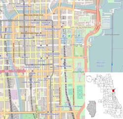 | |
| Location | 122 S. Michigan Avenue (80 East Adams Street) Chicago, Illinois 60603 |
|---|---|
| Coordinates | 41°52′47.46″N87°37′29.77″W / 41.8798500°N 87.6249361°W |
| Built | 1911 |
| Architect | Daniel Burnham & Company |
| Architectural style | Beaux-Arts |
| NRHP reference No. | 84000293 [1] |
| Added to NRHP | 1984 |
The Peoples Gas Building is an office building at 122 South Michigan Avenue on the corner of Adams Street in the Loop community area of Chicago, Illinois.