Old Town, Chicago

Last updated

Old Town Triangle Historic District
Old town sign.JPG
An Old Town sign at Wells Street and North Avenue
Chicago locator map.png
Red pog.svg
USA Illinois location map.svg
Red pog.svg
Usa edcp location map.svg
Red pog.svg
Location Chicago, Illinois, U.S.
Coordinates 41°54′40″N87°38′22″W / 41.9111°N 87.6395°W / 41.9111; -87.6395
Built1872
Architectural style Italianate, Queen Anne
NRHP reference No. 84000347 [1]
Significant dates
Added to NRHPNovember 8, 1984
Designated CLSeptember 28, 1977

Old Town is a neighborhood and historic district in Near North Side and Lincoln Park, Chicago, Illinois, [2] [3] home to many of Chicago's older, Victorian-era buildings, including St. Michael's Church, one of seven buildings to survive the Great Chicago Fire.

Contents

Location and name

St. Michaels Church (center) in Old Town in 2015; the borders of Old Town have sometimes been described as the hearing distance of its bells. St.Michaels Church, Chicago in Old Town in 2015.jpg
St. Michaels Church (center) in Old Town in 2015; the borders of Old Town have sometimes been described as the hearing distance of its bells.
Klinkel Hall, a German beer hall in 1854 at present-day 1623 North Wells, was one of the locations for the Lager beer riot of 1855. Klinkel Hall In Chicago Lager Beer Riot Of 1855 Cropped.jpg
Klinkel Hall, a German beer hall in 1854 at present-day 1623 North Wells, was one of the locations for the Lager beer riot of 1855.

In the 19th century, German and Luxembourgish [8] immigrants moved to the meadows north of North Avenue and began farming what had previously been swampland, planting celery, potatoes, and cabbages. This led the area to be nicknamed "The Cabbage Patch", [9] [10] a name which stuck until the early 1900s. [9]

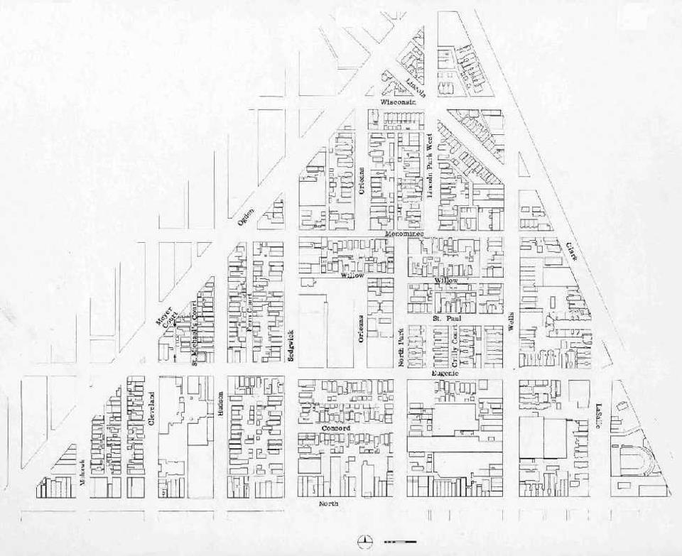
During World War II, the triangle formed by North Avenue, Clark Street, and Ogden Avenue (since removed) were designated a 'neighborhood defense unit' by Chicago's Civil Defense Agency. [11] In the years immediately after the war, the population of "North Town" (as it had come to be known by the 1940s) sponsored annual art fairs called the "Old Town Holiday". The art fairs were popular attractions for the neighborhood, [12] and the name "Old Town" was used in the title of the Old Town Triangle Association when it was formed in 1948, by residents who wanted to improve the condition of buildings that were suffering from physical deterioration. [10] [13]

In the 1950s, much of Old Town was an enclave for many of the first Puerto Ricans to come to Chicago. They referred to the area as part of "La Clark".[ citation needed ]

No legal entity is known as "Old Town", but claims have been made as to the nature of its legally-unspecified borders:

It is important to stress that there is no such legal entity as Old Town. Old Town is where you make it.

Richard Atcheson, Holiday Magazine, March 1967 [14]

This neighborhood is supposed to be as much a sound as a place, and it's from the bells of St. Michael's Church. The story goes you only really live in Old Town if you can hear them.

Alan G. Artner, Chicago Tribune , March 29, 2008 [4]

... it was said that all who lived within hearing distance of the church's bells were Old Towners.

Donna Gill, Chicago Tribune, December 4, 1967 [5]

History

19th century

A plaque about Carl Street Studios on the building itself A Plaque about Carl Street On the Studio itself, yo.jpg
A plaque about Carl Street Studios on the building itself
The former location of the Society for Human Rights at 1710 N. Crilly Court in Chicago in 2015 Former Location of the Society for Human Rights, 1701 N. Crilly Court, Chicago 2015.jpg
The former location of the Society for Human Rights at 1710 N. Crilly Court in Chicago in 2015

The land known as Old Town originally served as a home and trade center to many Native American nations, including the Potawatomi, Miami, and Illinois. [15] [16]

Following the 1833 Treaty of Chicago, most of the indigenous people were forcibly removed, and the land was then settled in the 1850s by German-Catholic immigrants. Clark Street is a leftover of the culture, being an old road which followed a slight ridge along Lake Michigan.[ citation needed ]

Old Town is the site of many of Chicago's older, Victorian-era buildings, as well as St. Michael's Church, originally a Bavarian-built church and one of seven to survive within the boundaries of the Great Chicago Fire. [17]

Many of the streets and alleys, particularly in the Old Town Triangle section, predate the Great Chicago Fire and do not all adhere to a typical Chicago grid pattern.[ citation needed ]

20th century

People and art at the Old Town Art Fair in the 1960s Photography by Victor Albert Grigas (1919-2017) 000479640006 (38142840332) (2).jpg
People and art at the Old Town Art Fair in the 1960s
Anti-Vietnam War protesters in Lincoln Park during the 1968 Democratic National Convention; the band MC5 can be seen playing
Hippies in Old Town in 1968 Photography by Victor Albert Grigas (1919-2017) 00223 Old Town Art Fair Chicago 1968 (36846582284).jpg
Hippies in Old Town in 1968
Vendors and pedestrians at the Old Town Art Fair on Wells Street in 1968 Photography by Victor Albert Grigas (1919-2017) 00233 Old Town Art Fair Chicago 1968 (37525504852).jpg
Vendors and pedestrians at the Old Town Art Fair on Wells Street in 1968

Old Town has one Brown-Purple Line 'El' station, at 1536–40 North Sedgwick Street. It is one of the oldest standing stations on the El, built in 1900.[ citation needed ]

In 1924, the first gay rights organization in American history, the Society for Human Rights, was established by Henry Gerber at his home, the Henry Gerber House, on North Crilly Court. The Henry Gerber House was designated a Chicago Landmark on June 6, 2001. [18] In June 2015, it was named a National Historic Landmark. [19]

In 1927, sculptors Sol Kogen and Edgar Miller purchased and subsequently rehabilitated a house on Burton Place, near Wells Street, into the Carl Street Studios. During the 1930s, an art colony emerged in the neighborhood as artists moved from the Towertown neighborhood near Washington Square Park.[ citation needed ]

In 1955, upon the first election of Mayor Daley, 43rd ward alderman Paddy Bauler, who kept a saloon in Old Town at North and Sedgwick Avenues called De Luxe Gardens, [20] [21] [22] [23] [24] famously declared "Chicago ain't ready for reform yet" many times over in his bar while dancing a jig. [25]

During the 1960s, the neighborhood was the center of the yippie and hippie counter culture in the midwestern United States. This was mostly because by the 1950s and 1960s, many of the original families that had settled in the neighborhood had moved to the suburbs during white flight, leaving older Victorian buildings with storefronts available to rent inexpensively. A community of Puerto Ricans formed along Wieland, North Park, Sedgwick and west on North Avenue. The Young Lords, then a street gang with Jose Cha-Cha Jimenez had a branch of their group at Wieland and North Avenues. This dense storefront-laden area (Wells and North Avenues) became also the nexus of hippie culture, (as well as the newly emerging out-homosexual culture) and gave rise to the boutiques (Crate & Barrel, for example) in the neighborhood today. Seed was a literary staple of the neighborhood at the time.

There is a little piece of Chicago Real Estate, west of Lincoln Park, that is the pride of urban conservationists and the despair of bulldozers. It is a community widely known as Old Town ... Old Town is full of conflict, full of life; a sometimes maddening but always exciting place to live.

Richard Atcheson, Holiday Magazine, March 1967 [14]

The violent events that took place during the 1968 Democratic National Convention transpired primarily in Grant Park, Old Town, and Lincoln Park, adjacent to Old Town. [26]

I pointed out that it was in the best interests of the City to have us in Lincoln Park ten miles away from the Convention hall. I said we had no intention of marching on the Convention hall, that I didn't particularly think that politics in America could be changed by marches and rallies, that what we were presenting was an alternative life style, and we hoped that people of Chicago would come up, and mingle in Lincoln Park and see what we were about.

Abbie Hoffman, from the Chicago 7 trial [27]

The film The Weather Underground has a scene on La Salle Avenue in Old Town, which describes the Zeitgeist of the era.

Old Town was home to many gays and lesbians from the 1960s through the 1980s. There were numerous gay bars lining Wells Street (all of them closed as of 2013). This was the first "gay ghetto" in Chicago, predating the current Lake View neighborhood (which is the current epicenter of gay life); As the area gentrified, gay residents moved further north to Lincoln Park and then Lake View neighborhoods.

During the 1960s and 1970s, Old Town became the center of Chicago folk music, which was experiencing a revival at the time. In 1957, the Old Town School of Folk Music opened at 333 West North Avenue and stayed at that address until 1968, when the school moved to 909 West Armitage Avenue. [28] It has retained the name, although it is no longer located within Old Town. Singer-songwriters such as Bob Gibson, Steve Goodman, Bonnie Koloc, and John Prine played at several clubs on Wells Street, such as The Earl of Old Town. [29] [30] The Old Town School of Folk Music was closely associated with these artists and clubs. One large and successful folk club was Mother Blues, which featured nationally known artists and groups such as Jose Feliciano, Odetta, Oscar Brown Jr., Josh White, and Chad Mitchell. It also presented comedian George Carlin, Sergio Mendez, Brazil '66, and The Jefferson Airplane.[ citation needed ]

Bijou Theater Bijou-Theater-Chicago.jpg
Bijou Theater

A few of the institutions from the 1960s era still exist today, such as Crate & Barrel, The Second City, the Old Town Ale House, Bijou Video, the Old Town School of Folk Music (which moved after the 1968 riots), the Fudge Pot, the Up Down Tobacco Shop (which used to be located just south of its current location), and the Old Town Aquarium (which moved in 2019 to Irving Park, while keeping its name).

After the assassination of Martin Luther King Jr. and the subsequent riots, the neighborhood experienced a tense racial division during the 1970s and 1980s which left a segregation between Old Town north of North Ave. and Old Town south of North Ave. In the early 2000s, this trend had begun to shift towards a gentrification of the area south of North Ave. on Sedgwick, Blackhawk, Hudson and Mohawk streets, near the Marshall Field Garden Apartments. The area to the west of these streets, near the North and Clybourn Red Line stop had been dubbed "SoNo" by real estate developers. SoNo's boundaries are North Avenue, Halsted Street, Division Street and the North Branch of the Chicago River. Currently, Old Town south of North Avenue is a mixture of wealth and poverty, though the area is steadily gentrifying. [31] The demolition of the Cabrini–Green high rise housing projects to the south has led to significant demographic changes in the neighborhood. The original Francis X. Cabrini Row Houses still are standing. The Parkside of Old Town development was built replacing the Cabrini-Green high rises just south of Old Town.

By 1976, Wells Street in Old Town had many sex-industry businesses operating, [32] so many that Wells street was specifically named in Time Magazine's 1976 article "The Porno Plague". [33] It was thought that some of the businesses had mob connections. [34]

21st century

horses in a field next to Noble Horse Theater in 2011. Note the John Hancock Building in the background Horses! (6078304745).jpg
horses in a field next to Noble Horse Theater in 2011. Note the John Hancock Building in the background

Current cultural amenities in the neighborhood include Old Town Triangle Art Center, [35] and the annual Old Town Art Fair. Noble Horse Theater stood from 1871 until a 2015 arson [36] forced a sale in 2017, [37] and the land was bought and built into condominiums. [38]

Education

Chicago Public Schools (CPS) operates public schools for the area.

Manierre K–8 School is in "Sedville", a gang territory area in Old Town. As of 2013, it was considered a low-performing school. [39] In the 2010s, CPS considered merging Jenner K–8 in Cabrini-Green and Manierre together, but concerns involving students crossing gang territorial lines meant that both schools remained open. [40]

Notable residents

See also

Related Research Articles

<span class="mw-page-title-main">Lake View, Chicago</span> Community area in Chicago

Lakeview, also spelled Lake View, is one of the 77 community areas of Chicago, Illinois. Lakeview is located in the city's North Side. It is bordered by West Diversey Parkway on the south, West Irving Park Road on the north, North Ravenswood Avenue on the west, and the shore of Lake Michigan on the east. The Uptown community area is to Lakeview's north, Lincoln Square to its northwest, North Center to its west, and Lincoln Park to its south. The 2020 population of Lakeview was 103,050 residents, making it the second-largest Chicago community area by population.

<span class="mw-page-title-main">Lincoln Park, Chicago</span> Community area in Chicago

Lincoln Park is a designated community area on the North Side of Chicago, Illinois. It is located west of Lincoln Park.

<span class="mw-page-title-main">Cabrini–Green Homes</span> Public housing development in Chicago

Cabrini–Green Homes was a Chicago Housing Authority (CHA) public housing project on the Near North Side of Chicago, Illinois. The Frances Cabrini Rowhouses and Extensions were south of Division Street, bordered by Larrabee Street to the west, Orleans Street to the east and Chicago Avenue to the south, with the William Green Homes to the northwest.

<span class="mw-page-title-main">Edgewater, Chicago</span> Community area in Chicago

Edgewater is a lakefront community area on the North Side of the city of Chicago, Illinois six miles north of the Loop. The most recently established of the city's 77 official community areas, Edgewater is bounded by Foster Avenue on the south, Devon Avenue on the north, Ravenswood Avenue on the west, and Lake Michigan on the east. Edgewater contains several beaches for residents to enjoy. Chicago's largest park, Lincoln Park, stretches south from Edgewater for seven miles along the waterfront, almost to downtown. Until 1980, Edgewater was part of Uptown, and historically it constituted the northeastern corner of Lake View Township, an independent suburb annexed by the city of Chicago in 1889. Today, Uptown is to Edgewater's south, Lincoln Square to its west, West Ridge to its northwest and Rogers Park to its north.

<span class="mw-page-title-main">Near North Side, Chicago</span> Community area in Chicago

The Near North Side is the eighth of Chicago's 77 community areas. It is the northernmost of the three areas that constitute central Chicago, the others being the Loop and the Near South Side. The community area is located north and east of the Chicago River. To its east is Lake Michigan, and its northern boundary is the early 19th-century city limit of Chicago, North Avenue. In 2020 the Near North Side had 105,481 residents, surpassing Lake View as the largest Chicago community area by population. It is also the most densely populated community area and has the second most skyscrapers, after the Loop. With the exception of Goose Island, the Near North Side is known for its extreme affluence, typified by the Gold Coast, Magnificent Mile, Navy Pier, and skyscrapers.

<span class="mw-page-title-main">Humboldt Park, Chicago</span> Community area in Chicago

Humboldt Park, one of 77 designated community areas, is on the West Side of Chicago, Illinois. The Humboldt Park neighborhood is known for its dynamic social and ethnic demographic change over the years. The Puerto Rican community has identified strongly with the area since the 1970s. Humboldt Park is also the name of a 207-acre (0.8 km2) park adjacent to the community area.

<span class="mw-page-title-main">Logan Square, Chicago</span> Community area in Chicago

Logan Square is an official community area, historical neighborhood, and public square on the northwest side of the City of Chicago. The Logan Square community area is one of the 77 city-designated community areas established for planning purposes. The Logan Square neighborhood, located within the Logan Square community area, is centered on the public square that serves as its namesake, located at the three-way intersection of Milwaukee Avenue, Logan Boulevard and Kedzie Boulevard.

<span class="mw-page-title-main">Chicago History Museum</span> Public museum operated by the Chicago Historical Society

Chicago History Museum is the museum of the Chicago Historical Society (CHS). The CHS was founded in 1856 to study and interpret Chicago's history. The museum has been located in Lincoln Park since the 1930s at 1601 North Clark Street at the intersection of North Avenue in the Old Town Triangle neighborhood. Long known as the CHS, the society adopted the name, Chicago History Museum, in September 2006 for its public presence.

<span class="mw-page-title-main">West Town, Chicago</span> Community area in Chicago

West Town, northwest of the Loop on Chicago's West Side, is one of the city's officially designated community areas. Much of this area was historically part of Polish Downtown, along Western Avenue, which was then the city's western boundary. West Town was a collection of several distinct neighborhoods and the most populous community area until it was surpassed by Near West Side in the 1960s. The boundaries of the community area are the Chicago River to the east, the Union Pacific railroad tracks to the south, the former railroad tracks on Bloomingdale Avenue to the North, and an irregular western border to the west that includes the city park called Humboldt Park. Humboldt Park is also the name of the community area to West Town's west, Logan Square is to the north, Near North Side to the east, and Near West Side to the south. The collection of neighborhoods in West Town along with the neighborhoods of Bucktown and the eastern portion of Logan Square have been referred to by some media as the "Near Northwest Side".

<span class="mw-page-title-main">Oakland, Chicago</span> Community area in Chicago

Oakland, located on the South Side of Chicago, Illinois, USA, is one of 77 officially designated Chicago community areas. Bordered by 35th and 43rd Streets, Cottage Grove Avenue and Lake Shore Drive, The Oakland area was constructed between 1872 and 1905. Some of Chicago's great old homes may be seen on Drexel Boulevard. The late 19th-century Monument Baptist Church on Oakwood Blvd. is modeled after Boston's Trinity Church. Oakwood /41st Street Beach in Burnham Park is at 4100 S. Lake Shore Drive. With an area of only 0.6 sq mi Oakland is the smallest community area by area in Chicago.

<span class="mw-page-title-main">Chatham, Chicago</span> Community area in Chicago

Chatham is one of the 77 community areas of the city of Chicago, Illinois. It is located on the city's South Side. It includes the neighborhoods of Chatham-Avalon, Chatham Club, Chesterfield, East Chatham, West Chatham and the northern portion of West Chesterfield. Its residents are predominantly African American, and it is home to former Senator Roland Burris. Housing many city employees and other officials, Chatham has been a central area for Chicago's middle-class African Americans since the late 1950s.

<span class="mw-page-title-main">Division Street (Chicago)</span> Street in Chicago, Illinois and west suburbs

Division Street is a major east-west street in Chicago, Illinois, located at 1200 North. Division Street begins in the Gold Coast neighborhood near Lake Shore Drive, passes through Polonia Triangle at Milwaukee Avenue into Wicker Park and continues to Chicago's city limits and into the city's western suburbs. Once known as "Polish Broadway" during the heyday of Polish Downtown, Division Street was the favorite street of author Nelson Algren. A fountain dedicated in his name was installed in what had been the area that figured as the inspiration for much of his work.

<span class="mw-page-title-main">Wicker Park, Chicago</span> Neighborhood in Chicago, United States

Wicker Park is a neighborhood in the West Town community area of Chicago, Illinois, west of the Kennedy Expressway, east of Humboldt Park, and south of the Bloomingdale Trail, known for its hipster culture, art community, nightlife, and food scene.

<span class="mw-page-title-main">St. Michael's Church, Old Town, Chicago</span>

St. Michael's Church in the Old Town neighborhood of Chicago is a Roman Catholic church staffed by the Redemptorist order of priests. The parish was founded to minister to German and Luxembourgish Catholic immigrants in 1852 with its first wooden church completed that year at a cost of $750. The building stands at the intersection of Eugenie Street and Cleveland Avenue. The church was built as a haven for German immigrants who were outcasts in Old Chicago. In addition, the town's main church, St. Joseph's Church, was overcrowded. The Redemptorists were invited to administer the parish in 1860 and a large brick church was finished in 1869. When completed, its tower made it the tallest building in Chicago and the United States, a distinction it held until the old Chicago Board of Trade Building was completed in 1885.

<span class="mw-page-title-main">Cermak Road</span>

Cermak Road, also known as 22nd Street, is a 19-mile, major east–west street on Chicago's near south and west sides and the city's western suburbs. In Chicago's street numbering system, Cermak is 2200 south, or twenty-two blocks south of the baseline of Madison Street. Normally, one mile comprises eight Chicago blocks, but the arterial streets Roosevelt Road, formerly named Twelfth Street and at 1200 South, and Cermak Road were platted before the eight-blocks-per-mile plan was implemented. Roosevelt Road is one mile south of Madison Avenue and there are twelve blocks within that mile. Cermak Road is two miles south of Madison Avenue and there are ten blocks within the mile between Roosevelt and Cermak Roads.

<span class="mw-page-title-main">Henry Gerber House</span> Chicago home of early U.S. LGBT rights pioneer

The Henry Gerber House is located on North Crilly Court in the Old Town neighborhood of Chicago, Illinois, United States. It is a single-family brick row house built in 1885 in the Queen Anne style, mostly intact from that time. In the 1920s it housed the apartment occupied by German-born Henry Gerber, founder of the short-lived Society for Human Rights, which was incorporated in Illinois as the first American organization working for gay rights. Inspired by nascent gay-rights organizations he had seen in Germany, Gerber held meetings here and published newsletters, the first known gay civil rights periodicals in the country, for a year until the Chicago police raided the house in 1925.

<span class="mw-page-title-main">Cooley Vocational High School</span> School in Chicago, Illinois, United States

Edwin Gilbert Cooley Vocational High School was a public 4–year vocational high school and middle school located in the Old Town neighborhood on the Near North Side of Chicago, Illinois, United States.

<span class="mw-page-title-main">Near North Career Metropolitan High School</span> School in Chicago, Illinois, United States

Near North Career Metropolitan High School was a public 4–year magnet high school located in the Old Town neighborhood on the Near North Side of Chicago, Illinois, United States. Operated by the Chicago Public Schools district, Near North opened in September 1979.

Wednesday Journal, Inc. is a newspaper publisher based in Oak Park, Illinois. It publishes a free weekly community newspaper in Chicago's Austin neighborhood, paid weekly newspapers in the city's western suburbs and parenting magazines in the Chicago metropolitan area.

<span class="mw-page-title-main">West Side, Chicago</span> District in Illinois, United States

The West Side is one of the three major sections of the city of Chicago, Illinois, U.S. The other two sections within Chicago that associate with the West Side are the North Side and the South Side. The West Side consists of communities that are of historical, cultural, and ideological importance to the history and development of Chicago. On the flag of Chicago, the West Side is represented by the central white stripe.

References

  1. "National Register Information System". National Register of Historic Places . National Park Service. January 23, 2007.
  2. "Boundaries – Community Areas (current)". City of Chicago | Data Portal. Retrieved May 17, 2020.
  3. "Boundaries – Neighborhoods". City of Chicago | Data Portal. Retrieved May 17, 2020.
  4. 1 2 "Old Town". tribunedigital-chicagotribune. March 29, 2008. Retrieved March 26, 2015.
  5. 1 2 "Old Town: Gold Rush in a Cabbage Patch (December 4, 1967)". Chicago Tribune.
  6. "1855—Beer Riot". chicagology.com. Retrieved August 19, 2020.
  7. Gale, Neil (January 3, 2017). "The Digital Research Library of Illinois History Journal™: The Chicago Lager Beer Riot of 1855". The Digital Research Library of Illinois History Journal™. Retrieved August 19, 2020.
  8. "Luxembourgers".
  9. 1 2 Baugher, Shirley (2011). Hidden History of Old Town. Charleston, SC: The History Press. p. 29. ISBN   978-1-60949-207-6.
  10. 1 2 "Old Town: Gold Rush in a Cabbage Patch (December 4, 1967)". Chicago Tribune. Retrieved June 16, 2015.
  11. https://www.oldtowntriangle.com/wp-content/uploads/2015/10/OTTA-Map-from-Facebook.jpg [ bare URL image file ]
  12. "EXPECT CROWD OF 40,000 FOR OLD TOWN FAIR (May 29, 1960)". Chicago Tribune.
  13. "Old Town". www.encyclopedia.chicagohistory.org.
  14. 1 2 Atcheson, Richard: "The Spirit of Old Town", page 67. Holiday Magazine, The Curtis Publishing Company, March 1967
  15. "Native Americans". Encyclopedia of Chicago. Chicago Historical Society. 2005. Retrieved August 31, 2009.
  16. Ph.d, Dr Neil Gale (August 13, 2020). "The Digital Research Library of Illinois History Journal™ : Many Early Chicago Areas Were Called "The Cabbage Patch."". The Digital Research Library of Illinois History Journal™. Retrieved July 22, 2023.
  17. "Chicago Landmarks – Old Town Triangle District". City of Chicago Department of Planning and Development, Landmarks Division. 2003. Retrieved August 31, 2009.
  18. "Henry Gerber House". City of Chicago Department of Planning and Development, Landmarks Division. 2003. Retrieved June 27, 2007.
  19. Sun-Times (June 19, 2015). "Old Town site of nation's first gay rights group designated national landmark | Chicago". Chicago.suntimes.com. Archived from the original on July 1, 2015. Retrieved June 28, 2015.
  20. Baugher, Shirley (2011). Hidden History of Old Town. History Press. ISBN   9781609492076.
  21. Sean Parnell. "De Luxe Gardens in Memoriam: Chicago Bar Project". chibarproject.com.
  22. Lindberg, Richard (August 1998). To Serve and Collect. SIU Press. ISBN   9780809322237.
  23. Chicago Tribune. "Alderman Mathias". chicagotribune.com.
  24. "Life". google.com. March 31, 1947.
  25. "Good Government Movements". www.encyclopedia.chicagohistory.org.
  26. "Chicago Tribune – Historical Newspapers". February 16, 2024.
  27. "Testimony of Abbie Hoffman in the Chicago Seven Trial". umkc.edu. Archived from the original on January 14, 2011.
  28. "History – Old Town School of Folk Music". oldtownschool.org. Retrieved March 26, 2015.
  29. "On the Town (December 21, 1969)". Chicago Tribune.
  30. "Remembering Earl Pionke". Chicago Tonight – WTTW. Retrieved March 26, 2015.
  31. "Gentrification". www.encyclopedia.chicagohistory.org.
  32. Sandbrook, Dominic (January 6, 2018). Mad As Hell: The Crisis of the 1970s and the Rise of the Populist Right. Anchor Books. ISBN   9781400077243 via Google Books.
  33. "The Porno Plague". Time Magazine . April 5, 1976. Archived from the original on May 1, 2007. Retrieved October 26, 2010.
  34. "Suspected Porn Boss Dies In His Apartment". Chicago Tribune. October 7, 1988.
  35. "Old Town Triangle Association". www.oldtowntriangle.com.
  36. "Fire Devastates Noble Horse Theater; 'Free the Horses' Graffiti Discovered". DNAinfo Chicago. Retrieved January 2, 2022.
  37. Koziarz, Jay (June 23, 2017). "A final look inside Old Town's Noble Horse Theatre and Stables". Curbed Chicago. Retrieved January 2, 2022.
  38. Koziarz, Jay (August 17, 2017). "Penthouse in unbuilt 'Equis' development asks $1.4M". Curbed Chicago. Retrieved January 2, 2022.
  39. Konkol, Mak; PAUL Biasco (May 21, 2013). "Parents Win Battle, Manierre Elementary Won't Close". DNA Info. Archived from the original on December 22, 2016. Retrieved December 22, 2016.
  40. Bloom, Mina (September 4, 2015). "For Proposed Merger, 'Help Us to Help You,' Jenner Official Says to Ogden". DNA Info. Archived from the original on December 22, 2016. Retrieved December 22, 2016.