
Michigan Avenue is a north-south street in Chicago which runs at 100 east on the Chicago grid. The northern end of the street is at Lake Shore Drive on the shore of Lake Michigan in the Gold Coast Historic District. The street's southern terminus is at Sibley Boulevard in the southern suburb of Harvey, though like many Chicago streets it exists in several disjointed segments.

Wrigley Rooftops is a name for the sixteen rooftops of residential buildings which have bleachers or seating on them to view baseball games or other major events at Wrigley Field. Since 1914 Wrigley roofs have dotted the neighborhood of Wrigleyville around Wrigley Field, where the Chicago Cubs play Major League Baseball. Venues on Waveland Avenue overlook left field, while those along Sheffield Avenue have a view over right field.

The Richard J. Daley Center, also known by its open courtyard Daley Plaza and named after longtime mayor Richard J. Daley, is the premier civic center of the City of Chicago in Illinois. The Center's modernist skyscraper primarily houses offices and courtrooms for the Cook County Circuit Courts. It is adjacent to the Chicago City Hall and County Building. The open plaza used for gatherings and events is the site of the Chicago Picasso.

Chicago City Hall is a 10-story building that houses the official seat of government of the City of Chicago in Illinois. Adjacent to the Richard J. Daley Center and the James R. Thompson Center, the building that includes Chicago City Hall houses the offices of the mayor, city clerk, and city treasurer; some city departments; aldermen of Chicago's various wards; and chambers of the Chicago City Council on the west side of the building. The building's east side is devoted to the various offices of Cook County, including chambers for the Cook County Board of Commissioners.

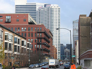
The Near West Side, one of the 77 community areas of Chicago, is on the West Side, west of the Chicago River and adjacent to the Loop. The Great Chicago Fire of 1871 started on the Near West Side. Waves of immigration shaped the history of the Near West Side of Chicago, including the founding of Hull House, a prominent settlement house. In the 19th century railroads became prominent features. In the mid-20th century, the area saw the development of freeways centered in the Jane Byrne Interchange.

The Chicago Pedway is a network of tunnels, ground-level concourses and bridges connecting skyscrapers, retail stores, hotels, and train stations throughout the central business district of Chicago, Illinois.

Randolph Street is a street in Chicago. It runs east–west through the Chicago Loop, carrying westbound traffic west from Michigan Avenue across the Chicago River on the Randolph Street Bridge, interchanging with the Kennedy Expressway (I-90/I-94), and continuing west. It serves as the northern boundary of Grant Park and the Chicago Landmark Historic Michigan Boulevard District. Several large theaters, as well as city and state government buildings are on and adjacent to Randolph. Metra's Millennium Station is located under Randolph Street.

Lakeshore East is a master-planned mixed use urban development being built by the Magellan Development Group in the Loop community area of Chicago in Cook County, Illinois, United States. It is located in the northeastern part of the Loop, which, along with Illinois Center, is called the New Eastside. The development is bordered by Wacker Drive to the north, Columbus Drive to the west, Lake Shore Drive to the east, and East Randolph Street to the south. Skidmore, Owings & Merrill created the master plan for the area. The development, which had been scheduled for completion in 2011, was set for completion in 2013 by 2008. Development continued with revised plans for more buildings in 2018 and continuing construction of the Vista Tower in 2019.
The Miglin-Beitler Skyneedle was a proposed 125-floor skyscraper intended for Chicago, Illinois, United States, by Lee Miglin and J. Paul Beitler and designed by architect César Pelli. The site of the proposed Skyneedle now is host to a parking garage. If it had been built when it was planned, the 1,999 ft (609 m) tall Miglin-Beitler Skyneedle would have been the tallest building in the world.

Morris Adjmi Architects is a New York City-based architecture and interior design firm that provides design services to corporate, commercial and residential clients.

The Rock N Roll McDonald's is a flagship McDonald's restaurant formerly located in Chicago. It is one of the most famous McDonald's locations in the world and was once the busiest in the United States. Both the 1983 and 2005 structures on the site, located in the River North neighborhood of Chicago, a few city blocks west of the Magnificent Mile, had been tourist attraction since the opening in 1983. The 2018 redesign has no rock 'n' roll theme, but is still the flagship McDonald's location in Chicago. The 2018 redesign won the design excellence Award of Merit from the Chicago chapter of the American Institute of Architects in 2019.
Fulton River District is a Chicago neighborhood located on the edge of Chicago's downtown, northwest of the Loop. The district is bounded by the Chicago River to the east, the Kennedy Expressway to the west, Ohio Street to the north and Madison Street to the south, making it part of the Near West Side and West Town community areas of Chicago in Cook County, Illinois, United States. Just across the expressway to the west is the Fulton Market District. Money magazine ranked the neighborhood as #4 best place to live in the United States in 2019.
Wolf Point is the location at the confluence of the North, South and Main Branches of the Chicago River in the present day Near North Side, Loop, and Near West Side community areas of Chicago. This fork in the river is historically important in the development of early Chicago. Located about 1.6 miles (2.6 km) from Lake Michigan, this was the location of Chicago's first three taverns, its first hotel, Sauganash Hotel, its first ferry, its first drug store, its first church, its first theater company, and the first bridges across the Chicago River. The name is said to possibly derive from a Native American Chief whose name translated to wolf, but alternate theories exist.

The Chicago Riverwalk is a multi-use public space located on the south bank of the main branch of the Chicago River, extending from Lake Shore Drive and Lake Michigan to Lake Street. The Chicago Riverwalk contains bars, cafes and restaurants; small parks; boat and kayak rentals; a Vietnam War memorial; and other amenities. Its planned final extent is Wolf Point.

The Gogo Building, formerly known as the River Center, is an 840,000-square-foot (78,000 m2) commercial building located at 111 N. Canal Street in the West Loop community area of Chicago, Illinois. Originally constructed as a warehouse in the early 1900s, the vintage, loft-style building is now home to various commercial tenants, most notably Gogo Inflight Internet, which has its logo on the cube topping the building. Other tenants include Twitter, Uber, Vivid Seats, SAP Fieldglass, Potbelly Sandwich Works and Kin + Carta. The building is one of the best surviving examples in downtown Chicago of the once vibrant industrial district along the Chicago River.
725 W. Randolph Street is proposed skyscraper in Chicago designed by architectural firm Roger Ferris + Partners with architect of record Perkins Eastman. As proposed, the building will contain residences and an Equinox-brand hotel. It is one of two buildings under development in the West Loop by Related Midwest that has faced opposition from local residents. The Chicago Plan Commission approved the building in 2018, and Related plans to break ground in 2019.

151 North Franklin is a skyscraper located at 151 North Franklin Avenue in the Chicago Loop. Completed in 2018 and standing at 568 feet tall with 35 floors at the northeast corner of West Randolph Street and North Franklin Avenue, the building is the current corporate headquarters of namesake tenant CNA Insurance, which has been headquartered in the Loop since 1900. It also hosts large office spaces for Facebook and the law firm Hinshaw & Culbertson.

The Wm. J. Cassidy Tire Building is a building at 344 N. Canal Street, Chicago, Illinois. Designed by Henry J. Schlacks and constructed in 1902, it originally served as a factory and warehouse for the Tyler & Hippach Mirror Co.

The Archer Daniels Midland Wheat Mill was a plant in Chicago's Fulton Market District. The complex included brick loft buildings, a grain elevator, and silos. The oldest buildings in the complex were built in 1897 and were designed by William Carbys Zimmerman and John J. Flanders. It originally served as Eckhart & Swan's wheat and rye mill.


