Parkwood Hills

Last updated

Parkwood Hills
Neighbourhood
Courtyard 1210Meadowlands.jpg
Townhouses on Meadowlands Drive.
Newottawamap.png
Red pog.svg
Parkwood Hills
Coordinates: 45°21′30″N75°43′23″W / 45.35833°N 75.72306°W / 45.35833; -75.72306
Developed1959
Government
   MPs Anita Vandenbeld
   MPPs Chandra Pasma
   Councillors Sean Devine
  Governing bodyGeneral Burns Community Association
  PresidentJeff Seaman [1]
Elevation
90 m (300 ft)
Time zone UTC-5 (Eastern (EST))
  Summer (DST) UTC-4 (EDT)
Forward sortation area
K2E

Parkwood Hills is a neighbourhood in Knoxdale-Merivale Ward in the west end of Ottawa, Canada. Prior to amalgamation in 2001, it was located in the City of Nepean. It is notable for the thriller Parkwood Hills (2002) which was filmed on location in the area by Kolin Casagrande, and for being a typical and illustrative example of town planning and development by Minto in the context of its position as the property manager for the National Capital Commission.

Contents

Location

Central to this development is Meadowlands Drive to the north (some of the neighbourhood goes past north of Meadowlands to Baseline Road), bounded to the east by Fisher Avenue and to the west by Merivale Road. Image. It is in Knoxdale-Merivale Ward which was expanded in 2006. [2] The councillor for Knoxdale-Merivale is Sean Devine, replacing the previous incumbent, Keith Egli, who retired prior to the 2022 Municipal Election. The neighbourhood is part of the General Burns Community Association, along with Stewart Farm, Borden Farm, Fisher Glen, CitiPlace and part of Carleton Heights. North of Meadowlands, the area is part of the Fisher Heights & Area Community Association.

History of the area

Before 1959

It is known that at least some of this land was farmland, since the Mulvagh farmhouse was here. The farmhouse was later taken over by the Parkwood Presbyterian Church. [3] Farming was challenging in some respects, due to the Depression, animal predation [4] [5] and fire risk. [6]

Development from 1959

Parkwood Hills is the name given to a residential development to the east of the section of Ottawa known as Nepean. One possible source for the name is Parkwood Hill, the fictional suburban setting for the 1948-1969 UK radio series Mrs Dale's Diary .

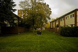
It is a mixed-dwelling suburb, having apartment blocks, townhouses and an assortment of single-family houses. The development is largely the work of the building company, Minto, which maintains ownership of many of the multi-residence buildings. [7] The tract has been developed over the past half-century and is largely complete. [8] The development was planned by architect John Russell in 1959. He was influenced by Californian community layouts and house models, [9] but see Ottawa urban planning. The building took place between 1959 and 1972. [10] In 1967 Minto built the first high-rise condominium development in Canada, called Horizon House, and located on Meadowlands Drive at Chesterton.

Suburban development flourished in the 1950s and '60s, with Ottawa companies, including Minto and Campeau Corporation building slews of suburban singles in Elmvale Acres, Parkwood Hills and similar areas, many of them in the 1,200-square-foot range. [11]

Movie

The movie Parkwood Hills was made on location here in 2002 by Kolin Casagrande, who later produced The Walkers in 2004. [12] It is a "short horror film, made as part of a project that assigned filmmakers to make short films with a horror theme," and was shown as part of a Halloween entertainment in Ottawa in 2007. [13] Since the plot centres on the fears of a babysitter, it possibly falls into the horror-of-personality subgenre.

For children

Schools

Public schools in Nepean are administered by Ottawa-Carleton District School Board (Parkwood Hills, Century, Sir Winston Churchill, and Merivale High School) . Catholic schools are administered by the Ottawa-Carleton Catholic School Board(Frank Ryan and St. Rita). Amalgamation of some schools has been recently recommended, due to a fall in student numbers. [14] Parkwood Hills Public School closed in 2010 after a low decline in students. Students afterwards went to Sir Winston Churchill.

Des Laurier High School has an active basketball team which played a friendly against the local police in May 2009. [15] Parkwood Hills Public School won a Health Pennant from the Ministry of Health on 4 May 2007, [16] [17] and took part in the Who is Nobody program in 2009. [18]

Childcare

Huron Towers Preschool/Kindergarten Child Care Centre caters for 44 children. In 2010 the Child Care Center moved to a new, environmentally friendly building where it will cater for 47 children on Capilano Drive and Beaver Ridge. [19] St. Luke's Child Care Center also caters for 47 children . This center operates various childcare programs and outside visits. [20]

Recreational

115th Parkwood Hills Scouts meets weekly from fall through spring, and holds meetings for Beavers, Cubs and Sea Scouts. [21]

Churches

Parkwood Presbyterian Church on Chesterton drive [22] was built in 1974, but its first service was held in Parkwood Hills Public School in 1964. [3] Due to expansion in attendance, a congregation was formed in 1965, and the Mulvagh farmhouse - at the corner of Meadowlands and Chesterton - became the manse, with the congregation's first full-time minister. Between 1965 and 2021 there have been five resident ministers.

Due to further growth of the congregation, an expansion fund was set up in the early 1980s. The old manse was renovated to become the Fellowship Centre in 1989, with a wheelchair ramp added in 1990. In 1996 the church building was expanded, and the congregation was involved in various missions in 1996 and 1998. [3] [23]

This is a church-going community which is surrounded by other neighbourhoods, so that the only church in Parkwood Hills does not have a monopoly on the local faithful. Other nearby churches include United, Anglican, Brethren, Christian Reformed, Lutheran, Pentecostal, Roman Catholic and United, all within a few km of Parkwood Hills.

Amenities

This community includes parks, playgrounds, tennis courts and retail areas. [24] A neighbourhood bonfire takes place at Halloween. [25]

Parks and sport

Parkwood Hills Recreation Centre is in Meadowland Mall, on Merivale Road. [26]

General Burns park, named after E. L. M. Burns, contains an outdoor public swimming pool, [27] 4 tennis courts, [28] [29] baseball field, soccer field and a children's play area. The General Burns Community Centre is in a 1950s log cabin, and offers recreational and community programs, which include pilates, taekwondo, 117th Company Pathfinders, 115th Parkwood Hills Scout group, Duffer Doo and Parkwood Hills Softball Association. [30] In winter from mid-December the park operates an outdoor ice hockey rink and children's ice pad. [31]

Parkwood Hills Softball Association operates youth and adult softball leagues, and holds charity tournaments. They award various trophies: the Neil Cohen Memorial Trophy, the Ron Potvin Memorial Trophy and the Junior Umpire Achievement Award. [32]

Raoul Wallenberg park is named after the humanitarian Raoul Wallenberg.

Allotments and gardening

The Nepean Allotment Gardens on Viewmount comprise 200 plots. [33]

Public transit

This is run by OC Transpo on the OC Transpo routes, and discussed at the Public Transit in Ottawa site. [34] Buses run mainly on Meadowlands Drive, consisting of the regular routes, 86 and 111, and the commuter route, 57. Image.

Climate

The weather for Parkwood Hills is included in the Nepean weather forecast here. Canada climate data is here. Mini snowploughs are a not-uncommon sight. Image.

Climate data for Nepean - Barrhaven
MonthJanFebMarAprMayJunJulAugSepOctNovDecYear
Record high °C (°F)14
(57)
15.4
(59.7)
26.7
(80.1)
33.1
(91.6)
35.8
(96.4)
38.1
(100.6)
44.7
(112.5)
48.8
(119.8)
35
(95)
27.8
(82.0)
23.9
(75.0)
16.3
(61.3)
39.8
(103.6)
Mean daily maximum °C (°F)−5.1
(22.8)
−4.1
(24.6)
3.2
(37.8)
11.8
(53.2)
20.1
(68.2)
25.8
(78.4)
28.5
(83.3)
26.9
(80.4)
20.5
(68.9)
15.5
(59.9)
5.8
(42.4)
−3
(27)
11.9
(53.4)
Mean daily minimum °C (°F)−13.3
(8.1)
−12.3
(9.9)
−5.1
(22.8)
2.6
(36.7)
10.7
(51.3)
14.7
(58.5)
17.4
(63.3)
15.1
(59.2)
10.1
(50.2)
4
(39)
−1.8
(28.8)
−10.1
(13.8)
2.1
(35.8)
Record low °C (°F)−35.6
(−32.1)
−36.1
(−33.0)
−30.6
(−23.1)
−16.7
(1.9)
−5.6
(21.9)
−0.1
(31.8)
5
(41)
2.6
(36.7)
−3
(27)
−7.8
(18.0)
−21.7
(−7.1)
−34.4
(−29.9)
−36.1
(−33.0)
Average precipitation mm (inches)25.2
(0.99)
17.6
(0.69)
36.3
(1.43)
60.5
(2.38)
78.4
(3.09)
85
(3.3)
90.6
(3.57)
87.1
(3.43)
85.3
(3.36)
74.9
(2.95)
59.8
(2.35)
31.3
(1.23)
732
(28.8)
Average snowfall cm (inches)50.2
(19.8)
45
(18)
30.8
(12.1)
10
(3.9)
0
(0)
0
(0)
0
(0)
0
(0)
0
(0)
0.1
(0.0)
21.9
(8.6)
57.2
(22.5)
175.7
(69.2)
Source: [35]

Flora and fauna

Native plants

This area is included in Ottawa's efforts to reinstate some of the native flora and wildlife habitat which has been displaced due to development. [36] Domestic gardeners are encouraged to plant native species such as Solomon's seal and bloodroot, although many of them are already doing their bit to discourage invasive alien species (also described as non-indigenous, non-native, invasive and exotic) such as dandelion, Queen Anne's lace, buckthorn, garlic mustard and emerald ash borer. [37] [38] [39] [40] [41]

Birds

Like many similar suburban neighbourhoods in this zone, Parkwood Hills is rich in gardens, shaded by mature trees and beautified with a wide variety of shrubs. This has created a habitat favoured by many species of birds, particularly those less nervous of living in close proximity with humans. In consequence, backyard birdwatching can be most rewarding for the suburban enthusiast. Birds to be found regularly in the area are grackles, cardinals, hummingbirds and chickadees. Image. [42] [43] [44] Recently the Townsend's solitaire was found and photographed in Parkwood Hills by F. Ouellette-Streeting. [45]

Wildlife

Common animals are eastern grey squirrels and skunks. There are two ways in which wildlife might be viewed here: as a control issue [4] and as a recreational issue with conservation and education in mind. [46] Deer can wander onto roads and into suburbs, so there is an annual Speeding Costs You...Deerly campaign for safe driving. [47]

Related Research Articles

<span class="mw-page-title-main">Ottawa West—Nepean</span> Federal electoral district in Ontario, Canada

Ottawa West—Nepean is a federal electoral district in Ontario, Canada, that has been represented in the House of Commons of Canada since 1997.

<span class="mw-page-title-main">Nepean, Ontario</span> Former municipality in Ontario, Canada

Nepean is a former municipality and now geographic area of Ottawa, Ontario, Canada. Located west of Ottawa's inner core, it was an independent city until amalgamated with the Regional Municipality of Ottawa–Carleton in 2001 to become the new city of Ottawa. However, the name Nepean continues in common usage in reference to the area. The population of Nepean is about 186,593 people.

<span class="mw-page-title-main">Bells Corners</span> Community in Ontario, Canada

Bells Corners is a suburban neighbourhood in Ottawa, Ontario, Canada. It is located along Robertson Road west of downtown, within Ottawa's western Greenbelt, in College Ward. As of the Canada 2016 Census, the community had a population of 9,272.

<span class="mw-page-title-main">Merivale Road</span>

Merivale Road is an arterial road in the west end of Ottawa, Ontario, Canada. It starts at Island Park Drive just north of Highway 417 and continues south until it ends at Prince of Wales Drive in Rideau Glen. South of Clyde Avenue, Merivale is known as Ottawa Road #17, while north of Clyde it is Ottawa Road #63.

<span class="mw-page-title-main">Meadowlands Drive</span>

Meadowlands Drive is a suburban road in Ottawa, Ontario, Canada. It begins at Prince of Wales Drive as a continuation of Hog's Back Road in the neighborhood of Rideauview. There are two small shopping plazas and a Shell station at its corner with Prince of Wales. It then continues westward towards Fisher Avenue and consists of low-income housing projects, low-rise apartment buildings, townhouses and semi-detached homes. The speed limit here is 50 km/h (31 mph). most of Meadowlands is one lane, other than between Prince of Wales to Fisher, and from Chesterton to Merivale.

<span class="mw-page-title-main">Barrhaven West Ward</span> Place in Ontario, Canada

Barrhaven West Ward is a city ward in Ottawa, Ontario, Canada. The ward consists of the western half of the Barrhaven subdivision. It consists of the neighbourhoods of Cedarhill Estates, Orchard Estates, Strandherd Meadows, Old Barrhaven, Barrhaven Mews, Jockvale, Halfmoon Bay and Stonebridge.

<span class="mw-page-title-main">Crystal Beach, Ottawa</span> Neighbourhood in Ottawa, Ontario, Canada

Crystal Beach is a neighbourhood in Ottawa, Ontario, Canada. It is located in the west end of Ottawa, in Bay Ward. The neighbourhood is triangular in shape, and its boundaries can broadly be described as Carling Avenue to the northeast, Moodie Drive to the west, and Corkstown Road to the south. It is. According to the Canada 2011 Census, the total population of the neighbourhood was 2,416.

<span class="mw-page-title-main">Knoxdale-Merivale Ward</span> Place in Ontario, Canada

Knoxdale-Merivale is a city ward in Ottawa, Ontario. Located in the city's west end, the ward is bordered to the east by the Rideau River and Fisher Avenue, the northern boundaries of the community of Barrhaven to the south, Ontario Highway 416 and Cedarview Road to the west and to the north by the Canadian National railway west of Merivale Road and Baseline Road to its east. It includes the communities of portions or all of Arlington Woods, Craig Henry, Tanglewood, Manordale, Crestview, Skyview, Parkwood Hills, Merivale Gardens, Grenfell Glen, Pineglen and Country Place.

Grenfell Glen is a small neighbourhood in Knoxdale-Merivale Ward in the city of Ottawa in Ontario, Canada.

Craig Henry is a residential neighbourhood in Knoxdale-Merivale Ward in the west end of Ottawa, Canada. It is located in the former city of Nepean. It is a residential subdivision that was developed from 1971 onwards. The neighbourhood is bordered by Woodroffe Avenue to the east, Greenbank Road to the west, Knoxdale Road to the south and the CN railroad separating it from Centrepointe and Briargreen to the north. The land previously belonged to the Craig Henry farm, and was developed by Jack Aaron.

<span class="mw-page-title-main">Borden Farm, Ottawa</span> Neighbourhood in Ottawa, Ontario, Canada

Borden Farm is a neighbourhood in Knoxdale-Merivale Ward in Ottawa, Ontario, Canada. It is located in the former city of Nepean, which was amalgamated into Ottawa in 2001. It was built on the site of the former Borden Dairy Farm. The land was bought by the Canada Mortgage and Housing Corporation (CMHC) in 1959. The Borden farm community was built in 1967–1976 as a joint development of the CMHC and the Ontario Housing Corporation and features single-family homes with parks and bikeways placed behind the houses, instead of on the streets. There was more development in the 1980s and early 1990s.

Skyline is a neighbourhood in Knoxdale-Merivale Ward in Ottawa, Ontario, Canada. Prior to amalgamation in 2001, the neighbourhood was located in the City of Nepean. It is bounded on the south by Meadowlands Drive of Parkwood Hills, on the west by Clyde Avenue and Merivale Road, on the north by Baseline Road and on the east by the neighbourhood of Fisher Heights.

<span class="mw-page-title-main">Fisher Heights</span> Neighbourhood in Ottawa, Ontario, Canada

Fisher Heights is a neighbourhood located in the far northeast corner of the former City of Nepean in Ottawa, Ontario, Canada. It is located in Knoxdale-Merivale Ward. The area is located south of the Experimental Farm and approximately 8 km away from downtown Ottawa.

Crestview is a neighbourhood in College Ward in the west end of Ottawa, Ontario, Canada. It was originally part of the City of Nepean before amalgamation with Ottawa in 2001. Together with the neighbouring community of Meadowlands, the area is served by the Crestview-Meadowlands Community Association. The community association's boundaries are Meadowlands Drive on the north, Merivale Road on the east, the CN Railtracks on the south and Woodroffe Avenue on the west.

Manordale is a neighbourhood in Knoxdale-Merivale Ward in the west end of Ottawa, Ontario, Canada. It is located in the former City of Nepean. It is bounded on the north and west by Knoxdale Road, east by Woodroffe Avenue, and south by Hunt Club Road.

<span class="mw-page-title-main">Tanglewood, Ottawa</span>

Tanglewood, also known as Tanglewood-Hillsdale, is a suburban neighbourhood in Knoxdale-Merivale Ward in the city of Ottawa, Ontario, Canada. It is located within the former City of Nepean in the west end of the city. It is located in the federal and provincial ridings of Nepean-Carleton. It is informally bounded by CN Railway to the north, Merivale Road to the east, Hunt Club Road to the south, and Woodroffe Avenue to the west.

Country Place is a residential neighbourhood near the geographical centre of Ottawa, Canada, in Knoxdale-Merivale Ward. Prior to 2001, it was part of the former city of Nepean. It is a mature residential subdivision with about 400 houses located just inside the Ottawa greenbelt near the Rideau River, and about 11 km from downtown Ottawa. It is bordered by the Black Rapids Creek and the greenbelt to the south, Prince of Wales Drive to the east, Merivale Road to the west, and the Pineglen community to the north. Amberwood Crescent meanders through the community, exiting onto Prince of Wales and Merivale. Tennyson Drive links Country Place to Pineglen.

<span class="mw-page-title-main">Minto Group</span> Developer in Ottawa, Canada

The Minto Group is a Canadian real estate company based in Ottawa, Ontario. It builds homes in Ottawa, Toronto, Calgary, and Florida, and manages multi-residential and commercial properties in Ontario and Alberta. As of 2018, Minto has built 85,000 new homes, and manages $2.9 billion in assets, including 13,000 multi-residential units and 2.7 million square feet of commercial space. The firm is one of Ottawa's largest residential landlords. Minto also has a publicly traded subsidiary, holding some of its multi-residential units, called Minto Apartment Real Estate Investment Trust. Some of Minto's joint-venture partners have been with Lasalle Investment Management, Greystar, and CPPIB.

Sean Devine is a Canadian politician, playwright, and actor. Devine currently represents Knoxdale-Merivale Ward on Ottawa City Council. His artistic career has spanned over three decades, including playwriting and directing, as well as acting roles on film and television. He has appeared in over twenty films and more than a dozen TV series.

References

  1. "Association | General Burns Community Association". 29 January 2018.
  2. Gordhunter.ca: about Knoxdale-Merivale ward.
  3. 1 2 3 Parkwood Presbyterian Church: History.
  4. 1 2 City of Ottawa website: wild animal control.
  5. Ontario website: sheep predator control.
  6. City of Ottawa website: farm fires page.
  7. Minto Group website
  8. Information from local residents.
  9. Crystal Beach Lakeview Community Association webpage.
  10. St Marks Anglican Church memories 1949-1999 by Lorne Bowerman, Chapter 1
  11. Househunting.ca: Small is the new big.
  12. IMDb: Parkwood Hills (2002) and The Walkers (2004)
  13. Canada.com: Phantoms, Exorcists etc.
  14. YourNepean.com: Committee recommends school amalgamations, May 20 2009.
  15. Ottawapolice.ca: Friendly against Des Laurier HS
  16. Ministry of Health: Parkwood Hills Public School receives healthy schools pennant.
  17. Ontario Ministry of Education: Parkwood Hills Public School (elementary).
  18. YourNepean.com: Parkwood students turn Nobody into Somebody, March 18, 2009.
  19. Huron Towers Preschool
  20. St Luke's Child Care Center.
  21. 115th Parkwood Hills Scouts website.
  22. Parkwood Presbyterian Church: map.
  23. Parkwood Presbyterian Church: the 1996 expansion.
  24. Elaine MacLean: description of the area.
  25. Youtube: Parkwood Hills Neighborhood Bonfire, 31 October 2008.
  26. Map location of Parkwood Hills Recreation Centre.
  27. General Burns outdoor swimming pool webpage.
  28. City of Ottawa: Tennis.
  29. General Burns tennis club website.
  30. General Burns park website.
  31. General Burns outdoor rink webpage.
  32. Parkwood Hills Softball Association website.
  33. Community Garden Network website.
  34. Public Transit in Ottawa discussion site.
  35. Canadian Climate Normals 1971-2000
  36. North American Native Plant Society website.
  37. Green Living Ottawa: Flora and Fauna
  38. Hanner, Sally (Winter 2008). "The Parkword" (PDF). Update on Owen Park Prairie storm water ponds . . .UPDUpdate on Owen Park Prairie storm water ponds: "an environment that favored invasive species like garlic mustard". Parkwood Hills Community Association. Retrieved 30 March 2010.
  39. "Fletcher Wildlife Garden". Volunteer at the Fletcher Wildlife Garden: mentions involvement of Parkwood Hills cubs. Ottawa Field Naturalists Club. 17 October 2009. Retrieved 30 March 2010.
  40. "Canadian Food Inspection Agency". Emerald Ash Borer Infested Place Order for the City of Gatineau, in the Province of Québec and the City of Ottawa, in the Province of Ontario. 9 September 2009. Retrieved 31 March 2010.
  41. "Canadian Food Inspection Agency". Emerald Ash Borer - Agrilus planipennis. 10 July 2009. Retrieved 31 March 2010.
  42. Birdwatching.com: birds in Canada.
  43. Birding in Canada: Birdwatching organisations and other information.
  44. Photos of fauna in Canada.
  45. Neily World, Birding Ottawa: F. Ouellette-Streeting
  46. Ottawa Field-Naturalists' Club website
  47. Ottawa: Wildlife / Vehicle Collision Prevention