Drenthe is a province of the Netherlands located in the northeastern part of the country. It is bordered by Overijssel to the south, Friesland to the west, Groningen to the north, and the German state of Lower Saxony to the east. As of January 2023, Drenthe had a population of about 502,000, and a total area of 2,680 km2 (1,030 sq mi).

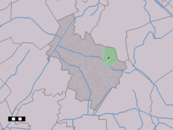
Midden-Drenthe is a municipality in the northeastern Netherlands. The municipality was created in 1998, in a merger of the former municipalities of Beilen, Smilde, and Westerbork. Between 1998 and 2000, the name of the municipality was Middenveld.

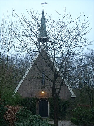
Beilen is a town in the Dutch province of Drenthe. It is a part of the municipality of Midden-Drenthe, and lies about 16 km south of Assen. The old Reformed church is the only remaining truly old building; a large fire destroyed a major part of Beilen in 1820.

Hooghalen is a village in the municipality Midden-Drenthe, in the Dutch province Drenthe. In Drenthe it is also called Hoal'n or Hoalen , but then people often mean the entire area, with the neighborhoods Laaghalen, Laaghalerveen and Oosthalen.

Orvelte is a village in the Dutch province of Drenthe. It is a part of the municipality of Midden-Drenthe, and lies about 18 km northeast of Hoogeveen.

Westerbork is a village in the municipality of Midden-Drenthe in the Netherlands. It is located in the middle of the eastern province of Drenthe. During World War II, the Westerbork transit camp was located near the village. The Westerbork Synthesis Radio Telescope and the Camp Westerbork Museum are now situated at the site.

Hijken is a village in the Dutch province of Drenthe. It is a part of the municipality of Midden-Drenthe, and lies about 13 km south of Assen, the province capital of Drenthe.
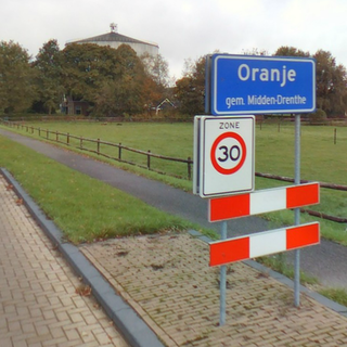
Oranje is a village in the Dutch province of Drenthe. It is a part of the municipality of Midden-Drenthe, and lies about 13 km southwest of Assen.

Wijster is a village in the Dutch province of Drenthe. It is a part of the municipality of Midden-Drenthe, and lies about 11 km north of Hoogeveen.

Drijber is a village in the Dutch province of Drenthe. It is a part of the municipality of Midden-Drenthe, and lies about 9 km north of Hoogeveen.

Smilde is a town in the Netherlands' northern province of Drenthe and lies about 10 kilometers (6.2 mi) southwest of the province capital of Assen. Smilde was a separate municipality until 1998, when it became a part of Middenveld. However, that name changed in 2000 and was renamed the municipality of Midden-Drenthe.

Bovensmilde is a village in the Netherlands' province of Drenthe. It is a part of the municipality of Midden-Drenthe, and lies about six kilometers (3.7 mi) southwest of Assen.
Hoogersmilde is a village in the Dutch province of Drenthe. It is a part of the municipality of Midden-Drenthe, and lies about 16 km southwest of Assen.
Witteveen is a village in the Dutch province of Drenthe. It is a part of the municipality of Midden-Drenthe, and lies about 16 km northeast of Hoogeveen.

Nieuw-Balinge is a village in the Dutch province of Drenthe. It is a part of the municipality of Midden-Drenthe, and lies about 10 km northeast of Hoogeveen.

Garminge is a village in the Dutch province of Drenthe. It is a part of the municipality of Midden-Drenthe, and lies about 15 km northeast of Hoogeveen.

Balinge is a village in the Dutch province of Drenthe. It is a part of the municipality of Midden-Drenthe, and lies about 14 km northeast of Hoogeveen.

Grolloo is a village in the Dutch province of Drenthe. It is a part of the municipality of Aa en Hunze, and lies about 11 km southeast of Assen.

Odoorn is a village in the Dutch province of Drenthe. It is a part of the municipality of Borger-Odoorn, and lies about nine km north of Emmen.
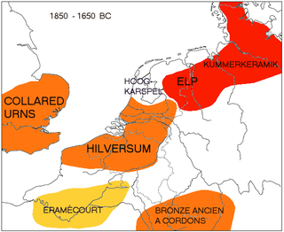
The Elp culture is a Bronze Age archaeological culture of the Netherlands having earthenware pottery of low quality known as "Kümmerkeramik" as a marker. The initial phase is characterized by tumuli, strongly tied to contemporary tumuli in Northern Germany and Scandinavia, and apparently related to the Tumulus culture in Central Europe. This phase was followed by a subsequent change featuring Urnfield (cremation) burial customs.