
Brent is a community on Cedar Lake on the Petawawa River in northern Algonquin Provincial Park and is located in geographic Deacon Township in the unorganized south part of Nipissing District in Northeastern Ontario, Canada.
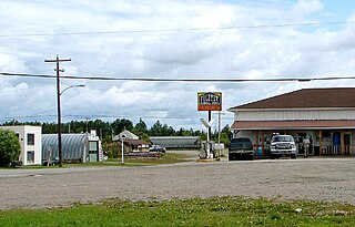
Foleyet is an unincorporated community in the Unorganized North Part of Sudbury District in Northeastern Ontario, Canada, midway between Chapleau and Timmins on Highway 101. The town was created during the construction of the Canadian Northern Railway (CNR) through the area in the early years of the 20th century.
Elsas railway station is a railway station in the community of Elsas in the Unorganized North part of Algoma District in northeastern Ontario, Canada. The station is on the Canadian National Railway transcontinental railway main line between the railway points of Agate to the west and Oatland to the east, and is a stop for Via Rail transcontinental Canadian trains. The station and settlement are on the northern shore of Kapuskasing Lake, the source of the Kapuskasing River.
Summit Lake is a lake in geographic Shenango Township in the Unorganized North Part of Sudbury District in Northeastern Ontario, Canada. It is in the James Bay drainage basin about 29 kilometres (18 mi) northwest of the community of Foleyet on Highway 101, and 4 kilometres (2.5 mi) northwest of the Missonga and 6.7 kilometres (4.2 mi) southeast of the Oatland railway points on the Canadian National Railway transcontinental main line, which runs along the entire west side of the lake.

The Kapuskasing River is a river in the James Bay drainage basin in Cochrane District and Algoma District in northeastern Ontario, Canada. The river is a left tributary of the Mattagami River.

The Groundhog River is a river in Cochrane District and Sudbury District in Northeastern Ontario, Canada. The river is in the James Bay drainage basin and is a left tributary of the Mattagami River.
Kapuskasing Lake is a lake in Algoma District and Sudbury District in northeastern Ontario, Canada. It is in the James Bay drainage basin and is the source of the Kapuskasing River. The majority of the lake is in geographic Kapuskasing Township, Algoma District, with just the southern tip in geographic Sherlock Township, Sudbury District.
Agate is an unincorporated place and railway point in geographic Kapuskasing Township, in the Unorganized North part of Algoma District in northeastern Ontario, Canada. It is on the Canadian National Railway transcontinental railway main line between the railway points of Dunrankin to the west and Elsas to the east, has a passing track, and is passed but not served by Via Rail transcontinental Canadian trains. The place is just northwest of Kapuskasing Lake, the source of the Kapuskasing River.
Dunrankin is an unincorporated place and railway point in geographic Kirkwall Township, in the Unorganized North part of Algoma District in northeastern Ontario, Canada. It is on the Canadian National Railway transcontinental railway main line between the dispersed rural community of Peterbell to the west and the railway point of Agate to the east, and is passed but not served by Via Rail transcontinental Canadian trains. The place is on the Dunrankin River, a left tributary of the Kapuskasing River.
The Dunrankin River is a river in Algoma District and Sudbury District in northeastern Ontario, Canada. It is in the James Bay drainage basin, begins at Upper Dunrankin Lake and is a left tributary of the Kapuskasing River.
The East Dunrankin River is a river in Algoma District and Sudbury District in northeastern Ontario, Canada. It is in the James Bay drainage basin, and is a right tributary of the Dunrankin River.
The Kirkwall River is a river in Algoma District and Sudbury District in northeastern Ontario, Canada. It is in the James Bay drainage basin, and is a right tributary of the Dunrankin River.
The Nemegosenda River is a river in Algoma District and Sudbury District in northeastern Ontario, Canada. It is in the James Bay drainage basin, and is a right tributary of the Kapuskasing River.
Oatland is an unincorporated place and railway point in geographic Lougheed Township, in the Unorganized North part of Algoma District in northeastern Ontario, Canada. It is on the Canadian National Railway transcontinental railway main line between the railway points of Elsas to the west and Missonga to the east, has a passing track, and is passed but not served by Via Rail transcontinental Canadian trains. Oatland is on Shiners Creek, a right tributary of the Nemegosenda River.
Missonga is an unincorporated place and railway point in geographic Shenango Township, in the Unorganized North part of Sudbury District in northeastern Ontario, Canada. It is on the Canadian National Railway transcontinental railway main line between the railway point of Oatland to the west and the dispersed rural community of Shawmere to the east, has a railway siding, and is passed but not served by Via Rail transcontinental Canadian trains. Missonga is on Shenango Lake, at a point where Mishionga Creek leaves the lake; Mishionga Creek is a left tributary of the Shawmere River.
Shawmere is an unincorporated place and dispersed rural community in geographic Oates Township, in the Unorganized North part of Sudbury District in northeastern Ontario, Canada. It is on the Canadian National Railway transcontinental railway main line between the railway point of Missonga to the west and the compact rural community of Foleyet to the east, has a passing track, and is passed but not served by Via Rail transcontinental Canadian trains. Shawmere is on the Shawmere River, part of the James Bay drainage basin.
The Shawmere River is a river in Sudbury District in northeastern Ontario, Canada. It is in the James Bay drainage basin, and is a left tributary of the Ivanhoe River.
Argolis is an unincorporated place and railway point in geographic Hayward Township, in the Unorganized North part of Algoma District in northeastern Ontario, Canada. It is on the Canadian National Railway transcontinental railway main line between the railway points of Fire River to the west and Peterbell to the east, has a passing track, and is passed but not served by Via Rail transcontinental Canadian trains. Argolis is on an unnamed right tributary of the Greenhill River, itself a tributary of the Missinaibi River, and is named for the Greek region of Argolis.
The Greenhill River is a river in Algoma District in northeastern Ontario, Canada. It is in the James Bay drainage basin, and is a left tributary of the Missinaibi River.
The Fire River is a river in Algoma District in northeastern Ontario, Canada. It is in the James Bay drainage basin, and is a left tributary of the Missinaibi River.
