
The Bernese Alps are a mountain range of the Alps, located in western Switzerland. Although the name suggests that they are located in the Berner Oberland region of the canton of Bern, portions of the Bernese Alps are in the adjacent cantons of Valais, Fribourg and Vaud, the latter being usually named Fribourg Alps and Vaud Alps respectively. The highest mountain in the range, the Finsteraarhorn, is also the highest point in the canton of Bern.

Valais, or Wallis, more formally the Canton of Valais, is one of the 26 cantons forming the Swiss Confederation. It is composed of thirteen districts and its capital and largest city is Sion. The flag of the canton is made of thirteen stars representing the districts, on a white-red background.

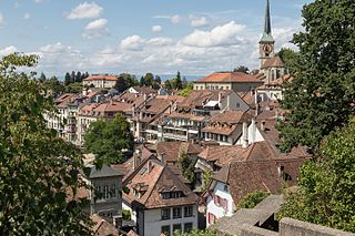
The canton of Bern or Berne is one of the 26 cantons forming the Swiss Confederation. Its capital city, Bern, is also the de facto capital of Switzerland. The bear is the heraldic symbol of the canton, displayed on a red-yellow background.
Burgdorf is the largest city in the Emmental in the canton of Bern in Switzerland. It was the capital of the district of the same name until 2010, when it became part of the new Emmental district.

The Emme is a river in Switzerland. It rises in the Alps between the peaks of Hohgant and Augstmatthorn in the canton of Bern. The Emme is 80 kilometres long and flows through the Emmental and between Zuchwil and Luterbach into the Aare. The drainage area is 983 km2 (380 sq mi). The average discharge at the mouth is approximately 20,000 litres per second. The maximum discharge can be up to 500,000 L/s (130,000 USgal/s).

Aarwangen District was a district in the northeast corner of the canton of Bern in Switzerland, with its seat at Aarwangen. It was disbanded on 31 December 2009. Its municipalities became part of the administrative region Emmental-Oberaargau.

The Bernese Oberland is the highest and southernmost part of the canton of Bern, and one of the canton's five administrative regions. It constitutes the Alpine region of the canton and the northern side of the Bernese Alps, including many of its highest peaks, among which the Finsteraarhorn, the highest in both range and canton.

The Swiss Plateau or Central Plateau is one of the three major landscapes in Switzerland, lying between the Jura Mountains and the Swiss Alps. It covers about 30% of the Swiss surface area, and is partly flat but mostly hilly. The average height is between 400 metres (1,300 ft) and 700 metres (2,300 ft) AMSL. It is by far the most densely populated region of Switzerland, the center of economy and important transportation.

Langnau im Emmental is a municipality in the administrative district of Emmental in the canton of Bern in Switzerland.

Lützelflüh is a municipality in the administrative district of Emmental in the Swiss canton of Bern.

Rüegsau is a municipality in the administrative district of Emmental in the Swiss canton of Bern.

Hasle bei Burgdorf is a municipality in the administrative district of Emmental in the canton of Bern in Switzerland.

Konolfingen is a municipality in the Bern-Mittelland administrative district in the canton of Bern in Switzerland.
Rüti bei Lyssach is a municipality in the administrative district of Emmental in the canton of Bern in Switzerland.

Seeland is a region in Switzerland, at the south-eastern foot of the mountain range of the Jura Mountains containing the 3 Lakes of Morat, Neuchâtel, and Bienne (Biel). In previous eras, it was the floodplain of the Aare and was thus swampy. After the huge hydrological works Jura water correction, the area drained out and could support more cultivation. Seeland is one of the most important regions in Switzerland for growing vegetables, particularly in the Grand Marais.

Wiler bei Utzenstorf is a municipality in the administrative district of Emmental in the canton of Bern in Switzerland.

Oberburg is a municipality in the administrative district of Emmental in the canton of Bern in Switzerland.
The Oberaargau is the region that encompasses the upper watershed of the Aar River in the canton of Bern in Switzerland. On the north, lie the Jura Mountains, and on the south the hills leading to the Emmental.
Bern-Mittelland District in the Canton of Bern was created on 1 January 2010. It is part of the Bern-Mittelland administrative region, and is the only district in the region. It contains 75 municipalities with an area of 946.30 km2 (365.37 sq mi) and a population of 418,191.
Seeland District in the Canton of Bern was created on 1 January 2010. It is part of the Seeland administrative region. It contains 42 municipalities with an area of 334.14 km2 (129.01 sq mi) and a population of 76,052.
This page is based on this
Wikipedia article Text is available under the
CC BY-SA 4.0 license; additional terms may apply.
Images, videos and audio are available under their respective licenses.

