Related Research Articles
An ice age is a long period of reduction in the temperature of Earth's surface and atmosphere, resulting in the presence or expansion of continental and polar ice sheets and alpine glaciers. Earth's climate alternates between ice ages and greenhouse periods, during which there are no glaciers on the planet. Earth is currently in the ice age called Quaternary glaciation. Individual pulses of cold climate within an ice age are termed glacial periods, and intermittent warm periods within an ice age are called interglacials or interstadials.
The history of Antarctica emerges from early Western theories of a vast continent, known as Terra Australis, believed to exist in the far south of the globe. The term Antarctic, referring to the opposite of the Arctic Circle, was coined by Marinus of Tyre in the 2nd century AD.

The Adélie penguin is a species of penguin common along the entire coast of the Antarctic continent, which is the only place where it is found. It is the most widespread penguin species, and, along with the emperor penguin, is the most southerly distributed of all penguins. It is named after Adélie Land, in turn, named for Adèle Dumont d'Urville, who was married to French explorer Jules Dumont d'Urville, who first discovered this penguin in 1840. Adélie penguins obtain their food by both predation and foraging, with a diet of mainly krill and fish.

The climate of Antarctica is the coldest on Earth. The continent is also extremely dry, averaging 166 mm (6.5 in) of precipitation per year. Snow rarely melts on most parts of the continent, and, after being compressed, becomes the glacier ice that makes up the ice sheet. Weather fronts rarely penetrate far into the continent, because of the katabatic winds. Most of Antarctica has an ice-cap climate with extremely cold and dry weather.

Mawson Station, commonly called Mawson, is one of three permanent bases and research outposts in Antarctica managed by the Australian Antarctic Division (AAD). Mawson lies in Holme Bay in Mac. Robertson Land, East Antarctica in the Australian Antarctic Territory, a territory claimed by Australia. Established in 1954, Mawson is Australia's oldest Antarctic station and the oldest continuously inhabited Antarctic station south of the Antarctic Circle. It houses approximately 20 personnel over winter and up to 53 in summer.
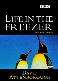
Life in the Freezer is a BBC nature documentary series written and presented by David Attenborough, first transmitted in the United Kingdom from 18 November 1993.

Faddey Faddeyevich Bellingshausen was a cartographer, explorer, and naval officer of the Russian Empire, who attained the rank of admiral. He participated in the first Russian circumnavigation of the globe, and subsequently became a leader of another circumnavigation expedition that discovered the continent of Antarctica. Like Otto von Kotzebue and Adam Johann von Krusenstern, Bellingshausen belonged to the cohort of prominent Baltic German navigators who helped Russia launch its naval expeditions.

Peter Matthiessen was an American novelist, naturalist, wilderness writer, zen teacher and onetime CIA agent. A co-founder of the literary magazine The Paris Review, he is the only writer to have won the National Book Award in both nonfiction and fiction. He was also a prominent environmental activist.

Multiple governments have set up permanent research stations in Antarctica and these bases are widely distributed. Unlike the drifting ice stations set up in the Arctic, the current research stations of the Antarctic are constructed either on rocks or on ice that are fixed in place.

Robert Charles Swan, OBE, FRGS is the first person to walk to both poles.

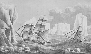
The Heroic Age of Antarctic Exploration was an era in the exploration of the continent of Antarctica which began at the end of the 19th century, and ended after the First World War; the Shackleton–Rowett Expedition of 1921–1922 is often cited by historians as the dividing line between the "Heroic" and "Mechanical" ages.

The geological history of the Earth follows the major geological events in Earth's past based on the geological time scale, a system of chronological measurement based on the study of the planet's rock layers (stratigraphy). Earth formed about 4.54 billion years ago by accretion from the solar nebula, a disk-shaped mass of dust and gas left over from the formation of the Sun, which also created the rest of the Solar System.

Mount Elkins, also known as Jökelen is a dark, steep-sided mountain with three major peaks, the highest 2,300 meters (7,500 ft) above sea level, in the Napier Mountains of Enderby Land. Enderby Land is part of East Antarctica and is claimed by Australia as part of the Australian Antarctic Territory. The mountain was named after Terence James Elkins, an ionospheric physicist with the Australian National Antarctic Research Expeditions at Mawson Station in 1960.

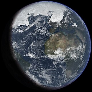
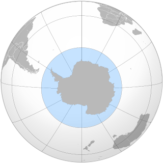
Antarctica is Earth's southernmost and least-populated continent. Situated almost entirely south of the Antarctic Circle and surrounded by the Southern Ocean, it contains the geographic South Pole. Antarctica is the fifth-largest continent, being about 40% larger than Europe, and has an area of 14,200,000 km2 (5,500,000 sq mi). Most of Antarctica is covered by the Antarctic ice sheet, with an average thickness of 1.9 km (1.2 mi).

A continent is any of several large geographical regions. Continents are generally identified by convention rather than any strict criteria. A continent could be a single landmass or a part of a very large landmass, as in the case of Asia or Europe. Due to this, the number of continents varies; up to seven or as few as four geographical regions are commonly regarded as continents. Most English-speaking countries recognize seven regions as continents. In order from largest to smallest in area, these seven regions are Asia, Africa, North America, South America, Antarctica, Europe, and Australia. Different variations with fewer continents merge some of these regions; examples of this are merging North America and South America into America, Asia and Europe into Eurasia, and Africa, Asia, and Europe into Afro-Eurasia.

The South Pole, also known as the Geographic South Pole, Terrestrial South Pole or 90th Parallel South, is the southernmost point on Earth and lies antipodally on the opposite side of Earth from the North Pole, at a distance of 20,004 km in all directions. It is one of the two points where Earth's axis of rotation intersects its surface.
The Southern Ocean, also known as the Antarctic Ocean, comprises the southernmost waters of the world ocean, generally taken to be south of 60° S latitude and encircling Antarctica. With a size of 20,327,000 km2 (7,848,000 sq mi), it is regarded as the second-smallest of the five principal oceanic divisions: smaller than the Pacific, Atlantic, and Indian oceans but larger than the Arctic Ocean.
Major explorations of Earth continued after the Age of Discovery. By the early seventeenth century, vessels were sufficiently well built and their navigators competent enough to travel to virtually anywhere on the planet by sea. In the 17th century, Dutch explorers such as Willem Jansz and Abel Tasman explored the coasts of Australia. Spanish expeditions from Peru explored the South Pacific and discovered archipelagos such as Vanuatu and the Pitcairn Islands. Luis Vaez de Torres chartered the coasts of New Guinea and the Solomon Islands, and discovered the strait that bears his name. European naval exploration mapped the western and northern coasts of Australia, but the east coast had to wait for over a century. Eighteenth-century British explorer James Cook mapped much of Polynesia and traveled as far north as Alaska and as far south as the Antarctic Circle. In the later 18th century, the Pacific became a focus of renewed interest, with Spanish expeditions, followed by Northern European ones, reaching the coasts of northern British Columbia and Alaska.

This article is a list of English-language nonfiction books which have been described by reliable sources as in some way directly relating to the subject of Antarctica, its history, geography, people, etc.

Antarctic sea ice is the sea ice of the Southern Ocean. It extends from the far north in the winter and retreats to almost the coastline every summer. Sea ice is frozen seawater that is usually less than a few meters thick. This is the opposite of ice shelves, which are formed by glaciers; they float in the sea, and are up to a kilometre thick. There are two subdivisions of sea ice: fast ice, which are attached to land; and ice floes, which are not.
References
- ↑ "End of the Earth: Voyaging to Antarctica". Goodreads. Retrieved 27 July 2014.
- ↑ "End of the Earth: Voyages to Antarctica - Peter Matthiessen". Travel Literature. Retrieved 27 July 2014.
- ↑ Cocker, Mark. "Ice work". The Guardian. Retrieved 27 July 2014.