
The District of Belconnen is one of the original eighteen districts of the Australian Capital Territory (ACT), used in land administration. The district is subdivided into 27 divisions (suburbs), sections and blocks. The district of Belconnen is largely composed of Canberra suburbs.

The District of Tuggeranong is one of the original eighteen districts of the Australian Capital Territory used in land administration. The district is subdivided into divisions (suburbs), sections and blocks and is the southernmost town centre of Canberra, the capital city of Australia. The district comprises nineteen suburbs and occupies 117 square kilometres (45 sq mi) to the east of the Murrumbidgee River.

The Division of Canberra is an Australian electoral division in the Australian Capital Territory. It is named for the city of Canberra, Australia's national capital, and includes all of central Canberra, Kowen, Majura, as well as part of Weston Creek, Woden Valley, Molonglo Valley, Belconnen, and Jerrabomberra. It is currently held by Alicia Payne of the Labor Party.

Calwell is a medium-sized suburb of Canberra, Australia in the district of Tuggeranong. Tuggeranong Hill is on its southern border and the Tuggeranong Homestead is to the north. Calwell is located close to the Monaro Highway which provides a direct route to Canberra City and to Cooma.
Gowrie is a suburb of Canberra, Australia, located in the northern end of the Tuggeranong Valley. Tuggeranong suburbs are the southernmost of Australia's capital city. Gowrie is named after Brigadier-General Alexander Gore Arkwright Hore-Ruthven, 1st Earl of Gowrie (1872–1955), Governor-General of Australia from 1936–1944.

Canberra Centre is a large shopping centre located in the northern section of the Canberra City Centre City Centre, Australian Capital Territory, Australia, being the largest centre within the Australian Capital Territory. It opened on 6 March 1963 as the Monaro Mall, becoming the first in Australia to contain three floors and be fully enclosed, though would later expand to cover a substantial outdoor component on Garema Place. It was designated an Australian Capital Historic Site in 1997. It underwent a $220 million redevelopment and became the Canberra Centre in 1989. It was the first shopping centre in Canberra to have a car park operated by Car Park Ticket Machines. Canberra Centre is currently 207,668 m² in size with over 380 speciality retailers, encompassing an ownership merge with the ACT Government.

The suburbs of Canberra are organised into a hierarchy of districts, town centres, group centres, local suburbs and other industrial areas and villages. While these divisions have no formal role in the governance or administration of the city, they formed a basis for the planning and development of the city and are significant to the city's commercial and social activities.
Bonython is a suburb of Tuggeranong, a township in southern Canberra, capital city of Australia.
Chisholm is a suburb in the Canberra, Australia district of Tuggeranong, named after Caroline Chisholm.
Fadden is a suburb in the Canberra, Australia district of Tuggeranong. The postcode is 2904. The suburb is named after Sir Arthur Fadden, Prime Minister of Australia briefly in 1941. It was gazetted on 5 August 1975. Its streets are named after Queensland politicians. It is surrounded by Macarthur, Gowrie and Wanniassa. It is bounded by Erindale Drive, the Wanniassa Hills Nature Reserve, Fadden Pine Plantation and Sternberg Crescent.
Gilmore is a suburb in the Canberra, Australia district of Tuggeranong. The postcode is 2905. The suburb is named after the poet and journalist, Dame Mary Gilmore. It was gazetted on 5 August 1975. Streets are named after journalists, particularly female journalists.
Isabella Plains is a suburb in the Canberra, Australia district of Tuggeranong. The postcode is 2905. The suburb is indirectly named after Isabella Maria Brisbane (1821–1849), who was the daughter of Sir Thomas Brisbane, the colonial Governor of New South Wales when the area was first explored by white settlers in 1823. Joseph Wild was employed by Brigade Major John Ovens and Captain Mark Currie to guide them to the Murrumbidgee River. They travelled south along the river and named the area now known as Tuggeranong "Isabella's Plain". This name was adopted, with a slight change of spelling, for the name of the new suburb. It was gazetted on 5 August 1975. Streets are named after New South Wales parish names.
Kambah is the northernmost suburb in the district of Tuggeranong, Canberra. It is located just south of Mount Taylor in the Canberra Nature Park. It is located north of the suburbs of Greenway and Wanniassa. It is bounded by Sulwood Drive to the north and Athllon Drive to the south-east.
Macarthur is a suburb in the Canberra district of Tuggeranong. The suburb is named after John Macarthur, one of the founders of Australia's Merino wool industry. It was gazetted on 22 March 1982 and first settled in 1983. The wool industry is the theme for street names. The suburb has an area of 1.27 km². It is next to the suburbs of Fadden and Gilmore, and is located north of Isabella Drive.

Monash is a suburb in the district of Tuggeranong, Canberra, Australia. The suburb is named after General Sir John Monash,, who commanded the Australian Army in France in the First World War. It was gazetted on 1 August 1975 and first settled in 1978. The suburb has an area of 3.41 km². Streets are named after engineers and the suburb consists primarily of detached houses on suburban blocks.
Richardson is a suburb in the Canberra, Australia, district of Tuggeranong. The postcode is 2905. It was gazetted on 5 May 1975. Streets are named after writers, especially female writers. It is next to the suburbs of Calwell, Isabella Plains, Gowrie and Chisholm. It is bounded by Johnson Drive, Ashley Drive and Isabella Drive. This suburb is named after the novelist Ethel Florence Lindesay Richardson (1870–1946) who wrote under the pen name Henry Handel Richardson.

Wanniassa is a suburb in Australia's capital, Canberra: more specifically, in the city's southern district of Tuggeranong. The suburb takes its name from a pastoral property granted to Thomas McQuoid in 1835, which he named after Wanayasa in West Java, Indonesia, where McQuoid had previously owned property. Streets are named after Victorian state politicians and the suburb was gazetted on 21 May 1974.

South.Point Tuggeranong is a two-storey regional shopping centre located in Greenway, Australian Capital Territory, servicing the district of Tuggeranong.

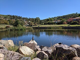
Tuggeranong Creek, a partly perennial stream of the Murrumbidgee catchment within the Murray-Darling basin, is located in the Tuggeranong district of Canberra, within the Australian Capital Territory, Australia.
