
San Juan is the capital city and most populous municipality in the Commonwealth of Puerto Rico, an unincorporated territory of the United States. As of the 2020 census, it is the 57th-most populous city under the jurisdiction of the United States, with a population of 342,259. San Juan was founded by Spanish colonists in 1521, who called it Ciudad de Puerto Rico.

Camuy is a town and municipality of Puerto Rico, bordering the Atlantic Ocean, north of Lares and San Sebastián; east of Quebradillas; and west of Hatillo. Camuy is spread over 12 barrios and Camuy Pueblo. The town celebrated its 200th anniversary in 2007.

Old San Juan is a historic district located at the "northwest triangle" of the islet of San Juan in San Juan. Its area roughly correlates to the Ballajá, Catedral, Marina, Mercado, San Cristóbal, and San Francisco sub-barrios (sub-districts) of barrio San Juan Antiguo in the municipality of San Juan, Puerto Rico.

Río Piedras is a populous district of San Juan, and former town and municipality of Puerto Rico, which was merged with the municipality of San Juan in 1951. The district today is composed of various barrios such as Pueblo and Universidad. The historic town was founded in 1714 as El Roble, it was given municipality rights in 1823, and since 1903 it has been the home of the University of Puerto Rico's main campus, earning the popular name of Ciudad Universitaria today. The downtown and historic center of Río Piedras is officially known as the Pueblo barrio of the municipality of San Juan.
The 1918 San Fermín earthquake, also known as the Puerto Rico earthquake of 1918, struck the island of Puerto Rico at on October 11. The earthquake measured 7.1 on the moment magnitude scale and IX (Violent) on the Mercalli intensity scale. The mainshock epicenter occurred off the northwestern coast of the island, somewhere along the Puerto Rico Trench.

The Catedral de Nuestra Señora de Guadalupe is the cathedral for the Roman Catholic Diocese of Ponce located in downtown Ponce, Puerto Rico. The cathedral lies in the middle of Ponce's town square, known as Plaza Las Delicias, located at the center of the Ponce Historic Zone. For its historic significance, the cathedral was listed on the National Register of Historic Places in 1984. It is the seat of the Bishop of Ponce, currently Rubén González Medina.
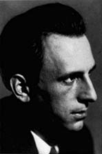
Heinrich Klumb was a German architect who worked in Puerto Rico during the mid 20th Century.

Antiguo Casino Camuyano is a building in downtown Camuy, Puerto Rico, which dates from 1910. It was listed on the U.S. National Register of Historic Places in 1984 and on the Puerto Rico Register of Historic Sites and Zones in 2000.

McCabe Memorial Church, also known as Iglesia Metodista Unida de la Playa de Ponce, is a historic church building in Barrio Playa in Ponce, Puerto Rico. It dates from 1908, and was designed by Antonin Nechodoma. It was listed on the U.S. National Register of Historic Places in 2008. It is one of four places such listed in Barrio Playa, the others being the U.S. Customs House, the Caja de Muertos Light, and the Cardona Island Light.
The Iglesia San Ramón Nonato, in some sources also referred to as Iglesia San Juan Bautista y San Ramón Nonato, is a Roman Catholic parish church in the town plaza of Juana Díaz, Puerto Rico.
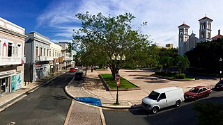
Río Piedras Pueblo, is one of 18 barrios in the municipality of San Juan, Puerto Rico. Rio Piedras Pueblo is what used to be the urban center-barrio of the former municipality of Río Piedras until 1951, when the municipality of Rio Piedras was merged with the municipality of San Juan.

The Primera Iglesia Metodista Unida de Ponce was the first structure erected in Puerto Rico by the celebrated architect Antonin Nechodoma. Constructed in 1907, the building houses a Methodist congregation and is located on Villa street in Ponce, Puerto Rico, in the city's historic district. The structure was listed on the U.S. National Register of Historic Places on 29 October 1987.

Our Lady of Lourdes Chapel is a historic chapel located at the Miramar district in Santurce, Puerto Rico. Its distinctive architecture bears a neo-Gothic style. It was designed by Czech architect Antonin Nechodoma and built in 1908.

Abra Honda is a barrio in the municipality of Camuy, Puerto Rico. Its population in 2010 was 1,943.

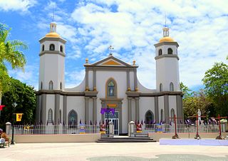
Camuy barrio-pueblo is a barrio and the administrative center (seat) of Camuy, a municipality of Puerto Rico. Its population in 2010 was 3,354.
Church of San Mateo de Cangrejos of Santurce was built in 1832 as a chapel. In 1896, state architect Pedro Cobreros, who designed other churches in Puerto Rico, reconstructed its facade and enlarged the interior.

The Church Santa María del Rosario of Vega Baja is a historic Catholic parish church from 1860 located in the main public square (plaza) of Vega Baja Pueblo, the historic and cultural downtown of the municipality of Vega Baja, Puerto Rico. The parish, which is part of the Roman Catholic Diocese of Arecibo, was added to the United States National Register of Historic Places in 1984 as part of the Historic Churches of Puerto Rico thematic multiple property submission. It was later added to the Puerto Rico Register of Historic Sites and Zones in 2000.

The Church, School, Convent and Parish House of San Agustín is a National Register of Historic Places (NRHP)-listed historic religious complex located in the Puerta de Tierra historic district of San Juan Antiguo in the city of San Juan, Puerto Rico. The complex consists of the Church of St. Augustine, its adjacent Augustinian convent and the parish house. The church itself was one of the first structures to be built using only concrete in the island and for this reason it is also listed in the Inventory of Historic Churches of Puerto Rico in 1990 in addition to being listed in the NRHP since 1985. The church complex is a contributing property, and, along the Capitol of Puerto Rico, it forms part of the monumental sequence of buildings, memorials and parks along the Ponce de León Avenue that constitute the Puerta de Tierra Historic District.

