
Ku-ring-gai Council is a local government area on the Upper North Shore of Sydney, in the state of New South Wales, Australia. The region is named after the Kuringgai tribe who once inhabited the area.

The Upper Hunter Shire is a local government area in the Upper Hunter Region of New South Wales, Australia. The Shire was formed in May 2004 from the Scone Shire and parts of Murrurundi and Merriwa shires.

The Hills Shire is a local government area in the Greater Western Sydney region of Sydney, New South Wales, Australia. The suburb is north-west of the Sydney central business district, and encompasses 401 square kilometres (155 sq mi) stretching from the M2 Hills Motorway in the south to Wiseman's Ferry on the Hawkesbury River in the north. The Hills Shire had a population of 157,243 as at the 2016 census.

The City of Willoughby is a local government area on the Lower North Shore of Sydney, in the state of New South Wales, Australia. It is located 6 kilometres (3.7 mi) north of the Sydney central business district. It was first proclaimed in October 1865 as the Municipality of North Willoughby.

The Warrumbungle Shire is a local government area in the central western region of New South Wales, Australia. The Shire is traversed by the Newell Highway. The Warrumbungle mountain range and Warrumbungles National Park are major tourist attractions for the Shire. Its capital is Coonabarabran, a city in the southwest.
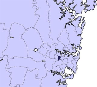
The Municipality of Burwood is a local government area in the inner-west of Sydney, in the state of New South Wales, Australia.

Camden Council is a local government area in the Macarthur region of Sydney, in the state of New South Wales, Australia. The area is located south west of the Sydney central business district and comprises 201 square kilometres (78 sq mi) with an estimated population at the 2016 census of 78,218. The Mayor of Camden is Cr. Theresa Fedeli, a member of the Liberal Party.

The City of Penrith is a local government area in the state of New South Wales, Australia. The seat of the city is located in Penrith, located about 50 kilometres (31 mi) west of Sydney's central business district.It occupies part of the traditional lands of the Darug people. First incorporated as a municipality on 12 May 1871, on 1 January 1949, the municipalities of Penrith, St Marys and Castlereagh and part of the Nepean Shire amalgamated to form a new Municipality of Penrith. Penrith was declared a City on 21 October 1959, and expanded westwards to include Emu Plains and Emu Heights, formerly part of the City of Blue Mountains, on 25 October 1963. As at the 2016 census the City of Penrith had an estimated population of 196,066.

The City of Randwick is a local government area in the eastern suburbs of Sydney, New South Wales, Australia. Established in 1859, Randwick is the second-oldest local government area in New South Wales, after the City of Sydney. It comprises an area of 36 square kilometres (14 sq mi) and as at the 2016 census had a population of 140,660.

Woollahra Municipal Council is a local government area in the eastern suburbs of Sydney, in the state of New South Wales, Australia. Woollahra is bounded by Sydney Harbour in the north, Waverley Council in the east, Randwick City in the south and the City of Sydney in the west.

Leeton Shire is a local government area in the Riverina region of New South Wales, Australia. The Shire is located adjacent to the Murrumbidgee River and falls within the Murrumbidgee Irrigation Area.

Bannaby is a locality in the Southern Tablelands of New South Wales, Australia in Upper Lachlan Shire. It is located near the township of Taralga, on the Bannaby road. At the 2016 census, it had a population of 36.
Somersby is a semi-rural locality of the Central Coast region of New South Wales, Australia, to the northwest of Gosford along the Pacific Highway. It is part of the Central Coast Council local government area.

The City of Lithgow is a local government area in the Central West region of New South Wales, Australia. The area is located adjacent to the Great Western Highway and the Main Western railway line.

Tenterfield Shire is a local government area located in the New England region of New South Wales, Australia. The Shire is situated adjacent to the New England Highway.

Wentworth Shire is a local government area in the far south-west Riverina region of New South Wales, Australia. This Shire is located adjacent to the Murray and Darling Rivers. The Shire's major roads are the Sturt and the Silver City Highways. The Shire includes the towns of Wentworth, Buronga, Gol Gol, Dareton and Pooncarie.

Glencoe is a regional town in South Australia, Australia located approximately 25 km north-west of Mount Gambier. At June 2016, Glencoe had an estimated population of 661.

Jondaryan is a rural town in Toowoomba Region, Queensland, Australia. At the 2016 Australian Census Jondaryan recorded a population of 385.
Pine Creek is a rural locality in the Mid North region of South Australia, situated in the Regional Council of Goyder. It was established in August 2000 when boundaries were formalised for the long established local name.

The Snowy Monaro Regional Council is a local government area located in the Snowy Mountains and Monaro regions of New South Wales, Australia. The council was formed on 12 May 2016 through a merger of the Bombala, Cooma-Monaro and Snowy River shires.


