Ertij Fort

Last updated
Ertij Fort
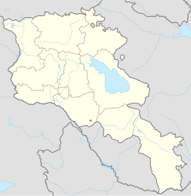
Vayots Dzor Province, Armenia
Ertij Fort1.jpg
The fort of Ertij upon a hill in Arpi.
Armenia adm location map.svg
Red pog.svg
Ertij Fort
Coordinates 39°43′49″N45°16′07″E / 39.7304139°N 45.2686417°E / 39.7304139; 45.2686417
TypeFortress
Site information
Open to
the public
Yes
ConditionSome walls remain.
Site history
Built13th century
MaterialsStone

Ertij is a fort built during the 13th century. It is situated upon a hill adjacent to the village of Arpi in the Vayots Dzor Province of Armenia. Nearby in the gorge carved by the Arpa River is the cave shrine of Jrovank.

Related Research Articles

Bgheno-Noravank 11th-century Armenian monastery in the Syunik Marz of Armenia

Bgheno-Noravank Monastery is an 11th-century Armenian monastery in the Syunik Marz of Armenia. It now consists of a small church dating to 1062, located on a little wooded promontory, and ornately decorated with borders and biblical reliefs. The ruins of this church were rediscovered in the 1920s by Axel Bakunts, a well-known prose writer, during one of his wanderings as an agronomist.

Akunk Place in Gegharkunik, Armenia

Akunk is a village in the Gegharkunik Province of Armenia. It was founded on the site of a Bronze Age settlement and has a fort dating from the 6th-4th century BC. There are two Tukh Manuk pilgrimage sites in the village as well. West of Akunk is the Klor Dar cyclopean fort.

Astghadzor Place in Gegharkunik, Armenia

Astghadzor is a village in the Gegharkunik Province of Armenia.

Lanjaghbyur Place in Gegharkunik, Armenia

Lanjaghbyur is a village in the Gegharkunik Province of Armenia, founded in 1828.

Noratus Place in Gegharkunik, Armenia

Noratus is a major and historical village in the Gegharkunik province of Armenia, near the town of Gavar. It is famous for the Noratus cemetery.

Tsovagyugh Place in Gegharkunik, Armenia

Tsovagyugh, is a major village in the Gegharkunik Province of Armenia. The ruins of a church are in the village, and upon an egg-shaped hill to the northeast are the remains of an Iron Age fort.

Tsovak Place in Gegharkunik, Armenia

Tsovak is a village in the Gegharkunik Province of Armenia. The village is the site of a large Iron Age fort atop the hill to the south and west, with an 8th-century BCE cuneiform inscription of Sarduri II cut into the stone at the north edge of the fortification.

Vaghashen Place in Gegharkunik, Armenia

Vaghashen is a village in the Gegharkunik Province of Armenia. There are two 16th-century churches in the village, and nearby are the ruins of Kyurdi Kogh and Aloyi Kogh cyclopean forts.

Vardenik Place in Gegharkunik, Armenia

Vardenik, is a major village in the Gegharkunik Province of Armenia that sits along the Vardenis River. It was founded in 1828-29 by emigrants from Mush. There are the cyclopean fort ruins of Kaftarli 3 km south, with petroglyphs downhill along the bank of the river. Some churches and shrines can be found in the vicinity.

Drakhtik Place in Gegharkunik, Armenia

Drakhtik is a village in the Gegharkunik Province of Armenia.

Jil, Armenia Place in Gegharkunik, Armenia

Jil, is a village located near the northern shore of Lake Sevan in the Gegharkunik Province of Armenia. It was founded in the 12th century. Most of the beach in close proximity to the village remains uninhibited with a strip of forested land that lines the shore. 2 km north of the village is the Dashti-ler Fort.

Khachaghbyur Place in Gegharkunik, Armenia

Khachaghbyur is a village in the Gegharkunik Province of Armenia. The village has a ruined Iron Age fort and a 13th-century church.

Martuni (village) Place in Gegharkunik, Armenia

Martuni is a village in the Gegharkunik Province of Armenia. The village is named in honor of Alexander Miasnikian, the first Soviet premier of Armenia, whose nom de guerre was "Martuni". There are medieval forts and the 10th-century castle of Aghjaghala nearby. The first inhabitants of the community were the survivals of Armenian Genocide, mostly from Van, Alashkert, Kars and Sasoun.

Getik, Gegharkunik Place in Gegharkunik, Armenia

Getik is a small village in the Gegharkunik Province of Armenia. It was founded in 1922 by settlers from Hin Bashkend, and has megalithic monuments, khachkars and an Iron Age cyclopean fort by the name of "Mughani Khach".

Vahan, Armenia Place in Gegharkunik, Armenia

Vahan is a village in the Gegharkunik Province of Armenia. When the village was founded in 1925, it was named in honor of Soviet politician and politburo member, Sergo Ordzhonikidze. Nearby upon a hill towards the eastern end of the village is an early Iron Age cyclopean fort.

Vanevan Place in Gegharkunik, Armenia

Vanevan is a small village in the Gegharkunik Province of Armenia.

Yeranos Place in Gegharkunik, Armenia

Yeranos, is a major village in the Gegharkunik Province of Armenia. It has a church of S. Astvatsatsin dating back to 1215, as well as Tukh Manuk and S. Sofia shrines. Following the Gavar-Martuni road, near the chicken farm are the remains of a cyclopean fort.

Zaritap Place in Vayots Dzor, Armenia

Zaritap is a village in the Vayots Dzor Province of Armenia. For a time the village was renamed in honor of Meshadi Azizbekov, an early Bolshevik and one of the 26 Baku Commissars. In the vicinity are 13th-century khachkars and the traces of an old fort.

Zovaber, Gegharkunik Place in Gegharkunik, Armenia

Zovaber is a village in the Gegharkunik Province of Armenia. It was founded in 1830 by emigrants from Maku. The village has a church of S. Stepanos, built in 1860.

Koghb, Armenia Place in Tavush, Armenia

Koghb, is a major village and rural community located in the Tavush Province of Armenia, located near the town of Noyemberyan.

References