Related Research Articles

Mount Ruapehu is an active stratovolcano at the southern end of the Taupō Volcanic Zone and North Island volcanic plateau in New Zealand. It is 23 km (14 mi) northeast of Ohakune and 23 km (14 mi) southwest of the southern shore of Lake Taupō, within the Tongariro National Park. The North Island's major ski resorts and only glaciers are on its slopes.

The Ring of Fire is a tectonic belt of volcanoes and earthquakes.

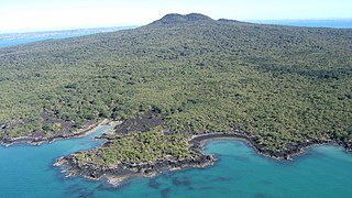
Rangitoto Island is a volcanic island in the Hauraki Gulf near Auckland, New Zealand. The 5.5 km (3.4 mi) wide island is a symmetrical shield volcano cone capped by central scoria cones, reaching a height of 260 m (850 ft). Rangitoto is the youngest and largest of the approximately 50 volcanoes of the Auckland volcanic field, having erupted in two phases about 1450 CE and 1500 CE and covering an area of 2,311 ha. It is separated from the mainland of Auckland's North Shore by the Rangitoto Channel. Since World War II, it has been linked by a causeway to the much older, non-volcanic Motutapu Island.

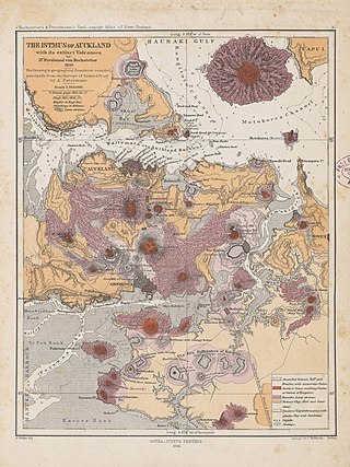
The Auckland volcanic field is an area of monogenetic volcanoes covered by much of the metropolitan area of Auckland, New Zealand's largest city, located in the North Island. The approximately 53 volcanoes in the field have produced a diverse array of maars, tuff rings, scoria cones, and lava flows. With the exception of Rangitoto, no volcano has erupted more than once, but the other eruptions lasted for various periods ranging from a few weeks to several years. Rangitoto erupted several times and recently twice; in an eruption that occurred about 600 years ago, followed by a second eruption approximately 50 years later. The field is fuelled entirely by basaltic magma, unlike the explosive subduction-driven volcanism in the central North Island, such as at Mount Ruapehu and Lake Taupō.

Lake Pupuke is a heart-shaped freshwater lake occupying a volcanic crater between the suburbs of Takapuna and Milford on the North Shore of Auckland, New Zealand. The heart shape is a result of its formation by the linking of two circular craters – a larger one forming most of the lake and a smaller one forming the arm in the northeast. Separated from the sea by less than 200 m at one point, it has a circumference of about 4.5 km and reaches 57 m in depth. It is popular for recreational activities and the lakefront property around it.

The Panmure Basin, also sometimes known as the Panmure Lagoon, is a tidal estuary within a volcanic crater or maar in New Zealand's Auckland volcanic field. It is located to the south of Panmure town centre.

The volcanism of New Zealand has been responsible for many of the country's geographical features, especially in the North Island and the country's outlying islands.

Tank Farm is the name of a volcanic explosion crater on the North Shore of Auckland, New Zealand, near the approaches to the Auckland Harbour Bridge.

Mount Smart is one of the volcanoes and Tūpuna Maunga in the Auckland volcanic field. A century of quarrying removed almost all the 87 meter scoria cone along with extensive terracing excavated by Māori. The former quarry is now the site of Mount Smart Stadium.

The geology of New Zealand is noted for its volcanic activity, earthquakes and geothermal areas because of its position on the boundary of the Australian Plate and Pacific Plates. New Zealand is part of Zealandia, a microcontinent nearly half the size of Australia that broke away from the Gondwanan supercontinent about 83 million years ago. New Zealand's early separation from other landmasses and subsequent evolution have created a unique fossil record and modern ecology.

Mount Matavanu is an active volcano on the island of Savaiʻi in Samoa. The volcano was formed during an eruption in 1905. Lava flows from the eruption covered a large area of land in the Gagaʻemauga district, leading to the relocation of several villages.

Matukutūreia / McLaughlins Mountain is one of the volcanic cones in the Auckland volcanic field. It has a peak 73 metres above sea level, and was the site of a pā. The scoria cone was originally crescent-shaped and featured Māori terraces and kumara pits, before extensive quarrying reduced it to a pyramid-shaped mound big enough to support the summit water tank for Papatoetoe. A small part of the summit and the eastern side of the cone were left unquarried, plus a large area of lava flows to the south of the cone remains intact. These remaining parts have recently been transferred to Department of Conservation Management, primarily because of the high heritage values of the Matukuturua Stonefields gardens.

Waitomokia is a volcano in the Auckland volcanic field. Waitomokia's 600 m (2,000 ft) wide tuff crater contained three small scoria cones up to 20 m (66 ft) high, one with a crater, which were quarried in the 1950s.

Taylors Hill, is a volcano in the Auckland volcanic field. It erupted about 33,000 years ago. Its scoria cone reaches 57 m (187 ft) high.

The Puhinui Craters are located in Auckland's Puhinui Reserve and are part of the Auckland volcanic field in the North Island of New Zealand. They were first recognised as volcanic craters in 2011. A cluster of three small maar craters like these is unique in the Auckland volcanic field. Their ages are unknown but most probably all three erupted during the same eruptive episode. They could have been associated with the eruption of nearby Matukutureia but this is speculation at present.

Maungawhau / Mount Eden is a scoria cone and Tūpuna Maunga in the Mount Eden suburb of Auckland, New Zealand. The cone is part of the Auckland volcanic field, the tallest located on the isthmus.

Maungarei / Mount Wellington is a 135-metre volcanic peak and Tūpuna Maunga located in the Auckland volcanic field of Auckland, New Zealand. It is the youngest onshore volcano of the Auckland volcanic field, having been formed by an eruption around 10,000 years ago. It is the largest of Auckland's scoria cones and has a near-circular base with a flattish rim and three small craters. It is situated in the Mount Wellington suburb of Central Auckland.

Te Tātua a Riukiuta / Big King is a volcano and Tūpuna Maunga in Three Kings, New Zealand that erupted 28,500 years ago. The volcano had three prominent peaks known as Three Kings and a number of smaller peaks until most of them were quarried away, leaving a sole remaining large peak known as Big King.

On 9 December 2019, Whakaari / White Island, an active stratovolcano island in New Zealand's northeastern Bay of Plenty region, explosively erupted. The island was a popular tourist destination, known for its volcanic activity, and 47 people were on the island at the time. Twenty-two people died, either in the explosion or from injuries sustained, including two whose bodies were never found and were later declared dead. A further 25 people suffered injuries, with the majority needing intensive care for severe burns. Continuing seismic and volcanic activity, together with heavy rainfall, low visibility and the presence of toxic gases, hampered recovery efforts over the week following the incident.

The Albert Park Volcano was one of the volcanoes in the Auckland volcanic field in New Zealand. A small volcano that erupted approximately 145,000 years ago, the volcanic remnants were quarried during the early colonial history of Auckland between 1840 and 1869. The volcano was dwarfed by the pre-volcanic sandstone ridge of Albert Park directly to the south-east, and only recognised as volcanic by Ferdinand von Hochstetter when he visited Auckland in 1859.
References
- 1 2 Smith, Jacqueline (25 September 2010). "Auckland's hot spots spark disaster drama". The New Zealand Herald . Retrieved 10 June 2021.
- ↑ "Eruption". Gibson Group. Retrieved 10 June 2021.
- 1 2 3 4 "Wellington production firm 'destroys' Auckland". The Dominion Post . 13 October 2010. Retrieved 10 June 2021.
- 1 2 "Eruption". NZ On Screen . Retrieved 10 June 2021.
- ↑ "Scriptwriter Graeme Tetley dies". The New Zealand Herald . 14 March 2011. Retrieved 10 June 2021.
- ↑ Smith, Richard; Lowe, David J.; Wright, Ian. "Volcanoes - Cone volcanoes and volcanic fields". Te Ara: The Encyclopedia of New Zealand . Retrieved 10 June 2021.
- ↑ "TV Pick of the week: Eruption". The New Zealand Herald . 7 October 2010. Retrieved 10 June 2021.