Essex Point

Last updated
Location of Byers Peninsula, Livingston Island in the South Shetland Islands. Byers-Peninsula-location-map.png
Location of Byers Peninsula, Livingston Island in the South Shetland Islands.
Topographic map of Byers Peninsula featuring Antarctic Specially Protected Area ASPA 126 and its two restricted zones ASPA-126-Byers-Peninsula.png
Topographic map of Byers Peninsula featuring Antarctic Specially Protected Area ASPA 126 and its two restricted zones
Topographic map of Livingston Island and Smith Island Livingston-Island-Map-2010-15.png
Topographic map of Livingston Island and Smith Island

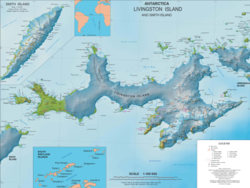
Essex Point is a point at the northwest end of Byers Peninsula, Livingston Island in the South Shetland Islands, Antarctica. It forms the west side of the entrance to Barclay Bay and the northeast side of the entrance to Svishtov Cove, and is surmounted by Drong Hill.

Contents

The feature is part of the Antarctic Specially Protected Area ASPA 126 Byers Peninsula, situated in one of its restricted zones. [1]

It was named by the UK Antarctic Place-names Committee (UK-APC) in 1958 after the American sealing ship Essex (under Captain Chester), one of the fleet of American sealers from Stonington, CT, which visited the South Shetland Islands in 1820–21 and 1821–22. [2]

Location

The point is located at 62°34′33.9″S61°11′02″W / 62.576083°S 61.18389°W / -62.576083; -61.18389 Coordinates: 62°34′33.9″S61°11′02″W / 62.576083°S 61.18389°W / -62.576083; -61.18389 which is 2.18 km northeast of Start Point and 24.16 kn southwest of Cape Shirreff (Argentine mapping in 1954, British mapping in 1968, detailed Spanish mapping in 1992, and Bulgarian mapping in 2005, 2009 and 2017).

Maps

Related Research Articles

Rugged Island (South Shetland Islands)

Rugged Island is an island 3 miles (4.8 km) long and 1 mile (1.6 km) wide, lying west of Livingston Island in the South Shetland Islands. Its surface area is 10.4 square kilometres (4.0 sq mi). The island's summit San Stefano Peak rises to 256 metres (840 ft) above sea level. Rugged Island is located at 62°38′S61°15′W. Rugged Island was known to both American and British sealers as early as 1820, and the name has been well established in international usage for over 100 years.

Osogovo Bay

Osogovo Bay, "named after the Osogovo region in western Bulgaria," is bounded by the south coast of Rugged Island, by Astor Island, and by the west coast of the Byers Peninsula south of Laager Point, Livingston Island in the South Shetland Islands, Antarctica.

Svishtov Cove

Svishtov Cove is a 2.19 km wide cove indenting for 1.48 km the northwest extremity of Ray Promontory on Byers Peninsula, Livingston Island in the South Shetland Islands, Antarctica. it is entered southwest of Essex Point and northeast of Start Point.

Start Point (Livingston Island)

Start Point is a point marking the northwest end of Byers Peninsula, Livingston Island in the South Shetland Islands, Antarctica and forming the southwest side of the entrance to Svishtov Cove and the northeast side of the entrance to the New Plymouth bay. Discovered by Edward Bransfield in January 1820, and so named by him because of its resemblance to a point on the south coast of England by the same name and because it was the place where his operations began.

Cape Shirreff

Cape Shirreff is a prominent cape at the north end of the rocky peninsula which separates Hero Bay and Barclay Bay on the north coast of Livingston Island, in the South Shetland Islands of Antarctica. The cape was named by Edward Bransfield in 1820 after Captain William H. Shirreff, the British commanding officer in the Pacific at that time.

Williams Point

Williams Point is the point forming both the north extremity of Varna Peninsula and the northeast tip of Livingston Island in the South Shetland Islands, Antarctica. Separated from Zed Islands to the north by Iglika Passage.

New Plymouth (Livingston Island)

New Plymouth is a bay bordered by an extensive line of beaches, lying south of Start Point and between Rugged Island and the west end of Livingston Island in the South Shetland Islands, Antarctica.

Robbery Beaches

Robbery Beaches are beaches extending along the north side of Byers Peninsula, Livingston Island in the South Shetland Islands, Antarctica between Essex Point to the west and Nedelya Point to the east. They are crossed by Eridanus Stream and Bedek Stream.

Camp Byers Antarctic camp

Camp Byers is a Spanish seasonal base camp on Byers Peninsula, Livingston Island in the South Shetland Islands, Antarctica. The locality is also designated for use as an International Field Camp. When necessary for scientific research purposes, temporary camping is allowed elsewhere on the protected peninsula under certain conditions.

Dospey Heights

Dospey Heights are the ice-free heights on Ray Promontory in the northwestern part of Byers Peninsula on Livingston Island in the South Shetland Islands, Antarctica. Extending 6 km southeastwards from Essex Point and Start Point, and 2.6 km wide. Rising to 265 m at Start Hill.

Voyteh Point

Voyteh Point is the point forming the east side of the entrance to Richards Cove on the north coast of Ray Promontory in the northwestern part of Byers Peninsula on Livingston Island in the South Shetland Islands, Antarctica. It is surmounted by Sàbat Hill. The area was visited by early 19th century sealers.

Chester Cone

Chester Cone is the ice-free peak rising to 188 m in the central part of Byers Peninsula, Livingston Island in the South Shetland Islands, Antarctica surmounting Midge Lake to the northwest.

Ray Promontory

Ray Promontory is the 7 km long and 2.8 km wide promontory lying between Barclay Bay and the New Plymouth sound, and forming the northwest part of Byers Peninsula, Livingston Island in the South Shetland Islands, Antarctica ending up in Start Point and Essex Point. The promontory's interior is mostly occupied by Dospey Heights.

Window Island island in Antarctica

Window Island is a small ice-free island off the north coast of Ray Promontory in the northwest of Byers Peninsula, Livingston Island in the South Shetland Islands, Antarctica. The island has a surface area of 23 hectares and rises to 72 m (236 ft). It was known to the early 19th century sealers operating on Byers Peninsula.

South Beaches (Livingston Island)

South Beaches are the beaches extending along the south side of Byers Peninsula, Livingston Island in the South Shetland Islands, Antarctica between Devils Point to the west and Rish Point to the east. The beaches were visited by 19th century sealers.

Varadero Point

Varadero Point is a point projecting 620 m into Barclay Bay from Robbery Beaches on Byers Peninsula, Livingston Island in the South Shetland Islands, Antarctica and forming the west side of the entrance to Baba Tonka Cove. Dominated by Varadero Hill.

Lair Point

Lair Point is a point projecting 570 m into Barclay Bay from Robbery Beaches on Byers Peninsula, Livingston Island in the South Shetland Islands, Antarctica and forming the east side of the entrance to Kukuzel Cove. Dominated by Lair Hill.

Point Smellie

Point Smellie is a small steep-sided headland extending into Osogovo Bay from President Beaches on Byers Peninsula, Livingston Island in the South Shetland Islands, Antarctica and dominated by Smellie Hill.

Camp Livingston (Antarctica) Antarctic camp

Camp Livingston is an Argentine seasonal base camp on Byers Peninsula, Livingston Island in the South Shetland Islands, Antarctica. The area was visited by early 19th century sealers.

Ivanov Beach

Ivanov Beach is the mostly ice-free beach on Drake Passage stretching 5 km (3.1 mi) in southwest–northeast direction on the southeast coast of Barclay Bay in western Livingston Island, South Shetland Islands in Antarctica. It extends to Nedelya Point and Byers Peninsula on the southwest, Rowe Point and Etar Snowfield on the northeast, and the slopes of Rotch Dome on the southeast. Its ice-free area is ca. 144 hectares. The beach features Bilyar Point 1.7 km (1.1 mi) northeast of Nedelya Point, Mneme Lake just west of Rowe Point and a minor point 1.1 km (0.68 mi) southwest of the latter. The beach is protected by shallows, and numerous offshore rocks and islets with the largest of them being Cutler Stack off Nedelya Point.

References

PD-icon.svg This article incorporates  public domain material from the United States Geological Survey document: "Essex Point".(content from the Geographic Names Information System )