Euclid–East 120th station

Last updated • 3 min readFrom Wikipedia, The Free Encyclopedia
Euclid–E. 120th
East 120th Cleveland RTA station.jpg
General information
Location12000 Euclid Avenue
Cleveland, Ohio
Coordinates 41°30′45″N81°36′2″W / 41.51250°N 81.60056°W / 41.51250; -81.60056
Owned by Greater Cleveland Regional Transit Authority
Line(s) Lake Erie District (Norfolk Southern)
Cleveland Short Line Sub. (CSX)
Platforms1 island platform
Tracks2
Construction
Structure typeEmbankment
ParkingNone
Other information
Website East 120th page archive
History
OpenedMarch 15, 1955
ClosedAugust 11, 2015
Original company Cleveland Transit System
Former services
Preceding station GCRTA wordmark logo.svg Rapid Transit Following station
Cedar–University
toward Airport
Red Line Superior
toward Windermere

Euclid–East 120th (signed as East 120th) was a station on the RTA Red Line in the University Circle neighborhood of Cleveland, Ohio. It was located at the Euclid Avenue (U.S. Route 20) and Coltman Road intersection, near the western end of Lake View Cemetery. At the end of service on August 11, 2015, it became the first, and thus far only, station in the history of the RTA to permanently close.

Contents

History

The station was near the site of a pre-1930 Nickel Plate railroad station. The lobby building of the railroad station was located on the other side of the tracks along the south side of Euclid Avenue. That railway station was removed as part of the Cleveland Union Terminal project and replaced by the East Cleveland station adjacent to today's Superior Rapid Transit station.

When the Cleveland Transit System Rapid Transit was constructed in the early 1950s, it used the original right-of-way laid out for the Van Sweringen brothers' rapid transit system in 1928. The original right-of-way included passenger tunnels and stairways at Mayfield Road (U.S. Route 322), but CTS decided not to place a station there because the buses running on Mayfield Road were those of Redifer Bus Co., not CTS, and CTS did not want to provide an interconnection for a competing bus line. [1] Therefore, the Mayfield station was eliminated in favor of the Euclid–East 120th station. The station opened with the opening of the CTS Rapid Transit on the east side on March 15, 1955. [2]

When originally opened, the entrance to the station along Euclid Avenue was in the middle of the railroad bridge over the street. The station was not very visible, and this may have contributed to its disuse. A further tunnel was constructed under the tracks to provide a more visible entrance at the east side of the bridge.

The former Euclid-East 120th station headhouse in February 2020 Euclid - East 120th Street Station post-closure.jpg
The former Euclid–East 120th station headhouse in February 2020

As ridership on the rapid transit system declined, RTA examined the economic viability of maintaining stations that had minimal rider counts. As few as 70 people a day used Euclid–East 120th station, making it the least used station on the system, and a policy was proposed to allow closing the station. [3] The Plain Dealer endorsed the station closing as part of an overall program to control costs on the rapid transit system. [4] Despite protests from city and union officials, RTA adopted the policy. [5] However, opposition to closing the station increased, [6] and the station remained open.

In September 2007, RTA announced plans to relocate the station to Mayfield Road, approximately 0.3 miles (0.48 km) south. [7] Originally the station was to be completed in 2010 at a cost of $9 million, but a lack of federal funding postponed the project. [8] On December 14, 2011, RTA was awarded $12.5 million in grant money from the U.S. Department of Transportation, via the Federal Transit Administration. Construction on the new station began in October 2013 and on August 11, 2015, the Little Italy–University Circle station opened. That same day, the Euclid–East 120th station closed. [9]

Notable places nearby

Related Research Articles

<span class="mw-page-title-main">RTA Rapid Transit</span> Public transit network in Cleveland, Ohio

RTA Rapid Transit is a rapid transit and semi-metro system owned and operated by the Greater Cleveland Regional Transit Authority (GCRTA).

<span class="mw-page-title-main">Greater Cleveland Regional Transit Authority</span> Public transit agency for the city and suburbs of Cleveland, Ohio, USA

The Greater Cleveland Regional Transit Authority is the public transit agency for Cleveland, Ohio, United States and the surrounding suburbs of Cuyahoga County. RTA is the largest transit agency in Ohio, with a ridership of 22,431,500, or about 79,000 per weekday as of the second quarter of 2024.

<span class="mw-page-title-main">Tower City Center</span> Mixed-use facility in Cleveland, Ohio

Tower City Center is a large mixed-use facility in Downtown Cleveland, Ohio, on its Public Square. The facility is composed of a number of interconnected office buildings, including Terminal Tower, the Skylight Park mixed-use shopping center, Jack Cleveland Casino, Hotel Cleveland, Chase Financial Plaza, and Tower City station, the main hub of Cleveland's four RTA Rapid Transit lines.
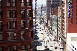
<span class="mw-page-title-main">Euclid Avenue (Cleveland)</span> Main thoroughfare in Cleveland, Ohio

Euclid Avenue is a major street in Cleveland, Ohio, United States. It runs northeasterly from Public Square in Downtown Cleveland, passing Playhouse Square and Cleveland State University, to University Circle, the Cleveland Clinic, Severance Hall, Case Western Reserve University's Maltz Performing Arts Center, Case Western Reserve University and University Hospitals Case Medical Center. The street runs through the suburbs of East Cleveland, Euclid, and Wickliffe, to Willoughby as a part of U.S. Route 20 and U.S. Route 6. The HealthLine bus rapid transit line runs in designated bus lanes in the median of Euclid Avenue from Public Square to Louis Stokes Station at Windermere in East Cleveland.

<span class="mw-page-title-main">University Circle</span> Neighborhood of Cleveland, Ohio, United States

University Circle is a district in the neighborhood of University on the East Side of Cleveland, Ohio. It is home to the Cleveland Museum of Art, Severance Hall, the Cleveland Institute of Art, the Cleveland Cinematheque, Case Western Reserve University, the Cleveland Institute of Music, the Museum of Contemporary Art Cleveland, the Cleveland Botanical Garden, historic Lake View Cemetery, the Cleveland Museum of Natural History, and University Hospitals/Case Medical Center.
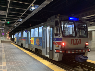
<span class="mw-page-title-main">Blue Line (RTA Rapid Transit)</span> Light rail line of the RTA Rapid Transit system

The Blue Line is a light rail line of the RTA Rapid Transit system in Cleveland and Shaker Heights, Ohio, running from Tower City Center downtown, then east and southeast to Warrensville Center Blvd near Chagrin Blvd. 2.6 miles (4.2 km) of track, including two stations, are shared with the rapid transit Red Line, the stations have low platforms for the Blue Line and high platforms for the Red Line. The Blue Line shares the right-of-way with the Green Line in Cleveland, and splits off after passing through Shaker Square. All RTA light rail lines use overhead lines and pantographs to draw power.
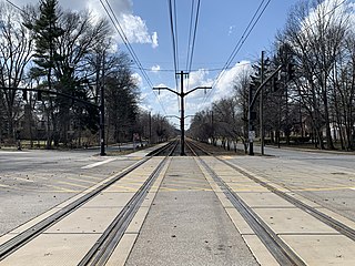
<span class="mw-page-title-main">Green Line (RTA Rapid Transit)</span> Light rail line of the RTA Rapid Transit system in Cleveland and Shaker Heights, Ohio

The Green Line is a light rail line of the RTA Rapid Transit system in Cleveland and Shaker Heights, Ohio, running from Tower City Center downtown, then east to Green Road near Beachwood. 2.6 miles (4.2 km) of track, including two stations, are shared with the rapid transit Red Line; the stations have low platforms for the Green Line and high platforms for the Red Line. The Green Line shares the right-of-way with the Blue Line in Cleveland, and splits off after passing through Shaker Square. All RTA light rail lines use overhead lines and pantographs to draw power.

<span class="mw-page-title-main">Cedar–University station</span> Rapid transit station in Cleveland

Cedar–University station is a station on the RTA Red Line in Cleveland, Ohio. The station is located in University Circle at the foot of Cedar Hill along Cedar Glen Parkway.

<span class="mw-page-title-main">Airport station (GCRTA)</span> Rapid transit station in Cleveland

Airport station is a station on the RTA Red Line in Cleveland, Ohio. It is the western terminus of the Red Line and is located off the lower level below the middle of the baggage claim level of Cleveland Hopkins International Airport.

<span class="mw-page-title-main">West 25th–Ohio City station</span> Rapid transit station in Cleveland

West 25th–Ohio City station is a station on the RTA Red Line in the Ohio City neighborhood of Cleveland, Ohio. It is located at the intersection of West 24th Street, Abbey Avenue and Lorain Avenue, diagonally across Lorain Avenue from the West Side Market.

<span class="mw-page-title-main">Tri-C–Campus District station</span> Rapid transit station in Cleveland

Tri-C–Campus District station is a station on the RTA Rapid Transit system in Cleveland, Ohio, serving the Red, Blue, and Green Lines. It is located just east of East 34th Street near the intersection of East 34th and Broadway, on the north side of the CSX railway tracks, and below the bridge that carries East 34th Street over the railway tracks. Tri-C refers to Cuyahoga Community College.
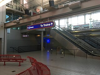
<span class="mw-page-title-main">Louis Stokes Station at Windermere</span> Rapid transit station in Cleveland

Louis Stokes Station at Windermere is a rapid transit station on the RTA Red Line in East Cleveland, Ohio. It is located on the northwest side of Euclid Avenue between Bryn Mawr and Doan Roads. It is the eastern terminus of the Red Line and the HealthLine, a bus rapid transit route.

<span class="mw-page-title-main">Superior station</span> Rapid transit station in Cleveland

Superior station is a station on the RTA Red Line in East Cleveland, Ohio. It is located on Superior Avenue at the intersection of Emily Street, approximately 1½ blocks west of Euclid Avenue. A small parking lot is located northeast of the station entrance along Emily Street.

<span class="mw-page-title-main">East 79th station (GCRTA Red Line)</span> Rapid transit station in Cleveland

East 79th station is a station on the RTA Red Line in Cleveland, Ohio. It is located on the west side of East 79th Street between Woodland Avenue and Grand Avenue. The entrance is on the east side of East 79th Street.

<span class="mw-page-title-main">East 55th station</span> Rapid transit station in Cleveland

East 55th station is a station on the RTA Red, Blue, and Green Lines in Cleveland, Ohio. The station entrance is located on the east side of East 55th Street just north of the intersection with Bower Avenue and the eastern terminus of Interstate 490.

<span class="mw-page-title-main">West 65th–Lorain station</span> Rapid transit station in Cleveland

West 65th–Lorain station is a station on the RTA Red Line in Cleveland, Ohio. It is located between Lorain Avenue and Madison Avenue at West 61st Street.

<span class="mw-page-title-main">HealthLine</span> Bus rapid transit line in Cleveland, Ohio

The HealthLine is a bus rapid transit (BRT) line run by the Greater Cleveland Regional Transit Authority in Cleveland and East Cleveland, Ohio, United States. The line runs along Euclid Avenue from Public Square in downtown Cleveland to the Louis Stokes Station at Windermere in East Cleveland. It began operation on October 24, 2008. Its current name was the result of a naming rights deal with the Cleveland Clinic and University Hospitals of Cleveland. The HealthLine is denoted with a silver color and abbreviated simply as HL on most RTA publications.
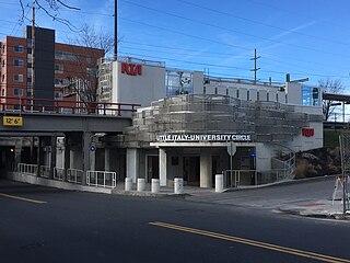
<span class="mw-page-title-main">Little Italy–University Circle station</span> Rapid transit station in Cleveland

Little Italy–University Circle station is a station on the RTA Red Line in the University Circle neighborhood of Cleveland, Ohio. It is located at the Mayfield Road and East 119 Street intersection, near the western end of Little Italy.

<span class="mw-page-title-main">Cedar Glen Apartments</span> United States historic place

The Cedar Glen Apartments is a historic apartment building located in the University Circle neighborhood of Cleveland, Ohio, in the United States. Designed by prominent local architect Samuel H. Weis and completed in 1927, the building originally contained luxury apartments and served as a gateway to the more exclusive neighborhood of Cleveland Heights, on whose border the building is located. Threatened with demolition in 1992, the building was purchased by new owners and converted into condominiums.

<span class="mw-page-title-main">Transportation in Cleveland</span> Overview of transportation in Cleveland, Ohio

The transportation system of Cleveland is a network that includes several modes of transportation including sidewalks, roads, public transit, bicycle paths and regional and international airports.

References

  1. Christiansen, Harry (1975). Trolley Trails Through Greater Cleveland and Northern Ohio. Vol. 3. Lakewood: Trolley Lore/Western Reserve Historical Society. p. 473.
  2. Exner, Rich (March 14, 2005). "Red Line rapid marks 50 years in service". The Plain Dealer . p. A1. Retrieved 2007-06-02.
  3. Lawless, James (May 6, 1992). "Policy would let RTA shut station committee OKs rider minimum". The Plain Dealer . p. 1B. Retrieved 2007-06-02.
  4. "A stop too many on the Red Line". Editorial. The Plain Dealer. May 5, 1992. p. 10C. Retrieved 2007-06-02.
  5. Lawless, James (June 6, 1992). "New policy may doom 4 rapid stations". The Plain Dealer . p. 4B. Retrieved 2007-06-02.
  6. Thoma, Pauline (August 25, 1992). "'Don't close that station' Rapid riders plead with RTA to save stop on Euclid Ave". The Plain Dealer . p. 2B. Retrieved 2007-06-02.
  7. "Regional Transit Authority unveils exciting plans for University Circle". cleveland.com. 5 September 2007.
  8. "Plans for an RTA station in Little Italy: Whatever happened to ...?". cleveland.com. 23 May 2011.
  9. "Little Italy–University Circle / Euclid–E 120 Station" (Press release). Greater Cleveland Regional Transit Authority. August 10, 2015. Retrieved 2015-08-13.