
Leppard Glacier is a large valley glacier draining east between the Aristotle Mountains and Voden Heights, and flowing into Scar Inlet north of Ishmael Peak, on the east coast of Graham Land, Antarctica. The glacier was first seen from the air and photographed in part by Hubert Wilkins on December 20, 1928, and was surveyed by the Falkland Islands Dependencies Survey (FIDS) in 1955. It is now clear that, on the photographic evidence of his outward flight, Wilkins gave the name "Crane Channel" to this glacier, and that on his return flight he photographed what is now accepted as Crane Glacier, perhaps thinking that it was the same feature. Since Crane Glacier has been retained for the northern of these glaciers photographed by Wilkins, the UK Antarctic Place-Names Committee has named this feature for Norman A.G. Leppard, assistant surveyor with the FIDS, who surveyed this area in 1955.
Armstrong Reef is a reef that encompasses a large number of ice-free plutonic islets and rocks, extending for 9 km (6 mi) from the south-west end of Renaud Island, in the Biscoe Islands of Antarctica. It was first accurately shown on an Argentine government chart of 1957, and was named by the UK Antarctic Place-Names Committee for Terence Armstrong, a British sea ice specialist.
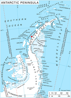
Bergel Rock is a rock nearly 1 nautical mile (1.9 km) south of Quintana Island in the southwestern Wilhelm Archipelago. It was named by the UK Antarctic Place-Names Committee for Alexandra Bergel, a granddaughter of Sir Ernest Shackleton, and a sponsor for HMS Endurance which made surveys in this area in February 1969.

Birley Glacier is a glacier, at least 10 nautical miles (19 km) long, flowing west into the eastern extremity of Barilari Bay north of Vardun Point, on the west coast of Graham Land. First seen and roughly surveyed in 1909 by the French Antarctic Expedition under Jean-Baptiste Charcot, it was re-surveyed in 1935–36 by the British Graham Land Expedition (BGLE) under John Rymill, and later named for Kenneth P. Birley, who contributed toward the cost of the BGLE, 1934–37.
Bolton Glacier is a glacier flowing into the head of Briand Fjord, Flandres Bay, on the west coast of Graham Land. It was mapped in 1959 by the Falkland Islands Dependencies Survey from photos taken by Hunting Aerosurveys Ltd in 1956–57, and named by the UK Antarctic Place-Names Committee for William B. Bolton (1848–89), English photographer who, with B.J. Sayce, invented the collodion emulsion process of dry-plate photography in 1864.

Breitfuss Glacier is a glacier 10 nautical miles (19 km) long, which flows southeast from Avery Plateau into Mill Inlet to the west of Cape Chavanne, on the east coast of Graham Land. It was charted by the Falkland Islands Dependencies Survey (FIDS) and photographed from the air by the Ronne Antarctic Research Expedition in 1947. It was named by the FIDS for Leonid Breitfuss, a German polar explorer, historian, and author of many polar bibliographies.
Conway Island lies in Crates Bay to the west of Lens Peak and facing Bregare Point, off the northeast coast of Stresher Peninsula, Graham Land. It was photographed by Hunting Aerosurveys Ltd in 1956–57, and mapped from these photos by the Falkland Islands Dependencies Survey. It was named by the UK Antarctic Place-Names Committee in 1959 for Martin Conway, 1st Baron Conway of Allington, an English mountaineer and a pioneer of polar skiing during his crossing of Vestspitsbergen in 1896.
Cornet Island is an island 1.5 nautical miles (3 km) northeast of Milnes Island along the west side of the Grandidier Channel, in the Biscoe Islands. It was first charted by the British Graham Land Expedition of 1934–37 under John Rymill. The name, given by the UK Antarctic Place-Names Committee in 1959, is descriptive of the island's shape when seen from the air.
The Darbel Islands are a group of islands and rocks extending southwest from Cape Bellue for 5 nautical miles (9 km) across the entrance to Darbel Bay, off the west coast of Graham Land. They were charted in 1930 by Discovery Investigations personnel on the Discovery II and named Marin Darbel Islands after the bay in which they were found. Both names have since been shortened by the UK Antarctic Place-Names Committee.
Dennison Reef is a reef between the Shull Rocks and the Pauling Islands, lying east of the south end of the Biscoe Islands in Crystal Sound. It was mapped from air photos obtained by the Ronne Antarctic Research Expedition (1947–48) and from surveys by the Falkland Islands Dependencies Survey (1958–59). It was named by the UK Antarctic Place-Names Committee for David M. Dennison, a physicist who took x-ray diffraction pictures which were used to interpret the crystal structure of ice.

Plummer Glacier is a short glacier descending east through the Enterprise Hills to the north of Lippert Peak and the Douglas Peaks, in the Heritage Range in Antarctica. Mapped by United States Geological Survey (USGS) from surveys and U.S. Navy air photos, 1961-66. Named by Advisory Committee on Antarctic Names (US-ACAN) for Charles C. Plummer, United States Antarctic Research Program (USARP) glaciologist at Palmer Station in 1965.
Erskine Glacier is a glacier 16 nautical miles (30 km) long on the west coast of Graham Land, flowing west into Darbel Bay to the north of Hopkins Glacier. It was first surveyed by the Falkland Islands Dependencies Survey (FIDS) in 1946–47, and named "West Gould Glacier". With East Gould Glacier it was reported to fill a transverse depression across Graham Land, but further survey in 1957 showed no close topographical alignment between the two. The name Gould has been limited to the east glacier and an entirely new name, for Angus B. Erskine, leader of the first FIDS party to travel down the glacier and to survey it in detail, has been approved for the west glacier.

Field Glacier is a glacier on Pernik Peninsula, Loubet Coast in Graham Land, situated south of Salmon Cove, and flowing west into Lallemand Fjord just south of Kanchov Peak. It was mapped from air photos taken by the Falkland Islands and Dependencies Aerial Survey Expedition, 1956–57. In association with the names of glaciologists grouped in this area, it was named by the UK Antarctic Place-Names Committee after William B.O. Field, an American glaciologist and surveyor, sometime Research Fellow of the American Geographical Society.
The Molnar Rocks are insular rocks lying 4 nautical miles (7 km) west of the middle of Lavoisier Island, in the Biscoe Islands of Antarctica. The rocks were mapped from air photos taken by the Falkland Islands and Dependencies Aerial Survey Expedition in 1956–57, and were named by the UK Antarctic Place-Names Committee for George W. Molnar, an American physiologist who has specialized in the reactions of the body to cold environments.

Foley Glacier is a glacier about 4 nautical miles (7 km) long flowing north from the western end of Thurston Island just east of Cape Petersen. It was named by the Advisory Committee on Antarctic Names after Kevin M. Foley, of the United States Geological Survey, Reston, Virginia, a computer specialist and team member of the Glaciological and Coastal-Change Maps of Antarctica Project.
Green Glacier is a glacier on the east side of Graham Land, Antarctica, 15 nautical miles (28 km) long and 4 nautical miles (7 km) wide, flowing from the plateau northeast between Dugerjav Peak and Rugate Ridge, and then east into Vaughan Inlet next north of Pirne Peak and south of the terminus of Hektoria Glacier.

Mudge Passage is a marine passage running east-west from the vicinity of Prospect Point, Graham Coast, between Beer Island and Dodman Island to the north and Saffery Islands and Trump Islands to the south, to the vicinity of Extension Reef. The passage was navigated and charted by Captain C.R. Elliott in RRS John Biscoe in January 1979. Named by the United Kingdom Antarctic Place-Names Committee (UK-APC) in association with Harrison Passage and Maskelyne Passage to the northeast, after Thomas Mudge (1715–94), English horologist who made substantial improvements to marine chronometers.
The Medley Rocks are a group of reefs and rocks lying close off the northeast side of D'Urville Island, in the Joinville Island group, Antarctica. They were surveyed by the Falkland Islands Dependencies Survey in 1953–54, and were so named in 1956 because of the "medley" of reefs and rocks in this area.
The Laputa Nunataks are a range of nunataks and snow-covered hills with minor rock outcrops, rising from about 500 metres (1,600 ft) to over 1,000 metres (3,300 ft), and located 6 nautical miles (11 km) northwest of Adie Inlet on the east side of Graham Land, Antarctica. They were first charted by the Falkland Islands Dependencies Survey and photographed from the air by the Ronne Antarctic Research Expedition in 1947. They were named by the UK Antarctic Place-Names Committee after Laputa, the flying island in Jonathan Swift's Gulliver's Travels.
Lens Peak is a peak at the south side of Holtedahl Bay just east of Conway Island, on the northeast coast of Stresher Peninsula on the west coast of Graham Land, Antarctica. It was photographed by Hunting Aerosurveys Ltd in 1956–57, and mapped from these photos by the Falkland Islands Dependencies Survey. The peak was named by the UK Antarctic Place-Names Committee in 1960 from association with a group of features in the area commemorating pioneers of research on snow blindness and the design of snow goggles.


