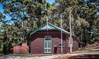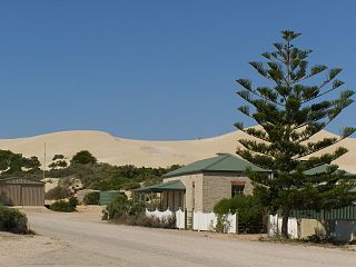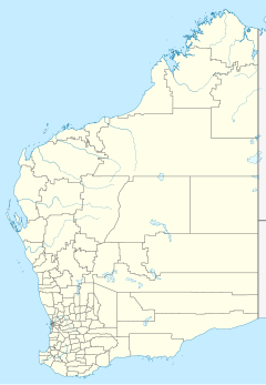
Eucla National Park is a national park in Western Australia, 1,238 kilometres (769 mi) east of Perth.

The Nullarbor Plain is part of the area of flat, almost treeless, arid or semi-arid country of southern Australia, located on the Great Australian Bight coast with the Great Victoria Desert to its north. It is the world's largest single exposure of limestone bedrock, and occupies an area of about 200,000 square kilometres (77,000 sq mi). At its widest point, it stretches about 1,100 kilometres (684 mi) from east to west across the border between South Australia and Western Australia.

The Great Australian Bight is a large oceanic bight, or open bay, off the central and western portions of the southern coastline of mainland Australia.

Albany is a port city in the Great Southern region in the Australian state of Western Australia, 418 kilometres (260 mi) southeast of Perth, the state capital. The city centre is at the northern edge of Princess Royal Harbour, which is a part of King George Sound. The central business district is bounded by Mount Clarence to the east and Mount Melville to the west. The city is in the local government area of the City of Albany. While it is the oldest colonial, although not European, settlement in Western Australia — predating Perth and Fremantle by over two years — it was a semi-exclave of New South Wales for over four years until it was made part of the Swan River Colony.

Port Lincoln is a city on the Lower Eyre Peninsula in the Australian state of South Australia. Known as Galinyala by the traditional owners, the Barngarla people, it is situated on the shore of Boston Bay, which opens eastward into Spencer Gulf. It is the largest city in the West Coast region, and is located approximately 280 km (170 mi) from the state's capital city of Adelaide.

Eyre Highway is a 1,664-kilometre (1,034 mi) highway linking Western Australia and South Australia via the Nullarbor Plain. Signed as National Highways 1 and A1, it forms part of Highway 1 and the Australian National Highway network linking Perth and Adelaide. It was named after explorer Edward John Eyre, who was the first European to cross the Nullarbor by land, in 1840–1841. Eyre Highway runs from Norseman in Western Australia, past Eucla, to the state border. Continuing to the South Australian town of Ceduna, it crosses the top of the Eyre Peninsula before reaching Port Augusta.

Torbay is a small town and a bay in the Great Southern region of Western Australia, 20 kilometres (12 mi) west of Albany. Torbay is within the City of Albany local government area. The Torbay townsite was gazetted in 1910.

Ceduna is a town in South Australia located on the shores of Murat Bay on the coast, west of the Eyre Peninsula. It lies west of the junction of the Flinders and Eyre Highways around 786 km northwest of Adelaide. The nearby port of Thevenard lies 3 km to the west on Cape Thevenard. It is in the District Council of Ceduna, the federal electoral Division of Grey, and the state electoral district of Flinders.

Eucla is the easternmost locality in Western Australia, located in the Goldfields-Esperance region of Western Australia along the Eyre Highway, approximately 11 kilometres (7 mi) west of the South Australian border. At the 2016 Australian census, Eucla had a population of 53.

Coolgardie–Esperance Highway is a 370-kilometre (230 mi) Western Australian highway between Coolgardie and Esperance. It runs in a north–south direction linking the state's Eastern Goldfields to the coast.

Cocklebiddy is a small roadhouse community located on the Eyre Highway in Western Australia. It is the third stop after Norseman on the journey eastwards across the Nullarbor Plain. Like other locations in the region, the site consists of little more than a roadhouse. The current business name of the roadhouse is the Wedgetail Inn and, like most other Nullarbor establishments, has access to satellite television, as well as providing caravan park and hotel-motel facilities.

Balladonia is a small roadhouse community located on the Eyre Highway in Western Australia. It is the first stop east of Norseman on the journey east across the Nullarbor Plain. Between Balladonia and Caiguna is a 146.6-kilometre (91.1 mi) stretch of the highway which is one of the longest straight stretches of road in the world.

Eyre Bird Observatory is an educational, scientific and recreational facility in the Nuytsland Nature Reserve, Western Australia. Cocklebiddy is the nearest locality on the Eyre Highway, 49 km (30 mi) to the north. It is in the Hampton bioregion, which is sandwiched between the Nullarbor Plain to the north and the Great Australian Bight to the south, in one of the least populated places on the Australian continent. It was established in 1977 by Birds Australia in the disused Eyre Telegraph Station as Australia's first bird observatory, to provide a base for the study and enjoyment of the birds of the area.

Hampton is an interim Australian bioregion located in southeastern coastal Western Australia, with a small portion (4%) extending into adjacent South Australia. It has an area of 1,088,198 hectares. The Hampton bioregion is part of the Coolgardie woodlands ecoregion.

Fowlers Bay, formerly known as Yalata, is a bay, town and locality in the Australian state of South Australia located about 658 kilometres (409 mi) north-west of the state capital, Adelaide. The town is located on Port Eyre, at the western end of the larger Fowlers Bay. It was named Yalata after Yalata station, established in the 1860s and stretching from the Nullarbor Plain across to near Streaky Bay on the Eyre Peninsula, whose homestead was located on the hill nearby. The name Yalata now belongs to a small Aboriginal community further west, which was also situated on station land.

Australia was a relatively early adopter of electrical telegraph technology in the middle of the nineteenth century, despite its low population densities and the difficult conditions sometimes encountered in laying lines. From 1858 onwards, the major capitals were progressively linked, culminating in the addition of Perth in 1877. Australia was linked to the rest of the world for the first time in 1872, through the Overland Telegraph which ran some 3,200 kilometres (2,000 mi) from Adelaide through to Darwin. The network continued to expand in size and sophistication until 1959 and in heavy usage until 1945, after which time telephone usage began to erode public patronage of telegraphy services. The final publicly provided telegraphy service was closed in 1993.
Lake Newland Conservation Park is a protected area in the Australian state of South Australia located on the west coast of the Eyre Peninsula about 10 kilometres (6.2 mi) north of the town of Elliston. It was proclaimed in 1991 in order to protect Lake Newland, a hypersaline lake, and an associated wetland complex. It lies in the traditional lands of the Wirangu people.

The Nuyts Archipelago is an island group in South Australia in the Great Australian Bight, to the south of the town of Ceduna on the west coast of the Eyre Peninsula. It consists of mostly granitic islands and reefs that provide breeding sites for Australian sea lions and support colonies of short-tailed shearwater. It also includes the island group known as the Isles of St Francis. All the islands, with the exception of a part of Evans Island, are located within the protected areas of the Nuyts Archipelago Wilderness Protection Area and the Nuyts Archipelago Conservation Park.

The Roe Plains is a coastal plain in the southeastern corner of Western Australia.
Old Eyre Highway is a remnant part of the Eyre Highway that was abandoned in the construction of a route closer to the coast of the Great Australian Bight.


