
The Lower Mainland is a geographic and cultural region of the mainland coast of British Columbia that generally comprises the regional districts of Metro Vancouver and the Fraser Valley. Home to approximately 3.05 million people as of the 2021 Canadian census, the Lower Mainland contains sixteen of the province's 30 most populous municipalities and approximately 60% of the province's total population.
The Fraser Valley is a geographical region in southwestern British Columbia, Canada and northwestern Washington State. It starts just west of Hope in a narrow valley encompassing the Fraser River and ends at the Pacific Ocean stretching from the North Shore Mountains, opposite the city of Vancouver BC, to just south of Bellingham, Washington.

Abbotsford is a city in British Columbia next to the Canada–United States border, Greater Vancouver and the Fraser River. With a census population of 153,569 people (2021), it is the largest municipality in the province outside metropolitan Vancouver. Abbotsford–Mission has the third-highest proportion of visible minorities among census metropolitan areas in Canada, after the Greater Toronto Area and the Greater Vancouver CMA. It is home to Tradex, the University of the Fraser Valley, and Abbotsford International Airport.

Chilliwack is a city of about 100,000 people and 261 km2 (100 sq mi) in the Canadian province of British Columbia. It is located about 100 km (62 mi) east of the City of Vancouver in the Fraser Valley. The enumerated population is 93,203 in the city and 113,767 in the greater metropolitan area.

Quesnel is a city located in the Cariboo Regional District of British Columbia, Canada. Located nearly evenly between the cities of Prince George and Williams Lake, it is on the main route to northern British Columbia and the Yukon. Quesnel is located at the confluence of the Fraser River and Quesnel River. As of 2021, Quesnel's metropolitan area had a population of 23,113 making it one of the largest urban centres between Prince George and Kamloops.
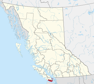
The Capital Regional District (CRD) is a local government administrative district encompassing the southern tip of Vancouver Island and the southern Gulf Islands in the Canadian province of British Columbia. The CRD is one of several regional districts in British Columbia and had an official population of 415,451 as of the Canada 2021 Census.

View Royal is a town in Greater Victoria and a member municipality of the Capital Regional District of British Columbia, Canada. View Royal has a population of 11,575 residents. With over 700 hectares of parkland, View Royal includes Thetis, McKenzie, Pike, and Prior Lakes and portions of Esquimalt Harbour and Portage Inlet.

Greater Vancouver, also known as Metro Vancouver, is the metropolitan area with its major urban centre being the city of Vancouver, British Columbia, Canada. The term "Greater Vancouver" describes an area that is roughly coterminous with the region governed by the Metro Vancouver Regional District (MVRD), though it predates the 1966 creation of the regional district. It is often used to include areas beyond the boundaries of the regional district but does not generally include wilderness and agricultural areas that are included within the MVRD.

The Fraser Valley Regional District (FVRD) is a regional district in British Columbia, Canada. Its headquarters are in the city of Chilliwack. The FVRD covers an area of 13,361.74 km2 (5,159 sq mi). It was created in 1995 by an amalgamation of the Fraser-Cheam Regional District and Central Fraser Valley Regional District and the portion of the Dewdney-Alouette Regional District from and including the District of Mission eastwards.

Central Saanich is a district municipality in Greater Victoria, British Columbia, Canada, and a member municipality of the Capital Regional District. It is located on the Saanich Peninsula, in the far south-east of Vancouver Island. It is the traditional territory of the W̱SÁNEĆ people. The district began as a farming community, and many hobby farms, along working farms and vineyards, still exist. In recent decades, the area has seen increasing residential, commercial, and industrial development, especially around the neighbourhoods of Brentwood Bay and Saanichton, which are occasionally referred to as separate communities.

Langford is a city on southern Vancouver Island in the province of British Columbia, Canada. Langford is one of the 13 component municipalities of Greater Victoria and is within the Capital Regional District. Langford was incorporated in 1992 and has a population of over 40,000 people. Its municipal neighbours are Colwood to the southeast, Highlands to the north, Metchosin to the southwest, and View Royal to the northeast.
Sechelt is a district municipality located on the lower Sunshine Coast of British Columbia. Approximately 50 km northwest of Vancouver, it is accessible from mainland British Columbia by a 40-minute ferry trip between Horseshoe Bay and Langdale, and a 25-minute drive from Langdale along Highway 101, also known as the Sunshine Coast Highway. The name Sechelt is derived from the she shashishalhem word shíshálh, the name of the First Nations people who first settled the area thousands of years ago.
The District of North Saanich is located on the Saanich Peninsula of British Columbia, approximately 25 km (16 mi) north of Victoria on southern Vancouver Island. It is one of the 13 Greater Victoria municipalities. The district is surrounded on three sides by 20 km (12 mi) of ocean shoreline, and consists of rural/residential areas and a large agricultural base. It is home to the Victoria International Airport and the Swartz Bay Ferry Terminal.

The District of Kent is a district municipality located 116 kilometres (72 mi) east of Vancouver, British Columbia. Part of the Fraser Valley Regional District, Kent consists of several communities, the largest and most well-known being Agassiz—the only town in the municipality—Harrison Mills, Kilby, Mount Woodside, Kent Prairie, Sea Bird Island and Ruby Creek. Included within the municipality's boundaries are several separately-governed Indian reserves, including the Seabird Island First Nation's reserves on and around the island of the same name.

Queensborough is a neighbourhood in the city of New Westminster, British Columbia, Canada. It is on the eastern tip of Lulu Island on the Fraser River.

Popkum, also known as Popkum Village, is an unincorporated community in the Fraser Valley Regional District, in the census metropolitan area of Chilliwack, British Columbia, Canada. Its namesake is the indigenous Popkum First Nation and adjacent Indian reserve. The name is derived from the Halq'eméylem word Pópkw'em meaning "puffballs."
The Leq'á:mel First Nation, formerly known as Lakahahmen First Nation, is a First Nations band government whose community and offices are located in the area near Deroche, British Columbia in the Fraser Valley region in Canada, about 12 kilometres east of the District of Mission. They are a member government of the Sto:lo Nation Chiefs Council, which is one of two tribal councils of the Sto:lo.

Chilliwack—Hope is a federal electoral district in the Fraser Valley region of British Columbia.
Mission—Matsqui—Fraser Canyon is a federal electoral district located in Fraser Valley of British Columbia.
