
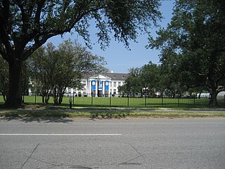
Tremé is a neighborhood in New Orleans, Louisiana. "Tremé" is often rendered as Treme, and the neighborhood is sometimes called by its more formal French name, the Faubourg Tremé; it is listed in the New Orleans City Planning Districts as Tremé / Lafitte when including the Lafitte Projects.

The Faubourg Marigny is a neighborhood of the city of New Orleans, Louisiana, United States.

The 7th Ward is a legally defined voting ward and a neighborhood of the city of New Orleans. A sub-district of the Mid-City District Area, its boundaries as defined by the New Orleans City Planning Commission are: A.P. Tureaud Avenue, Agriculture, Allen, Industry, St. Anthony, Duels, Frenchmen and Hope Streets to the north, Elysian Fields Avenue to the east, St. Claude and St. Bernard Avenues, North Rampart Street and Esplanade Avenue to the south, and North Broad Street to the west.

Navarre is a neighborhood of the city of New Orleans. A subdistrict of the Lakeview District Area, its boundaries as defined by the City Planning Commission are: I-610, Canal Boulevard and Florida Boulevard to the north, Orleans Avenue to the east, City Park Avenue to the south and the Pontchartrain Expressway and Pontchartrain Boulevard to the west.

St. Bernard Projects was a housing project in the city of New Orleans. A subdistrict of the Mid-City District Area, its boundaries as defined by the New Orleans City Planning Commission were: Harrison Avenue to the north, Paris Avenue to the east, Lafreniere Street and Florida Avenue to the south and Bayou St. John to the west.

Gentilly Woods is a neighborhood of the city of New Orleans. A subdistrict of the Gentilly District Area, its boundaries as defined by the City Planning Commission are: Dreux Avenue to the north, Industrial Canal to the east, Gentilly Boulevard to the south and People's Avenue to the west.

Mid-City is a neighborhood of the city of New Orleans. A sub-district of the Mid-City District Area, its boundaries as defined by the New Orleans City Planning Commission are: City Park Avenue, Toulouse Street, North Carrollton, Orleans Avenue, Bayou St. John and St. Louis Street to the north, North Broad Street to the east, and the Pontchartrain Expressway to the west. It is a historic district on the National Register of Historic Places. In 2023, the neighborhood was cited as one of the "coolest" in the world by Time Out. In common usage, a somewhat larger area surrounding these borders, usually the areas bounded by the beltway formed by Interstates 10 and 610, is often also referred to as part of Mid-City.

Uptown is a primarily residential neighborhood of the city of New Orleans. A subdistrict of the Uptown/Carrollton Area, its boundaries as defined by the New Orleans City Planning Commission are: LaSalle Street to the north, Napoleon Avenue to the east, Magazine Street to the south and Jefferson Avenue to the west.

Milan is a neighborhood of the city of New Orleans, Louisiana, U.S.A. A sub-district of the Central City/Garden District Area, its boundaries as defined by the New Orleans City Planning Commission are: South Claiborne Avenue to the north, Toledano Street and Louisiana Avenue to the east, St. Charles Avenue to the south, and Napoleon Avenue to the west.

Touro is a neighborhood of the city of New Orleans. A subdistrict of the Central City/Garden District Area, its boundaries as defined by the New Orleans City Planning Commission are: St. Charles Avenue to the north, Toledano Street to the east, Magazine Street to the south and Napoleon Avenue to the west.

Bayou St. John, also known as Faubourg St. John, is a neighborhood of the city of New Orleans. A subdistrict of the Mid-City area, its boundaries as defined by the New Orleans City Planning Commission are: Esplanade Avenue to the north, North Broad Street to the east, St. Louis Street to the south, and the Bayou St. John waterway, the neighborhood's namesake, to the west. The neighborhood was built along what is known as the Esplanade Ridge. The Esplanade Ridge Historic District was added to the National Register of Historic Places in 1980 and includes much of the neighborhood.

Tulane/Gravier is a neighborhood of the city of New Orleans, Louisiana, U.S.A. A subdistrict of the Mid-City District Area, its boundaries as defined by the New Orleans City Planning Commission are: St. Louis Street to the north, North Claiborne Avenue, Iberville Street, North and South Derbigny Street, Cleveland Street, South Claiborne Avenue to the east, the Pontchartrain Expressway to the south and South Broad Street to the west.

City Park is a neighborhood of the city of New Orleans, US. A subdistrict of the Lakeview District Area, its boundaries as defined by the City Planning Commission are: Allen Toussaint Boulevard to the north, Bayou St. John to the east, Orleans Avenue, North Carrollton Avenue and Toulouse Street to the south and City Park and Orleans Avenues to the west. The neighborhood is named after and dominated by City Park.
Dillard is a neighborhood of the city of New Orleans. A subdistrict of the Gentilly District Area, its boundaries as defined by the City Planning Commission are: Mirabeau Avenue to the north, Elysian Fields Avenue to the east, Benefit Street and I-610 to the south and Paris Avenue, Pratt Drive and the London Avenue Canal to the west.

Filmore is a neighborhood of the city of New Orleans. A subdistrict of the Gentilly District Area, its boundaries as defined by the City Planning Commission are: * Allen Toussaint Boulevard to the north, London Avenue Canal to the east, Press Drive, Paris Avenue and Harrison Avenue to the south and Bayou St. John to the west.
St. Anthony is a neighborhood of the city of New Orleans. A subdistrict of the Gentilly District Area, its boundaries as defined by the City Planning Commission are: New York Street to the north, Elysian Fields Avenue to the east, Mirabeau Avenue to the south and the London Avenue Canal to the west.
Desire Area is a neighborhood of the city of New Orleans. A subdistrict of the Bywater District Area, its boundaries as defined by the City Planning Commission are: Gentilly Boulevard to the north; the Industrial Canal to the east; Florida Boulevard, Alvar Street, Higgins Boulevard, Piety Street, Pleasure Street, Oliver White Avenue, and Desire Street to the south; and People's Avenue to the west. It is part of the Upper 9th Ward.
Florida Area is a neighborhood of the city of New Orleans. A subdistrict of the Bywater District Area, its boundaries as defined by the City Planning Commission are: Florida Boulevard, Gallier, Law, Congress and North Dorgenois Streets to the north; Mazant Street to the east; North Galvez Street to the south; and Montegut Street, Law Street, and Almonaster Avenue to the west.
St. Claude is a neighborhood of the city of New Orleans. A subdistrict of the Bywater District Area, its boundaries as defined by the City Planning Commission are: Law, Montegut and North Galvez Streets to the north, Lesseps Street to the east, Burgundy Street, Clouet Street and St. Claude Avenue to the south and Franklin Avenue to the west.

St. Roch is a neighborhood of the U.S. city of New Orleans. A subdistrict of the Bywater District Area, its boundaries as defined by the City Planning Commission are: Lafreniere Street, Paris Avenue, I-610, Benefit Street, and Dahlia Walk to the north; People's and Almonaster Avenues to the east; St. Claude Avenue to the south; Elysian Fields Avenue, Hope, Frenchmen, Duels, St. Anthony, Industry, Allen, & Agriculture Streets, A.P. Tureaud Avenue, Abundance, Republic, Treasure, & Dugue Streets, and Florida & St. Bernard Avenues to the west.

