Mid-City New Orleans

Last updated

Mid-City
CanalRedcarFirstGraceNOLA.jpg
Canal Streetcar in Mid-City
Flag of Mid-City, New Orleans, Louisiana.png
Mid-City Map from OpenStreetMap.png
Coordinates: 29°58′19″N90°05′49″W / 29.97194°N 90.09694°W / 29.97194; -90.09694
CountryUnited States
StateLouisiana
City New Orleans
Planning DistrictDistrict 4, Mid-City District
Area
  Total1.66 sq mi (4.3 km2)
  Land1.66 sq mi (4.3 km2)
  Water0.00 sq mi (0.0 km2)
Elevation
0 ft (0 m)
Population
 (2010)
  Total6,217
  Density3,700/sq mi (1,400/km2)
Time zone UTC-6 (CST)
  Summer (DST) UTC-5 (CDT)
Area code 504
Mid-City Historic District
USA Louisiana location map.svg
Red pog.svg
Usa edcp location map.svg
Red pog.svg
LocationRoughly bounded by Derbigny St., Conti St., City Park Ave. and I-10, New Orleans, Louisiana
Area850 acres (340 ha)
ArchitectMultiple
Architectural style Bungalow/Craftsman, Colonial Revival, Italianate
NRHP reference No. 93001394 [1]
Added to NRHPDecember 10, 1993

Mid-City is a neighborhood of the city of New Orleans. A sub-district of the Mid-City District Area, its boundaries as defined by the New Orleans City Planning Commission are: City Park Avenue, Toulouse Street, North Carrollton, Orleans Avenue, Bayou St. John and St. Louis Street to the north, North Broad Street to the east, and the Pontchartrain Expressway to the west. It is a historic district on the National Register of Historic Places. [2] In 2023, the neighborhood was cited as one of the "coolest" in the world by Time Out. [3] In common usage, a somewhat larger area surrounding these borders, usually the areas bounded by the beltway formed by Interstates 10 and 610, is often also referred to as part of Mid-City.

Contents

Geography

Mid-City is located at 29°58′19″N90°05′49″W / 29.97194°N 90.09694°W / 29.97194; -90.09694 [4] and has an elevation of 0 feet (0.0 m). [5] According to the United States Census Bureau, the district has a total area of 1.66 square miles (4.3 km2), all land.

Mid-City is located, as the name indicates, in the middle of New Orleans on what was once the backslope of the Mississippi River natural levee, a gradually declining section of the river's flood plain. As such, it was not settled as early as adjacent neighborhoods and was called the "back of town"—the city ended at the swamp, unlike today, when the city reaches the lake. The Esplanade Ridge and the adjoining Metairie Ridge formed a natural spur from the River; but what is now Mid-City, surrounded by these higher-elevated sections, was part of the "backswamp" until development in the late nineteenth and early twentieth centuries. [2] [6]

Adjacent neighborhoods

Boundaries

The New Orleans City Planning Commission defines the boundaries of Mid-City as these streets: City Park Avenue, Toulouse Street, North Carrollton Avenue, Orleans Avenue, Bayou St. John, St. Louis Street, North Broad Street and the Pontchartrain Expressway. [7]

Demographics

As of the census of 2000, there were 19,909 people, 5,830 households, and 2,939 families residing in the neighborhood. [8] The population density was 11,993 /mi2 (4,630 /km2).

As of the census of 2010, there were 14,633 people, 5,258 households, and 2,318 families residing in the neighborhood. [8]

Mid-City is one of New Orleans most racially diverse neighborhoods with its proximity to uptown, downtown and the suburbs contributing to its integrated diversity. [9]

Landmarks

Mid-City branch of New Orleans Public Library in 2016 New Mid-City Library New Orleans December 2016.jpg
Mid-City branch of New Orleans Public Library in 2016

Mid-City is the home of a number of city landmarks. Canal Street, one of the most important thoroughfares of the city, bisects the neighborhood down the middle; the streetcar route follows Canal to Carrollton Avenue, another prominent New Orleans street that passes through Mid-City. Tulane Avenue, which is the terminus of U.S. Route 61, also runs just upriver from Canal Street; before the interstate highway system, this was the primary route into New Orleans from Baton Rouge. An important cross-street is Norman C. Francis Parkway, named for the former president of Xavier University of Louisiana, which is located near the southwestern end of the parkway.

The Orleans Parish Criminal Court, the Faubourg Brewing Company, Jesuit High School, Warren Easton High School, and the Falstaff Brewery (now converted to apartments) are physically among the most prominent buildings scattered across Mid-City, in addition to a number of churches and large houses along Canal Street. Tulane Avenue in particular shows some remnants of the area's industrial past. However, more characteristic of Mid-City today are the many shotgun houses and larger houses that make up most of this primarily residential neighborhood.

Culture

Running around the New Year bonfire in Mid-City New Orleans (2006) Running Round New Year Bonfire New Orleans.jpg
Running around the New Year bonfire in Mid-City New Orleans (2006)

Mid-City is a generally local, middle-class neighborhood in that it contains fewer tourist destinations than other parts of the city. Restaurants and bars rely heavily on local clientele, giving the area a quirky local flavor.[ citation needed ]

In the period before Hurricane Katrina on New Year's Eve, residents of Mid-City placed their Christmas trees in an area in Orleans Avenue and created a bonfire with the trees. They then threw fireworks into the bonfire. Joanna Weiss of the Boston Globe reported that "a fire truck waited down the street, almost as an afterthought." [10]

Hurricane Katrina

Mid-City experienced extensive flooding in the aftermath of Hurricane Katrina and has been involved in an ongoing rebuilding effort. Repopulation and reconstruction are concentrated along major thoroughfares; March 2007 estimates were that 55% of the residents were again living in the area. [6]

Education

New Orleans Public Schools and Recovery School District operate the public school system.

Warren Easton Senior High School is in Mid-City. [11]

The Israel Meyer Augustine Middle School building was put for sale in 2014. [12]

New Orleans Public Library operates the Mid-City Branch. [13]

See also

Related Research Articles

<span class="mw-page-title-main">Streetcars in New Orleans</span>

Streetcars in New Orleans have been an integral part of the city's public transportation network since the first half of the 19th century. The longest of New Orleans' streetcar lines, the St. Charles Avenue line, is the oldest continuously operating street railway system in the world. Today, the streetcars are operated by the New Orleans Regional Transit Authority (RTA).

<span class="mw-page-title-main">Tremé</span> New Orleans Neighborhood in Louisiana, United States

Tremé is a neighborhood in New Orleans, Louisiana. "Tremé" is often rendered as Treme, and the neighborhood is sometimes called by its more formal French name, the Faubourg Tremé; it is listed in the New Orleans City Planning Districts as Tremé / Lafitte when including the Lafitte Projects.

<span class="mw-page-title-main">7th Ward of New Orleans</span> New Orleans neighborhood in Louisiana, United States

The 7th Ward is a legally defined voting ward and a neighborhood of the city of New Orleans. A sub-district of the Mid-City District Area, its boundaries as defined by the New Orleans City Planning Commission are: A.P. Tureaud Avenue, Agriculture, Allen, Industry, St. Anthony, Duels, Frenchmen and Hope Streets to the north, Elysian Fields Avenue to the east, St. Claude and St. Bernard Avenues, North Rampart Street and Esplanade Avenue to the south, and North Broad Street to the west.

<span class="mw-page-title-main">17th Ward of New Orleans</span>

The 17th Ward is one of the 17 Wards of New Orleans, a section of the city of New Orleans, Louisiana. New Orleans Districts and Wards. The 17th Ward, along with the 16th, was formed when the City of New Orleans annexed City of Carrollton in 1870.

<span class="mw-page-title-main">Navarre, New Orleans</span> New Orleans Neighborhood in Louisiana, United States

Navarre is a neighborhood of the city of New Orleans. A subdistrict of the Lakeview District Area, its boundaries as defined by the City Planning Commission are: I-610, Canal Boulevard and Florida Boulevard to the north, Orleans Avenue to the east, City Park Avenue to the south and the Pontchartrain Expressway and Pontchartrain Boulevard to the west.

<span class="mw-page-title-main">Bayou St. John</span> River in Louisiana, United States

Bayou St. John is a bayou within the city of New Orleans, Louisiana.

<span class="mw-page-title-main">5th Ward of New Orleans</span>

The 5th Ward or Fifth Ward is a division of the city of New Orleans, Louisiana, one of the 17 Wards of New Orleans.

The city planning commission for New Orleans divided the city into 13 planning districts and 73 distinct neighborhoods in 1980. Although initially in the study 68 neighborhoods were designated, and later increased by the City Planning Commission to 76 in October 2001 based in census data, most planners, neighborhood associations, researchers, and journalists have since widely adopted the 73 as the number and can even trace the number back to the early 1900s. While most of these assigned boundaries match with traditional local designations, some others differ from common traditional use. This is a result of the city planning commission's wish to divide the city into sections for governmental planning and zoning purposes without crossing United States census tract boundaries. While most of the listed names have been in common use by New Orleanians for generations, some designated names are rarely heard outside the planning commission's usage.

<span class="mw-page-title-main">Gentilly, New Orleans</span> New Orleans neighborhood in Louisiana, United States

Gentilly is a broad, predominantly middle-class and racially diverse section of New Orleans, Louisiana. The Gentilly neighborhood is bounded by Lake Pontchartrain to the north, France Road to the east, Bayou St. John to the west, and CSX Transportation railroad tracks to the south.

<span class="mw-page-title-main">St. Charles Avenue</span> Thoroughfare in New Orleans, United States

St. Charles Avenue is a thoroughfare in New Orleans, Louisiana, U.S. and the route of the St. Charles Streetcar Line. It is also famous for the dozens of mansions that adorn the tree-lined boulevard for much of the uptown section of the boulevard. It is named for St. Charles Borromeo, patron saint of Charles III of Spain, the monarch when France transferred the then-vast territory of Louisiana to Spain at the conclusion of the Seven Years' War in 1763.

<span class="mw-page-title-main">Carrollton Avenue</span> Thoroughfare in New Orleans, Louisiana, US

Carrollton Avenue is a major thoroughfare stretching 3.9 miles (6.3 km) across the Uptown/Carrollton and Mid-City districts of New Orleans. South Carrollton Avenue runs from St. Charles Avenue in the Riverbend in a northeast lake-bound direction through Carrollton and into Mid-City. After crossing Canal Street it continues as North Carrollton Avenue until intersecting with Esplanade Avenue and Wisner Boulevard at the entrance to City Park.

<span class="mw-page-title-main">Esplanade Avenue, New Orleans</span> Historic Street in New Orleans

Esplanade Avenue is a historic street in New Orleans, Louisiana. It runs northwest from the Mississippi River to Beauregard Circle at the entrance to City Park.

<span class="mw-page-title-main">Canal Streetcar Line</span> Historic streetcar line in New Orleans, Louisiana

The Canal Streetcar Line is a historic streetcar line in New Orleans, Louisiana. It is operated by the New Orleans Regional Transit Authority (RTA). It originally operated from 1861 to 1964. It was redesigned and rebuilt between 2000 and 2004, and operation was reinstated in 2004 after a 40-year hiatus. Primarily running along its namesake street, Canal Street, it consists of two branches named for their outer terminals, totaling about 5+12 miles (8.9 km) in length: "Canal–Cemeteries" and "Canal–City Park/Museum". Each branch is denoted with the red and light green colors respectively on most RTA publications.

<span class="mw-page-title-main">Bayou St. John (neighborhood)</span> New Orleans Neighborhood in Louisiana, United States

Bayou St. John, also known as Faubourg St. John, is a neighborhood of the city of New Orleans. A subdistrict of the Mid-City area, its boundaries as defined by the New Orleans City Planning Commission are: Esplanade Avenue to the north, North Broad Street to the east, St. Louis Street to the south, and the Bayou St. John waterway, the neighborhood's namesake, to the west. The neighborhood was built along what is known as the Esplanade Ridge. The Esplanade Ridge Historic District was added to the National Register of Historic Places in 1980 and includes much of the neighborhood.

<span class="mw-page-title-main">Fairgrounds, New Orleans</span> New Orleans Neighborhood in Louisiana, United States

Fairgrounds is a neighborhood of the city of New Orleans. A subdistrict of the Mid-City District Area, its boundaries as defined by the New Orleans City Planning Commission are: Florida Avenue, Dugue, Treasure, Republic and Abundance Streets to the north, North Broad Street to the east, Esplanade Avenue to the south and Bayou St. John to the west.

<span class="mw-page-title-main">Tulane/Gravier, New Orleans</span> New Orleans Neighborhood in Louisiana, United States

Tulane/Gravier is a neighborhood of the city of New Orleans, Louisiana, U.S.A. A subdistrict of the Mid-City District Area, its boundaries as defined by the New Orleans City Planning Commission are: St. Louis Street to the north, North Claiborne Avenue, Iberville Street, North and South Derbigny Street, Cleveland Street, South Claiborne Avenue to the east, the Pontchartrain Expressway to the south and South Broad Street to the west.

<span class="mw-page-title-main">City Park, New Orleans</span> New Orleans Neighborhood in Louisiana, United States

City Park is a neighborhood of the city of New Orleans, US. A subdistrict of the Lakeview District Area, its boundaries as defined by the City Planning Commission are: Allen Toussaint Boulevard to the north, Bayou St. John to the east, Orleans Avenue, North Carrollton Avenue and Toulouse Street to the south and City Park and Orleans Avenues to the west. The neighborhood is named after and dominated by City Park.

<span class="mw-page-title-main">Lake Terrace/Lake Oaks, New Orleans</span> New Orleans Neighborhood in Louisiana, United States

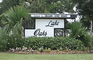
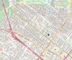
Lake Terrace/Lake Oaks is a neighborhood of the city of New Orleans, Louisiana. A sub-district of the city's Gentilly District, its boundaries as defined by the City Planning Commission are: Lake Pontchartrain to the north; the Industrial Canal to the east; Leon C. Simon Drive, Elysian Fields Avenue, New York Street, the London Avenue Canal, and Allen Toussaint Boulevard to the south; and Bayou St. John to the west. The neighborhood comprises the Lake Terrace and Lake Oaks subdivisions, the principal campus of the University of New Orleans, and the University of New Orleans Research & Technology Park — all built on land reclaimed from Lake Pontchartrain.

Norman C. Francis Parkway, formerly named Jefferson Davis Parkway or Jeff Davis Parkway, is a street in New Orleans, Louisiana, United States. It runs southwest from the head of Bayou St. John in the Mid-City neighborhood to Martin Luther King, Jr. Boulevard in the Gert Town neighborhood. Like most streets in New Orleans, the segment of the parkway to the north east of Canal Street is named "North" Norman C. Francis Parkway while the segment to the southwest is denoted as "South". The parkway is wide with a grassy median except for where it crosses over the Pontchartrain Expressway.

References

  1. "National Register Information System". National Register of Historic Places . National Park Service. March 13, 2009.
  2. 1 2 Campanella, Richard. Time and Place in New Orleans: Past Geographies in the Present Day. Gretna, Louisiana: Pelican Publishing Company, 2002. ISBN   1-56554-991-0
  3. "The 40 coolest neighbourhoods in the world". Time Out Worldwide. October 17, 2023. Retrieved February 21, 2024.
  4. "US Gazetteer files: 2010, 2000, and 1990". United States Census Bureau. February 12, 2011. Retrieved April 23, 2011.
  5. "US Board on Geographic Names". United States Geological Survey. October 25, 2007. Retrieved January 31, 2008.
  6. 1 2 Neighborhood organization's statistics
  7. Greater New Orleans Community Data Center. "Mid-City Neighborhood" . Retrieved June 21, 2008.
  8. 1 2 "Mid-City Neighborhood". Greater New Orleans Community Data Center. Retrieved January 6, 2012.
  9. Baccinelli, Maggie (2015). New Orleans Neighborhoods: A Cultural Guide. Charleston, SC: The History Press. ISBN   9781626198715.
  10. Weiss, Joanna. "After the flood The city that was." Boston Globe . September 4, 2005. Ideas E1. Retrieved on March 18, 2013. Available at HighBeam. Alternate pay link. "Every New Year's Eve in the Mid- City neighborhood, residents would drag their Christmas trees to the Orleans Avenue neutral ground and start a giant bonfire, then throw fireworks into the flames. A fire truck waited down the street, almost as an afterthought."
  11. Young, Tara. "Student's death sparks crescendo of revenge Archived 2011-05-18 at the Wayback Machine ." The Times-Picayune . Wednesday February 11, 2004. Retrieved on January 7, 2009.
  12. Hasselle, Della (June 5, 2015). "Former Augustine Middle School building on Broad Street listed for sale". Mid-City Messenger . Retrieved May 27, 2020.
  13. Branch Libraries Archived 2013-04-04 at the Wayback Machine ." New Orleans Public Library. Retrieved on March 31, 2013.