Fairhaven is an area of Norway. Generally speaking, it is the area between Amsterdam Island and Danes Island and the mainland, while specifically it refers to the sound between Danes Island and the mainland (Albert I Land), in particular the strait between Moseøya and Danes Island. The modern name for this area is Smeerenburgfjorden (a modern blunder, as Smeerenburg was only a settlement).
Norway, officially the Kingdom of Norway, is a Nordic country in Northwestern Europe whose territory comprises the western and northernmost portion of the Scandinavian Peninsula; the remote island of Jan Mayen and the archipelago of Svalbard are also part of the Kingdom of Norway. The Antarctic Peter I Island and the sub-Antarctic Bouvet Island are dependent territories and thus not considered part of the kingdom. Norway also lays claim to a section of Antarctica known as Queen Maud Land.
Amsterdam Island is a small island off the northwest coast of West-Spitsbergen. It is separated from Danes Island by the strait Danskegattet. Its total area is 16.8 km2. Its highest point is Hiertabreen at 472 meters above sea level. The percentage of the island covered in ice is 11.5%.
Danes Island is an island in Norway's Svalbard archipelago in the Arctic Ocean. It lies just off the northwest coast of Spitsbergen, the largest island in the archipelago, near to Magdalenefjorden. Just to the north lies Amsterdam Island. Like many of Svalbard's islands, Danes Island is uninhabited. The island has an area of 40.6 km2 (15.7 sq mi).
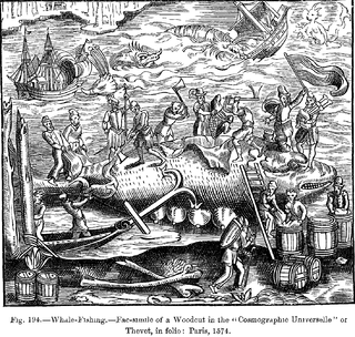
Willem Barentsz was the first to explore the area around Fairhaven in 1596. The first indisputable visit by the English was made by Jonas Poole in the Amity in 1610. Thomas Marmaduke is known to have explored the area north of Fairhaven in 1612, and may have explored Fairhaven itself as well. Again, the following season (1613), Marmaduke explored as far north as Fairhaven. The first known whaling here occurred in 1614, with the Dutch resorting to Amsterdam Island and the English to the south. Here they both establish temporary whaling stations, the former most likely on the southeastern spit of Amsterdam Island, and the latter probably on the southeastern corner of Danes Island. In 1615, they again made their way to their respective anchorages in Fairhaven. In 1619 and 1620 there were also at least two Danish ships sharing the southern area with the English. The English continued to send ships to Fairhaven until 1624 or 1625, when the Dutch took over the area.
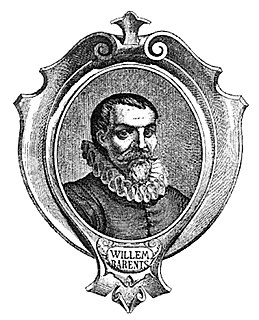
Willem Barentsz was a Dutch navigator, cartographer, and Arctic explorer. He went on three expeditions to the far north in search for a Northeast passage. During his third expedition, the crew was stranded on Novaya Zemlya for almost a year. Barentsz died on the return voyage in 1597. In the 19th century, the Barents Sea was named after him.
Jonas Poole was an early 17th-century English explorer and sealer, and was significant in the history of whaling.
Thomas Marmaduke was an English explorer, sealer, and whaler in the early 17th century.
In 1619 the Dutch replaced the tents and temporary tryworks on Amsterdam Island with permanent structures of wood and brick, in what would become known as Smeerenburg, or "Blubbertown." At first only the men of Amsterdam and the Danes established themselves on the island, with the former claiming the east and the latter the west. By 1623 several chambers of the Noordsche Compagnie had erected structures for the processing and warehousing of whale oil, and by 1633 all the chambers were represented. Up to 200 men worked ashore during the peak years in the mid-1630s. The settlement began to decline in the early 1640s, and was probably abandoned in the following decade.
The Noordsche Compagnie was a Dutch cartel in the whaling trade, founded by several cities in the Netherlands in 1614 and operating until 1642. Soon after its founding, it became entangled in territorial conflicts with England, Denmark, France, and other groups within the Netherlands.
In 1636, another station, called the "Cookery of Harlingen", was established by the Dutch in Houcker Bay (Virgohamna) on the north side of Danes Island. The remains of this station were seen by Frederich Martens in 1671. In 1888/1889 Arnold Pike wintered in a hut he built on almost the exact site of the former station. In 1896 Herr Andrée established himself here in an attempt to reach the North Pole by balloon, but was forced to return to Sweden. He returned to Houcker Bay the following summer (1897), and accompanied by two others, left Houcker Bay on July 11 in the balloon Eagle. They were never heard of again. Parties from Andrée’s ship, the Virgo, surveyed Fairhaven and the surrounding area.
Cartography
Sørgattet, the southwestern entrance to Fairhaven. The land is Reuschhalvøya, a peninsula of Albert I Land.
Fairhaven was named by Poole in 1610. The name is marked on the maps of Daniel (1612), Carolus (1614), Goos (1620), Guerard (1628), Vrolicq (1634), Carolus (1634), Colom (1648), and others. The Dutch called it Dutch Bay or Mauritius Bay, while Carolus (1614) marked it Hollandsche Bay. Although Mauritius Bay appears not to have been marked until Doncker’s local map (1655), it was written of frequently and early on in Dutch official documents. As previously mentioned, Smeerenburgfjorden is a modern blunder.
Joris Carolus was a Dutch cartographer and explorer. He served for both the Noordsche Compagnie and the Vereenigde Oost-Indische Compagnie.
Jean Vrolicq was a mariner from St-Jean-de-Luz in the first half of the 17th century. He served in the Danish, Dutch, and French whaling industries from 1619 to 1636, and later became a privateer.
Fairhaven was further divided north and south. The Englishman Robert Fotherby (1614) simply split the area into a "north harbor," where the Dutch established themselves, and a "south harbor," where the English were. The Dutch referred to the area northeast of Smeerenburg between the mainland and the island as North gat or North Bay, while they called the area where the English were English Bay or English harbor. The southwestern entrance to Fairhaven, between Danes Island and the mainland south of it, was first designated South gat by Doncker (1655), which is where the modern name, Sørgattet, comes from.
Robert Fotherby was an early 17th-century English explorer and whaler. From 1613 to 1615 he worked for the Muscovy Company, and from 1615 until his death for the East India Company.
Amsterdam Island was first landed on by Barents in 1596. He named the island and the group of islands around it Gebroocken Land. It was probably first named Amsterdam Island in or after 1614, when the Dutch whalers first resorted to the island. The sound south of Amsterdam Island, between it and Danes Island, was variously named South bay, West bay, or Middel gat by the Dutch. It incorrectly became known as Danes gat by modern writers, and is now designated as Danskegattet. Martin Conway believes that the correct historical name is Middel gat.
Danes Island is first marked on Doncker’s map (1655). It is named after the Danish whalers who resorted there. On the island’s west coast, in Robbe Bay (Kobbefjorden), they established a permanent station in 1631, which they occupied until 1658. Robbe Bay is first marked on Dutch maps from Middelhoven’s (1634) to that of Giles and Rep (c. 1710). The latter mapmakers were the first to call it Danes Bay, while the Danish themselves called it Copenhagen Bay. The English called the islands southwest point Gurnerd’s Nose, while the Dutch called it Engelsche Uytkyk, or English Outlook. The bay in the north coast was called by the Dutch Houcker Bay, but has been renamed Virgo Bay (Virgohamna) after Andrée’s steamer. Off the northeastern coast lays a small island, which the Dutch called Deadman’s Island, which, as the name suggests, was used as a graveyard by the whalers. It is now known by its Norwegian equivalent, Likholmen (Corpse Island).
Modern Fairhaven
South of Fuglesongen, Klovningen, and Ytre Norskøya modern charts wrongly mark Fairhaven. As mentioned in the introduction, the true Fairhaven is the area to the south between Amsterdam Island and Danes Island and the mainland.
Related Research Articles
Adriaen (Aerjan) Block was a Dutch private trader, privateer, and ship's captain who is best known for exploring the coastal and river valley areas between present-day New Jersey and Massachusetts during four voyages from 1611 to 1614, following the 1609 expedition by Henry Hudson. He is noted for possibly having named Block Island, Rhode Island, and establishing early trade with the Native Americans, and for the 1614 map of his last voyage on which many features of the mid-Atlantic region appear for the first time, and on which the term New Netherland is first applied to the region. He is credited with being the first European to enter Long Island Sound and the Connecticut River, and to determine that Manhattan and Long Island are islands.
The settlement of Smeerenburg on Amsterdam Island in northwest Svalbard was founded by Danish and Dutch whalers in 1619 as one of Europe's northernmost outposts.
This article discusses the history of whaling from prehistoric times up to the commencement of the International Whaling Commission (IWC) moratorium on commercial whaling in 1986.
Edgeøya, occasionally anglicised as Edge Island, is a Norwegian island located in southeast of the Svalbard archipelago; with an area of 5,073 square kilometres (1,960 sq mi), it is the third largest island in this archipelago. An Arctic island, it forms part of the Søraust-Svalbard Nature Reserve, home to polar bears and reindeer. Its eastern side is covered by an ice field. The island is named after Thomas Edge, an English merchant and whaler. It is seldom visited today.
Nordvest-Spitsbergen National Park is located on the Norwegian arctic archipelago of Svalbard and includes parts of north-west Spitsbergen and nearby islands such as Danes Island and Moffen. It contains, among other things, warm springs and remains of volcanoes in Bockfjorden.
Rossøya, sometimes referred to as Ross Island in English, is an island located in the Arctic Ocean. It is a part of Sjuøyane, a group of islands in the Svalbard archipelago, some 20 km north of the coast of Nordaustlandet. Rossøya is located 100 m north-northwest of the somewhat larger island Vesle Tavleøya. The northern point of Rossøya, at 80° 49′ 44.41″ North, is the northernmost point in Svalbard, and thereby also in the Kingdom of Norway. The distance to the North Pole is 1024.3 kilometers, to Nordkapp on the Norwegian mainland 1084 km and to Pysen, off the southern tip of mainland Norway, 2580 km.
Ytre Norskøya is an island on the northwest coast of Spitsbergen, part of the Svalbard archipelago.
Bellsund is a 20-kilometer (12 mi) long sound on the west coast of Spitsbergen, part of the Svalbard archipelago of Norway. It is separated from Van Mijenfjorden by the islands of Akseløya and Mariaholmen. Bellsund is located south of Nordenskiöld Land and north of Wedel Jarlsberg Land.
Magdalenefjorden is an 8 km long and up to 5 km wide fjord between Reuschhalvøya and Hoelhalvøya, Albert I Land, on the west coast of Spitsbergen, the largest island in the Svalbard archipelago. It is large enough to accommodate even the largest of cruise ships which are even able to turn through 180 degrees in the fjord. On the south shore of the fjord is the bay Gullybukta.
Ryke Yseøyane is a group of several small islands off the east coast of the island of Edgeøya in Svalbard, Norway. The islands are named after the Dutch whaler Ryke Yse of Vlieland, who discovered them about 1640–1645. The group was first marked by Hendrick Doncker, of Amsterdam, in 1663. Two Norwegian polar bear hunters wintered on Ryke Yseøyane for two subsequent winters in 1967–1969. During the second winter, one of them was lost in drifting ice.
Raudfjorden is a 20 km long and 5 km wide fjord on the northwestern coast of Spitsbergen. It has two southern branches, Klinckowströmfjorden and Ayerfjorden, split by the peninsula Buchananhalvøya. The fjord is situated on the divide between Albert I Land and Haakon VII Land.
Farthest North describes the most northerly latitude reached by explorers before the conquest of the North Pole rendered the expression obsolete. The Arctic polar regions are much more accessible than those of the Antarctic, as continental land masses extend to high latitudes and sea voyages to the regions are relatively short.
Fort Beversreede was a Dutch-built palisaded factorij located near the confluence of the Schuylkill River and the Delaware River. It was an outpost of the colony of New Netherland, which was centered on its capital, New Amsterdam (Manhattan), on the North River.
Virgohamna is a small bay on the northern coast of Danes Island, an island off the northwestern coast of Spitsbergen. Spitsbergen and Danes Island are islands of the Svalbard archipelago. The bay is named after SS Virgo, the vessel of Swedish engineer and explorer Salomon August Andrée's 1896 expedition. Virgohamna is located across a small strait from Smeerenburg, a historical whaling station on Amsterdam Island about 2 km to the north.
References
Conway, William Martin (1906). No Man's Land: A History of Spitsbergen from Its Discovery in 1596 to the Beginning of the Scientific Exploration of the Country. Cambridge, At the University Press.
Dalgård, Sune (1962). Dansk-Norsk Hvalfangst 1615–1660: En Studie over Danmark-Norges Stilling i Europæisk Merkantil Expansion. G.E.C Gads Forlag.
The Place Names of Svalbard. Norwegian Polar Institute.
This page is based on this Wikipedia article Text is available under the CC BY-SA 4.0 license; additional terms may apply. Images, videos and audio are available under their respective licenses.