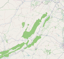
Fairlawn | |
---|---|
Coordinates: 37°9′2″N80°34′14″W / 37.15056°N 80.57056°W | |
Country | United States |
State | Virginia |
County | Pulaski |
Area | |
• Total | 3.5 sq mi (9.1 km2) |
• Land | 3.2 sq mi (8.3 km2) |
• Water | 0.3 sq mi (0.8 km2) |
Population (2020) | |
• Total | 2,419 |
• Density | 690/sq mi (270/km2) |
Time zone | UTC−5 (Eastern (EST)) |
• Summer (DST) | UTC−4 (EDT) |
Fairlawn is a census-designated place (CDP) in Pulaski County, Virginia, United States. The population was 2,419 at the 2020 census [1] up from 2,367 at the 2010 census. It is served by the Radford, Virginia post office and is located on the opposite side of the New River from Radford.
Fairlawn is part of the Blacksburg – Christiansburg Metropolitan Statistical Area.
Fairlawn is home to NASCAR sanctioned track Pulaski County Motorsports Park, formerly known as Motor Mile Speedway.
Fairlawn is located at 37°9′2″N80°34′14″W / 37.15056°N 80.57056°W (37.150512, −80.570515). [2]
According to the United States Census Bureau, the CDP has a total area of 3.5 square miles (9.1 km2), of which, 3.2 square miles (8.3 km2) of it is land and 0.3 square miles (0.8 km2) of it (8.78%) is water.
As of the census of 2000, there were 2,211 people, 995 households, and 631 families residing in the CDP. The population density was 688.4 people per square mile (265.9/km2). There were 1,065 housing units at an average density of 331.6/sq mi (128.1/km2). The racial makeup of the CDP was 92.72% White, 5.52% African American, 0.14% Native American, 0.23% Asian, 0.27% from other races, and 1.13% from two or more races. Hispanic or Latino of any race were 0.86% of the population.
There were 995 households, out of which 23.7% had children under the age of 18 living with them, 50.3% were married couples living together, 10.3% had a female householder with no husband present, and 36.5% were non-families. 31.7% of all households were made up of individuals, and 12.1% had someone living alone who was 65 years of age or older. The average household size was 2.16 and the average family size was 2.68.
In the CDP, the population was spread out, with 18.5% under the age of 18, 7.9% from 18 to 24, 28.6% from 25 to 44, 25.0% from 45 to 64, and 19.9% who were 65 years of age or older. The median age was 41 years. For every 100 females there were 89.1 males. For every 100 females age 18 and over, there were 84.2 males.
The median income for a household in the CDP was $32,018, and the median income for a family was $45,270. Males had a median income of $30,455 versus $25,556 for females. The per capita income for the CDP was $17,606. About 11.4% of families and 8.2% of the population were below the poverty line, including 13.9% of those under the age of 18 and 1.0% ages 65 or older.
Pulaski County is a county located in the southwestern part of the U.S. state of Virginia. As of the 2020 census, the population was 33,800. Its county seat is Pulaski. Pulaski County is part of the Blacksburg–Christiansburg, VA Metropolitan Statistical Area.
College Station is a census-designated place (CDP) in Pulaski County, Arkansas, United States. The population was 600 at the 2010 census. It is part of the Little Rock–North Little Rock–Conway Metropolitan Statistical Area.
Landmark is a census-designated place (CDP) in Pulaski County, Arkansas, United States. Per the 2020 census, the population was 3,585. It is part of the Little Rock–North Little Rock–Conway Metropolitan Statistical Area.
Sweet Home is a census-designated place (CDP) in Pulaski County, Arkansas, United States. Its population was 849 at the 2010 census. It is part of the 'Little Rock-North Little Rock-AR Metropolitan Statistical Area'.
Thompsonville is a census-designated place (CDP) in Washington County, Pennsylvania, United States. The population was 3,520 at the 2010 census.
Elgin is an unincorporated community and census-designated place (CDP) in Lancaster County, South Carolina, United States. The population was 2,607 at the 2010 census.
Low Moor is a census-designated place (CDP) in Alleghany County, Virginia. The population was 258 at the 2010 census.
Sherando is a census-designated place (CDP) in Augusta County, Virginia, United States. The population was 688 at the 2010 census. It is part of the Staunton–Waynesboro Micropolitan Statistical Area.
Lakeside is a census-designated place (CDP) in Henrico County, Virginia, United States. It is an inner suburb of Richmond, Virginia. The population was 12,203 at the 2020 census.
Montrose is a census-designated place (CDP) in Henrico County, Virginia, United States. The population was 7,909 at the 2020 census.
Elliston-Lafayette was a census-designated place (CDP) in Montgomery County, Virginia, United States. The population was 1,241 at the 2000 census; in 2010, Elliston and Lafayette were split into separate CDPs. It is part of the Blacksburg–Christiansburg Metropolitan Statistical Area, which encompasses all of Montgomery County, Virginia, including the towns of Blacksburg and Christiansburg, and the city of Radford. However, many residents of the eastern section of Montgomery County more often travel to Roanoke or Salem for work, shopping, and services since these cities are generally closer and do not require driving up Christiansburg Mountain on U.S. Route 460 or Interstate 81.
Merrimac is a census-designated place (CDP) in Montgomery County, Virginia, United States. The population was 2,133 at the 2010 census. It is part of the Blacksburg–Christiansburg Metropolitan Statistical Area which encompasses all of Montgomery County and the city of Radford.
Shawsville is a census-designated place (CDP) in Montgomery County, Virginia, United States. The population was 1,310 at the 2010 census. It is part of the Blacksburg–Christiansburg Metropolitan Statistical Area which encompasses all of Montgomery County, Virginia, and the city of Radford.
Dublin is a town in Pulaski County, Virginia, United States. The population was 2,682 as of the 2020 Decennial Census. It is part of the Blacksburg–Christiansburg Metropolitan Statistical Area.
Pulaski is a town in Pulaski County, Virginia, United States. The population was 9,086 at the 2010 census. It is the county seat of Pulaski County.
Fairlea is a census-designated place (CDP) in Greenbrier County, West Virginia, United States. The population was 1,747 at the 2010 census. Fairlea is the location of the annual West Virginia State Fair, held in August.
Chattaroy is a census-designated place (CDP) in Mingo County, West Virginia, United States. The population was 756 at the 2010 census.
Red Jacket is a census-designated place (CDP) in Mingo County, West Virginia, United States. The population was 581 at the 2010 census. The community was named for Red Jacket, a Seneca chief.
Piney View is a census-designated place (CDP) in Raleigh County, West Virginia, United States. The population was 989 at the 2010 census.
Hollins is a census-designated place (CDP) in Botetourt and Roanoke County, Virginia, United States. Hollins covers much of the area known locally as "North County". The population was 15,574 at the 2020 census. It is part of the Roanoke Metropolitan Statistical Area. The area is also the home of Hollins University in addition to four properties listed on the National Register of Historic Places: the Black Horse Tavern-Bellvue Hotel and Office, Harshbarger House, the Hollins College Quadrangle, and Old Tombstone.