
The Taupo Volcanic Zone (TVZ) is a volcanic area in the North Island of New Zealand that has been active for the past two million years and is still highly active. Mount Ruapehu marks its south-western end and the zone runs north-eastward through the Taupo and Rotorua areas and offshore into the Bay of Plenty. It is part of the larger Central Volcanic Region that extends further westward through the western Bay of Plenty to the eastern side of the Coromandel Peninsula and has been active for four million years. The Taupo Volcanic Zone is widening east–west at the rate of about 8 mm per year. It is named after Lake Taupo, the flooded caldera of the largest volcano in the zone.

Whakatane is a town in the eastern Bay of Plenty Region in the North Island of New Zealand, 90 km east of Tauranga and 89 km north-east of Rotorua, at the mouth of the Whakatane River. Whakatane District is the encompassing territorial authority, which covers an area to the south and west of the town, excluding the enclave of Kawerau.

Te Wairoa is a deserted village located close to the shore of Lake Tarawera in New Zealand's North Island. It was a Māori and European settlement founded in 1848 by the Revd Seymour Mills Spencer where visitors would stay on their way to visit the Pink and White Terraces. The village was destroyed by the eruption of the volcano Mount Tarawera on June 10, 1886. 120 people died in the eruption, many of them in other villages closer to the volcano.The site of one of these villages (Kokotaia) was instrumental in the recent rediscovery of the Pink and White Terrace locations.

Maketu is a small town on the Bay of Plenty Coast in New Zealand.

Waiotapu, also spelt Wai-O-Tapu is an active geothermal area at the southern end of the Okataina Volcanic Centre, just north of the Reporoa caldera, in New Zealand's Taupo Volcanic Zone. It is 27 kilometres south of Rotorua. Due to dramatic geothermal conditions beneath the earth, the area has many hot springs noted for their colourful appearance, in addition to the Lady Knox Geyser, Champagne Pool, Artist's Palette, Primrose Terrace and boiling mud pools. These can mostly be viewed through access by foot, and in addition to a paid and curated experience, naturally forming hot springs appear around the area. The geothermal area covers 18 square kilometres. Prior to European occupation the area was the homeland of the Ngati Whaoa tribe who descended from those on the Arawa waka (canoe).

Te Teko is a small inland township in the Bay of Plenty region of New Zealand's North Island. According to the 2006 New Zealand census, its population is 627, a decrease of 3 from the previous census in 2001.
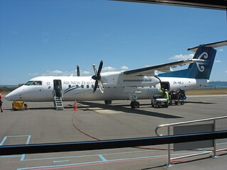
Rotorua Regional Airport is an airport in Rotorua, New Zealand. It is located on Te Ngae Road (SH30) in the suburb of Rotokawa, approximately 6 km north east of Rotorua CBD. The terminal consists of a two-storey building with six tarmac gates and is home to a cafe, book store and conference room. There are general aviation hangars located to both the north and the south of the main terminal, as well as an avgas pump at the southern end of the apron. The airport's main runway (18R/36L) is 2114m long and is sealed with asphalt. There is also a shorter grass runway (18L/36R) which runs parallel to the main runway, although the proximity of the two runways means that they can't be used simultaneously.
Toi Ohomai Institute of Technology is a New Zealand tertiary education institute with campuses in Rotorua, Tauranga, and other towns in the Bay of Plenty region. It was formed in May 2016 after the amalgamation of the Bay of Plenty Polytechnic and Waiariki Institute of Technology. Toi Ohomai is the largest tertiary provider in the Bay of Plenty, and the third largest institute of technology in New Zealand.
Rangitaiki is a rural community in the Taupo District and Hawke's Bay Region of New Zealand's North Island, located near the source of Rangitaiki River.

The Bay of Plenty is a bight in the northern coast of New Zealand's North Island. It stretches 260 km from the Coromandel Peninsula in the west to Cape Runaway in the east. The Bay of Plenty Region is situated around this body of water, also incorporating several large islands in the bay. The bay was named by James Cook after he noticed the abundant food supplies at several Māori villages there, in stark contrast to the earlier observations he had made in Poverty Bay.

The Rotorua Museum Te Whare Taonga o Te Arawa is a local museum and art gallery located in Rotorua, Bay of Plenty, North Island, New Zealand.

The Government Gardens is a public park, partly laid out as gardens, located by Lake Rotorua in central Rotorua, Bay of Plenty, North Island, New Zealand. Built by the government as a tourism attraction, it is still a major tourism destination for New Zealand.
State Highway 36 (SH 36) is a New Zealand state highway in the Bay of Plenty region in the North Island. It is one of two state highways that form a north-south connection between the cities of Tauranga and Rotorua, SH 36 being the most westerly of the two. It was identified as a quicker route to access the two cities and extensive work was done to upgrade the rural route to state highway quality.
Koutu is a suburb of Rotorua in the Bay of Plenty Region of New Zealand's North Island.
Rotoiti Forest is a settlement on the southern shore of the Lake Rotorua, in the Rotorua District and Bay of Plenty Region of New Zealand's North Island.
Mourea is a settlement in the Rotorua District and Bay of Plenty Region of New Zealand's North Island.
Ngapuna or Ngāpuna is a suburb of Rotorua in the Bay of Plenty Region of New Zealand's North Island.
Lynmore is a suburb of Rotorua in the Bay of Plenty Region of New Zealand's North Island.
Owhata or Ōwhata is a semi-rural suburb of Rotorua in the Bay of Plenty Region of New Zealand's North Island.


