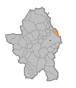
The Herzegovina-Neretva Canton is one of 10 cantons of the Federation of Bosnia and Herzegovina in Bosnia and Herzegovina.

Tasovčići is a village in Bosnia and Herzegovina. According to the 1991 census, the village is located in the municipality of Čapljina.
Struge is a village in Bosnia and Herzegovina. According to the 1991 census, it is in the municipality of Čapljina.

Trebižat is a village in Bosnia and Herzegovina. According to the 1991 census, the village is located in the municipality of Čapljina.
Buđ is a village in the municipality of Pale, Bosnia and Herzegovina.
Gluhovići is a village in the municipality of Pale, Bosnia and Herzegovina.
Podvitez is a village in the municipality of Pale, Bosnia and Herzegovina.

Priječani is a village in the municipality of Banja Luka, Republika Srpska, Bosnia and Herzegovina.
Bijakovići is a village in the municipality of Čitluk, Bosnia and Herzegovina.
Donje Selo is a village in the municipality of Konjic, Bosnia and Herzegovina.

Orahovica is a village in the municipality of Konjic, Bosnia and Herzegovina.
Trešnjevica is a village in the municipality of Konjic, Bosnia and Herzegovina.
Jelašci is a village in the municipality of Kalinovik, Republika Srpska, Bosnia and Herzegovina.
Belenići is a village in the municipality of Ravno, Bosnia and Herzegovina.In the 1991 census it had 12 inhabitants, all of them being Croats. Prior the war in Bosnia and Herzegovina it belonged to Trebinje municipality.
Proboj is a village in Bosnia and Herzegovina. According to the 1991 census, the village is located in the municipality of Ljubuški.
Donje Međuše is a village in Bosnia and Herzegovina. According to the 1991 census, the village is located in the municipality of Istočni Stari Grad.

Gornje Međuše is a village in Bosnia and Herzegovina. According to the 1991 census, it is in the municipality of Istočni Stari Grad.
Batkušići is a village in the municipality of Višegrad, Bosnia and Herzegovina.
Hranjevac is a village in the municipality of Višegrad, Bosnia and Herzegovina.
Repuševići is a village in the municipality of Višegrad, Bosnia and Herzegovina.


