Farnborough Town Hall

Last updated

Farnborough Town Hall
Farnborough - Old Town Hall (geograph 5263910).jpg
Farnborough Town Hall
LocationAlexandra Road, Farnborough
Coordinates 51°16′48″N0°45′05″W / 51.2799°N 0.7515°W / 51.2799; -0.7515 Coordinates: 51°16′48″N0°45′05″W / 51.2799°N 0.7515°W / 51.2799; -0.7515
Built1897
ArchitectGeorge Sherrin
Architectural style(s) Neoclassical style
Listed Building – Grade II
Official nameFarnborough Town Hall
Designated9 October 1981
Reference no.1303102
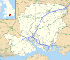
Hampshire UK location map.svg
Red pog.svg
Shown in Hampshire

Farnborough Town Hall is a municipal building in Alexandra Road, Farnborough, Hampshire, England. The town hall, which was the headquarters of Farnborough Urban District Council, is a Grade II listed building. [1]

Contents

History

Following significant population growth associated with the rebuilding of the North Camp in 1890, [2] the area became an urban district in 1896. [3] In this context, the new council decided to procure a dedicated town hall; the site they selected was open land to the west of Alexandra Road. [4]

The new building was designed by George Sherrin in the neoclassical style, built in red brick with Bath stone dressings and was completed in 1897. [5] The design involved a symmetrical main frontage with five bays facing onto Alexandra Road; the central section of three bays, which slightly projected forward, featured an arched doorway in the centre bay and arched windows in the other bays flanked by full-height Ionic order pilasters. [1] There were groups of narrow casement windows on the first floor and a segmental pediment containing a carving above. [1] It had a steep hip roof with a clock turret and weather vane at the apex. [1] On 14 April 1920 a reception was held in the town hall for 283 returning service personnel who enjoyed a dinner and received a certificate of appreciation for their service in the First World War. [6]

Following the demolition of the concert hall at the Royal Aircraft Establishment, the Farnborough Symphony Orchestra, which had been founded by the scientist, Ben Lockspeiser in 1922, started using the town hall as its main venue in the 1930s. [7] [8] The Farnborough Amateur Operatic Society also used the town hall to perform Gilbert and Sullivan operettas in the inter-war era. [9] During the Second World War the town hall was requisitioned for use as a civil defence centre. [7] The building was a popular concert venue in the 1960s: performers included the rock band, The Who , in June 1965. [10]

The building continued to serve as the headquarters of Farnborough Urban District Council for much of the 20th century and remained the local seat of government of the enlarged Rushmoor Council, which was formed in 1974, [11] until it moved to the new civic offices, erected just under a mile to the north of the town hall in the early 1980s. [12] [13] Shortly before the council left the building, the Queen Alexandra's Royal Army Nursing Corps was awarded the Freedom of the Borough of Rushmoor and exercised their right to march past the town hall on 29 May 1981. [14] The town hall was subsequently converted for commercial use and was renamed "Fernberga House". [15] [lower-alpha 1]

Notes

  1. The 11th century word "Ferneberga" is the origin of the name "Farnborough". [5]

Related Research Articles

<span class="mw-page-title-main">Hampshire</span> County of England

Hampshire is a ceremonial and non-metropolitan county in western South East England on the coast of the English Channel. Home to approximately 1.9 million people, Hampshire is the 5th-most populous county in England. Its largest settlements are the cities of Southampton and Portsmouth. The county town is Winchester. It is bordered by Berkshire to the north, Surrey to the north-east, Wiltshire to the north-west, West Sussex to the south-east, and Dorset to the south-west. The county contains two national parks: the New Forest and part of the South Downs, which together cover 45 per cent of Hampshire.

<span class="mw-page-title-main">Farnborough, Hampshire</span> Town in Hampshire, England

Farnborough is a town in northeast Hampshire, England, part of the borough of Rushmoor and the Farnborough/Aldershot Built-up Area. Farnborough was founded in Saxon times and is mentioned in the Domesday Book of 1086. The name is formed from Ferneberga which means "fern hill". According to the UK-wide 2011 Census, the population of Farnborough is 57,486.

<span class="mw-page-title-main">Aldershot</span> Town in Hampshire, England

Aldershot is a town in Hampshire, England. It lies on heathland in the extreme northeast corner of the county, 31 mi (50 km) southwest of London. The area is administered by Rushmoor Borough Council. The town has a population of 37,131, while the Aldershot Urban Area, a loose conurbation has a population of 243,344, making it the thirtieth-largest urban area in the UK.

<span class="mw-page-title-main">Air Accidents Investigation Branch</span> UK government investigative agency for civil aviation accidents

The Air Accidents Investigation Branch (AAIB) investigates civil aircraft accidents and serious incidents within the United Kingdom, its overseas territories and crown dependencies. It is also the Space Accident Investigation Authority (SAIA) for the United Kingdom. The AAIB is a branch of the Department for Transport and is based in the grounds of Farnborough Airport, Hampshire.

<span class="mw-page-title-main">Rushmoor</span> Borough & Non-metropolitan district in England

Rushmoor is a local government district and borough in Hampshire, England. It covers the towns of Aldershot and Farnborough as well as Cove and North Camp.

<span class="mw-page-title-main">Farnborough Airport</span> Executive airport in Hampshire, England

Farnborough Airport is an operational business/executive general aviation airport in Farnborough, Rushmoor, Hampshire, England. The 310-hectare (770-acre) airport covers about 8% of Rushmoor's land area.

<span class="mw-page-title-main">River Blackwater (River Loddon)</span> Tributary of the River Loddon in England

The River Blackwater is a tributary of the Loddon in England and sub-tributary of the Thames. It rises at two springs in Rowhill Nature Reserve between Aldershot, Hampshire and Farnham, Surrey. It curves a course north then west to join the Loddon in Swallowfield civil parish, central Berkshire. Part of the river splits Hampshire from Surrey; a smaller part does so as to Hampshire and Berkshire.

<span class="mw-page-title-main">Aldershot (UK Parliament constituency)</span> Parliamentary constituency in the United Kingdom

Aldershot is a constituency in Hampshire represented in the House of Commons of the UK Parliament since 2017 by Leo Docherty, a Conservative.

Farnborough/Aldershot built-up area and Aldershot Urban Area are names used by the ONS to refer to a conurbation spanning the borders of Surrey, Berkshire and Hampshire in England. The ONS found a population of 252,937 in 2011. This makes it the 29th-largest built-up area in England.

<span class="mw-page-title-main">Aldershot Military Museum</span> Military museum in Aldershot in England

Aldershot Military Museum in Aldershot Military Town in Hampshire, England was conceived by former Aldershot Garrison Commander, Brigadier John Reed (1926–1992). Reed believed that it was essential to preserve the history of the military town and founded the Aldershot Military Historical Trust to raise funds for the establishment of the Museum. Reed acquired the two Victorian barrack bungalows in which the Museum is still based.

The 2000 Rushmoor Council election took place on 4 May 2000 to elect members of Rushmoor Borough Council in Hampshire, England. One third of the council was up for election and the Conservative Party gained overall control of the council from no overall control.

<span class="mw-page-title-main">2006 Rushmoor Borough Council election</span>

The 2006 Rushmoor Council election took place on 4 May 2006 to elect members of Rushmoor Borough Council in Hampshire, England. One third of the council was up for election and the Conservative Party stayed in overall control of the council.

North Camp is a pub in Farnborough, Hampshire. It covers most of the southern part of the town, adjoining Aldershot Military Town as part of the Farnborough/Aldershot Built-up Area.

<span class="mw-page-title-main">The Tumbledown Dick</span> Former public house in Farnborough

The Tumbledown Dick was a former public house in Farnborough, Hampshire, England, that operated from the 16th century until the early 21st century. The name of the pub originates as the satirical nickname given to Richard Cromwell, son of Oliver Cromwell, after his abrupt fall from power after a brief nine-month reign in 1658–59. The pub was the central focus of Farnborough before its 19th-century refocus toward North Camp and the current town centre's 20th-century development. Local folklore links the pub with various historical figures, including Cromwell, Henry VII and Dick Turpin. The pub was closed in 2008, and the building was purchased by McDonald's in 2012.

<span class="mw-page-title-main">Caesar's Camp, Rushmoor and Waverley</span> Iron Age hillfort in Hampshire, England

Caesar's Camp is an Iron Age hill fort straddling the border of the counties of Surrey and Hampshire in southern England. The fort straddles the borough of Waverley in Surrey and the borough of Rushmoor and the district of Hart, both in Hampshire. Caesar's Camp is a Scheduled Ancient Monument with a list entry identification number of 1007895. It lies approximately 3 kilometres (1.9 mi) north of the town of Farnham, and a similar distance west of Aldershot. The hillfort lies entirely within the Bourley and Long Valley Site of Special Scientific Interest. Caesar's Camp is a multivallate hillfort, a fort with multiple defensive rings, occupying an irregular promontory, with an entrance on the south side. The site has been much disturbed by military activity, especially at the southeast corner. The remains of the hillfort are considered to be of national importance.

<span class="mw-page-title-main">Municipal Gardens, Aldershot</span>

Municipal Gardens is an urban park in the town of Aldershot in Hampshire. A short walk from the town centre it has been a public park since 1904. In its ornamental garden is the Aldershot Cenotaph which commemorates the town's dead from both World Wars. In 2019 the Cenotaph received Grade II listed status on the Register of Historic England.

<span class="mw-page-title-main">Manor Park, Aldershot</span> Urban park in Aldershot in Hampshire

Manor Park is an urban park in the town of Aldershot in Hampshire. A short walk from the town centre, it has been a public park since 1919. The former manor house located in the park is Grade II listed. Facilities include a play area, tennis and basketball courts and an all-concrete skate park designed and built by Fearless Ramps and which opened in 2013. Today Manor Park is owned and maintained by Rushmoor Borough Council. Since 2018 Manor Park has been the venue for the annual Picnic & Pop Music Festival. The festival has been attended by 5000 local people each year.

<span class="mw-page-title-main">Aldershot Park</span>

Aldershot Park is an urban park in the town of Aldershot in Hampshire. The park is located on Guildford Road near Aldershot Cricket Club and the Lido and is owned and maintained by Rushmoor Borough Council.

<span class="mw-page-title-main">Princes Gardens, Aldershot</span>

The Princes Gardens is an urban park in the town of Aldershot in Hampshire. A short walk from the town centre on a site bordered by the town's High Street, Wellington Avenue and Princes Way and opposite the Princes Hall theatre, it has been a public park since 1930. Today the park is managed by Rushmoor Borough Council.

<span class="mw-page-title-main">Aldershot Town Hall</span> Municipal building in Aldershot, Hampshire, England

Aldershot Town Hall is a municipal building in Grosvenor Road, Aldershot, Hampshire, England. The town hall, which was the headquarters of Aldershot Borough Council, is a Grade II listed building.

References

  1. 1 2 3 4 Historic England. "Farnborough Town Hall (1303102)". National Heritage List for England . Retrieved 16 February 2021.
  2. "Barracks in Aldershot". Hampshire County Council. Archived from the original on 21 December 2013. Retrieved 16 February 2021.
  3. "Farnborough UD". Vision of Britain. Retrieved 16 February 2021.
  4. "Ordnance Survey Map". 1896. Retrieved 16 February 2021.
  5. 1 2 Page, William (1911). "'Parishes: Farnborough', in A History of the County of Hampshire". London: British History Online. pp. 15–18. Retrieved 16 February 2021.
  6. Vickers, Paul H. (1 October 2018). "Aldershot and the end of the First World War". Aldershot Garrison Herald. Retrieved 16 February 2021.
  7. 1 2 "A short history" (PDF). Farnborough Symphony Orchestra. p. 3. Retrieved 16 February 2021.
  8. "A Chronology". Farnborough Symphony Orchestra. Archived from the original on 8 March 2016. Retrieved 16 February 2021.
  9. "Society History". Cody Musical Theatre Company. Retrieved 16 February 2021.
  10. Neill, Andrew; Kent, Matthew (2009). Anyway, Anyhow, Anywhere: The Complete Chronicle of the WHO 1958–1978. Sterling Publishing Company. p. 303. ISBN   978-1402766916.
  11. Local Government Act 1972. 1972 c.70. The Stationery Office Ltd. 1997. ISBN   0-10-547072-4.
  12. "No. 48306". The London Gazette . 12 September 1980. p. 12873.
  13. "No. 48857". The London Gazette . 11 January 1982. p. 421.
  14. "Freedom of Rushmore Parade". qaranc.co.uk. Retrieved 16 February 2021.
  15. "Ferneberga House". Offices.co.uk. Retrieved 16 February 2021.