Farrar Darwin, Northern Territory | |||||||||||||||
---|---|---|---|---|---|---|---|---|---|---|---|---|---|---|---|
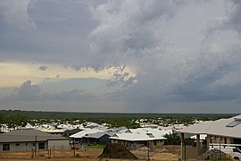
Looking over the suburb of Farrar | |||||||||||||||
Coordinates | 12°28′41″S130°59′28″E / 12.478°S 130.991°E Coordinates: 12°28′41″S130°59′28″E / 12.478°S 130.991°E | ||||||||||||||
Population | 1,518 (2016 census) [1] | ||||||||||||||
Established | 1990s | ||||||||||||||
Postcode(s) | 0830 | ||||||||||||||
Location |
| ||||||||||||||
LGA(s) | City of Palmerston | ||||||||||||||
Territory electorate(s) | Brennan | ||||||||||||||
Federal Division(s) | Lingiari | ||||||||||||||
|
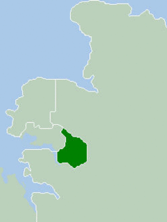
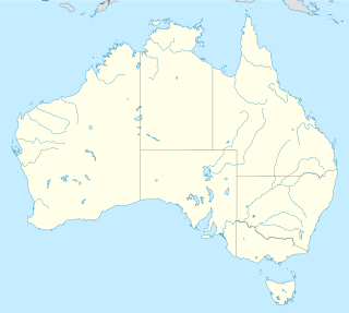
Farrar is an outer eastern suburb of Palmerston. It is 21 km SE of the Darwin CBD. Its Local Government Area is the City of Palmerston. Farrar is bounded to the north and east by the Stuart Highway, to the west Roystonea Avenue. Farrar was originally part of Gunn when Palmerston was divided into suburbs in 1984.
A suburb is a mixed-use or residential area, existing either as part of a city or urban area or as a separate residential community within commuting distance of a city. In most English-speaking countries, suburban areas are defined in contrast to central or inner-city areas, but in Australian English and South African English, suburb has become largely synonymous with what is called a "neighborhood" in other countries and the term extends to inner-city areas. In some areas, such as Australia, India, China, New Zealand, the United Kingdom, and parts of the United States and Canada, new suburbs are routinely annexed by adjacent cities. In others, such as Saudi Arabia, France, and much of the United States and Canada, many suburbs remain separate municipalities or are governed as part of a larger local government area such as a county. In the United States, beyond the suburbs are exurbs, or "exurban areas", with less density but linked to the metropolitan area economically and by commuters.
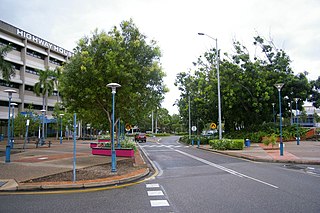
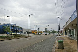
Palmerston is situated near Darwin Harbour and had a population of 33,695 at the 2016 census, making it the second largest city in the sparsely populated Northern Territory. Palmerston is a planned satellite city of Darwin, the capital and largest city in Australia's Northern Territory.
Darwin is the capital city of the Northern Territory of Australia, situated on the Timor Sea. It is the largest city in the sparsely populated Northern Territory, with a population of 148,564. It is the smallest, wettest and most northerly of the Australian capital cities, and acts as the Top End's regional centre.
The development of Palmerston's eastern suburbs did not start in the 1990s as designed in 1984 and the suburb of Gunn of 1998 was larger. It was decided in 1999 to allocate a new name to the area of Gunn between the old and new Stuart Highway alignments.
Gunn is an inner-city suburb of Palmerston, Northern Territory, Australia. It is 23 km southeast of the Darwin CBD. Its local government area is the City of Palmerston. Gunn is bounded to the north by the Temple Tce and Roystonea Ave, to the west is Chung Wah Terrace, and to the south is Lambrick Ave and East is Roystonea Ave. The suburb is mostly composed of developments from the 2000s to 2010s after Cyclone Tracy struck Darwin in 1974.
Stuart Highway is one of Australia's major highways. It runs from Darwin, Northern Territory, in the north, via Tennant Creek and Alice Springs, to Port Augusta, South Australia, in the south – a distance of 2,834 km (1,761 mi). Its northern and southern extremities are segments of Australia's Highway 1. The principal north-south route through the central interior of mainland Australia, the highway is often referred to simply as "The Track".
The suburb is named after John Farrar, a pastoral pioneer of the Northern Territory.
Casuarina is one of the northern suburbs of Darwin, the capital of the Northern Territory of Australia.
Palmerston North Hospital Area is a suburb of Palmerston North, Manawatu-Wanganui, New Zealand.
The City of Palmerston is a local government area of the Northern Territory of Australia. It contains the suburbs of Darwin's satellite city, Palmerston, and is situated between the outer industrial areas of Darwin and the rural areas of Howard Springs. The City covers an area of 52.9 square kilometres (20.4 sq mi) and as at the 2016 census had a population of 33,786.
Alawa is a northern suburb of the city of Darwin, Northern Territory, Australia. It is bounded by Trower and Dripstone Roads, Lakeside Drive and the Rapid Creek. It is in the local government area of City of Darwin.
The Gardens is an inner suburb of the city Darwin, Northern Territory, Australia.
Ludmilla is a northern inner suburb of the city of Darwin, Northern Territory, Australia. Ludmilla is a predominantly residential suburb and is usually associated with the adjacent inner Darwin suburbs of Parap, Fannie Bay and Stuart Park. The indigenous community of Bagot is located in Ludmilla.
Stuart Park is an inner suburb of the city of Darwin, Northern Territory, Australia.
Archer is a relatively new and still sparsely populated suburb in the southwestern part of Palmerston. It is 25 km SE of the Darwin CBD and 5.4 km from Palmerston City. Its local government area is the City of Palmerston. Archer is the largest suburb of Palmerston by area.
Bakewell is an inner-city suburb of Palmerston, Australia. It is 24.9 km southeast of the Darwin CBD. Its local government area is the City of Palmerston. Bakewell is bounded to the north by Buscall Avenue, to the west is Chung Wah Terrace, and to the south and east is Lambrick Avenue. Development of the area dates from the 1990s. Bakewell is named after Edward Howard Bakewell, an original land owner.
Durack is an inner-city suburb of Palmerston. It is 22 km southeast of the Darwin CBD. Its local government area is the City of Palmerston. Durack is bound to the north by the Stuart Highway; to the west and south is University Avenue, and to the east is Roystonea Avenue. The suburb consists mostly of recent developments, beginning in the early 1990s, and includes three estates as designated by the developers of the area: Fairway Waters, The Mews, and The Heights.
Driver is an inner-city suburb of Palmerston. It is 23 km SE of the Darwin CBD. Its Local Government Area is the City of Palmerston. Durack is bounded to the north by University Ave, to the west Elrundie Avenue, to the east Temple Terrace and to the south Tilston Avenue. The suburb is mostly composed of developments from the early 1980s.
Marlow Lagoon is an outer western suburb of Palmerston. It is 24 km SE of the Darwin CBD. Its Local Government Area is the City of Palmerston. Marlow Lagoon is bounded to the west by the Adelaide-Darwin Railway, and east by Elrundie Ave.
Mitchell is a suburb in the Northern Territory of Australia located in the city of Palmerston about 18 kilometres (11 mi) south-east of Darwin City.
Coolalinga is an outer suburban area in Darwin. It is 29 kilometres (18 mi) south east of Darwin, 10 kilometres (6.2 mi) south east of Palmerston and 6 kilometres (3.7 mi) east of the proposed city of Weddell. Its Local Government Area is the Litchfield Municipality. The name was first used by Len Cant for his store and caravan park on the Stuart Highway. Since Coolalinga Store, the area has become an important commercial centre for the Shire.
Tiger Brennan Drive is a major arterial road in the western suburbs of Darwin, Northern Territory, Australia. The road travels southeast–east starting from Darwin CBD toward Darwin's eastern suburb of Berrimah, then continues to a connection with the Stuart Highway at Palmerston. Tiger Brennan Drive runs parallel with the Stuart Highway for most of its length. The road was named after Harold "Tiger" Brennan, a long serving Northern Territory politician and former mayor of Darwin. The Berrimah Road to Stuart Highway Section has been assigned the alphanumeric route designation A15.
Yarrawonga is an outer northern suburb of Palmerston. It is 21 km SE of the Darwin City and 2.1 km from Palmerston City. Its Local Government Area is the City of Palmerston.
Darwin City (referred to as Darwin city centre or The CBD is a suburb in metropolitan Darwin which comprises the original settlement, the central business district, parkland and other built-up areas. It is the oldest part of Darwin and includes many of the city's important institutions and landmarks, such as Parliament, Government House, the Northern Territory Supreme Court, Bicentennial Park and the George Brown Darwin Botanic Gardens. The city centre is located in the local government areas of the City of Darwin and the Darwin Waterfront Precinct.
Johnston is a suburb of Palmerston, Northern Territory, Australia.