
Fawkner Park is a popular park in Melbourne's South Yarra and part of the City of Melbourne. It provides recreational areas for teams playing cricket, softball, soccer, Australian rules football, tennis, quadball and rugby. [1]

Fawkner Park is a popular park in Melbourne's South Yarra and part of the City of Melbourne. It provides recreational areas for teams playing cricket, softball, soccer, Australian rules football, tennis, quadball and rugby. [1]
The park was created in 1862, named after Melbourne co-founder John Pascoe Fawkner. It is trapezoidal in shape with an area of 41 hectares (101 acres), gently sloping towards a flat area, and was originally used for over seven different activities at one time, in sections specified for the purpose. It was also commonly used for walks and promenading. The layout of today remains similar to that of over 100 years ago, with pathways cutting through the park, edged with elm, oak and Moreton Bay Figs.
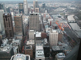
The Hoddle Grid is the contemporary name given to the approximately 1.61-by-0.80-kilometre grid of streets that form the Melbourne central business district, Australia. Bounded by Flinders Street, Spring Street, La Trobe Street, and Spencer Street, it lies at an angle to the rest of the Melbourne suburban grid, and so is easily recognisable. It is named after the surveyor Robert Hoddle, who marked it out in 1837, based on the city grid established in the first survey of Melbourne conducted by Robert Russell (architect) in 1836, establishing the first formal town plan. This grid of streets, laid out when there were only a few hundred settlers, became the nucleus for what is now Melbourne, a city of over five million people.
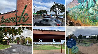
Fawkner is a suburb in Melbourne, Victoria, Australia, 12 km (7.5 mi) north of Melbourne's Central Business District, located within the Cities of Hume and Merri-bek local government areas. Fawkner recorded a population of 14,274 at the 2021 census.

St Kilda Road is a street in Melbourne, Victoria, Australia. It is part of the locality of Melbourne which has the postcode of 3004, and along with Swanston Street forms a major spine of the city.
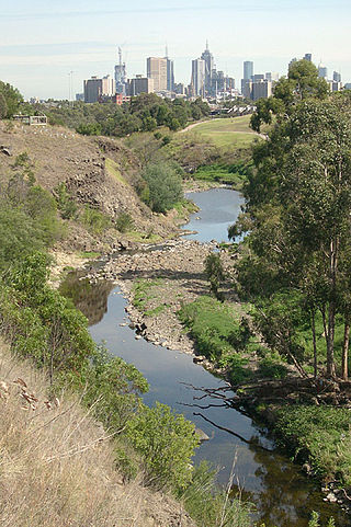
The Merri Creek is a waterway in southern parts of Victoria, Australia, which flows through the northern suburbs of Melbourne. It begins near Wallan and flows south for 70 km until joining the Yarra River at Dights Falls. The area where the creek meets the river was traditionally the location for large gatherings of the Wurundjeri people and is thought to have been the location for one of the earliest land treaties in Australia between Indigenous Australians and European settlers.
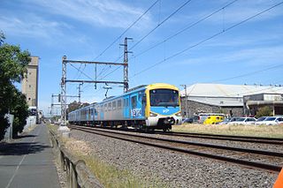
The Upfield Shared Path is a shared use path for cyclists and pedestrians, which follows Upfield railway line through the inner northern suburbs of Melbourne, Victoria, Australia.

The Division of Calwell is an Australian Electoral Division in the state of Victoria.

The Moonee Ponds Creek Trail is a shared use path for cyclists and pedestrians, which follows the Moonee Ponds Creek through the northern suburbs of Melbourne, Victoria, Australia.
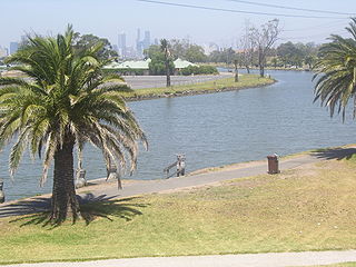
The Maribyrnong River Trail is a shared use path for cyclists and pedestrians, which follows the Maribyrnong River through the north western suburbs of Melbourne, Victoria, Australia.

The Merri Creek Trail is a shared use path for cyclists and pedestrians that follows the Merri Creek through the northern suburbs of Melbourne, Australia.

The topsail schooner Enterprize, also spelled and illustrated as Enterprise, was built in Hobart, Tasmania in 1830 by William Pender. It was used for coastal transport of cargo such as coal, livestock, and supplies.

The Division of Wills is an Australian electoral division of Victoria. It is currently represented by Peter Khalil of the Australian Labor Party.

Yarra Park is a public park that is part of the Melbourne Sports and Entertainment Precinct, a sporting precinct in Victoria, Australia. Located in Yarra Park is the Melbourne Cricket Ground (MCG) and numerous sporting fields and ovals, including the associated sporting complexes of Melbourne and Olympic Parks. The park and sporting facilities are located in the inner-suburb of East Melbourne. In the late 1850s, many of the earliest games of Australian rules football were played at Yarra Park, which was known at the time as the Richmond Paddock.
Upfield is a small residential and industrial locality 17 km away from the central business district in the northern suburbs of Melbourne, Victoria, Australia situated in the suburb of Campbellfield. It is in the local government area of the City of Hume. Some say the name is descriptive of the area's open country. It may also be a reference to Arthur Upfield, the author, who praised the area.
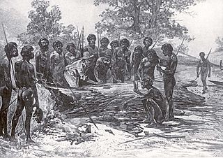
Batman's Treaty was an agreement between John Batman, an Australian grazier, businessman and coloniser, and a group of Wurundjeri elders, for the purchase of land around Port Phillip, near the present site of Melbourne. The document came to be known as Batman's Treaty and is considered significant as it was the first and only documented time when Europeans negotiated their presence and occupation of Aboriginal lands directly with the traditional owners. The treaty was implicitly declared void on 26 August 1835 by the Governor of New South Wales, Richard Bourke.
St Kilda Beach is a beach located in St Kilda, Port Phillip, Victoria, Australia, 6 kilometres (3.7 mi) south from the Melbourne city centre. It is Melbourne's most famous beach. The beach is a sandy beach about 700 metres (2,300 ft) long between St Kilda Marina and St Kilda Harbour along Jacka Boulevard and St Kilda Esplanade. It is located at the north-east corner of Port Phillip and is protected from ocean swell, though still affected by strong westerly winds. With Port Phillip Bay being open to the sea, St Kilda Beach is subject to regular tides.

The City of Coburg was a local government area about 10 kilometres (6 mi) north of Melbourne, the state capital of Victoria, Australia. The city covered an area of 19.44 square kilometres (7.51 sq mi), and existed from 1859 until 1994.
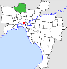
The City of Broadmeadows was a local government area about 20 kilometres (12 mi) north of Melbourne, the state capital of Victoria, Australia. The city covered an area of 63.65 square kilometres (24.58 sq mi), and existed from 1857 until 1994.
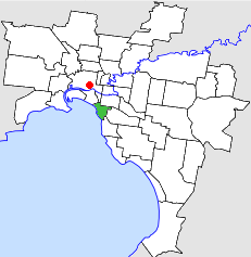
The City of St Kilda was a local government area on Port Phillip, about 5 kilometres (3.1 mi) south of Melbourne, the state capital of Victoria, Australia. The city covered an area of 8.70 square kilometres (3.36 sq mi), and existed from 1855 until 1994.
Melbourne Province was an electorate of the Victorian Legislative Council (Australia).
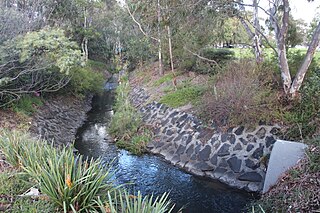
Merlynston Creek is a tributary of Merri Creek in Melbourne's northern suburbs, in Victoria, Australia.