The Dolomites, also known as the Dolomite Mountains, Dolomite Alps or Dolomitic Alps, are a mountain range in northeastern Italy. They form part of the Southern Limestone Alps and extend from the River Adige in the west to the Piave Valley in the east. The northern and southern borders are defined by the Puster Valley and the Sugana Valley. The Dolomites are in the regions of Veneto, Trentino-Alto Adige/Südtirol and Friuli-Venezia Giulia, covering an area shared between the provinces of Belluno, Vicenza, Verona, Trentino, South Tyrol, Udine and Pordenone.

Valais, more formally, the Canton of Valais, is one of the 26 cantons forming the Swiss Confederation. It is composed of thirteen districts and its capital and largest city is Sion.

El Pas de la Casa is a ski resort, town, and mountain pass in the Encamp parish of Andorra, lying on the border with France.

Marmolada is a mountain in northeastern Italy and the highest mountain of the Dolomites. It lies between the borders of Trentino and Veneto. The Marmolada is an ultra-prominent peak (Ultra), known as the "Queen of the Dolomites".

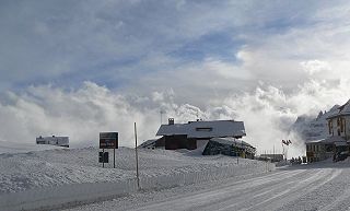
Pordoi is a pass in the Dolomites in the Alps, located between the Sella group in the north and the Marmolada group in the south. The pass is at an altitude of 2,239 m (7,346 ft), and the road crossing the pass connects Arabba with Canazei. It is the second highest surfaced road traversing a pass in the Dolomites, after the Sella Pass.

The Sella group is a plateau-shaped massif in the Dolomites mountains of northern Italy. The Sella lies north of the Marmolada and east of the Langkofel. The highest peak is Piz Boè at 3,151 m (10,338 ft) above sea level.

Tonale Pass (el. 1883 m./6178 ft.) is a high mountain pass in northern Italy across the Rhaetian Alps, between Lombardy and Trentino.

Sella Nevea, at an altitude of 1,195 m (3,921 ft), is a high mountain pass in the Julian Alps, in the Friuli-Venezia Giulia region of northeast Italy. Sella Nevea also lends its name to a frazione of the Chiusaforte municipality and the nearby Kanin-Sella Nevea Ski Resort.

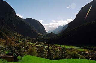
The Ötztal is an alpine valley located in Tyrol, Austria. The Ötztaler Ache river flows through the valley in a northern direction. The Ötztal separates the Stubai Alps in the east from the Ötztal Alps in the west. The valley is 65 km (40 mi) long. The northern end of the valley is at the confluence of the Ötztaler Ache and Inn rivers, 8 km east of Imst and 50 km west of Innsbruck. The only railway station of the valley, Ötztal railway station, is located here and connects the Ötztal with the Arlberg railway (Innsbruck-Bludenz) and also a motorway interchange to the A12 (E60).

The Bielerhöhe connects the Montafon valley in Vorarlberg with the Paznaun valley in Tirol. At 2,037 m above sea level, the Bielerhöhe lies in the Vorarlberg region, due north of the Silvretta Reservoir.

The Giau Pass (el. 2236 m.) is a high mountain pass in the Dolomites in the province of Belluno in Italy. It connects Cortina d'Ampezzo with Colle Santa Lucia and Selva di Cadore.

Tofane is a mountain group in the Dolomites of northern Italy, west of Cortina d'Ampezzo in the province of Belluno, Veneto. Most of the Tofane lie within the Ampezzo Dolomites Natural Park.

Veleta or Pico del Veleta is the third highest peak of the Iberian Peninsula and the second highest of the Sierra Nevada. Its height is given variously as 3,394 metres (11,135 ft), 3,396 metres (11,142 ft) and 3,398 metres (11,148 ft).

Cinque Torri comprise a small rock formation belonging to Nuvolao group in the Dolomiti Ampezzane north-west of San Vito di Cadore and south-west of Cortina d'Ampezzo.

The Stelvio Pass is a mountain pass in northern Italy bordering Switzerland at an elevation of 2,757 m (9,045 ft) above sea level. It is the highest paved mountain pass in the Eastern Alps, and the second highest in the Alps, 7 m (23 ft) below France's Col de l'Iseran.

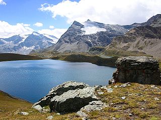
The Nivolet Pass is a mountain pass in the Eastern group of the Graian Alps in northern Italy. It is located at the top of the Orco Valley on the road from Turin to Ceresole Reale, in the Gran Paradiso National Park. Beyond the pass, the road terminates in the upper reaches of the eponymous Valsavarenche valley in the Gran Paradiso mountain group, before the valley descends to Valsavarenche and Villeneuve. The colle forms part of the boundary between the Aosta Valley and the Piedmont region. The highest point of the paved road is 2,641 metres. Two artificial lakes, Serrù Lake and Agnel Lake, are located immediately below the pass.

The Dolomiti Superski is a ski area in Italy. Created in 1974, it is spread over an area of about 3,000 km2 in the North-East of Italy, and includes most of the winter ski slopes of the Dolomites. Comprising 12 ski resorts and a total of 1,246 km of slopes, it is the largest ski area in the world. It regularly hosts World Cup alpine skiing and snowboarding races.

On 3 July 2022, a serac collapsed on the mountain of Marmolada, in the Dolomites at the regional border between Trentino and Veneto, Italy. Eleven people were killed and eight were wounded. The large-scale collapse of the serac led to one of the most serious accidents in the Alps in decades. The seismic energy released was comparable to an earthquake of 0.6 M.

Alta via 2 is a high route located in the Italian Dolomites between Brixen (Bressanone) in the north and Croce d’Aune near Feltre in the south.


