
The National Map is a collaborative effort of the United States Geological Survey (USGS) and other federal, state, and local agencies to improve and deliver topographic information for the United States. The purpose of the effort is to provide "...a seamless, continuously maintained set of public domain geographic base information that will serve as a foundation for integrating, sharing, and using other data easily and consistently".
Isearch is open-source text retrieval software first developed in 1994 by Nassib Nassar as part of the Isite Z39.50 information framework. The project started at the Clearinghouse for Networked Information Discovery and Retrieval (CNIDR) of the North Carolina supercomputing center MCNC and funded by the National Science Foundation to follow in the track of WAIS and develop prototype systems for distributed information networks encompassing Internet applications, library catalogs and other information resources.

The United States National Grid (USNG) is a multi-purpose location system of grid references used in the United States. It provides a nationally consistent "language of location", optimized for local applications, in a compact, user friendly format. It is similar in design to the national grid reference systems used in other countries. The USNG was adopted as a national standard by the Federal Geographic Data Committee (FGDC) of the US Government in 2001.
Pennsylvania Spatial Data Access (PASDA) is Pennsylvania's official public access geospatial information clearinghouse. PASDA serves as Pennsylvania's node on the National Spatial Data Infrastructure (NSDI). PASDA is a cooperative effort of the Pennsylvania Geospatial Technologies Office of the Office of Information Technology and the Pennsylvania State University Institute of Energy and the Environment.
Digital Earth is the name given to a concept by former US vice president Al Gore in 1998, describing a virtual representation of the Earth that is georeferenced and connected to the world's digital knowledge archives.

In computational geometry, the minimum bounding rectangle (MBR), also known as bounding box (BBOX) or envelope, is an expression of the maximum extents of a two-dimensional object (e.g. point, line, polygon) or set of objects within its x-y coordinate system; in other words min(x), max(x), min(y), max(y). The MBR is a 2-dimensional case of the minimum bounding box.
Geospatial metadata is a type of metadata applicable to geographic data and information. Such objects may be stored in a geographic information system (GIS) or may simply be documents, data-sets, images or other objects, services, or related items that exist in some other native environment but whose features may be appropriate to describe in a (geographic) metadata catalog.
A spatial data infrastructure (SDI), also called geospatial data infrastructure, is a data infrastructure implementing a framework of geographic data, metadata, users and tools that are interactively connected in order to use spatial data in an efficient and flexible way. Another definition is "the technology, policies, standards, human resources, and related activities necessary to acquire, process, distribute, use, maintain, and preserve spatial data". Most commonly, institutions with large repositories of geographic data create SDIs to facilitate the sharing of their data with a broader audience.

The National Biological Information Infrastructure (NBII) was a program coordinated by the United States Geological Survey's Biological Informatics Office within the USGS Biological Resources Discipline. Its purpose was to facilitate access to data and information on the biological resources of the United States, utilizing government agencies, academic institutions, non-government organizations, and private industry. It was terminated 15 January 2012.
A geoportal is a type of web portal used to find and access geographic information and associated geographic services via the Internet. Geoportals are important for effective use of geographic information systems (GIS) and a key element of a spatial data infrastructure (SDI).
The Arizona Geographic Information Council (AGIC) was established by executive order as Arizona's primary forum and oversight group for coordination efforts related to geographic information systems (GIS). AGIC identifies standards and implementation strategies to provide a framework for optimizing Arizona's investment in GIS. Through cooperation and partnerships, AGIC facilitates the acquisition, exchange and management of geospatial data and technology to benefit State agencies and the Arizona GIS community. AGIC meets on a regular basis and conducts an Annual GIS Conference to address statewide GIS issues, requirements and solutions.
SOSI is a geospatial vector data format predominantly used for exchange of geographical information in Norway.
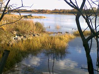
Wetlands of the United States are defined by the United States Army Corps of Engineers and the United States Environmental Protection Agency as "those areas that are inundated or saturated by surface or ground water at a frequency and duration sufficient to support, and that under normal circumstances do support, a prevalence of vegetations typically adapted for life in saturated soils. Wetlands generally include swamps, marshes, bogs, and similar areas." Wetlands can be valued in terms of their contributions to ecological, economic and social systems. Wetlands service these systems through multiple processes including water filtration, water storage and biological productivity. They also contribute the functions of flood control, providing a nutrient sink, groundwater recharge and habitat.

The National States Geographic Information Council (NSGIC) is an organization in the United States of America of the states, the District of Columbia, and the territories that works to improve the use and sharing of geospatial data and GIS tools. The purpose of the organization is "to advance effective state-led geospatial coordination for the nation. NSGIC serves as a national forum to develop future-oriented geospatial leadership and advance sound policies and practices for geospatial activities."
The Barrow Area Information Database (BAID) is designed to support Arctic science with a special focus on the research hubs of Barrow, Atqasuk, and Ivotuk on the North Slope of Alaska.
The National Wetlands Inventory (NWI) was established by the United States Fish and Wildlife Service (FWS) to conduct a nationwide inventory of U.S. wetlands to provide biologists and others with information on the distribution and type of wetlands to aid in conservation efforts. To do this, the NWI developed a wetland classification system that is now the official FWS wetland classification system and the Federal standard for wetland classification. The NWI also developed techniques for mapping and recording the inventory findings. The NWI relies on trained image analysts to identify and classify wetlands and deepwater habitats from aerial imagery. NWI started mapping wetlands at a small scale. Eventually, large-scale maps became the standard product delivered by NWI. As computerized mapping and geospatial technology evolved, NWI discontinued production of paper maps in favor of distributing data via online "mapping tools" where information can be viewed and downloaded. Today, FWS serves its data via an on-line data discovery "Wetlands Mapper". GIS users can access wetlands data through an online wetland mapping service or download data for various applications. The techniques used by NWI have recently been adopted by the Federal Geographic Data Committee as the federal wetland mapping standard. This standard applies to all federal grants involving wetland mapping to insure the data can be added to the Wetlands Layer of the National Spatial Data Infrastructure. NWI also produces national wetlands status and trends reports required by the United States Congress.
The Wind Energy Data and Information (WENDI) Gateway was established by the Environmental Sciences Division of Oak Ridge National Laboratory in March 2010 to support the United States Department of Energy's Wind and Hydropower Technologies Program. It provided a digital library for wind energy-related data and information from a wide spectrum of sources—including data centers, scientific and technical journals, and geographic information systems (GIS), as well as the websites of government agencies, corporations and trade organizations. The gateway was taken offline after funding ended in August 2012. Much of its content was incorporated into the OpenEI site.
Geographic information systems (GIS) play a constantly evolving role in geospatial intelligence (GEOINT) and United States national security. These technologies allow a user to efficiently manage, analyze, and produce geospatial data, to combine GEOINT with other forms of intelligence collection, and to perform highly developed analysis and visual production of geospatial data. Therefore, GIS produces up-to-date and more reliable GEOINT to reduce uncertainty for a decisionmaker. Since GIS programs are Web-enabled, a user can constantly work with a decision maker to solve their GEOINT and national security related problems from anywhere in the world. There are many types of GIS software used in GEOINT and national security, such as Google Earth, ERDAS IMAGINE, GeoNetwork opensource, and Esri ArcGIS.
ANZLIC, or The Spatial Information Council, is the peak intergovernmental organisation providing leadership in the collection, management and use of spatial information in Australia and New Zealand. It supports the establishment of a Spatial Data Infrastructure in the region and has published geospatial metadata standards. ANZLIC started in 1986 as the Australian Land Information Council (ALIC) and it became the Australia and New Zealand Land Information Council (ANZLIC) in 1991. ANZLIC, now refers to itself as the Spatial Information Council.