Elk Horn is an unincorporated community in Taylor County, Kentucky, United States. It lies along Route 76 southeast of the city of Campbellsville, the county seat of Taylor County. Its elevation is 735 feet (224 m). Although it is unincorporated, it has a post office, with the ZIP code of 42733.
Mannsville is an unincorporated community in Taylor County, Kentucky, United States. First called "Manns Lick" for a salt lick discovered on the site by its pioneer settler, American Revolutionary War veteran Moses Mann (c1757-1849), the site is at the junction of Kentucky Routes 70 and 337, some 7 miles east of the county seat of Campbellsville. Its elevation is 738 feet (225 m). Although it is unincorporated, it has a post office, with the ZIP code of 42758.
Acton is an unincorporated community in Taylor County, Kentucky, United States. It lies along Route 70 east of the city of Campbellsville, the county seat of Taylor County. Its elevation is 728 feet (222 m).
Bengal is an unincorporated community in Taylor County, Kentucky, United States. Located west of the city of Campbellsville, the county seat of Taylor County, it is served by Bengal Road from Campbellsville and by Route 323. Its elevation is 722 feet (220 m).
Black Gnat is an unincorporated community in Green and Taylor Counties in the U.S. state of Kentucky. It lies along Old U.S. Route 68 between the cities of Campbellsville and Greensburg, the county seats of Taylor and Green Counties. Its elevation is 846 feet (258 m).
Hatcher is an unincorporated community in Taylor County, Kentucky, United States. It lies along Route 55 south of the city of Campbellsville, the county seat of Taylor County. Its elevation is 820 feet (250 m).
Merrimac is an unincorporated community in Taylor County, Kentucky, United States. It lies along local roads a short distance east of Route 337, northeast of the city of Campbellsville, the county seat of Taylor County. Its elevation is 797 feet (243 m).

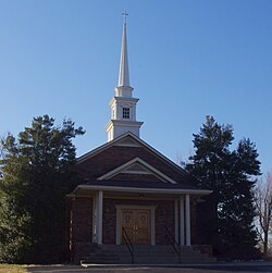
Saloma is an unincorporated community in Taylor County, Kentucky, United States. It lies along Routes 527 and 744 northwest of the city of Campbellsville, the county seat of Taylor County. Its elevation is 906 feet (276 m).
Yuma is an unincorporated community in Taylor County, Kentucky, United States. It lies along Route 76 southeast of the city of Campbellsville, the county seat of Taylor County. Its elevation is 722 feet (220 m).
Hendricks is an unincorporated community in Magoffin County, Kentucky, United States. It lies along Route 30 south of the city of Salyersville, the county seat of Magoffin County. Its elevation is 876 feet (267 m).
Sublett is an unincorporated community in Magoffin County, Kentucky, United States. It lies along Route 7 southeast of the city of Salyersville, the county seat of Magoffin County. Its elevation is 883 feet (269 m).
Swampton is an unincorporated community in Magoffin County, Kentucky, United States. It lies along Route 7 southeast of the city of Salyersville, the county seat of Magoffin County. Its elevation is 919 feet (280 m).
Wheelersburg is an unincorporated community in Magoffin County, Kentucky, United States. It lies along Route 1081 northeast of the city of Salyersville, the county seat of Magoffin County. Its elevation is 853 feet (260 m).
Wonnie is an unincorporated community in Magoffin County, Kentucky, United States. It lies along U.S. Route 460 and Kentucky Route 1081 northwest of the city of Salyersville, the county seat of Magoffin County. Its elevation is 814 feet (248 m).
Mariba is an unincorporated community in Menifee County, Kentucky, United States. It lies along U.S. Route 460 and Kentucky Route 77, southeast of the city of Frenchburg, the county seat of Menifee County. Its elevation is 1,175 feet (358 m). The community is part of the Mount Sterling Micropolitan Statistical Area.
Caney is an unincorporated community and coal town in Morgan County, Kentucky, United States. It lies along Route 191 south of the city of West Liberty, the county seat of Morgan County. Its elevation is 869 feet (265 m).
Lenox is an unincorporated community and coal town in Morgan County, Kentucky, United States. It lies along Route 172, northeast of the city of West Liberty, the county seat of Morgan County. Its elevation is 797 feet (243 m).
Moon is an unincorporated community in Morgan County, Kentucky, United States. It lies along Kentucky Route 172 northeast of the city of West Liberty, Kentucky, the county seat of Morgan County. Its elevation is 755 feet (230 m). The community's post office, with the ZIP code of 41457, closed in 1997.
Mize is an unincorporated community in Morgan County, Kentucky, United States. It lies along U.S. Route 460 and Kentucky Route 203, southwest of the city of West Liberty, the county seat of Morgan County. Its elevation is 817 feet (249 m). Although it is unincorporated, it has a post office, with the ZIP code of 41352.
White Oak is an unincorporated community in Morgan County, Kentucky, United States. It lies along U.S. Route 460 southeast of the city of West Liberty, the county seat of Morgan County. Its elevation is 801 feet (244 m).