Kentucky Route 55 is a 140.858-mile-long (226.689 km) state highway in the U.S. Commonwealth of Kentucky.

Kentucky Route 3005 serves as a northern bypass of Elizabethtown. Locally, it is known as Ring Road. It originates outside the western limits of Elizabethtown at an interchange with Western Kentucky Parkway. The road then takes a wide circuit to the north of the city, eventually entering the city limits. Its eastern terminus is at U.S. 62, here known as Mulberry Street, within the city limits and approximately 1 mile (1.6 km) west of Interstate 65.

Kentucky Route 29 is an 11.324-mile-long (18.224 km) state highway located entirely within Jessamine County in the U.S. state of Kentucky. The highway, maintained by the Kentucky Transportation Cabinet, runs north from High Bridge, Kentucky through Wilmore before ending at Nicholasville. Within Wilmore, KY 29 intersects Kentucky Route 1268 and junctions with Kentucky Route 3433. The highway acts as the border between Asbury University and Asbury Theological Seminary. Just north of Wilmore, KY 29 merges with U.S. Route 68 for 0.590 miles (0.950 km) before leaving US 68 and turning east heading towards Nicholasville. KY 29 terminates at Kentucky Route 39 and U.S. Route 27 Business in downtown Nicholasville.

Kentucky Route 1974, also known as Tates Creek Road, stretches from New Circle Road at its northern terminus and proceeds southeast towards Spears. It has become a popular commuting route from points south, especially with recent housing development south of Man o' War Boulevard that stretches to Kentucky Route 1980. KY 1974 was widened from two to four lanes south of Man o' War Boulevard to KY 1980 in the late 1990s. It becomes a rural two-lane road with very light traffic to its southern terminus with KY 169, which leads to the Valley View Ferry.

Kentucky Route 1303 is a 6.397-mile-long (10.295 km) state highway in Kenton County, Kentucky. The southern terminus of the route is at KY 536 in Independence. The northern terminus is at U.S. Route 25, U.S. Route 42 and U.S. Route 127 in Lakeside Park. On its way to KY 536 it goes through many towns. These towns include Edgewood, Erlanger, and Independence. The southernmost segment of the route is named Bristow Road, a moniker carried by KY 536 east of KY 1303. At Richardson Road in Independence, KY 1303 becomes Turkeyfoot Road, a name the route retains to its northern terminus.

Kentucky Route 21 is a 14.196-mile (22.846 km) west–east highway in Madison County, running from the Garrard County line near Paint Lick to Bighill, east of Berea.

Kentucky Route 526 is a state highway that provides a short rural connecting route between KY 185 and US 31W/US 68/KY 80 north of Bowling Green. Running through the north-central part of Warren County, the route is known locally as Mt. Olivet Road.

Kentucky Route 527 (KY 527) is a 27.129-mile-long (43.660 km) state highway in the U.S. state of Kentucky. The route begins in Campbellsville at US Route 68 (US 68), KY 55, and KY 70 and continues north to Saloma. It enters Marion and Raywick before continuing north to St. Francis where it intersects with KY 52. The northern terminus is at an intersection with KY 49 at Holy Cross.

Kentucky Route 914 (KY 914) is a highway in Somerset, Kentucky that encircles the city of Somerset.

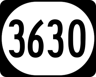
Kentucky Route 3630 is an east–west state highway in Jackson and Laurel Counties. The route was formerly KY 30 until it was rerouted.

Kentucky Route 35 is a 12.833-mile-long state highway in Kentucky that runs from US 127 in Owen County south of Sparta and heads north and goes through Sparta and meets KY 467 before meeting Interstate 71. KY 35 then passes by the Kentucky Speedway and comes to an end at US 42 in Warsaw.

Kentucky Route 47 is a 9.851-mile state highway in Kentucky that runs from KY 36 and KY 467 in Sanders to US 42 in Ghent KY 47 mostly stays in Carroll County but makes a short entrance into Gallatin County while passing under Interstate 71.

Kentucky Route 43 is a state highway in Kentucky that runs from BUS KY 55 and Boone Station Road northeast of Shelbyville to U.S. Route 421 southeast of Pleasureville.

Kentucky Route 163 (KY 163) is a 29.823-mile-long (47.995 km) state highway that traverses through two counties in south-central Kentucky. It runs from Tennessee State Route 51 at the Kentucky-Tennessee border south of Hestand to U.S. Route 68, Kentucky Route 80, and East Stockton Street in Edmonton via Tompkinsville.

Kentucky Route 191 (KY 191) is a 31.1-mile-long (50.1 km) state highway in the U.S. state of Kentucky. The highway connects Campton and West Liberty with mostly rural areas of Wolfe and Morgan counties.

Kentucky Route 206 (KY 206) is a 23.6-mile-long (38.0 km) state highway in the U.S. state of Kentucky. The highway connects mostly rural areas of Adair and Casey counties with Columbia.

Kentucky Route 208 (KY 208) is a 11.1-mile-long (17.9 km) state highway in the U.S. state of Kentucky. The highway travels through mostly rural areas of Taylor and Marion counties.

Kentucky Route 426 (KY 426) is a 3.395-mile-long (5.464 km) state highway in the U.S. state of Kentucky. The highway travels through rural areas of Marion County.


