Bayfield County is the northernmost county in the U.S. state of Wisconsin. As of the 2010 census, the population was 15,014. Its county seat is Washburn. The county was created in 1845 and organized in 1850.

Port Wing is a town in Bayfield County, Wisconsin, United States. The population was 368 at the 2010 census. The unincorporated community of Port Wing is located in the town.
Grafton is a town in Ozaukee County, Wisconsin, United States, and is in the Milwaukee metropolitan area. The town was created in 1846 and at the time of the 2010 census had a population of 4,053.
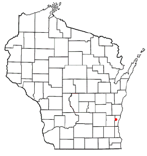
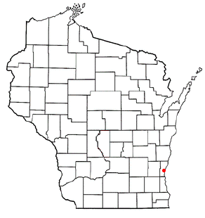
Saukville is a town in Ozaukee County, Wisconsin, United States. The Village of Saukville is located in the town's southeast quadrant. The population was 1,755 at the 2000 census.

Saukville is a village in Ozaukee County, Wisconsin, United States. Located on the Milwaukee River with a district along Interstate 43, the community is a suburb in the Milwaukee metropolitan area. The population was 4,451 at the 2010 census.

The West Twin River, formerly the Neshota River, is an 18.5-mile-long (29.8 km) river in east-central Wisconsin that is a tributary to Lake Michigan. It merges with the East Twin River in the city of Two Rivers, Wisconsin, less than a mile from the lakeshore. The source of the river is in southeast Brown County, near Richard J. Drum Memorial Forest. It is formed by the confluence of the Devils River and the Neshota River. On its course it passes through the unincorporated communities of Kingsbridge and Shoto.
State Trunk Highway 13 is a state highway running north–south across northwest and central Wisconsin. WIS 13 serves as a major north–south route connecting the communities of Wisconsin Dells, Wisconsin Rapids, Marshfield and Ashland. WIS 13 is part of the Lake Superior Circle Tour from its northern/western terminus to Ashland at is eastern junction with U.S. Highway 2 (US 2). The road also provides access to the Apostle Islands National Lakeshore off the Lake Superior shoreline at Bayfield. The highway is two-lane surface road with the exception of various urban multilane road sections.
State Trunk Highway 118 is a 6.86-mile (11.04 km) state highway in the U.S. state of Wisconsin. It runs from U.S. Route 63 east of Benoit east to Wisconsin Highway 112 south of Ashland. The highway is located in Bayfield and Ashland Counties in northwest Wisconsin. Highway 118 is maintained by the Wisconsin Department of Transportation.

Herbster is a census-designated place (CDP) in the Town of Clover in Bayfield County, Wisconsin, United States, located on the south shore of Lake Superior. Herbster is 7 miles (11 km) east of Port Wing and 8 miles (13 km) west of Cornucopia on Wisconsin Highway 13, the main route through the community. The primary north/south route is by Lenawee Road / Forest Road 262, leading from Lake Superior to the Chequamegon National Forest. As of the 2010 census, its population was 104. Herbster has an area of 5.572 square miles (14.43 km2), all of it land.

Port Wing is an unincorporated census-designated place in the town of Port Wing, Bayfield County, Wisconsin, United States. The community is along Wisconsin Highway 13 and Bayfield County Highway A. It is 30 miles (48 km) west of Bayfield. The Flag River enters Lake Superior at Port Wing's harbor.
Kohlsville is an unincorporated community in the town of Wayne in Washington County, Wisconsin, United States. The Kohlsville River flows through the community and is dammed, creating the Kohlsville Millpond.
Waubeka is an unincorporated census-designated place in the Town of Fredonia, Ozaukee County, Wisconsin, United States. Located on the Milwaukee River, the community is part of the Milwaukee metropolitan area. As of the 2010 census, its population is 657.
The geology of Wisconsin includes Precambrian crystalline basement rock over three billion years old. A widespread marine environment during the Paleozoic flooded the region, depositing sedimentary rocks which cover most of the center and south of the state.
The Suamico River is a river in north east Wisconsin that flows through the village of Suamico and into Green Bay in Lake Michigan. The source is near the community of Anston, in the town of Pittsfield. The river has been dredged by the United States Army Corps of Engineers to aid in recreational activity.

The Shioc River is a river in north east Wisconsin that flows through the village of Shiocton and into the Wolf River. The source is near the census-designated place of Navarino, in the town of Navarino.
The Kohlsville River is a river in eastern Wisconsin that flows through the community of Kohlsville and into the East Branch Rock River. The entirety of the river is located in Washington County.
Whittlesey Creek is a creek that flows through Bayfield County, Wisconsin. The source of the creek is northeast of Moquah and flows into Lake Superior north of Ashland Junction. As of 2010, 329 acres (1.33 km2) of land in the watershed belong to the Whittlesey Creek National Wildlife Refuge. The creek is named after Asaph Whittlesey, who was the first settler of Ashland and a member of the Wisconsin State Assembly.
The Evergreen River is a river in north east Wisconsin that flows through Langlade and Menominee counties. The source of the river is Flora Lake in the Town of Evergreen. The Evergreen River conjoins the Wolf River south of Markton. The majority of land around the river is wooded and largely undeveloped.
The Rainbow Lake Wilderness is a 7,135-acre (29 km2) wilderness area located within the Chequamegon unit of the Chequamegon-Nicolet National Forest. The land is in northeastern Wisconsin and entirely in Bayfield County. The wilderness area is operated by the United States Forest Service.
The Wausaukee River is a river that flows through Marinette County, Wisconsin. The source of the river is in the Town of Athelstane. The river then flows through the Town of Athelstane and into the Town of Wausaukee. The Wausaukee River continues through the village of Wausaukee before flowing into the Menominee River.