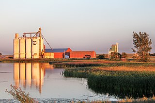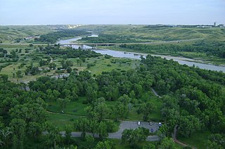
Lethbridge is a city in the province of Alberta, Canada. With a population of 106,550 in the 2023 municipal census, Lethbridge became the fourth Alberta city to surpass 100,000 people. The nearby Canadian Rocky Mountains contribute to the city's warm summers, mild winters, and windy climate. Lethbridge lies approximately 215 km (134 mi) southeast of Calgary on the Oldman River and 105 km (65 mi) northwest of the Canada–United States border at the Sweetgrass–Coutts Border Crossing.

Milk River is a town in Alberta, Canada that is named after the Milk River which flows immediately to its south. This location results in Milk River being one of the few Canadian communities within the Mississippi River drainage system. It is 70 kilometres (43 mi) south of Lethbridge, and 16 kilometres (9.9 mi) from the Canada–United States border. It is primarily a service centre for the many farms and cattle ranches which surround it.

Fort Whoop-Up was the nickname given to a whisky trading post, originally Fort Hamilton, near what is now Lethbridge, Alberta. During the late 19th century, the post served as a centre for trading activities, including the illegal whisky trade. The sale of whisky was outlawed but, due to the lack of law enforcement in the region prior to 1874, many whisky traders had settled in the area and taken to charging unusually high prices for their goods.
Highway 3 is a 324-kilometre (201 mi) highway that traverses southern Alberta, Canada, running from the Crowsnest Pass through Lethbridge to the Trans-Canada Highway in Medicine Hat. Together with British Columbia Highway 3 which begins in Hope, it forms an interprovincial route that serves as an alternate to the Trans-Canada from the Lower Mainland to the Canadian Prairies.

The history of Northwest Territories capital cities begins with the purchase of the Territories by Canada from the Hudson's Bay Company in 1869, and includes a varied and often difficult evolution. Northwest Territories is unique amongst the other provinces and territories of Canada in that it has had seven capital cities in its history. The territory has changed the seat of government for numerous reasons, including civil conflict, development of infrastructure, and a history of significant revisions to its territorial boundaries.

Ponoka is a town in central Alberta, Canada. It is located at the junction of Highway 2A and Highway 53, 59 kilometres (37 mi) north of Red Deer and 95 kilometres (59 mi) south of Edmonton.

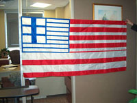
The official flag of Calgary features a cowboy hat and the letter "C" on a red field, with white strips on the top and bottom of the field. The flag was adopted in 1983 as a result of a contest. Gwynneth Llewellyn and Yvonne Fritz, a former Legislative Assembly of Alberta member, created the design.

Stirling is a village in southern Alberta, Canada that is surrounded by the County of Warner No. 5. The village is located on Highway 4, approximately 31 km (19 mi) southeast of Lethbridge and 72 km (45 mi) northwest of the Canada–US border.

Raymond is a town in southern Alberta, Canada that is surrounded by the County of Warner No. 5. It is south of Lethbridge at the junction of Highway 52 and Highway 845. Raymond is known for its annual rodeo during the first week of July and the large population of members of the Church of Jesus Christ of Latter-day Saints. Raymond is also significant for its connection to the history of the Japanese experience in Alberta. The town has a rich history in high school sports, basketball, Canadian football, Judo and women's rugby. Raymond was recently mentioned as one of the first communities in Alberta to become a net-zero solar-powered community, after having installed solar panels on most town buildings.
The Lethbridge City Council is the legislative governing body that represents the citizens of Lethbridge, Alberta. The council is composed of the mayor and eight councillors. The mayor is the city's chief elected official and the city manager is its chief administrative officer.

Lethbridge County is a municipal district in southern Alberta, Canada. It is in Census Division No. 2 and part of the Lethbridge census agglomeration. It was known as the County of Lethbridge prior to December 4, 2013. Its name was changed in time for 2014 to coincide with its 50th anniversary.

The modern history of Lethbridge extends to the mid-19th century, when the area was developed from drift mines opened by Nicholas Sheran in 1874, and the North Western Coal and Navigation Company in 1882. Prior to the development of drift mines in the area, Lethbridge, Alberta was known as Coal Banks, and was part of the territory of the Blackfoot Confederacy. The Confederacy was made up of the Kainai Nation, the Northern Peigan, the Southern Peigan (Blackfeet), and the Siksika Nation.

Indian Battle Park is a park located in the Oldman River valley urban park system of Lethbridge, Alberta. The park is home to Fort Whoop-Up, Helen Schuler Nature Centre and the High Level Bridge.
There are many forms of transport in Lethbridge, Alberta, Canada, including highways and public transit. Lethbridge's airport is Lethbridge Airport (YQL), which is south of the city boundary. Lethbridge also has an intricate cycling-and-pedestrian pathway that meets several destinations in the city, including the urban park system in the Oldman River valley.
West Lethbridge, is one of three geographical areas in Lethbridge, Alberta, Canada. It is the newest and the fastest growing. It is the home of the University of Lethbridge and is a residential area primarily.

The Red Coat Trail is a 1,300-kilometre (810 mi) route that approximates the path taken in 1874 by the North-West Mounted Police in their March West from Fort Dufferin to Fort Whoop-Up.
The Rocky Springs Segment of the Whoop-Up Trail was the location of campsites for travellers along the Whoop-Up Trail between Fort Benton, Montana and Fort Hamilton, Alberta in the 19th century. In 1991, it was the best-preserved segment of the Whoop-Up Trail within Montana and it included rut tracks still visible and the surrounding landscape was mostly natural. The numerous small springs in the area were mostly dried up by 1991 "due to modern cultivation and resultant ground water changes". It was listed on the National Register of Historic Places in 1993.

Ronald James Butlin was a Canadian ice hockey executive. He was president of the Western Canada Hockey League (WCHL) from 1968 to 1971, when the league separated from the Canadian Amateur Hockey Association (CAHA) due to grievances arising from the National Hockey League (NHL) agreement for the NHL Amateur Draft. He also served as president of the Canadian Hockey Association from 1968 to 1970, which was formed as a national governing body of junior ice hockey in Canada, in opposition to the CAHA. He sought to raise the age limit imposed by the NHL and negotiate better financial terms for the junior teams which developed future professional players. He criticized the CAHA for its spending on administration and wanted hockey policy to be determined by the teams instead of elected officials. He negotiated an agreement to reunite the WCHL with the CAHA in 1970, where the WCHL gained direct representation on the CAHA junior council, better financial return for drafted players, and received development grants from the NHL.


