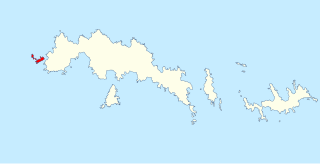
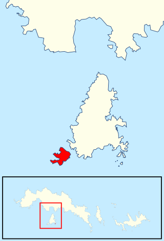
The Larsen Islands are a small group of islands north-west of Moreton Point, the western extremity of Coronation Island, in the South Orkney Islands of Antarctica. They were discovered by Captains George Powell and Nathaniel Palmer on the occasion of their joint cruise in December 1821. The islands were named on Petter Sørlle's chart, based upon his survey of the South Orkney Islands in 1912–1913, in honour of Carl Anton Larsen.

Annenkov Island is an island in South Georgia and the South Sandwich Islands, to the west of the main island of South Georgia. The Pickersgill Islands are to its southeast. It is irregularly shaped and 4 miles (6.4 km) long and 650 m (2,130 ft) high, lying 8 miles (13 km) off the south-central coast of South Georgia.
William Scoresby Archipelago is a group of islands which extends northward from the coast just east of William Scoresby Bay, Antarctica. The more important islands in the group are Bertha, Islay, Couling, and the Sheehan Islands. Most of the islands and features in this archipelago were discovered in February 1936 by Discovery Investigations (DI) personnel on the RSS William Scoresby. They named the group after their ship.
Borge Bay is a large, irregularly-shaped bay that dominates the east side of Signy Island, in the South Orkney Islands of Antarctica. It was charted in 1912 by Norwegian whaling captain Petter Sorlle, and named for Captain Hans Borge of the Polynesia, who undertook additional mapping of the bay during the following year. It was charted in more detail in 1927 and 1933 by Discovery Investigations personnel, who named many of its features. It was surveyed further in 1947 by the Falkland Islands Dependencies Survey (FIDS), which named several other features.
The Bruce Islands are a group of small islands and rocks 1.5 nautical miles (3 km) northwest of Eillium Island and 3 nautical miles (6 km) northwest of Route Point, the northwest tip of Laurie Island, in the South Orkney Islands. They were first roughly shown on Powell's chart resulting from the joint cruise of Captain George Powell and Captain Nathaniel Palmer in 1821. They were remapped in 1912–13 by Captain Petter Sorlle, and in 1933 by Discovery Investigations personnel on the RSS Discovery II, who named them for William S. Bruce, the leader of the Scottish National Antarctic Expedition, 1902–04.
Clowes Glacier is a glacier 2 nautical miles (4 km) wide, which flows east to enter Mason Inlet, on the east coast of Palmer Land. It was discovered and photographed from the air in December 1940 by the United States Antarctic Service. During 1947 it was photographed from the air by the Ronne Antarctic Research Expedition under Finn Ronne, who in conjunction with the Falkland Islands Dependencies Survey (FIDS) charted it from the ground. It was named by FIDS for Archibald J. Clowes, English oceanographer on the staff of the Discovery Committee, 1924–46.
Cockscomb Buttress is a prominent, isolated rock buttress rising to 465 metres (1,530 ft), standing 1 nautical mile (2 km) northwest of Echo Mountain and overlooking the east side of Norway Bight on the south coast of Coronation Island, in the South Orkney Islands. The name, which is descriptive, was given by the Falkland Islands Dependencies Survey following their survey of 1950.
Jensen Ridge is a curving ridge running eastward from Foca Point toward Jane Col on Signy Island in the South Orkney Islands. It was named in 1991 by the UK Antarctic Place-Names Committee after Captain Gullik Jensen, of the whaling ship Strombus from Tønsberg, Norway, who made the last whaling expedition to Signy Island in 1935–36.
Jane Col is a col to the west of Jane Peak at the head of Limestone Valley on Signy Island in the South Orkney Islands. It was named in association with Jane Peak by the UK Antarctic Place-Names Committee.

Grey Island is 1 km (0.62 mi) south of Michelsen Island and 2 km (1.2 mi) west of the southern part of Fredriksen Island, in the South Orkney Islands of Antarctica. It was first charted and named Holmen Graa on a map by the Norwegian whaler Captain Petter Sorlle, who made a running survey of the South Orkney Islands in 1912–13. The anglicised form appears on the chart by Discovery Investigations personnel on the Discovery II who surveyed the islands in 1933.
Eillium Island is a small island 2.2 km (1.4 mi) north-west of Rumbo Punta, the north-west tip of Laurie Island in the South Orkney Islands of Antarctica. It was first seen and roughly charted by Captain George Powell and Captain Nathaniel Palmer during their joint cruise in 1821. It was recharted in 1903 by the Scottish National Antarctic Expedition under Dr. William S. Bruce, who named it for his son Eillium.
Moe Island is an island 2 km (1.2 mi) long in the South Orkney Islands off Antarctica, separated from the south-west end of Signy Island by Fyr Channel. It was charted by Captain Petter Sørlle in 1912–13, and named after M. Thoralf Moe of Sandefjord, Norway, a contemporary whaling captain who worked in this area. The northernmost point of the island is Spaull Point, named by United Kingdom Antarctic Place-Names Committee (UK-APC) after Vaughan W. Spaull, British Antarctic Survey (BAS) biologist on Signy Island, 1969.
The Monk Islands are a group of very small islands and rocks lying 1.5 nautical miles (3 km) south of Meier Point, off the south coast of Coronation Island in the South Orkney Islands off Antarctica. They were first charted and named "Munken" by Norwegian whaling captain Petter Sørlle in 1912–13. The name approved is an anglicized form of the earlier Norwegian name appearing on the chart by Discovery Investigations personnel on the Discovery II, who surveyed the islands in 1933.

Fraser Point is a point between Marr Bay and Mackintosh Cove on the north coast of Laurie Island, in the South Orkney Islands of Antarctica. It was mapped by the Scottish National Antarctic Expedition in 1903, and in 1912–13 by Captain Petter Sorlle. It was remapped in 1933 by Discovery Investigations personnel on the Discovery II who named it for Francis C. Fraser.
Gibbon Bay is a bay 2 km (1.2 mi) long and wide, entered between Rayner Point and The Turret along the east coast of Coronation Island, in the South Orkney Islands of Antarctica. The bay was first seen in December 1821 by Captain George Powell and Captain Nathaniel Palmer, but was more accurately delineated on a 1912 chart by Captain Petter Sorlle. It was recharted in 1933 by Discovery Investigations personnel on the Discovery II and named for the ship's surgeon, Dr G.M. Gibbon.
The Moss Braes are west-facing slopes situated west of Robin Peak on Signy Island, in the South Orkney Islands off Antarctica. They were named by the UK Antarctic Place-Names Committee in 1990 from the extensive moss banks on the dissected rocky slopes.
Meier Point is a point forming the west side of the entrance to Norway Bight on the south side of Coronation Island, in the South Orkney Islands off Antarctica. It was named on a chart by Captain Petter Sørlle, a Norwegian whaler who made a running survey of the South Orkney Islands in 1912–13. The Gosling Islands lie close to this point.
Hart Rock is a rock, 10 metres (33 ft) high, lying 1.5 nautical miles northwest of the Herdman Rocks and 3 nautical miles north-northeast of the eastern extremity of Laurie Island, in the South Orkney Islands. It was first charted in 1838 by a French expedition under d'Urville. The rock was named in 1933 by Discovery Investigations personnel on the Discovery II, for T. John Hart, a member of the zoological staff of the Discovery Committee.

Lynch Island is an island lying in the eastern part of Marshall Bay, close off the south coast of Coronation Island in the South Orkney Islands, Antarctica.
