This article has multiple issues. Please help improve it or discuss these issues on the talk page . (Learn how and when to remove these messages)
|
Flerzheim | |
|---|---|
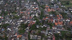 Aerial view | |
 | |
| Location of Flerzheim | |
 Flerzheim  Flerzheim | |
| Coordinates: 50°38′49″N6°59′15″E / 50.6469°N 6.9875°E | |
| Country | Germany |
| State | North Rhine-Westphalia |
| Admin. region | Cologne |
| District | Rhein-Sieg-Kreis |
| Town | Rheinbach |
| Founded | 807 |
| Time zone | UTC+01:00 (CET) |
| • Summer (DST) | UTC+02:00 (CEST) |
Flerzheim is a part ( Stadtteil ) of Rheinbach in the Rhein-Sieg-Kreis in North Rhine-Westphalia, Germany.