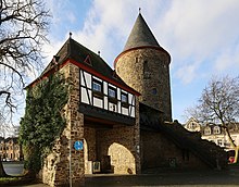
North Rhine-Westphalia or North-Rhine/Westphalia, commonly shortened to NRW, is a state (Land) in Western Germany. With more than 18 million inhabitants, it is the most populous state in Germany. Apart from the city-states, it is also the most densely populated state in Germany. Covering an area of 34,084 km2 (13,160 sq mi), it is the fourth-largest German state by size.
The Rhein-Erft-Kreis is a district in the west of North Rhine-Westphalia, Germany. Neighboring districts are Neuss, district-free Cologne, Rhein-Sieg, Euskirchen, Düren.
Euskirchen is a Kreis (district) in the south-west of North Rhine-Westphalia, Germany. Neighboring districts are Aachen, Düren, Rhein-Erft-Kreis, Rhein-Sieg, Ahrweiler, Daun, Bitburg-Prüm, and the Liège province (Belgium).

The Rhein-Sieg-Kreis is a Kreis (district) in the south of North Rhine-Westphalia, Germany. Neighboring districts are Rheinisch-Bergischer Kreis, Oberbergischer Kreis, Altenkirchen, Neuwied, Ahrweiler, Euskirchen, Rhein-Erft-Kreis, the urban district of Cologne. The federal city of Bonn is nearly completely surrounded by the district.
The Rheinisch-Bergische Kreis is a Kreis (district) in the Cologne Bonn Region of North Rhine-Westphalia, Germany. Neighboring districts are Kreis Mettman, Oberbergischer Kreis and Rhein-Sieg, and the district-free cities Cologne, Leverkusen, Solingen and Remscheid.
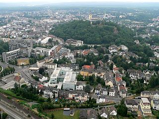
Siegburg is a city in the district of Rhein-Sieg-Kreis in North Rhine-Westphalia, Germany. It is located on the banks of the rivers Sieg and Agger, 10 kilometres (6.2 mi) from the former seat of West German government Bonn and 26 kilometres (16 mi) from Cologne. The population of the city was 39,192 in the 2013 census.

Hürth is a town in the Rhein-Erft-Kreis, North Rhine-Westphalia, Germany. Hürth shares borders with the city of Cologne and is about 6 km to the southwest of Cologne city centre, at the northeastern slope of the natural preserve Kottenforst-Ville. The town consists of thirteen districts, once independent villages, and is distributed over a relatively large area. The municipal area is interspersed with lakes and stretches of forest.

Ruppichteroth is a municipality in the Rhein-Sieg district, in the southern part of North Rhine-Westphalia, Germany. It is located approximately 30 kilometers east of Bonn.
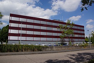
Bornheim is a town in the Rhein-Sieg district, in North Rhine-Westphalia, Germany. It is situated on the West bank of the Rhine, approx. 10 km north-west of Bonn, 20 km south of Cologne.

Königswinter is a town and summer resort in the Rhein-Sieg district, in North Rhine-Westphalia, Germany.
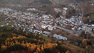
Schleiden is a town in North Rhine-Westphalia, Germany. It lies in the Eifel hills, in the district of Euskirchen, and has 12,998 inhabitants as of 30 June 2017. Schleiden is connected by a tourist railway to Kall, on the Eifel Railway between Cologne and Trier. The town consists of 18 settlements, the largest of which are Gemünd and Schleiden proper.

Bad Honnef is a spa town in Germany near Bonn in the Rhein-Sieg district, North Rhine-Westphalia. It is located on the border of the neighbouring state Rhineland-Palatinate. To the north it lies on the slopes of the Drachenfels mountain, part of the Siebengebirge.

Swisttal is a municipality in the Rhein-Sieg district, in North Rhine-Westphalia, Germany. Swisttal received its names from a brook named Swist, which flows in the middle of the municipality.

Meckenheim is a town in the Rhein-Sieg district, in North Rhine-Westphalia, Germany.

Lohmar is a town in the Rhein-Sieg district, in North Rhine-Westphalia, Germany.

Niederkassel is a town in the Rhein-Sieg district, in North Rhine-Westphalia, Germany, with a population of around 37,000 people. It is situated on the right bank of the Rhine, approx. 10 km (6 mi) north-east of Bonn and 15 km (9 mi) south-east of Cologne. Niederkassel is subdivided into seven quarters : Mondorf, Rheidt, Niederkassel, Uckendorf, Stockem, Lülsdorf and Ranzel. People can walk next to the river Rhine in Lülsdorf, Niederkassel and Rheidt.
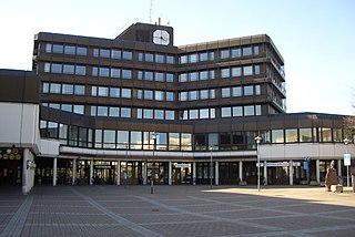
Sankt Augustin is a town in the Rhein-Sieg district in North Rhine-Westphalia, Germany. It is named after the patron saint of the Steyler missionaries, Saint Augustine of Hippo (354-430). The missionaries established the "Saint Augustine Monastery" near the current town centre in 1913. The municipality of Sankt Augustin was established in 1969, and on September 6, 1977, Sankt Augustin acquired town privileges. Sankt Augustin is situated about 8 km northeast of Bonn and 8 km southwest of Siegburg. Sankt Augustin belongs to the economic region of Bonn/Rhein-Sieg as well as the scientific region of Bonn. With over 59,000 inhabitants, it is the second-largest town in the Rhein-Sieg district.

Alfter is a municipality in the Rhein-Sieg district, in North Rhine-Westphalia, Germany. It is situated approximately 6 km west of Bonn.

Much is a municipality in the Rhein-Sieg district, in North Rhine-Westphalia, Germany. It is situated approximately 30 kilometres (19 mi) north-east of Bonn, and 20 kilometres (12 mi) south-west of Gummersbach.

The Swist is a stream, 43.6 kilometres (27.1 mi) long, in the German Rhineland. It rises on the northern edge of the Eifel at 330 metres above sea level and empties from the right and southeast into the Rhine tributary, the Erft, between Weilerswist and Bliesheim. Occasionally the Swist is also called the Swistbach, and locals often just call it der Bach.


